

Backpacking the Lost Coast Trail in Winter
Every January, my co-worker and friend, Shaun, plans a fun birthday backpacking trip. Last year, we went snow camping. This year, we opted for something… warmer? But definitely not drier! Despite some day-of travel difficulties, wet weather, and an annoying hit-and-run that resulted in my car being totaled in the Black Sands Beach parking lot, it was a successful and beautiful trip.
Note: Included in this blog post are links to the Outdoor Status permit notification website. These are affiliate links, and I will earn a small commission at no extra cost to you if you choose to participate in permit availability notifications. Thank you so much if you do use this service!
Intro & Trail Stats
The Lost Coast refers to a section of Northern California coastline that was/ is too treacherous and unstable to build Highway 1 through. Which, after driving the backroads 3 times, I can concur. The Lost Coast Trail is actually split into two sections. The northern half, which is by far the most popular section, and what we hiked, is 25 miles from Mattole Beach to Black Sands Beach, with the trail mostly consisting of sandy - rocky beach and grassy bluffs. There is a lesser-known southern section from Black Sands Beach/ Shelter Cove to Usal Beach that is mainly up above the beach and through somewhat overgrown trail, about 28 miles long, for a grand total of 53 miles. I’ll only be discussing the portion of trail we hiked, which is the northern half of the Lost Coast Trail.
Miles: 25
Elevation Gain/ Loss: 2,300 ft
Time to complete: 2-4 days
Permits Required: YES
Pets Allowed: YES
Trailheads: 2 - Mattole Beach & Black Sands Beach
Resupply Available: NO
Why Should You Hike the Lost Coast Trail? Do you love falling asleep to ocean waves? And looking at some of the steepest mountains rising right out of the beach while you’re walking next to them? Do you want to see unique wildlife that you don’t see on your backpacking trips in the woods? If you answered yes, and are also ok with the possibility of rainy and windy weather, the LCT is for you! And while this trip isn’t necessarily easy, it is great for beginner backpackers.
Logistics, Challenges & Tips
Permits
Permits for the Lost Coast Trail each year become available on October 1st of the preceding year. Permits are available year-round, though there are different quotas during the on and off-season. With the popularity of this trail increasing, and no permits available for walk-up registration, I highly recommend being online and getting permits on October 1st if you are planning on hiking from March - October.
Permits can be reserved on recreation.gov.
If you plan on making a campfire or using a stove while hiking, you will also need a California Fire Permit, which is very easy to obtain. All you need to do is watch a 5-minute video!
Transportation
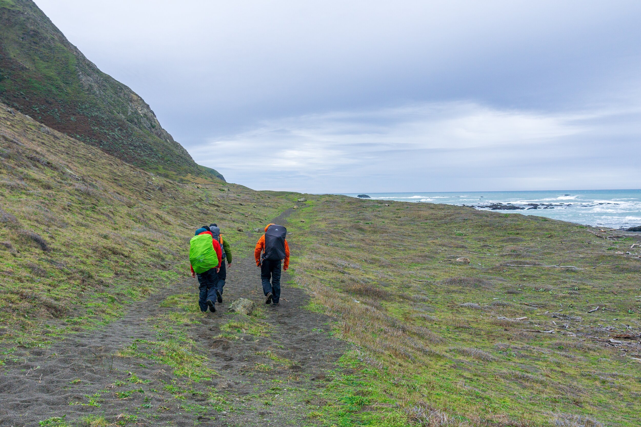
The Lost Coast Trail is a point-to-point hike. I suppose you could complete it as a 50-mile out-and-back hike, but most people will be hiking this trail one way. As you’ll surmise when looking at the maps for getting to the trailheads, there are no easy ways to get to the trailheads. What our group of 7 planned to do was leave 1 car (mine) at the Black Sands Beach Trailhead, and drive the other 2 cars (with all of us & gear) up to the start at Mattole. Upon finishing, I would drive the other drivers back to their cars, and then we’d all drive back to Black Sands Beach to pick the rest of the crew up and drive home. I can say, this was EXHAUSTING. I wouldn’t self-shuttle in the future, and instead, would park my car at the finishing trailhead and pay for a shuttle to drive me to the starting trailhead, despite the cost.
Tides
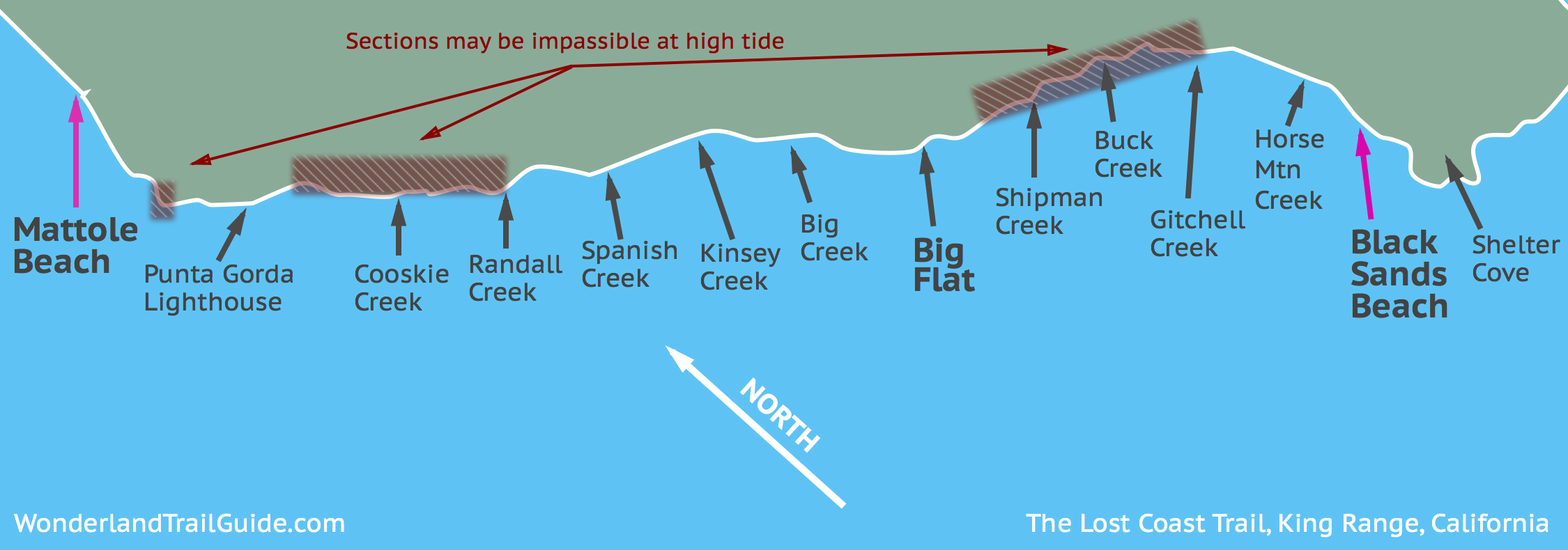
The Lost Coast Trail hosts 3 sections that are impassable at high tide, and a few others that can be tricky as well. And in reality, that doesn’t mean impassable just at high tide, but rather ~2-3 hours before and after high tide. You must prepare for these sections and plan your hiking days around them. The Wonderland Guide has a wonderful overview map of those impassable sections. There’s a tiny one in between Mattole Beach and the Punta Gorda Lighthouse, and the two 4-mile sections between Sea Lion Gulch and Randall Creek and slightly north of Shipman Creek to Gitchell Creek. High tide for us was around 11:00 am each day, which was a challenging time for hiking and how our campsites were situated.
If you are anything like me, you really have no idea what a tide chart/ table looks like or how to read one. I am a visual learner, so a graphical representation is the best way for me to identify the tides. To get both a graphical and table representation of tides, use this NOAA tide planner. Note that these are tide predictions, and they do differ from what the yearly tide book states. I found these numbers & times from NOAA to be very accurate on our trip. There are some more helpful links on the recreation.gov website that I recommend as well.
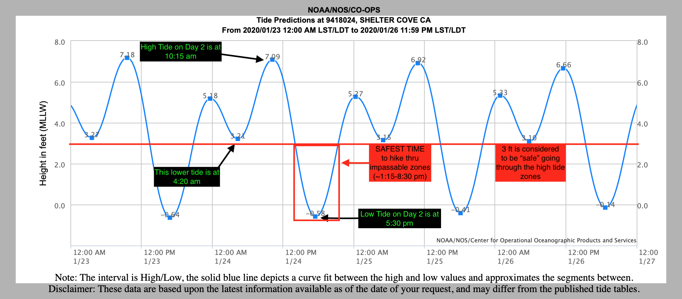
To decipher a few things from this graph: I’m focusing on Day 2 of our trip, where we were camped in the middle of an impassable high tide zone (Cooksie Creek). It is generally considered very safe to pass through one of these zones when the tide is below 3 ft. As you can see from this chart (which is interactive on the NOAA website), high tide for us was at 10:15 am and low tide was at 5:30 pm. The 3 ft. safety line is at around 1:15 and 8:30 pm, which means the safest time to pass through the impassable section was in between those times. I should also point out that it is the safest to travel during outgoing tide, not incoming high tide. So the absolute safest time to travel in the impassable zone is from 1:15 - 5:30 pm. And going back to the actual trip, this meant that we couldn’t leave camp and start hiking until 1:15. As you can see, the tides can really impact your hiking schedule, and it might force you to change your plans.
Also note: poor weather and wind can impact tides and make them more extreme, beyond the tide table. And even in lower tides, sneaker waves could still arise and come up pretty high. Always be cautious and never turn your back to the ocean.
Creek Crossings
If you’ve done any research on the Lost Coast Trail, you might be surprised to see me mentioning this. While Spring - Fall are the most popular times to hike the Lost Coast Trail, we went in January. And while it hasn’t been the wettest winter for Northern California (2020), we had multiple high creeks to cross, that are normally not worth mentioning during the summer season. Some of the crossings were crotch-high on myself (5’4”), and some were lower (shin-knee high), but fast-flowing and the safest place to cross was at the mouth of the creek and ocean. All of this to say: if you are hiking the Lost Coast Trail in the off-season, be prepared for high creek crossings. Be prepared to need to cross in your hiking shoes. These are not sandy creeks, but very, very rocky and fast-flowing creeks. You’ll need to cross in your shoes, not in “camp shoes” or “water shoes” or your flip-flops. I can honestly say that some of these creeks were stronger than the creeks I crossed in the Sierra on the PCT. Of particular concern were Spanish Creek, Big Creek, and Shipman Creek.
Weather
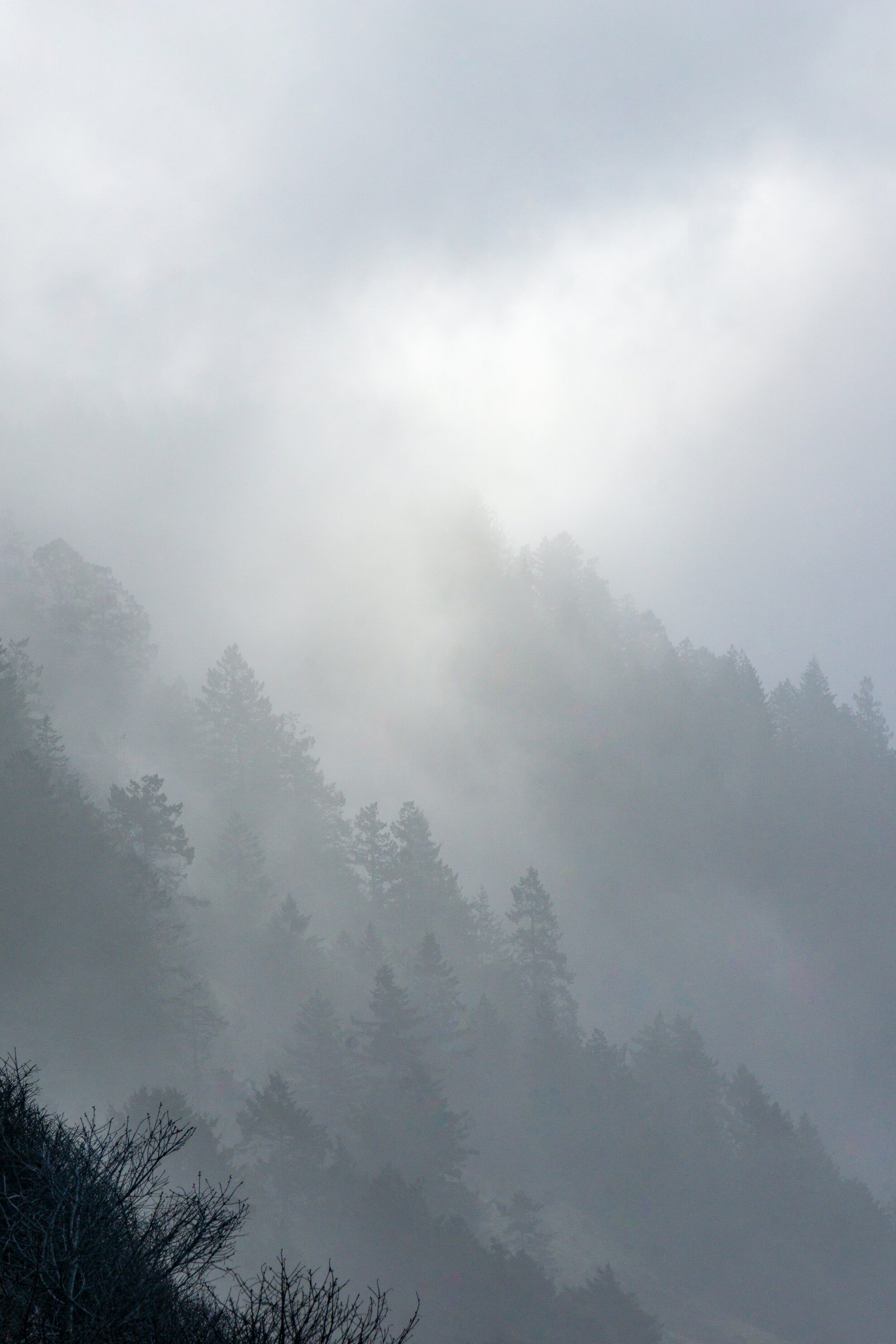
The Lost Coast is known for “moody”, aka, rainy weather. And we were treated to that lovely rainy weather, especially on our third day, where it rained all. day. long. Thankfully, coastal California doesn’t get too cold, so we experienced 50-60* F days, even with the rain. Don’t let those temperatures fool you though. If you don’t prioritize staying dry, hypothermia is still a major concern. There were also pockets of gorgeous weather, so don’t let that moody weather get you down. Just make sure you bring a good rain jacket, and make sure you’ve checked it’s waterproofness before embarking (when was the last time you re-applied DWR?).
Trail Conditions
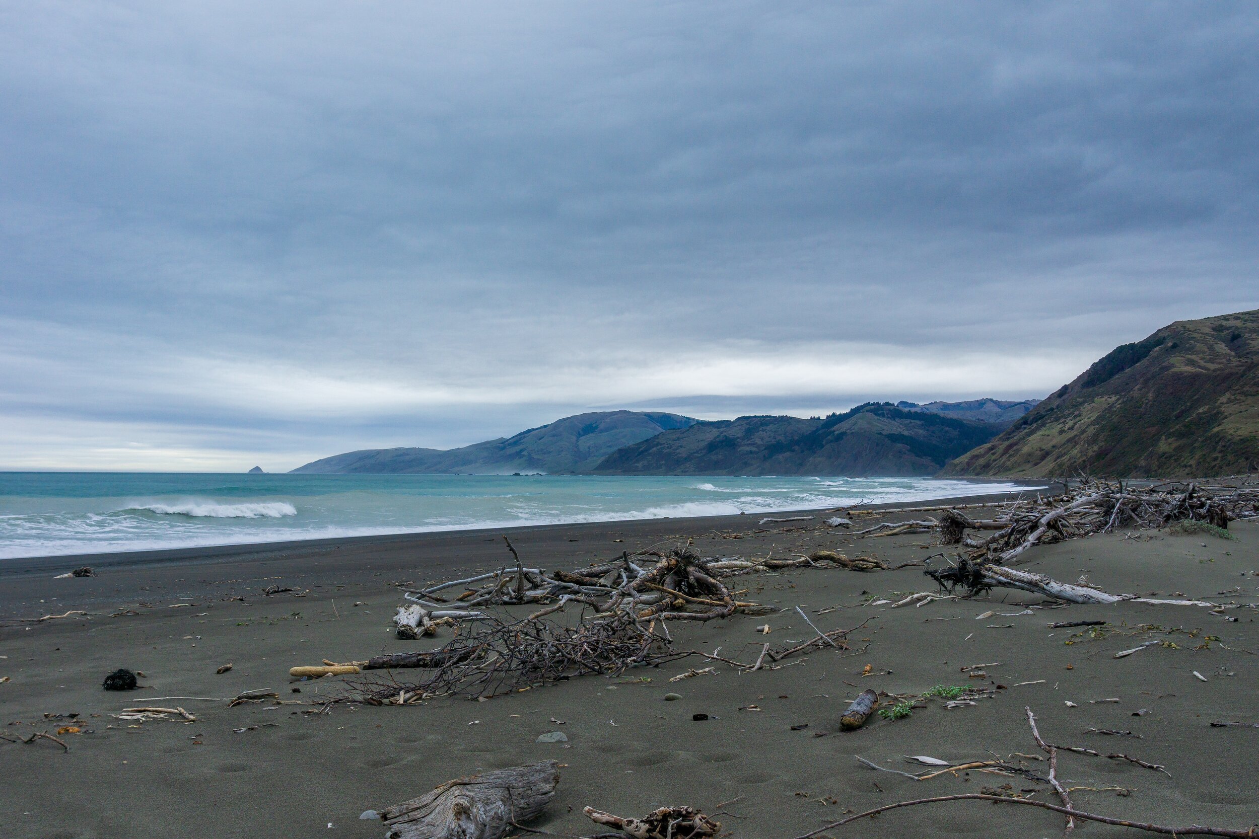
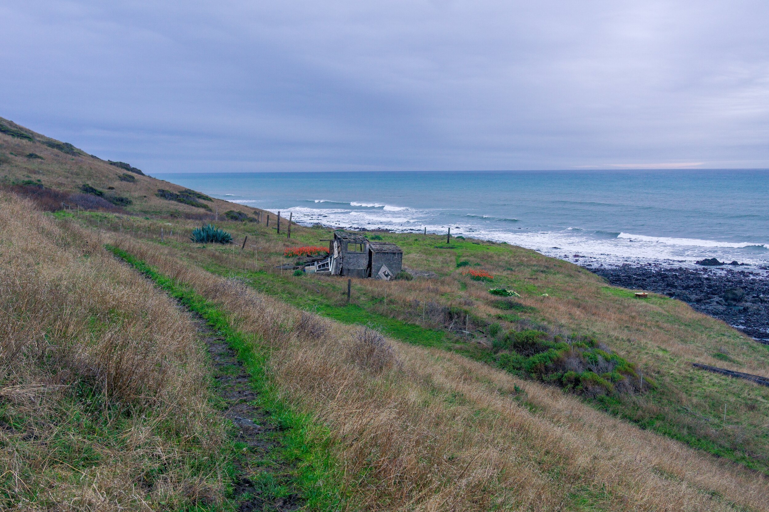
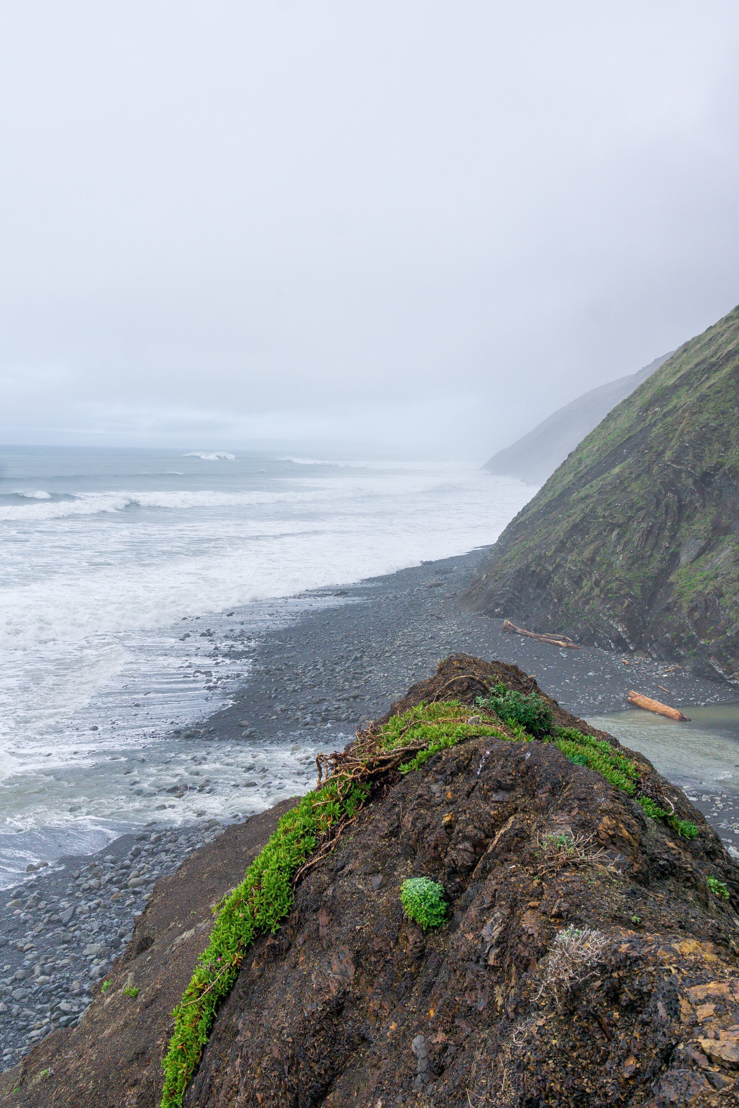
As I mentioned before, the Lost Coast is a rugged wilderness area that experiences some extreme weather. You are also hiking on a beach for a lot of the trail. That being said, the landscape poses some challenges to hiking. The beach itself is not always hard, compact sand. Instead, it’s usually a little soft, and you sink in a little with each step, especially while carrying a pack. Some parts of the beach aren’t sandy at all, but instead have decently large and unsteady boulders that you have to hike over and through to continue forward. You’ll want to have grippy shoes and take your time through these sections. Trekking poles are helpful. There are also some sections of trail that have fallen away due to erosion. The trail hasn’t necessarily been realigned, so sometimes bushwhacking and light downclimbing is necessary to navigate some parts of the trail, most notably, the slightly confusing section north of Sea Lion Gulch near the dilapidated structure and fence. Nothing is too hard or scary, but it’s something to be aware of.
Wildlife
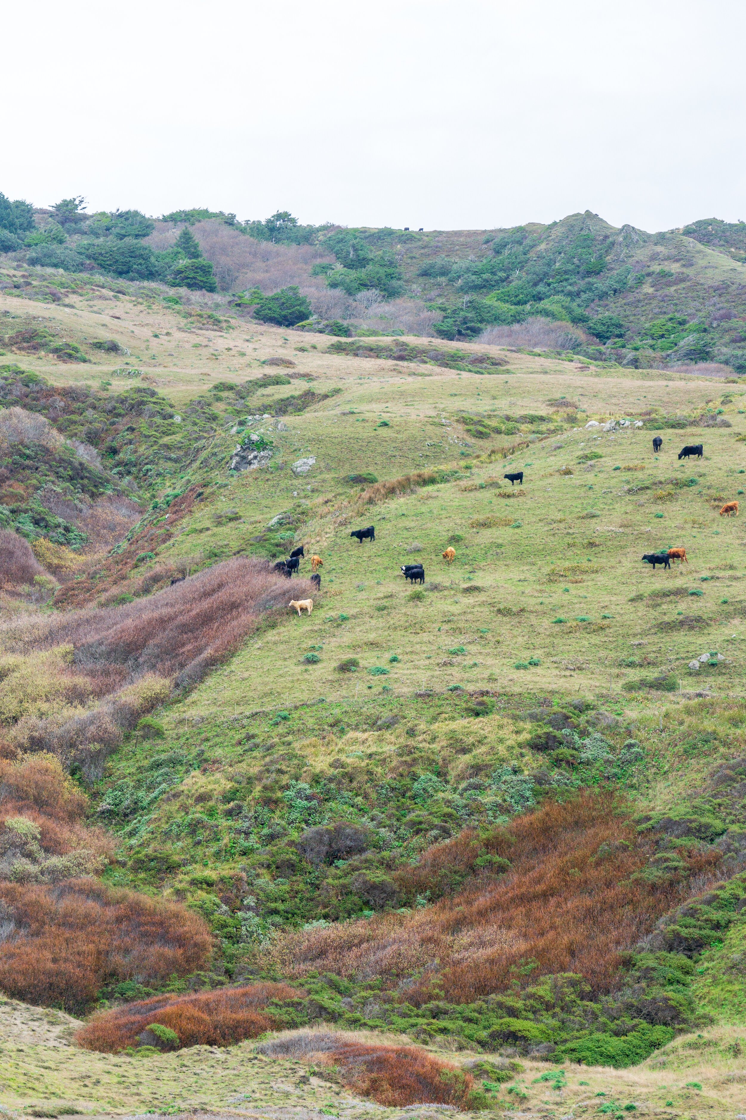
There is some pretty cool wildlife on the Lost Coast. Sea Lions, seals, toads, whales, cows, birds, turkeys, elk, and… bears! That’s right, black bears exist on the Lost Coast Trail, and the BLM requires bear canisters for this hike. We never saw signs of bears, but there have been sightings of them. We did see loads of harbor and elephant seals though! And of course, many birds. Ticks are also a problem on the Lost Coast. There are numerous sections with tall grasses that ticks love to live in. We didn’t need to worry about it while we were on the trail, but if you’re hiking in other seasons, make sure you treat your clothes with permethrin. It is probably a good idea to wear long pants as well.
Proper LNT
I’m mostly referring to bathroom time here! In a wild change from most places you are backpacking in, the BLM would actually like for you to dig a 6-8 inch cathole below the high tide line and go right there. Yes, this means going poop out in the open, and digging a hole in the sand. This method is preferred over digging holes in the dirt and grasses, though if you have to dig your hole on one of the bluffs, abide by normal LNT rules and go at least 200 ft away from the trail and streams. I personally thought going below the high tide line was so much easier. Digging a cathole in the damp sand was a breeze! And no bushwhacking off trail to find a good spot to go!

Trail Journal
Day 1: Mattole Trailhead to Cooksie Creek - 6.5 miles

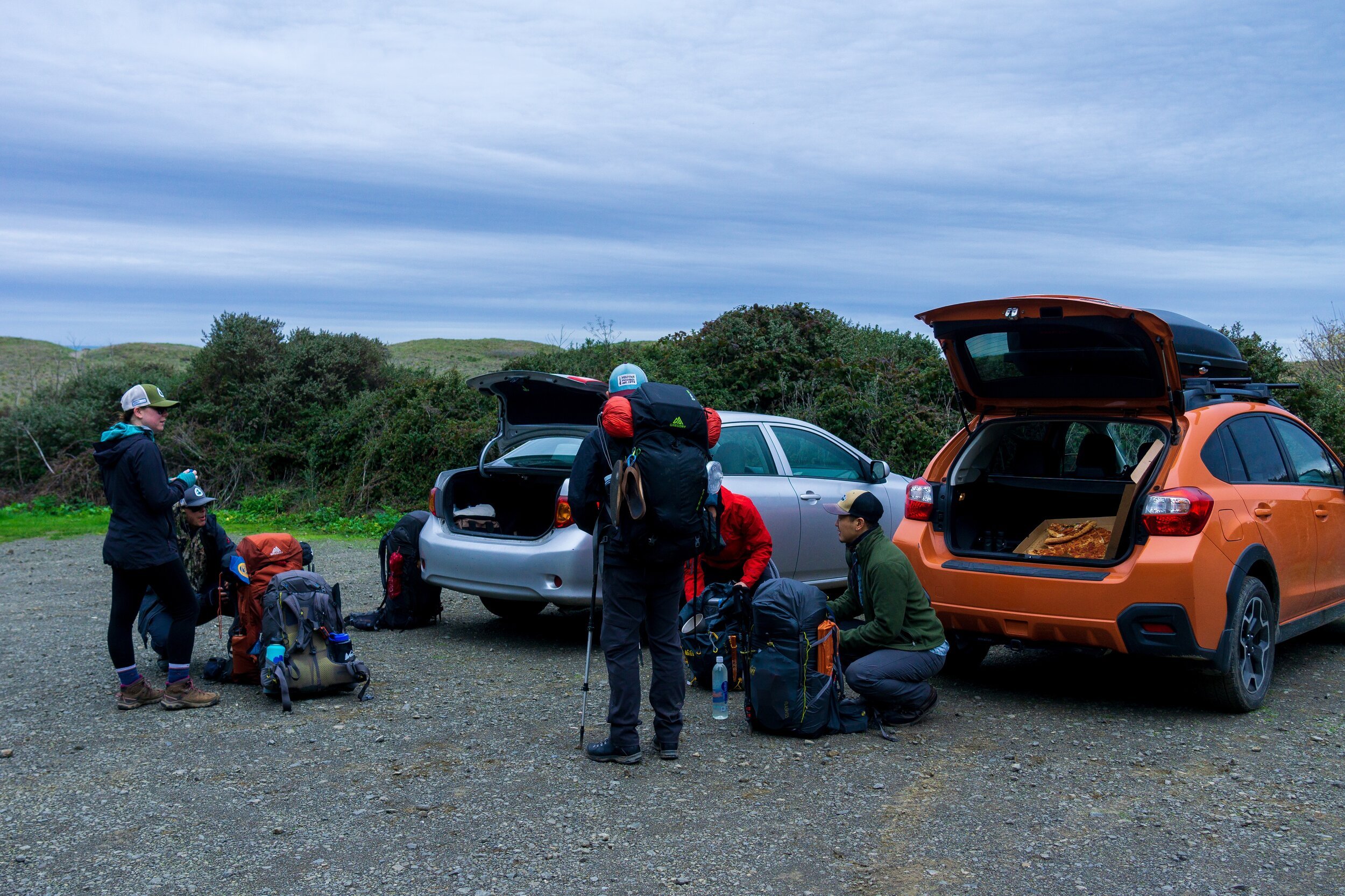
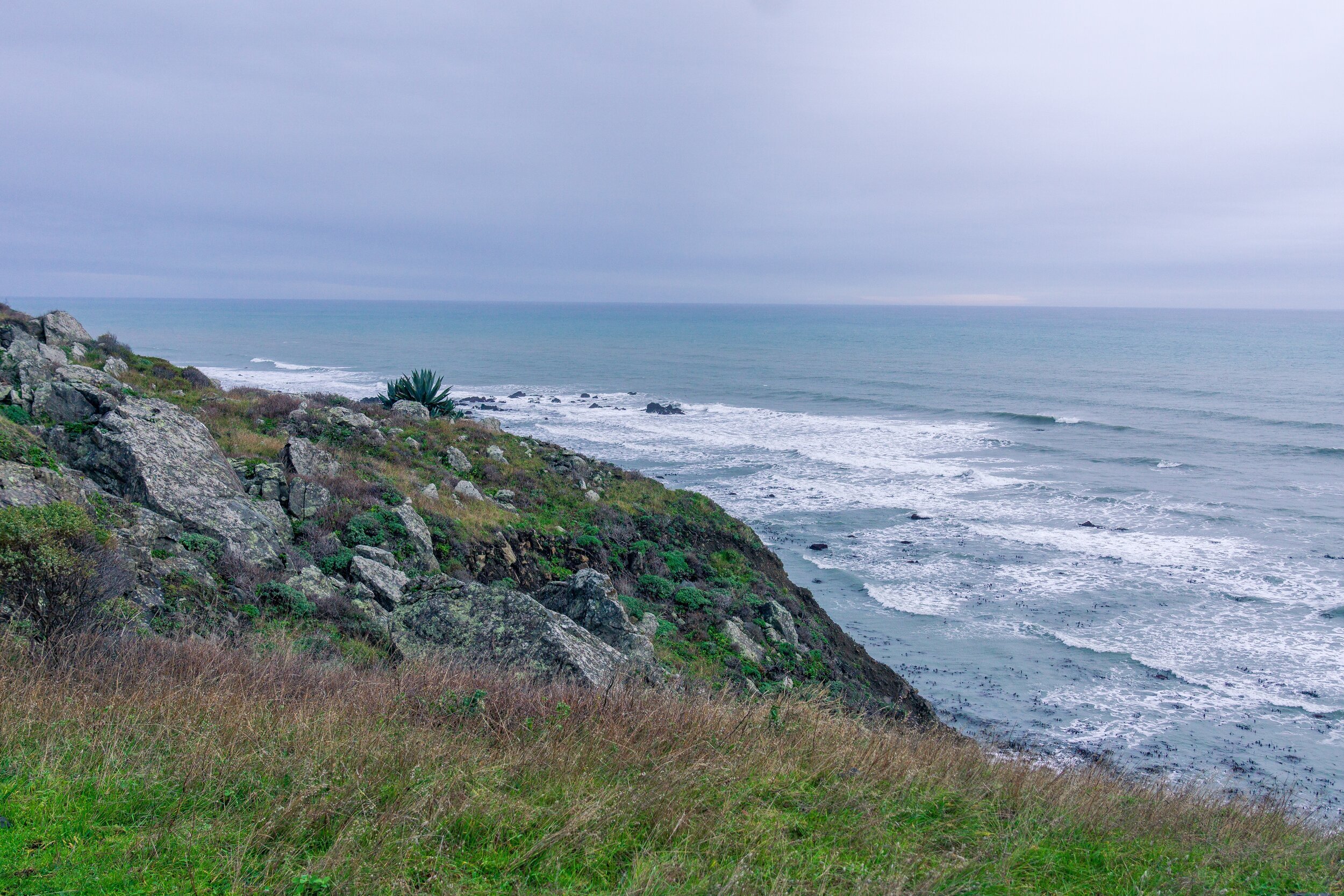
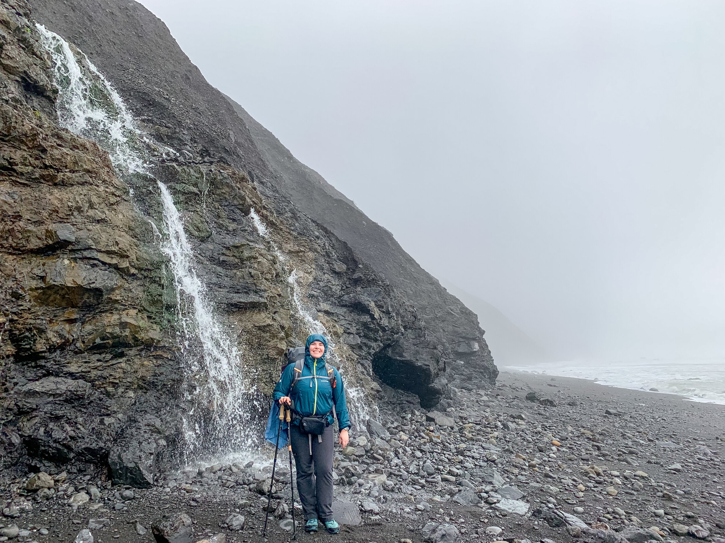
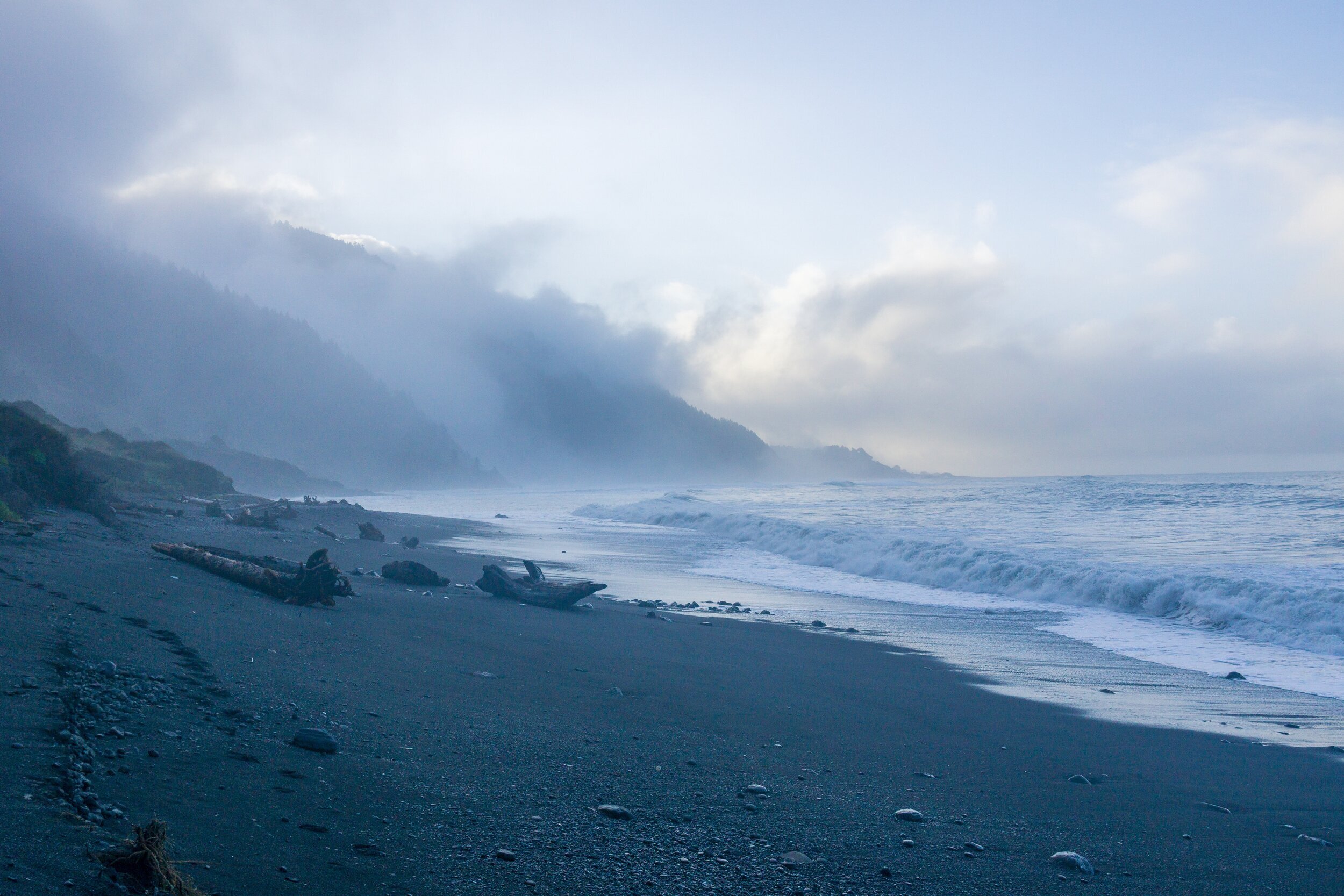
We arrived at Mattole Trailhead around mid-day, after a necessary sleep-in at the Wailaki campground, which we arrived at ~2 am the “night” before, and the 1.5 hour drive from Black Sands Trailhead to Mattole. We ate some last-minute pizza, finished packing our packs, and set off. Mattole Beach was wide and huge, and probably the most sandy and not rocky beach we were at. The trail was actually defined and inland more, but mostly sand, so we decided to hike closer to the ocean to enjoy the views. Everything smelled nice and fresh, and the hills were really green. I noticed some dark clouds moving around when we were at the trailhead, and sure enough, they moved in and dumped some rain hard and fast on us. We quickly dropped everything and got our rain jackets on, literally having only hike about 1/4 mile so far. We knew we were in for a weekend of rain, but were hoping it wouldn’t be that bad.
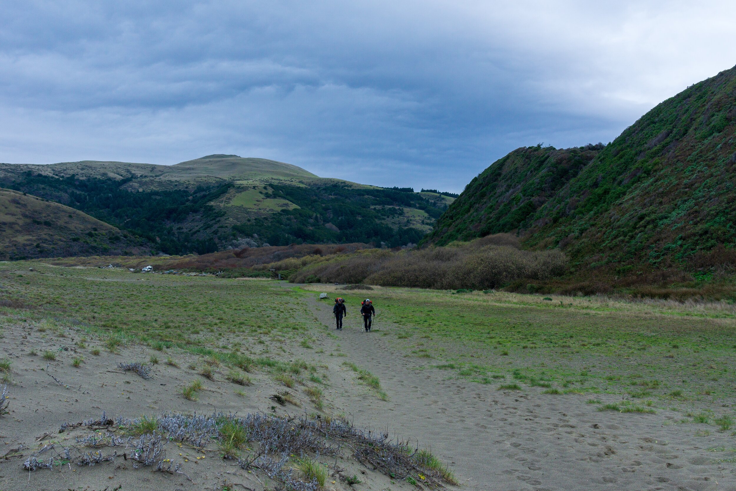
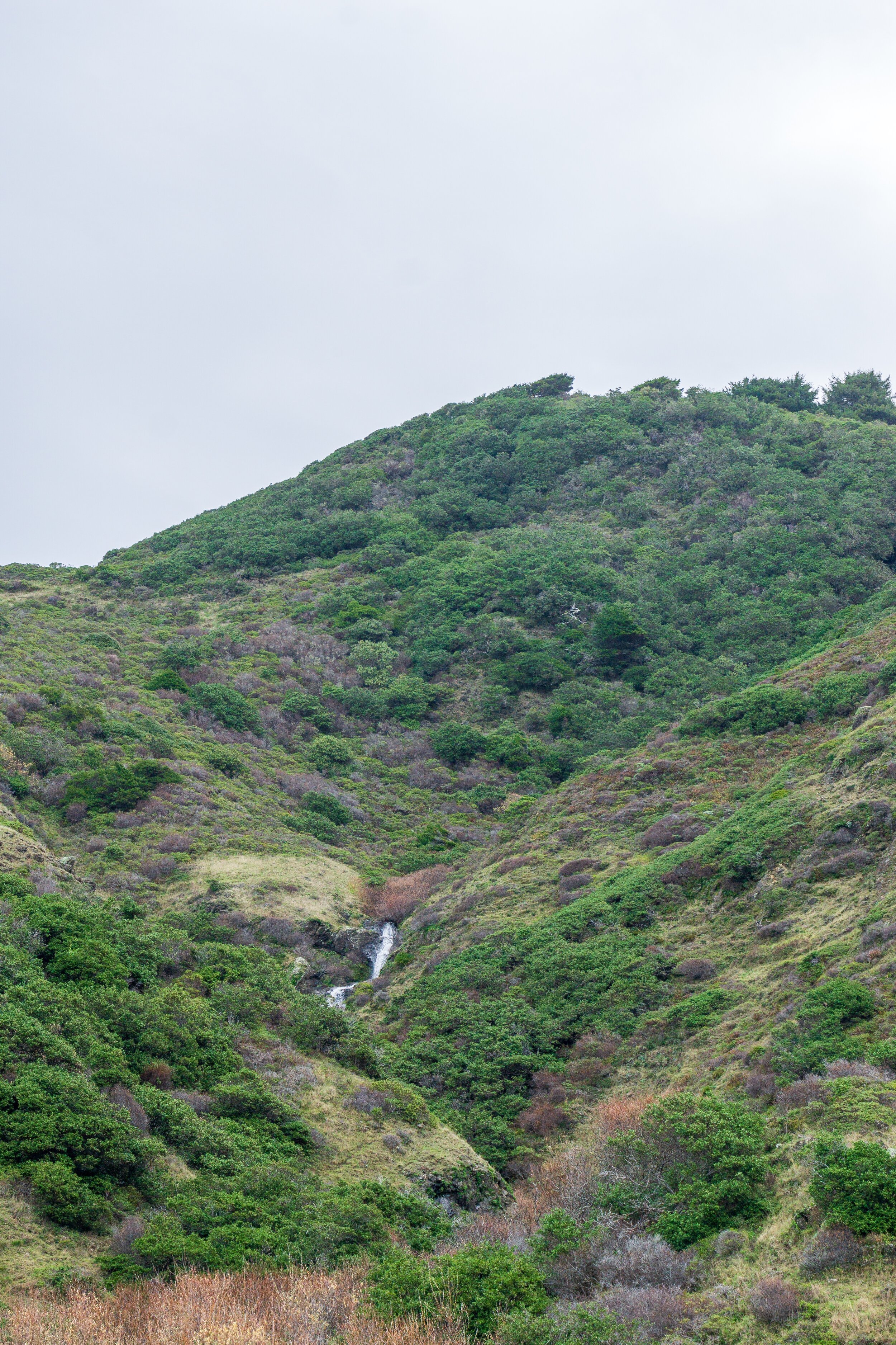
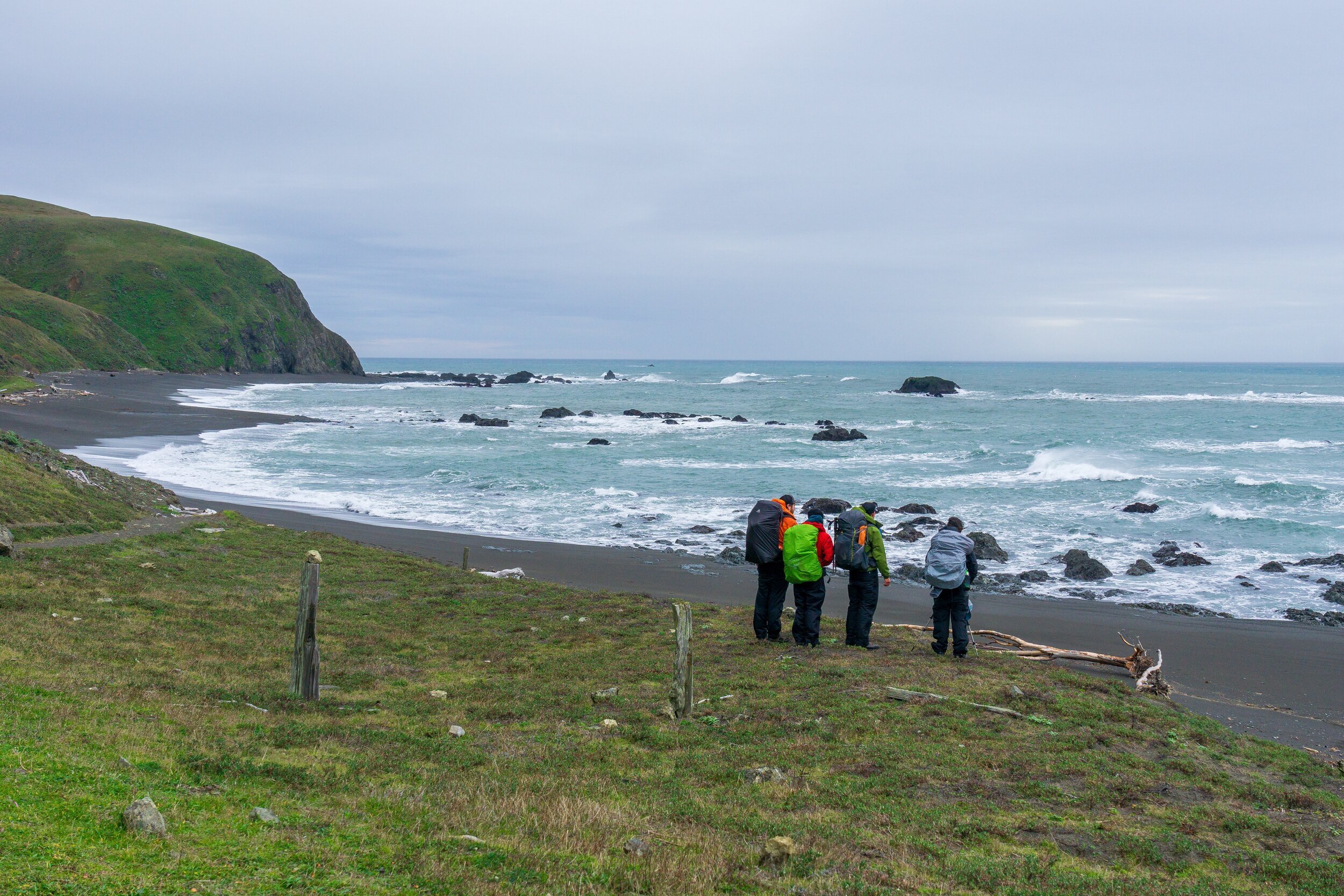
As usual at the beginning of a backpacking trip, everything was exciting and felt so new. Switching off between the beach and trail was fun, hearing the waves crash upon the shore was soothing, and seeing waterfalls flowing out of the mountains to our left, seemingly out of nowhere was beautiful. I felt like I was in a much colder Hawaii. Even the color of the ocean was amazing. I’m used to turbulent, northern California oceans looking more dark and grey, but the water looked incredibly blue and inviting.
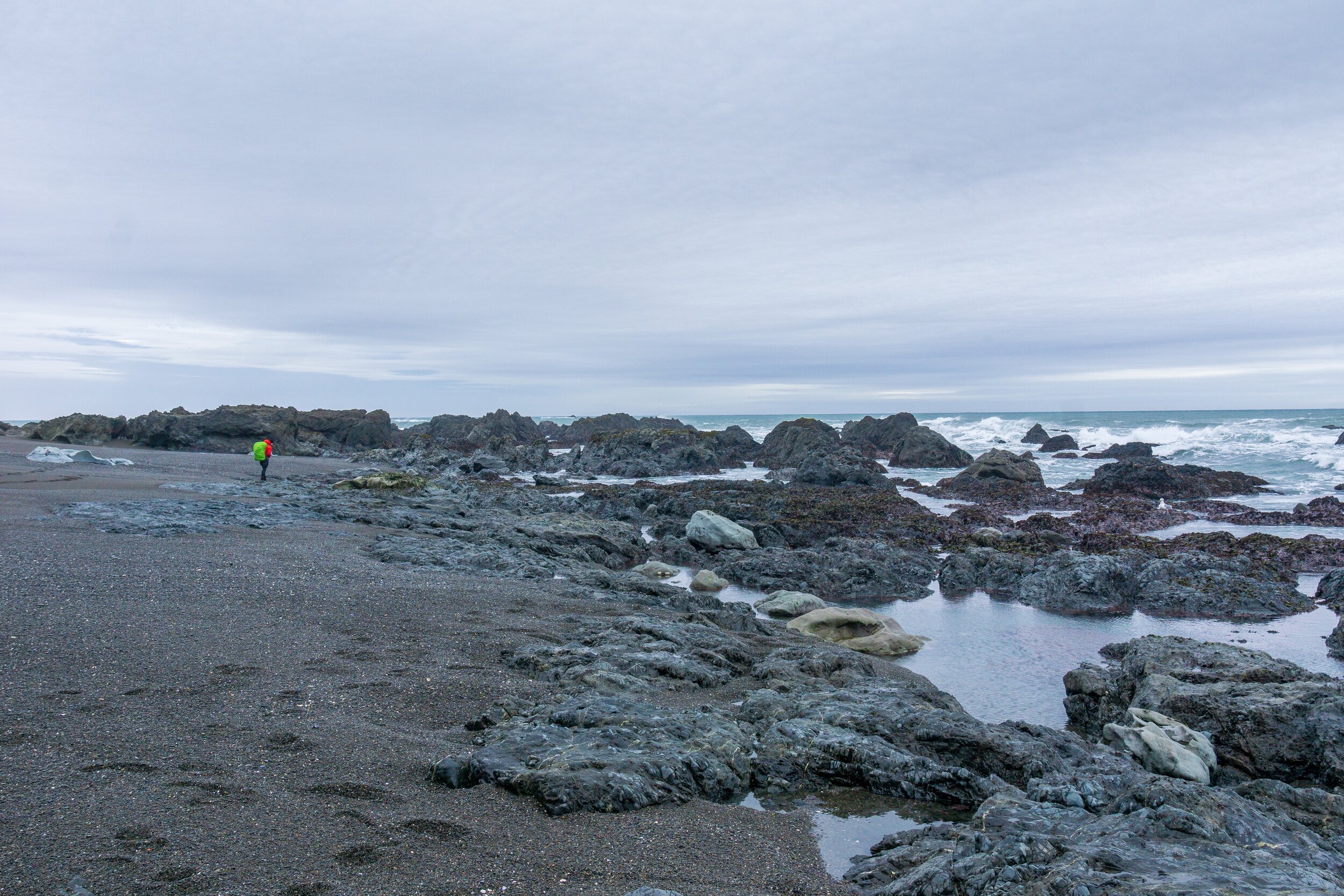
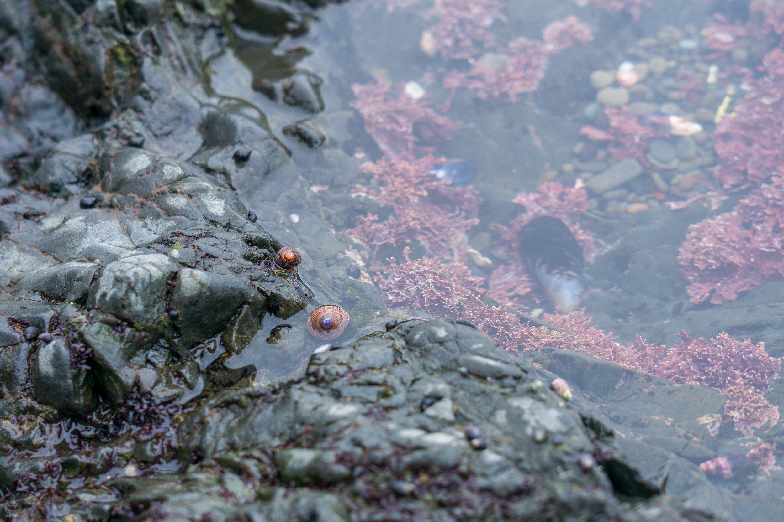
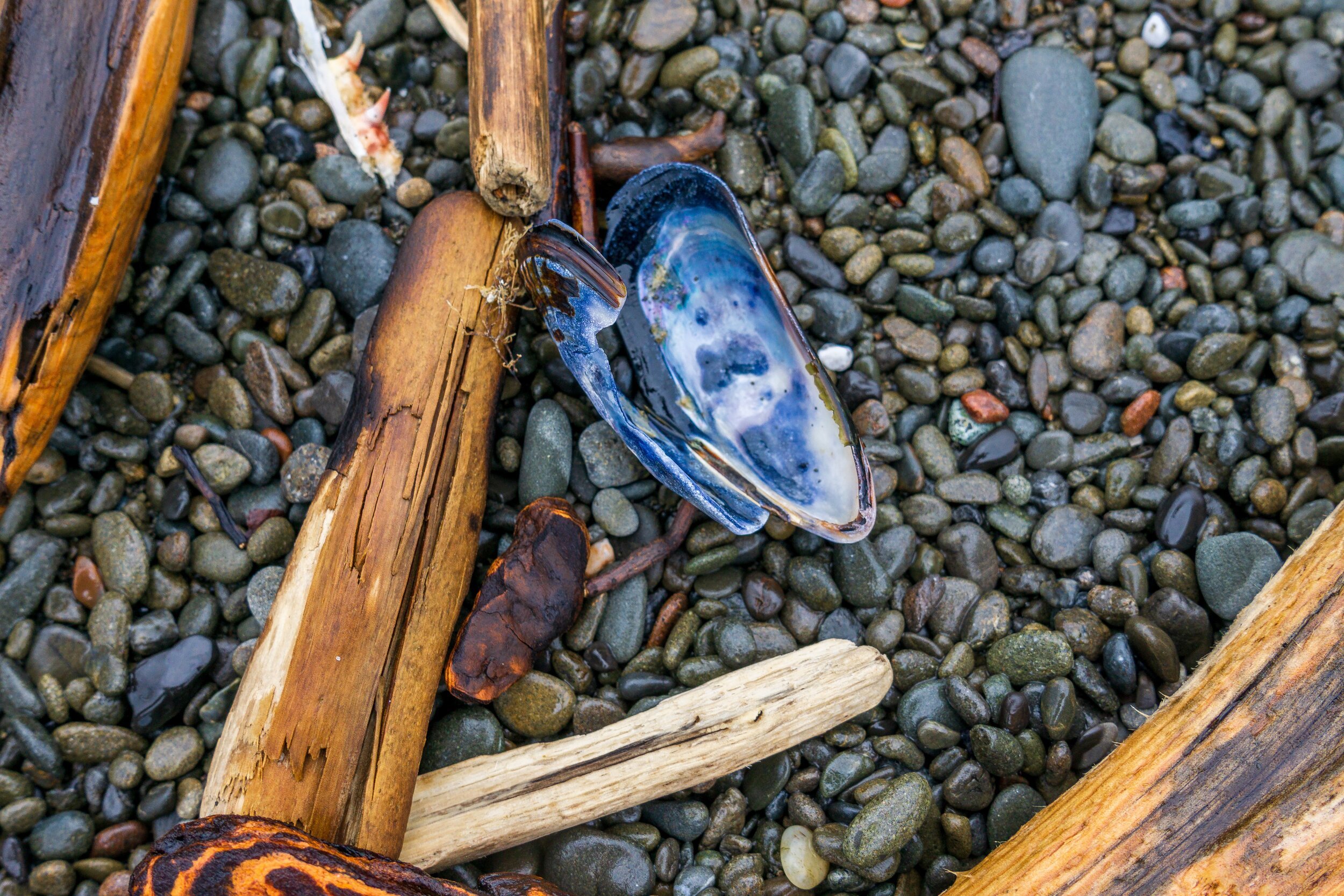
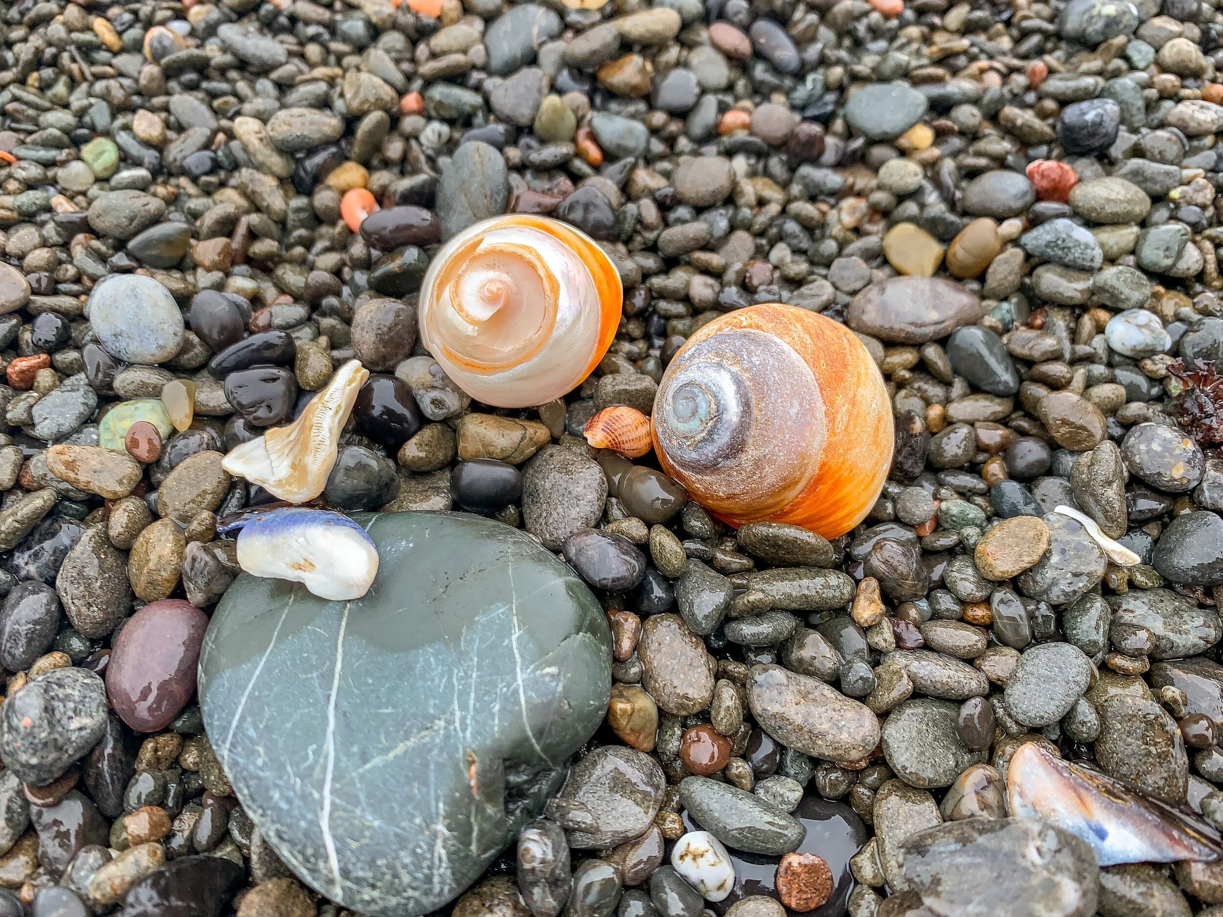
After only a couple of miles, we stopped again for a snack break and to explore some tide pools, marveling at the landscape and cool finds - like beautiful snails, mussels, and abalone shells. These were some of the only tide pools we were able to experience on our whole trip, and I was happy we took the time to explore them.


We weren’t expecting it - only hoping - but soon enough, we saw an enormous elephant seal on the beach. He was positioned up closer to the land, so we had to divert closer to the ocean to give him a nice, wide breadth. Despite their size, elephant seals can move pretty fast, and can be highly territorial. This guy bobbed his head at us a few times and gave some exasperated exhalations as we quickly passed by. It was such an awesome sight and we felt so lucky to see such a cool creature!


Little did we know that we’d run into the research team living in these cute, weather-worn cabins just a little bit down the trail, and they’d come bearing some exciting news: there were tons of harbor seals and elephant seals down the trail, after the lighthouse, and they were very close to the trail, some even on the trail itself! And, there were harbor seal pups! I was so excited. I love ocean life, and I couldn’t believe we happened to be hiking during pupping season. I think seeing seals on this trail is pretty common, but I felt so lucky to see some super cute nursing pups!

The Punta Gorda Lighthouse, constructed after a few too many shipwrecks on these shores.
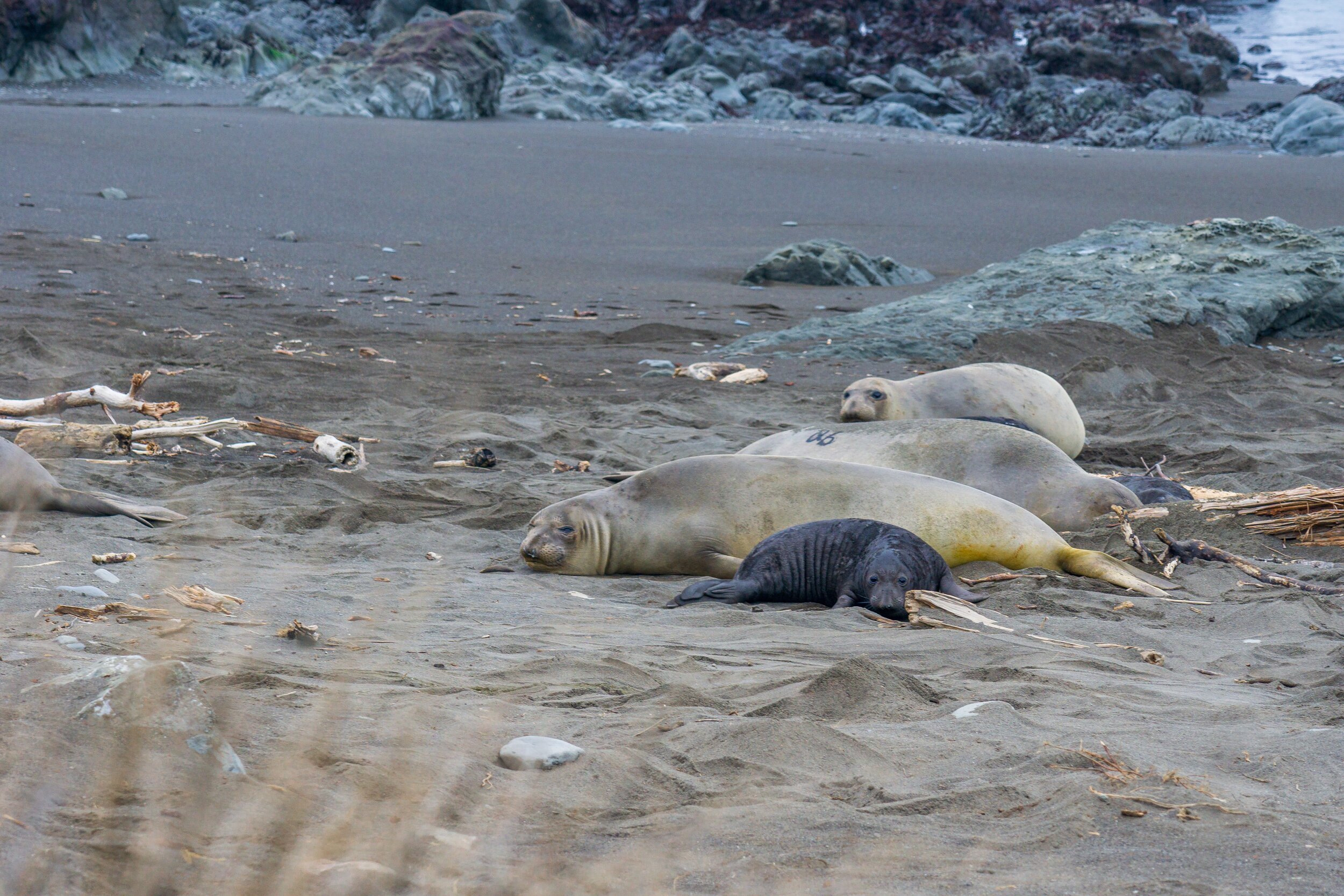


Look at how cute these sweet creatures are! All of my photos are taken with a longer lens, but they were still pretty close to us. The researches let us know that it was OK to walk past them, but just try not to linger too long, or else the moms might not be too happy. The really crazy thing though was the gigantic elephant seal literally right on the trail! We were forewarned about him, and the team suggested us bushwhacking around the big guys with at least 20 feet of room. Which was literally the best we could give them! This was probably the closest I’ve been to wildlife and it can be a little nerve-wrecking. You never know if they could jump up at you. I definitely wasn’t planning on being body-slammed by a seal on this trip. But overall, it was a super neat experience. I still can’t get over how they even got up to the trail! There wasn’t a super easy way down to beach for a non-bipedal. The beach was an ~5 foot or so drop down from the bluff we were walking on, but I guess they have their body flopping ways.
The seals were a nice little side show for us, but we realized it was getting late and the sun was starting to set, so we needed to get a move on.
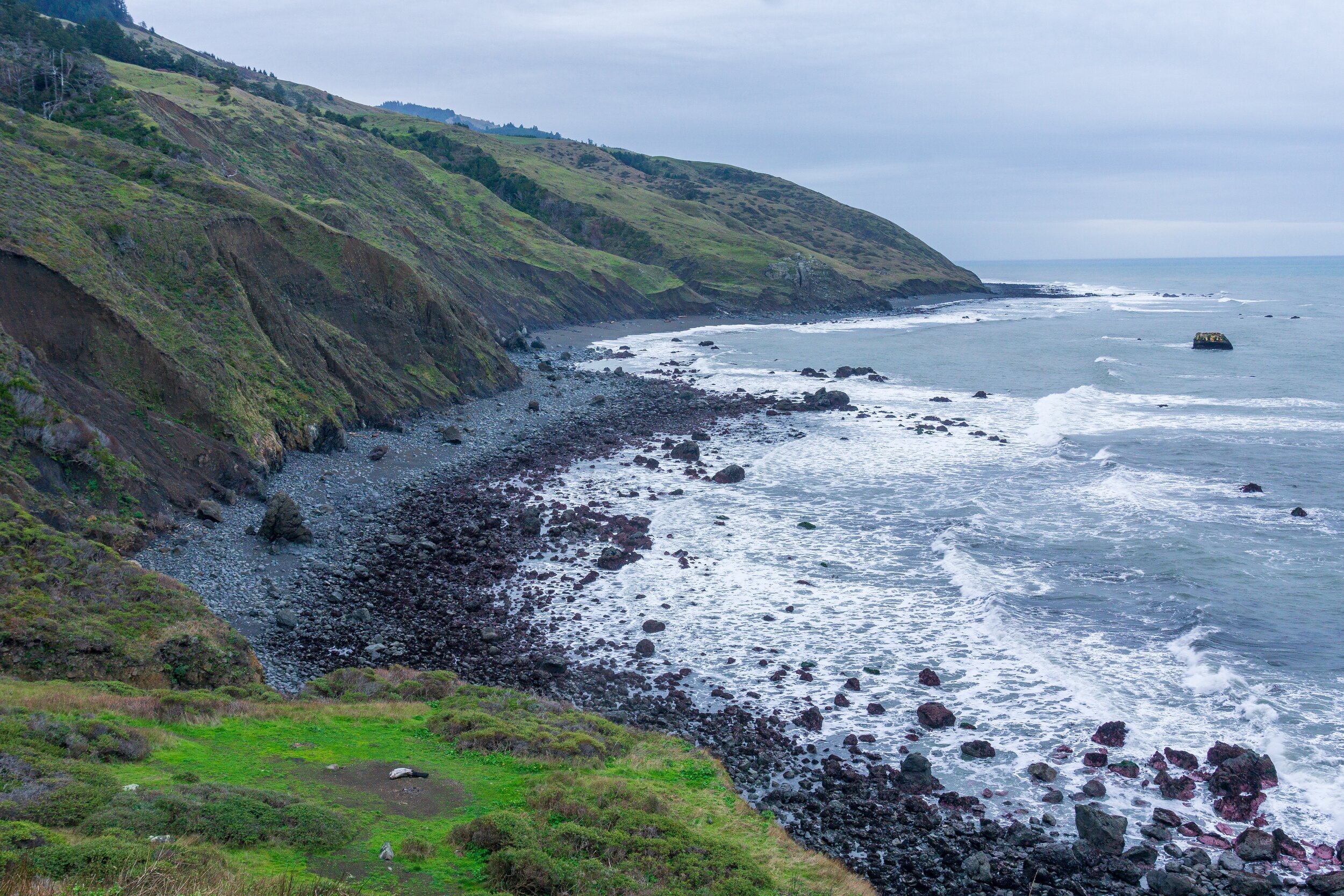
With low tide being at 5 pm for us, we entered into the second impassable tidal region of the hike, this one being 4 miles long. We finally got a taste for the very rocky beach, dodging ankle twisting boulders and notches to clamber our way across the shore.

Rocky & sandy hiking conditions
Looking down on our tracks on the beach
After some beach walking, we ended up climbing decently high on a bluff overlooking the ocean. It was a gorgeous part of the trail, and even though we were going a little steeply uphill, the going felt much easier than sinking sand. We passed the Sea Lion Gulch campsite during this stretch, which was an incredible spot. I would definitely want to camp there if it was less windy and we had a smaller group. The second section of bluff we climbed up was really pretty. The mountains were looming, and parts of the area looked almost tropical. The sun was starting to set, and it gave the whole landscape a beautiful, purplely-pink feel.
We also had to contend with our first confusing section of trail at the broken down structure. Normally, the trail passes through the gate and goes down to the ocean. However, this looked pretty unfeasible when we got to the rock outcropping that seemed to just fall right down to the beach. Instead, we walked a little further down some trampled grass and climbed under the fence, and scooted down some crumbling hillside to get down to the beach below.


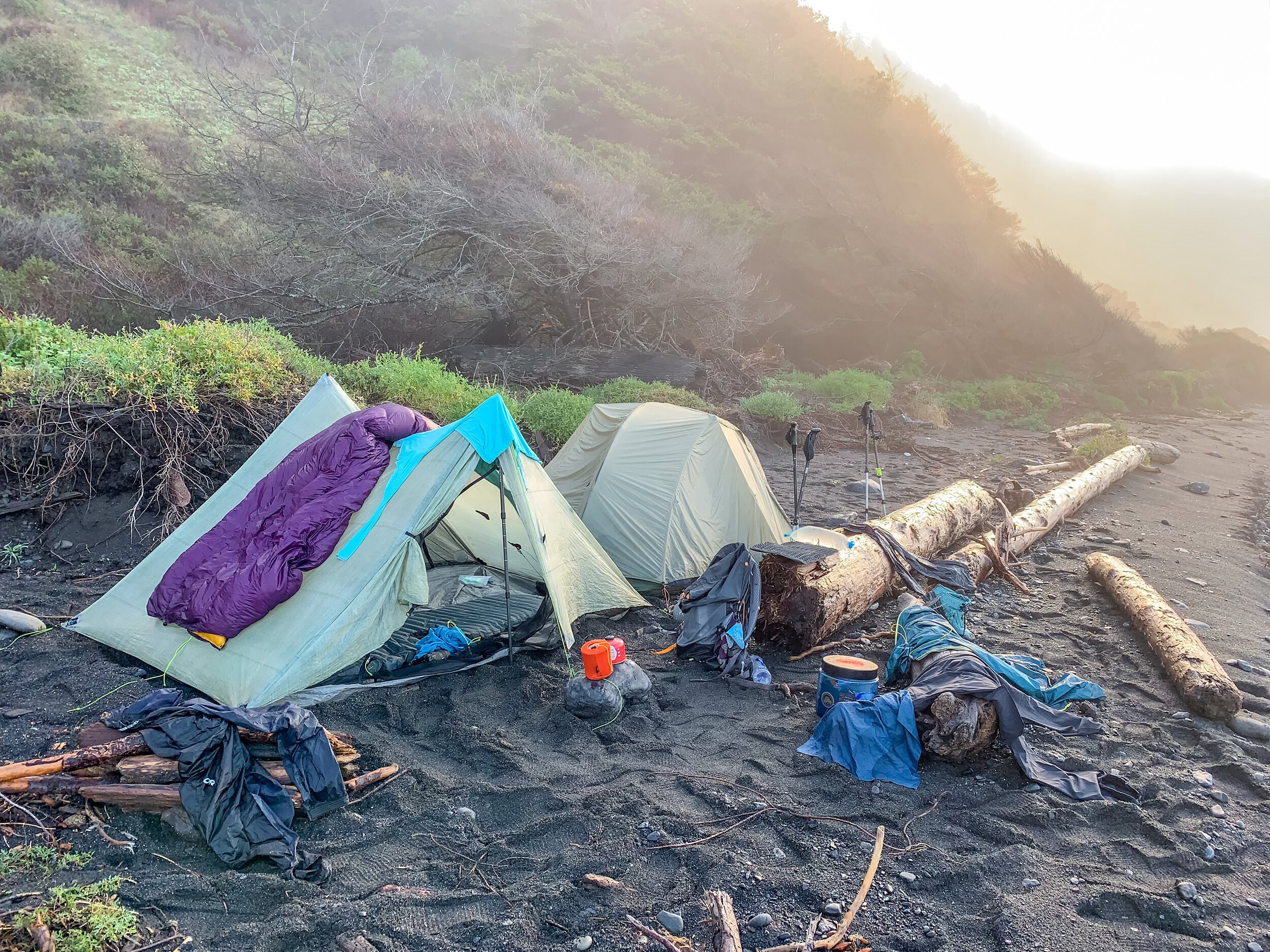
Once on the beach again, we had about a mile until we reached our destination of Cooksie Creek. Unfortunately for all of us, we also had to cross Cooksie to get to the campsites. This became a bit of a trend on this trip. While I’m sure there are campsites on the northern side of the creeks, we could not access those because of how high they were running. Cooksie was a great campsite though, nice and large enough for our group. We all set our tents up in the dark, startling many toads that were hanging out in the tent sites, and made our way to the fire pit. I normally don’t get to enjoy fires on backpacking trips, but Shaun and Tim put up a glorious effort to make a fire in damp conditions and keep it going for us to enjoy. It was the only fire we enjoyed on the whole trip, since it was the driest night we had. Around 9 pm, the wind really picked up and was followed by a downpour. We all ran back to our tents and fell asleep to the rain.
Day 2: Cooksie Creek to Big Creek - 7.25 miles

We had a pretty slow morning on our second day, which was warranted. None of us slept well the previous night, and since we were stuck in the middle of an impassable zone, we had time to chill. In fact, I’ve never spent so much time in camp in the morning before. With all that time on our hands, I got myself in a little trouble: I walked down to the creek to grab some water for breakfast and the day, and accidentally stepped in a sinking muddy spot and lost my camp shoe flip flop in the quicksand mud. I walked around and ate breakfast with one flip flop on until I decided to get changed into my hiking clothes. Thankfully my friend eventually helped me extract my flip flop with two large sticks. It migrated waaaay down there. So after that debacle, we had lots of continued down time, waiting for high tide to recede. We all wandered up to an overlook above camp to look out at the ocean, enjoy the view, and also check the tide. High tide was around 11:00 am, so we decided to eat lunch before leaving camp too. Finally, at 2 pm, we were all packed up and on the beach, ready to continue south.
The tide was receding, but we still had some waves come up pretty close to us while walking. We had about 2 miles left of the impassable section, and this was one of the coolest sections because of the rock. Similar to the Grand Canyon, where you can see layers of Earth and erosion and all that cool stuff, these rocks were so layered and twisted and angled and awesome. I wish I knew more about rocks so I could actually sound smart about them. But they were so cool! And the whole cliff was layered with these kinds of rock.


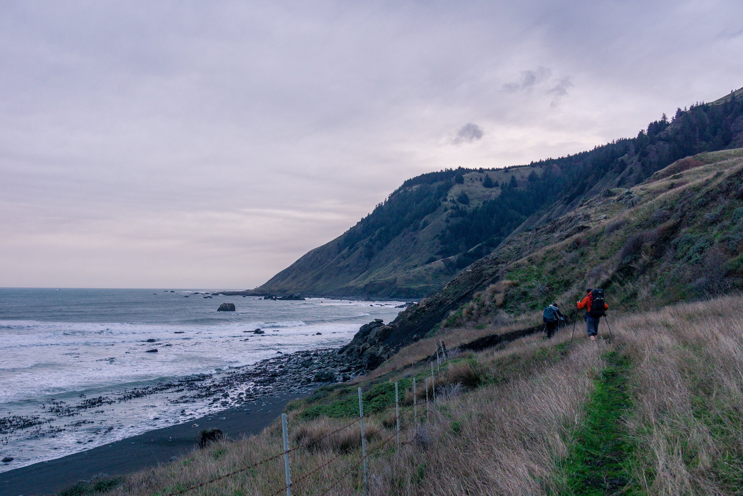
We passed the first two miles pretty quickly, and crossed Randall Creek, signifying the end of the impassable section of trail. We accidentally missed the turn right after Randall to hike up onto the bluff though, so we walked on the beach a little longer until we realized we were supposed to be on a trail and found a spot to scramble up to. The signage isn’t the best on this trail, but at least it isn’t too hard to get lost. Right before we got up onto the bluff, I saw a patch of blue sky poke through - the first I had seen since early in the morning. I was so excited and hopeful for the rest of the day to be bright and sunny. We did get to enjoy some beautiful sunny moments as we walked along Spanish Flat. This was a gorgeous part of the trail and the campsites looked awesome too. Again, not the best place to camp during the winter, as there was no shelter and it was pretty windy.


Eventually, the sun began to hide behind the clouds again, and it started to get a little darker. The wind started picking up as we neared the end of Spanish Flat and approached Kinsey Creek, and we knew that we probably weren’t going to make it to our hopeful campsite of Big Flat for the night. We set our sights on Big Creek and continued hiking through the drizzle.
We still had some fun though, and the trail kept surprising us. Instead of seashells and seals though, this time it was deer antlers.


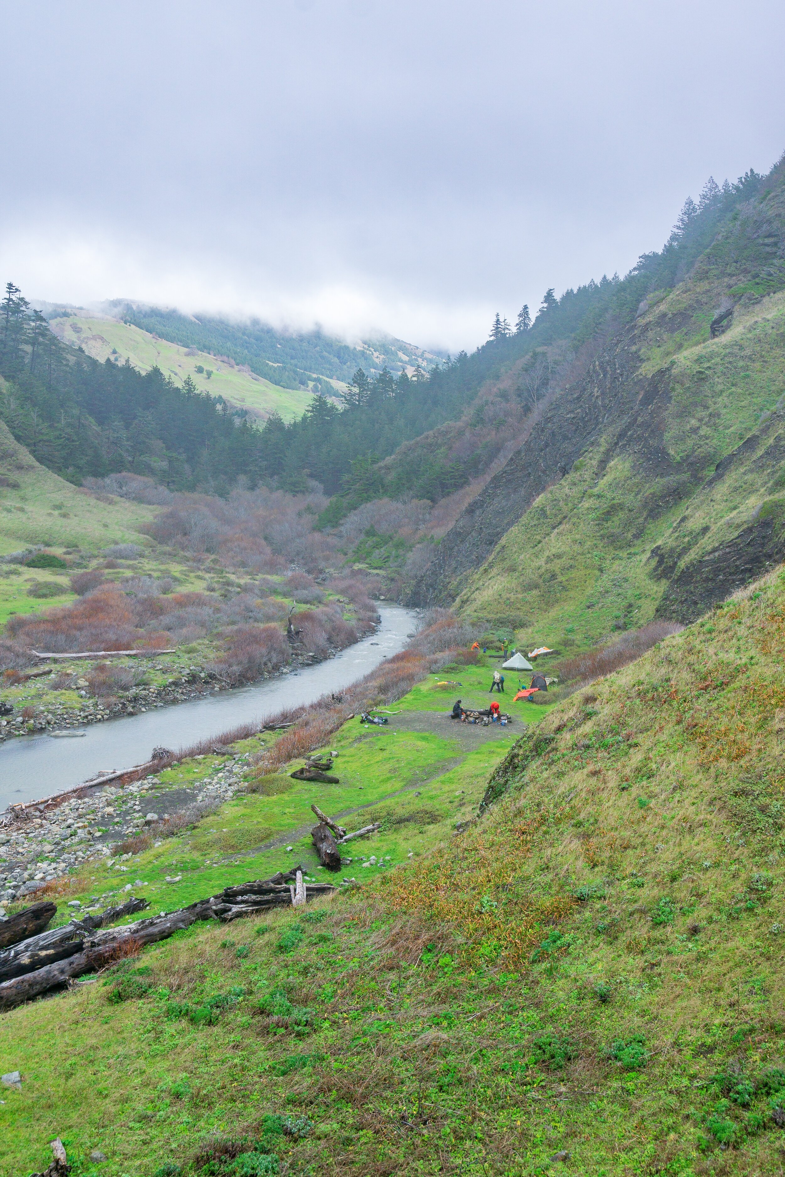
The rest of the afternoon we hustled towards camp, again hiking as the sun went down. We made it to Big Creek with a little light left and started scoping our tent sites. I’m not sure what it’s like here during the drier months, but the only campsites available to us were right on the sand, amongst the driftwood. It ended up being a pretty good camp, but a little bit exposed. The cool thing about Big Creek was a pre-existing “hut” made of wood. There are a few of these tree hut/teepee type structures on the trail, and while you shouldn’t build any new ones, the old ones are very cool, and this one came in handy. We were able to rig up a SOL emergency blanket over the roof to block the holes, and we all crammed into it to cook our dinners. It was slightly uncomfortable, and we were still getting wet due to the wind, so we eventually turned in for the night.
Day 3: Big Creek to South of Gitchell Creek - 8.9 miles

We had a slightly earlier wake up this morning, but all of us were a little hesitant to leave our tents since it was still very windy and rainy. I know I wanted to be hunkered down for basically the rest of the day, but knew we had to get a move on, so I got partially dressed and threw my rain gear on and was the wake-up committee for the group. After getting pummeled by rain, I went back to the tent, cooked breakfast in my vestibule and changed into my hiking clothes and packed up, except for the tent. I had a little bit of leakage into my Duplex overnight because my pitch wasn’t that great. The lumpy sand had me digging holes to create anchors for my stakes, so the whole tent ended up being just too close to the ground, which didn’t allow for the proper drainage mechanism of the tent to work. Luckily, the water pooled in a corner and I could just pour it out, and my quilt didn’t get wet.
A lucky break in the rain came, so I seized the opportunity to pack up the rest of my pack and get ready to leave. Not everyone was as quick, so I hung out in our little hut watching everyone pack their things up. I was getting pretty antsy to leave again, so decided to get a head start down to the creek crossing and scope out a good place to cross. There wasn’t a great place, with the water running pretty deep and fast, but we all made it across. It was a little sad to immediately get soaking wet by crossing a creek first thing, but it needed to be done! It was already raining decently by the time we crossed and began hiking again. We all just kind of put our heads down and marched on, not stopping until we got to a very interesting large house near the Big Flat area. It was private property behind a fence, and looked pretty spectacular and so out of place. I can’t believe I didn’t take a picture! I didn’t take many pictures this day just because the weather was so horrendous.
We had some large creek crossings to contend with today, even after Big Creek. Once we got to the Big Flat/ Miller Flat area (which would be a lovely place to camp), we had to make another creek crossing, the deepest of the trip. The group split off trying to find better places to cross, but the rain was pouring down and we were all getting soaked, and it was taking forever. We eventually all decided on a place to cross that didn’t look too fast, but was crotch-high on most of us. At this point, I gave up on being dry at all and embraced the wet, even with my gross, falling-apart rain pants on.
We kept hiking, with no intentions on stopping for anything, just quick snacks here and there. The rain finally slowed from a deluge to a steady rain as we approached Shipman Creek, the longest and most treacherous of the crossings. Upstream was a swim, and downstream the waves were crashing into the creek. The middle was fast and very rocky and dangerous. The best way through was to go downstream and take some hits from the incoming waves. It was a very challenging crossing, and timing was important, to try to go when there were smaller waves, and make it across as quickly and safely as possible, bracing yourself when an incoming wave was about to hit you. It was an odd sensation, but I was proud of myself for going first and leading the way.

Thankfully, Shipman Creek was the last hard creek to cross for the day, and the rain had started to let up a little bit. We kept hiking, crossing Buck Creek without incident. I admired the campsites at Buck Creek sitting on a bluff above the beach, and wished that we could camp there. But we couldn’t, because Buck is in the impassable zone, and we didn’t want to be stuck in that area waiting to hike out the next day. So, we kept pushing until Gitchell Creek, where we hoped to set up camp.
Unfortunately, there was absolutely no camping available at Gitchell Creek. I’m not sure if it was just a winter thing, but there was a huge logjam at Gitchell, and it was dark, so we couldn’t find any way around it to see if there were sites tucked away in the back. We all collected water from the creek and discussed our options. We were all cold and pretty much done for the day, so we decided to hike until we could find a decently OK campsite along the beach. We eventually found one and managed to cram our tents onto a very small bluff with just a few feet rise from the beach. It started drizzling again, and trying to set up a non-freestanding tent in the sand, while it’s raining and windy, and your stomach is growling is not very fun. It was even less fun when I dug a hole for my sand stake anchors and I disrupted a billion sand flies and they all started hopping around and getting EVERYWHERE. It was a nightmare. And most of my things were wet. I spent a long time killing all of the little flies inside of my tent. Scared to let anymore in, I just ate the rest of my cold food for dinner inside of my tent, and curled up in my quilt, happy to be dry and warm, finally.
Day 4: South of Gitchell to Black Sands Beach - 2.6 miles

After the wet and windy night, it was so nice to wake up and see a bright sky. I rolled my tent door back and saw pretty clouds and blue skies and much calmer seas, and everything seemed right in the world. I started getting my stuff organized while most people were still in their tents. I was for sure going to take advantage of the sun coming out to dry my gear for me.
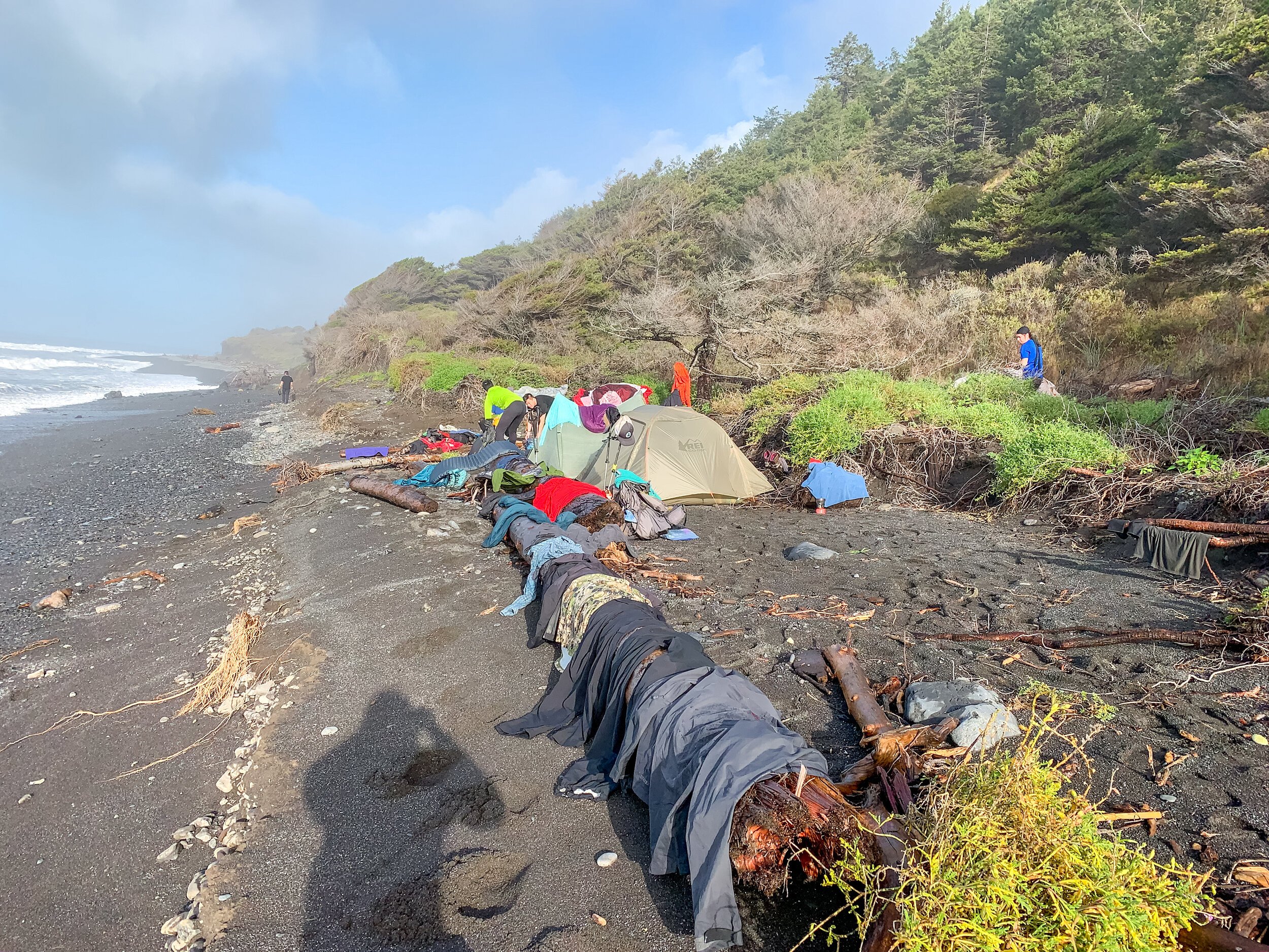
Soon enough, everyone else got out of bed and laid all of their things out to dry too. We ate breakfast, changed our clothes, admired the last bits of scenery, soaked up the warm sun, and watched our things dry before finally packing up and finishing off the trail.

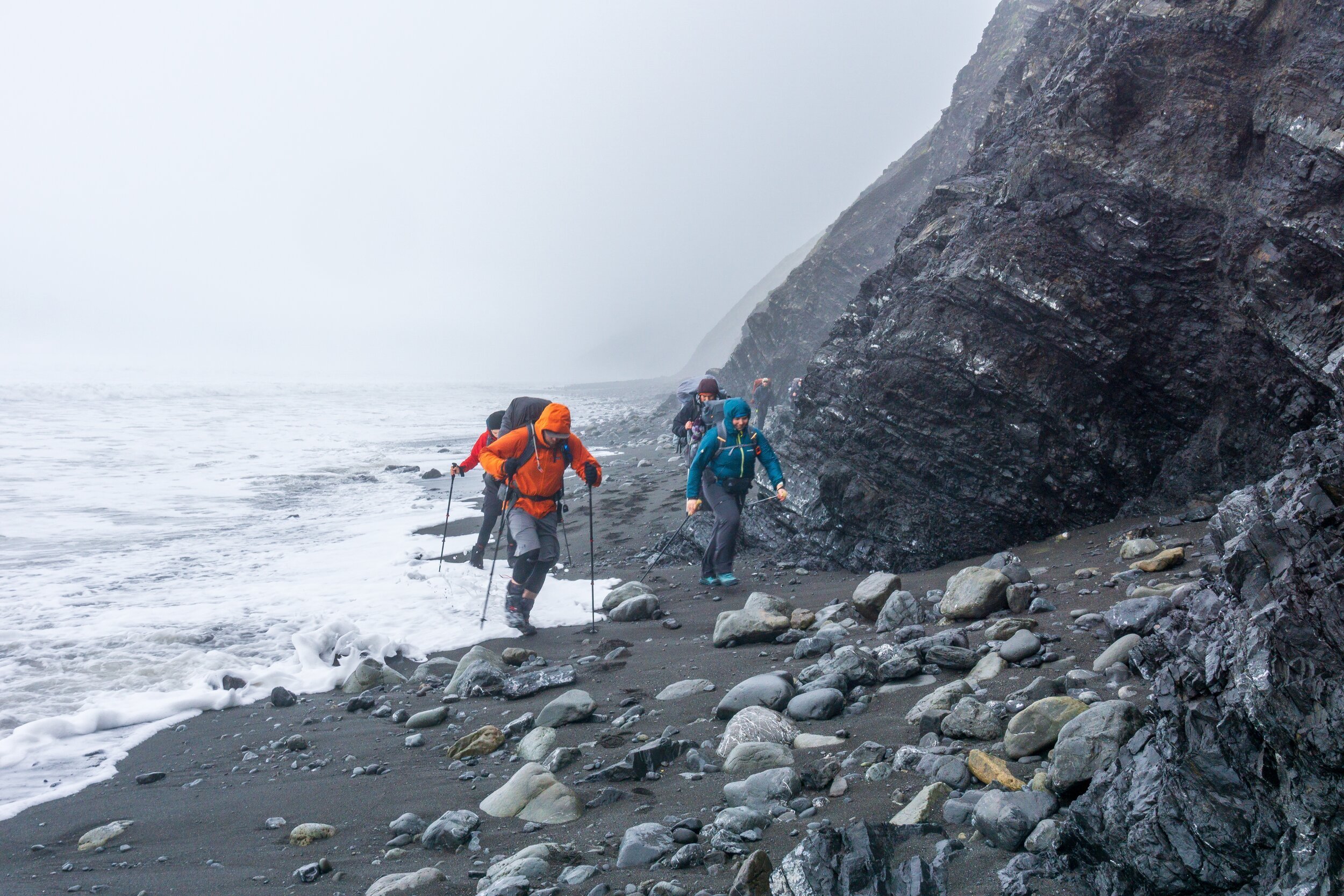
Our last trial would be navigating the big rocks, as seen in the photo below. The waves were still coming up pretty high, and crashing on the rocks, even though we weren’t in an impassable zone. So we got one more thrill: climbing up, around, and through the rock closer to land to avoid being trapped between the rocks by waves. Which was a good decision too, as the waves were really pounding the rock closer to the ocean. It was an exhilarating way to end the trip.

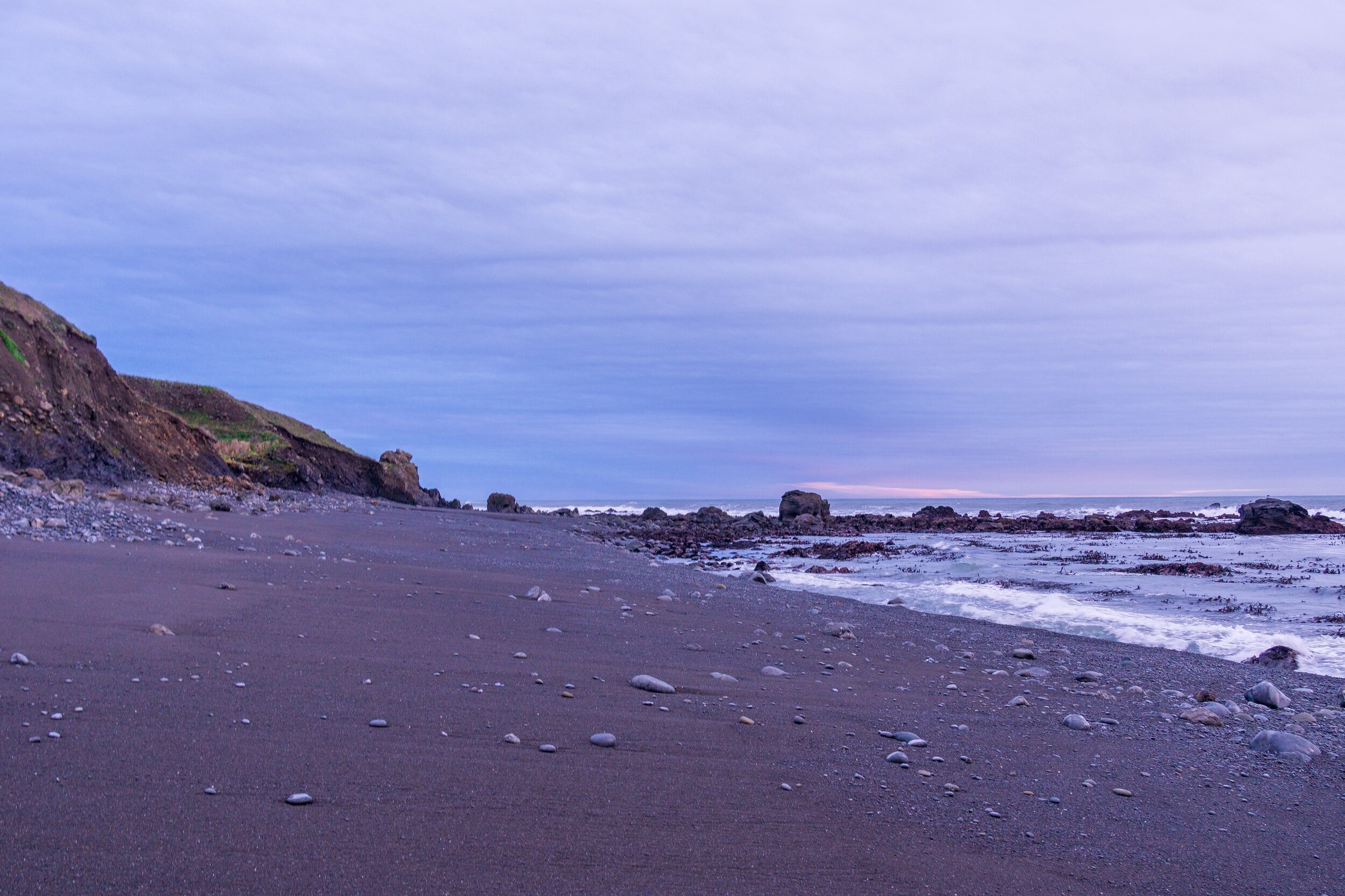
Black Sands Beach, the Southern Terminus
And just like that, we finished our hike! We were hoping for a breezy end to the day, but seeing my car a bit mangled from a lovely hit & run accident in the parking lot kind of put an end to the post-hike high real fast. We all made it back home in one piece, and I now have a new car to take on adventures. RIP Jetta.
