Emigrant Wilderness Backpacking: Iceland Lake
After a co-worker of mine lamented that he got snubbed for all of his backpacking trips this year (COVID, fire, smoke…), I knew we had to plan a great trip to change that luck. Thankfully, a group of us were all able to get time off, so we set off for the mountains! Emigrant wasn’t our first choice, but it was the only wilderness area open to overnight use at the time. Stoves were still banned, so we had to cold soak our food, but good times were had. Read on to learn about the trip route!
TRAIL INFO & STATS
Where: Emigrant Wilderness, Stanislaus National Forest
Miles: 20
Elevation Gain/ Loss: 4,400 ft
Time to complete: 2-4 days
Trail Type: Lollipop
Permits Required: YES
Pets Allowed: YES
Trailhead: Kennedy Meadows
Itinerary & Trip Planning
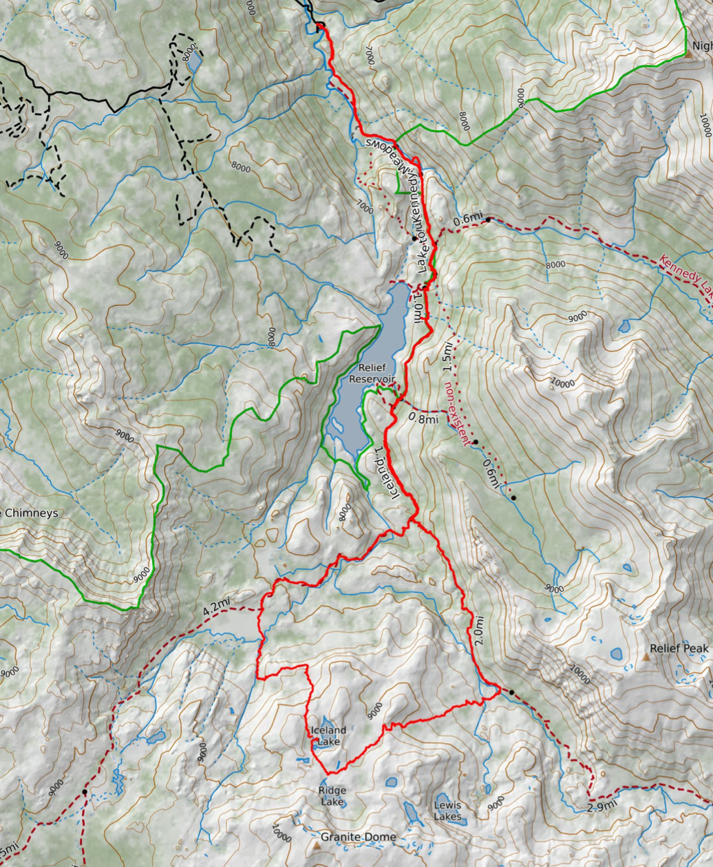
This hike has off-trail portions to get to Iceland Lake. While the trip is suited for beginner cross-country hikers, please do not take cross-country travel lightly. You should have a paper map and compass with you, and be familiar with reading topographical maps to understand the terrain you will be walking through. A GPS device will also come in handy. My Garmin Fenix 6 Sapphire watch and GaiaGPS phone app were great companions to the map & compass. While this trip was originally planned as an out-and-back, we were able to identify a path down to Relief Creek and Lower Relief Valley and see some new terrain! We also contemplated a summit of Granite Dome, but were too tired on the day we hiked to Iceland Lake. The best route up also looks like it’s near Upper Lewis Lake, and we did not venture over that way. You could easily spend another night up in this basin!


Trip Report & Trail Journal
Day One: Kennedy Meadows Trailhead to Summit Creek.
7.5 miles, +3,000 -1,000 feet elevation change.
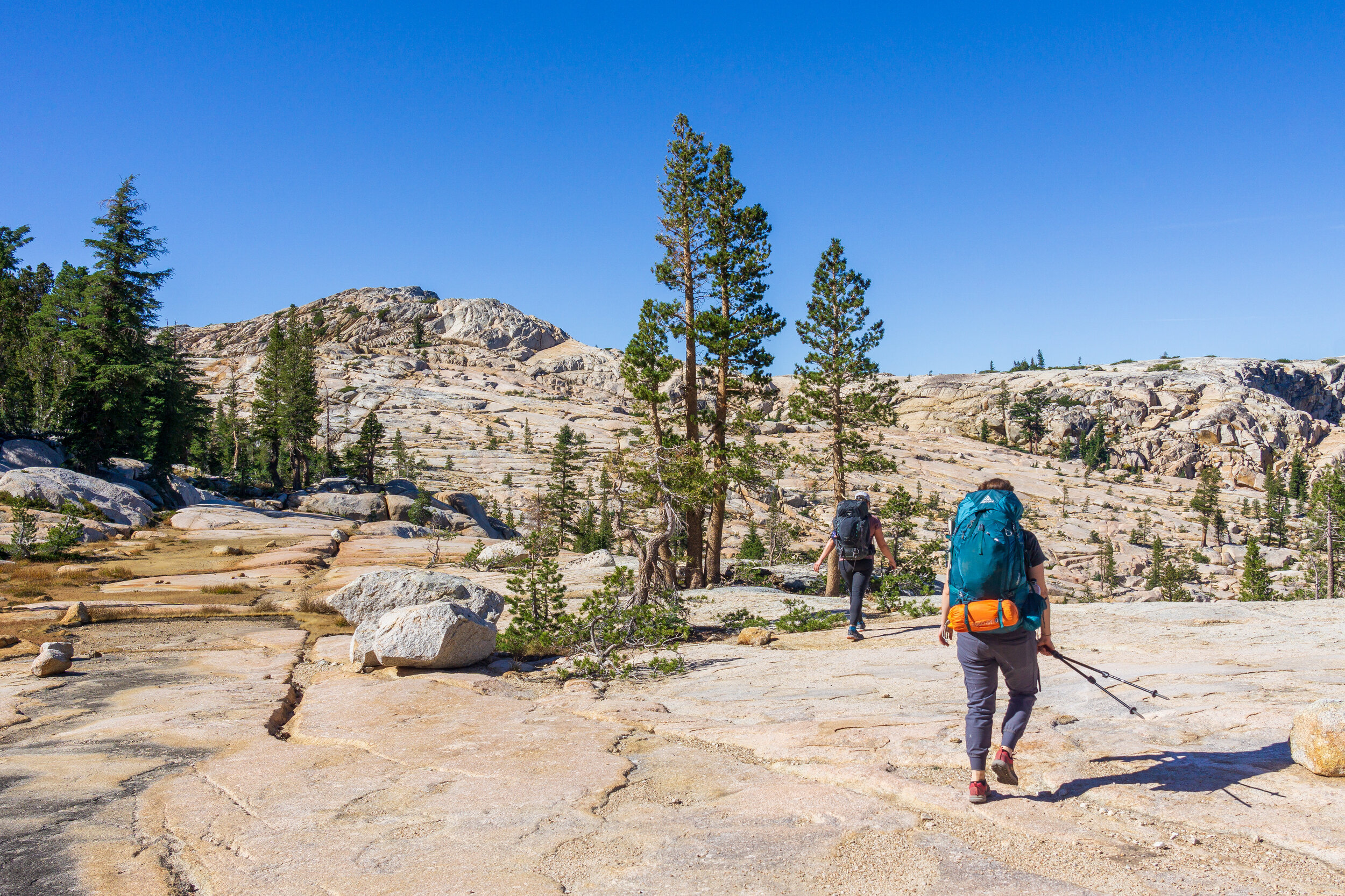
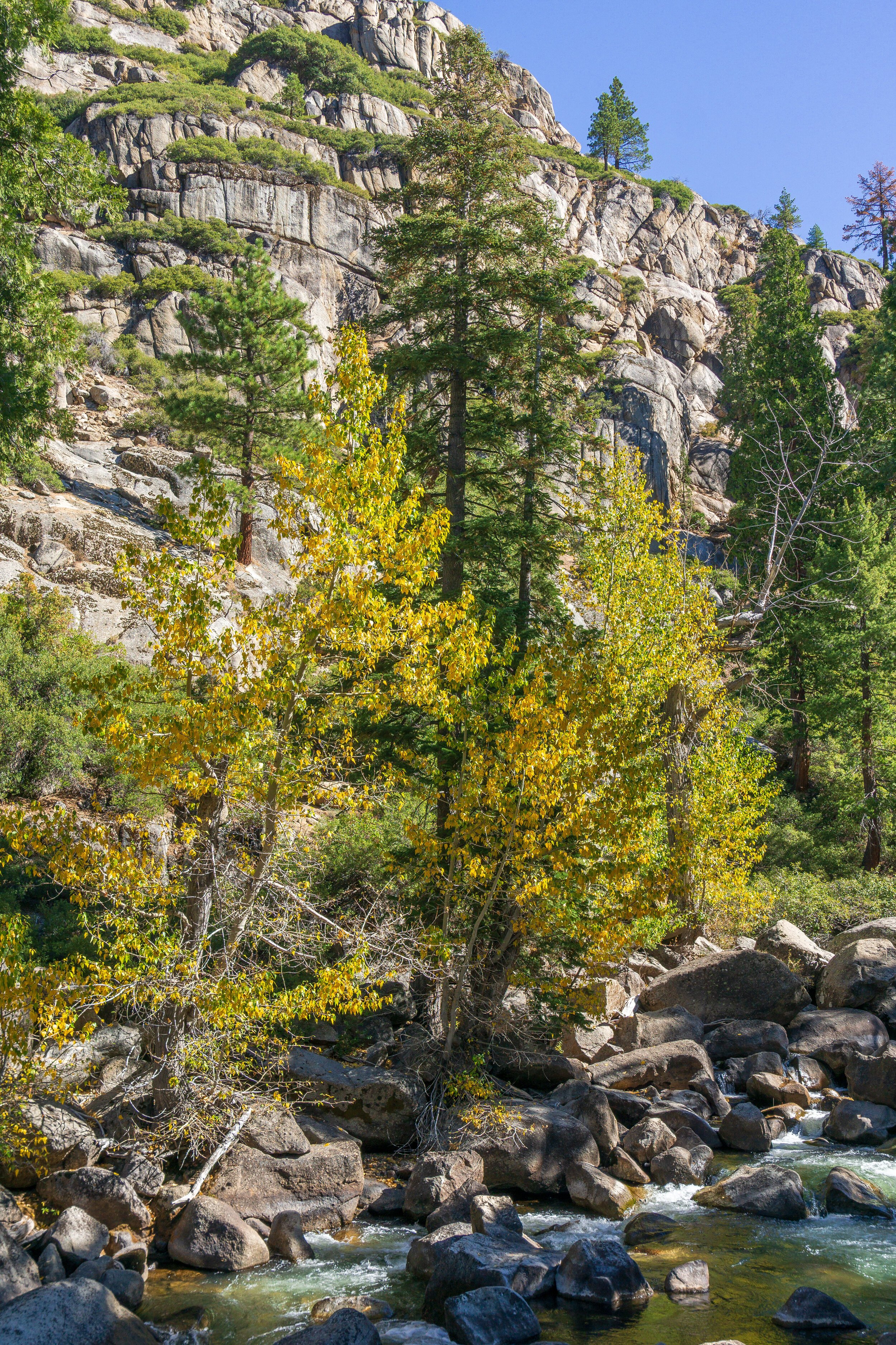
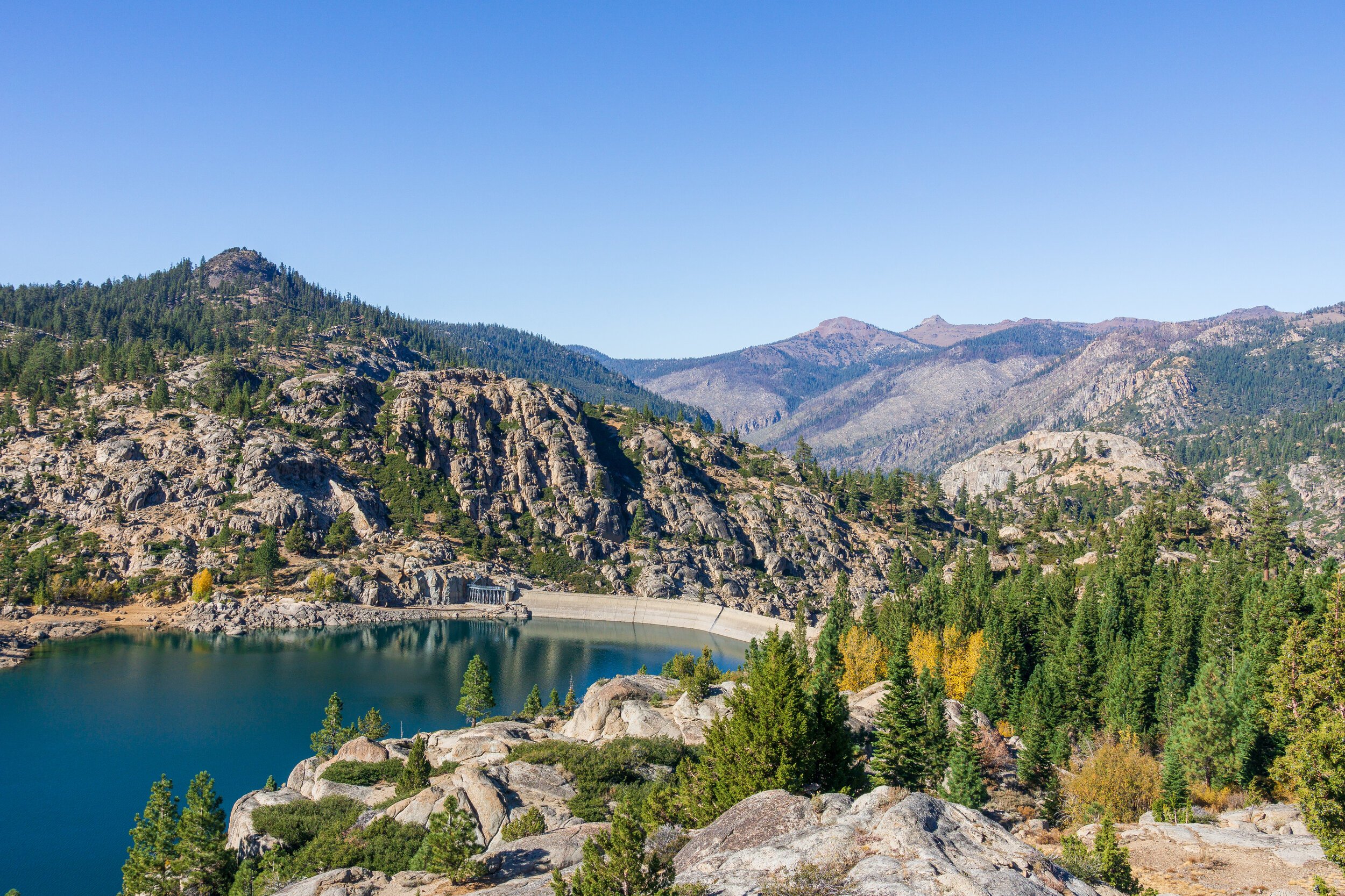
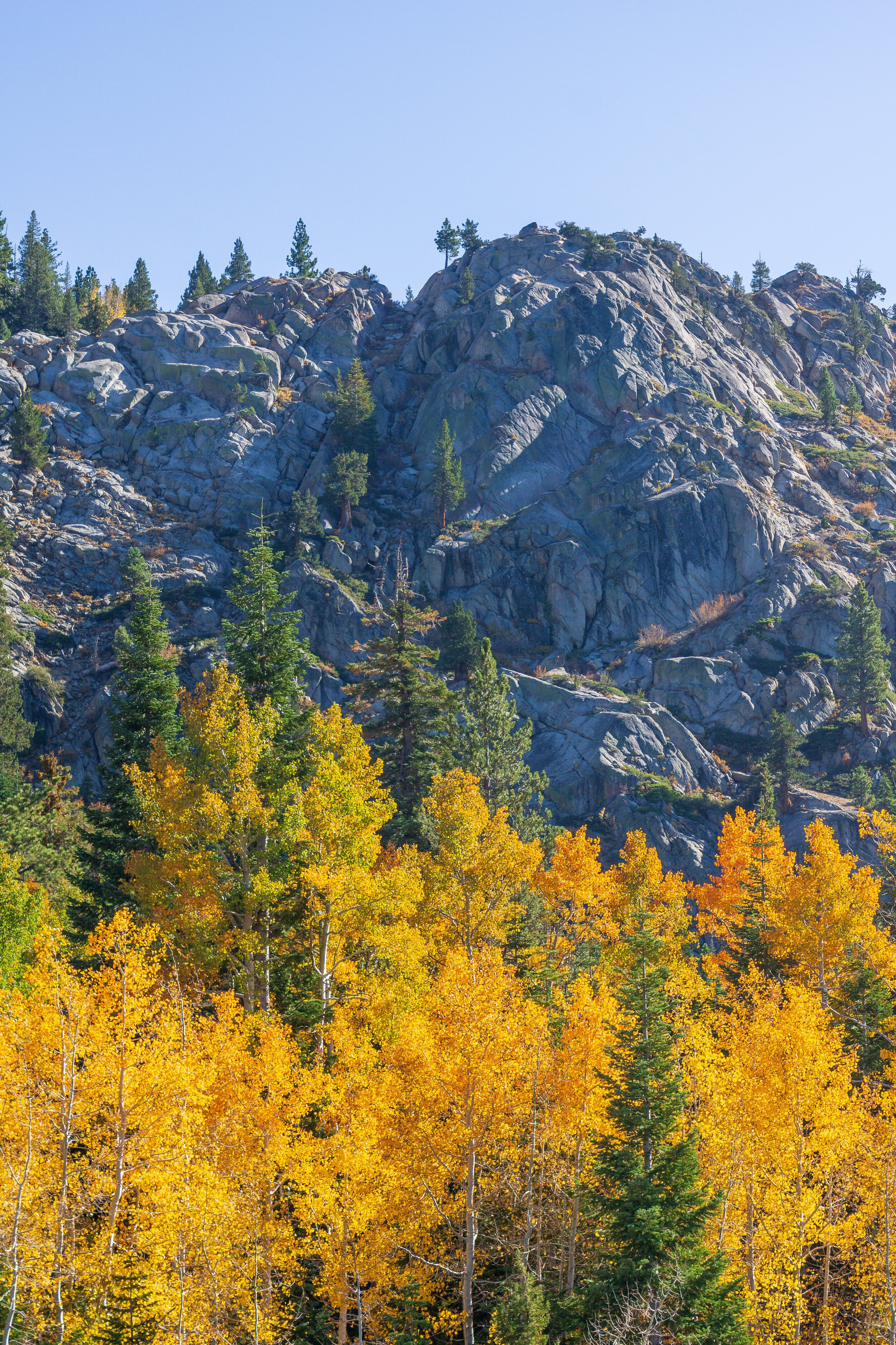
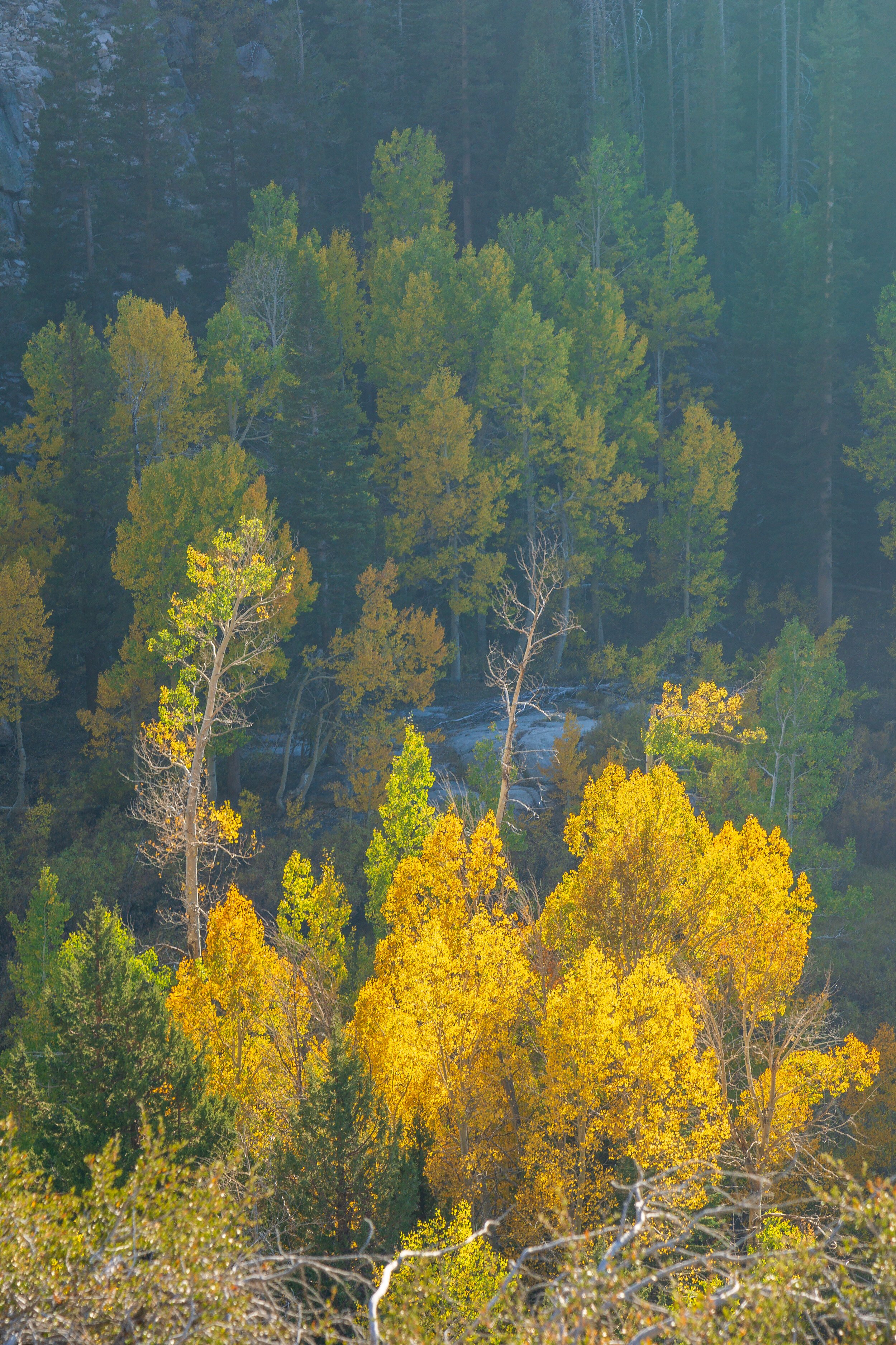
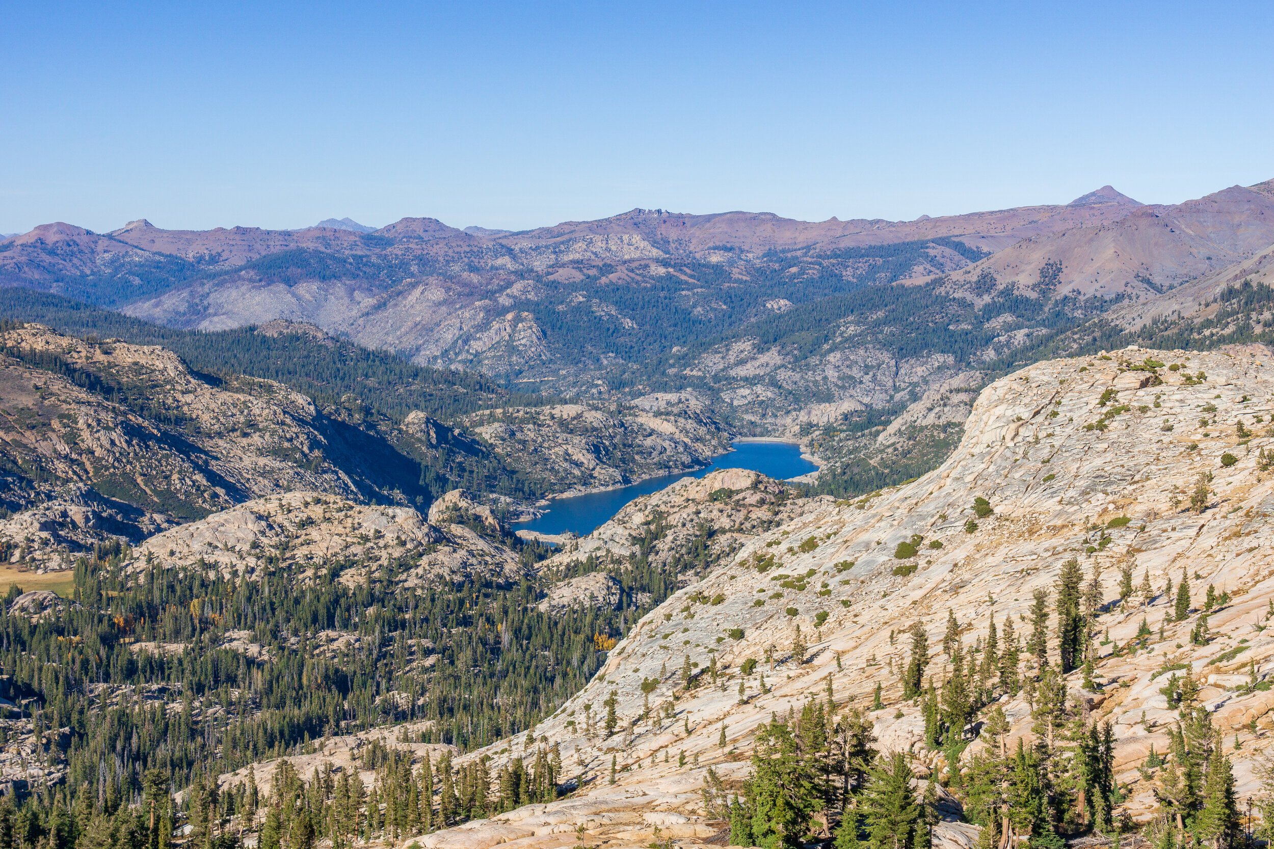
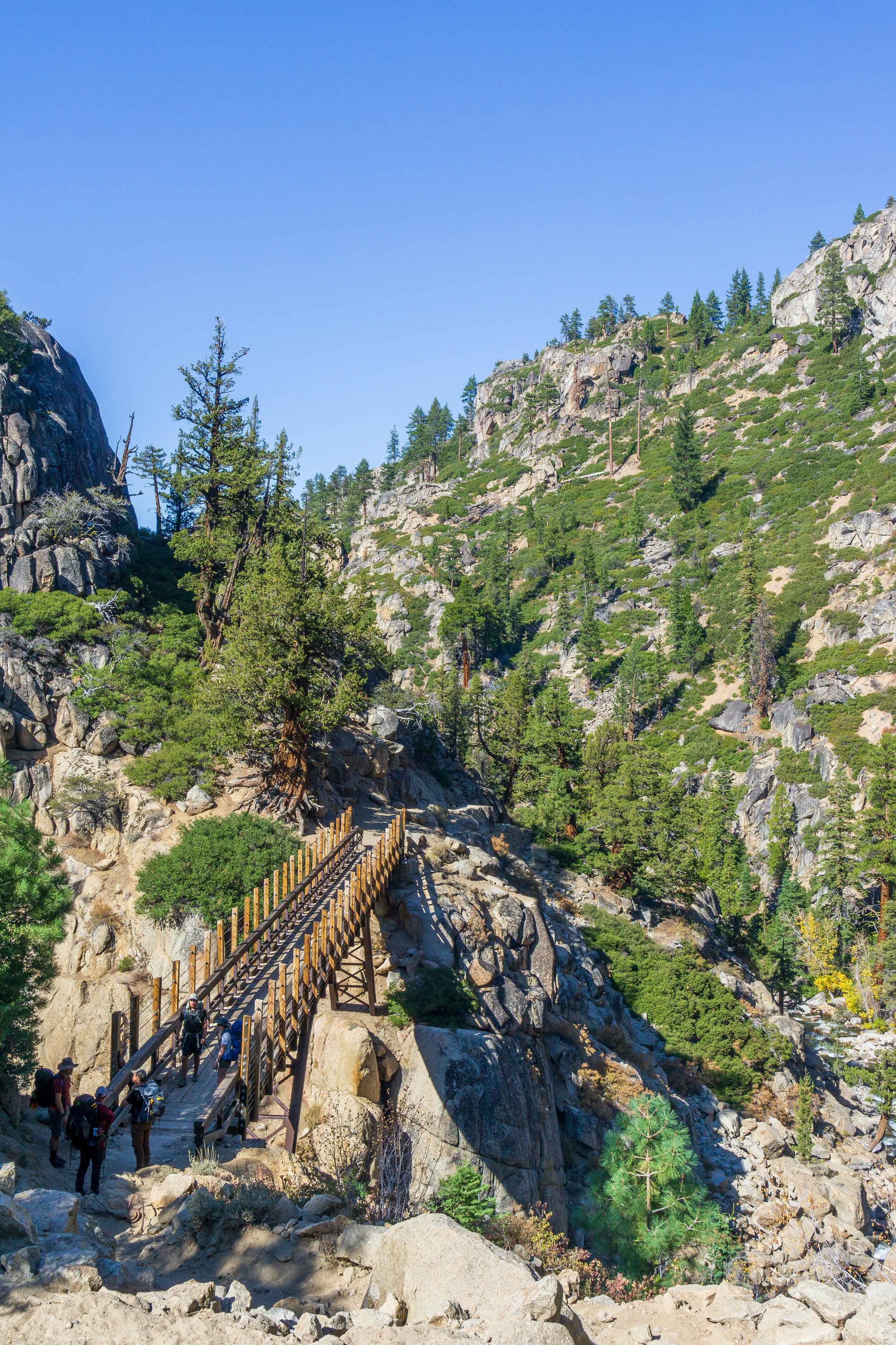
After a later than anticipated start, we finally hit the trail around 11:30 am from the trailhead past Kennedy Meadows Resort. Based on trip reports, I was dreading the first part of the hike because of horse poop, but it actually was really fine, probably because it was late in the season. The trail was very wide and sandy until we hit the border of the Emigrant Wilderness, when the trail turned into more of a trail than a dirt road. Starting at the border, about a mile into the hike, the trail begins to climb. Gradually at first, crossing over two footbridges, and then climbs more steeply until Relief Reservoir comes into view. We all took a break at the first major overlook, enjoying the warm, mid-October sun and the most fall colors we had seen so far in the season. I’m normally not a fan of wilderness reservoirs, but Relief is pretty. We enjoyed some flat/ downhill trail as we walked above the reservoir, which was a nice break from the constant up.
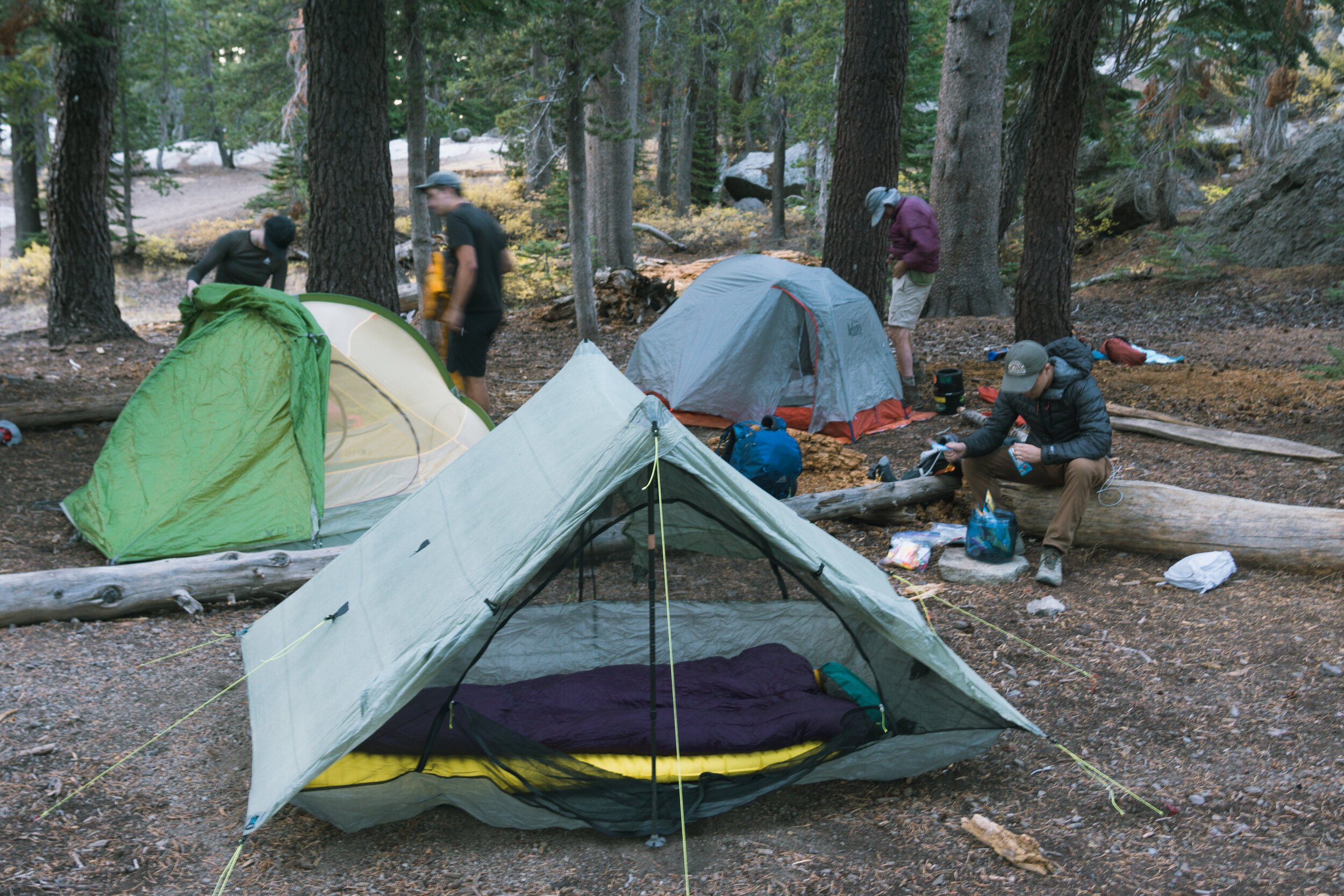
Our eyes were set on Grouse Creek as some of us were getting pretty low on water. Thankfully, this large creek was still flowing well, even in October. After a lengthy break in the shade, we continued our trek. The trail steadily climbs after this creek, but thankfully a lot of it is lightly shaded. Once we broke above the brush again, we had amazing views of Relief Valley and the ridges we were going to crest tomorrow. Since it was now late in the day, the light was perfect. I wanted to hang out on that ledge forever! We had to keep moving though. The trail flattened out a bit as we walked through Saucer Meadow and then we descended to our camp spot near Summit Creek. Be aware that there are “no camping” signs on the creek side of the trail, so be sure to camp on the other side of the trail.


Day Two: Summit Creek to Iceland Lake.
2.9 miles, +1,200 -300 feet elevation change.
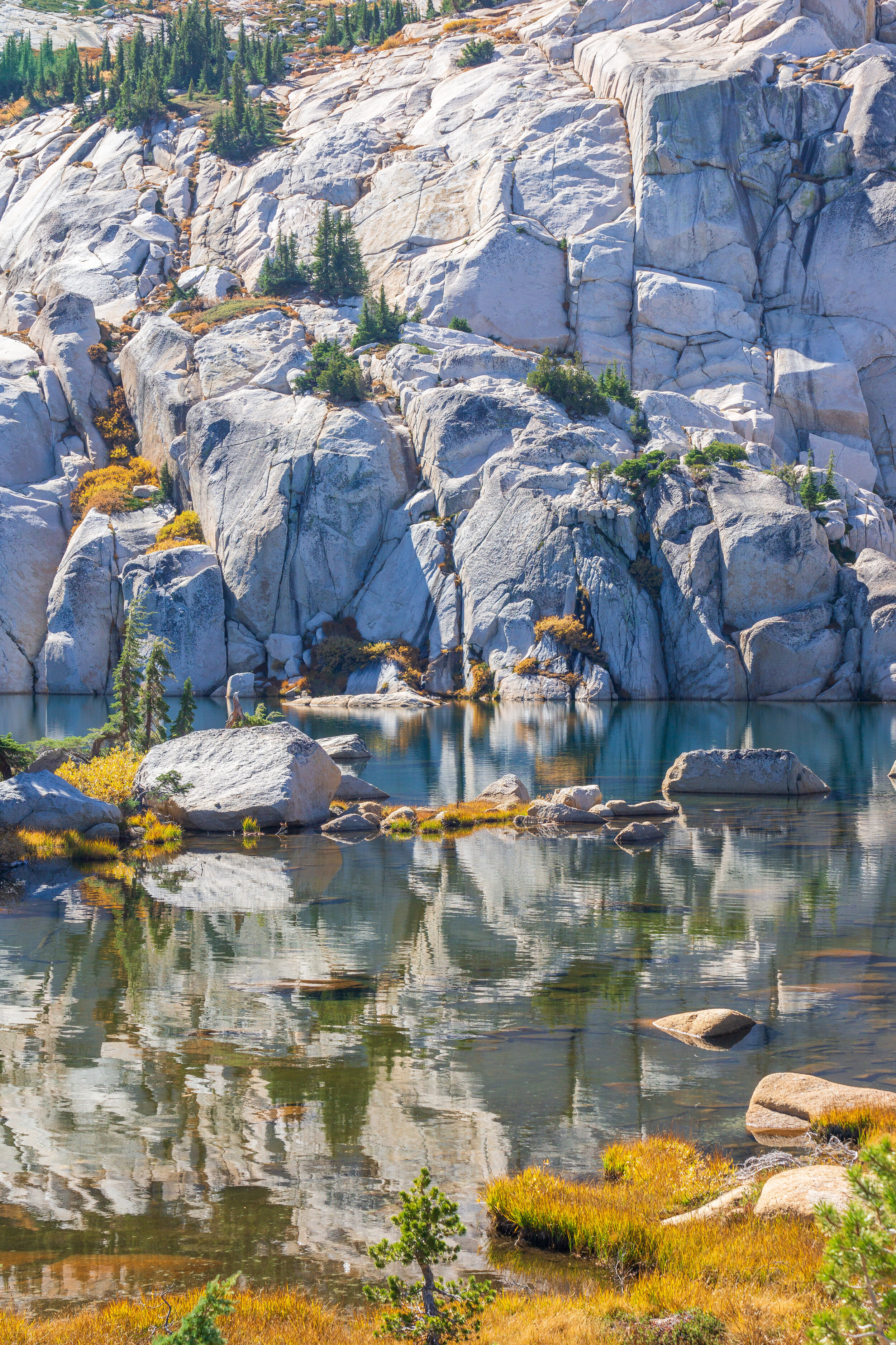
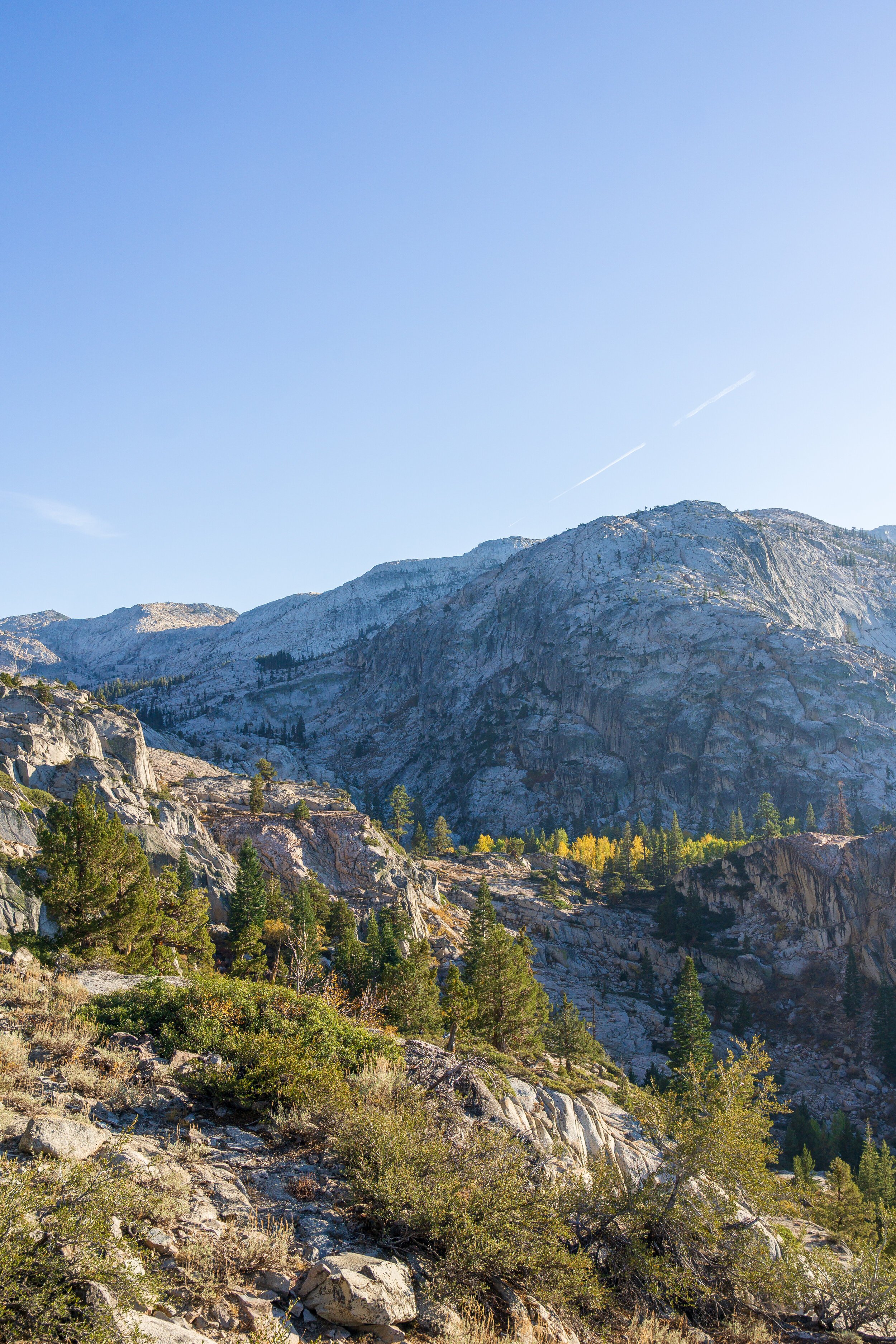
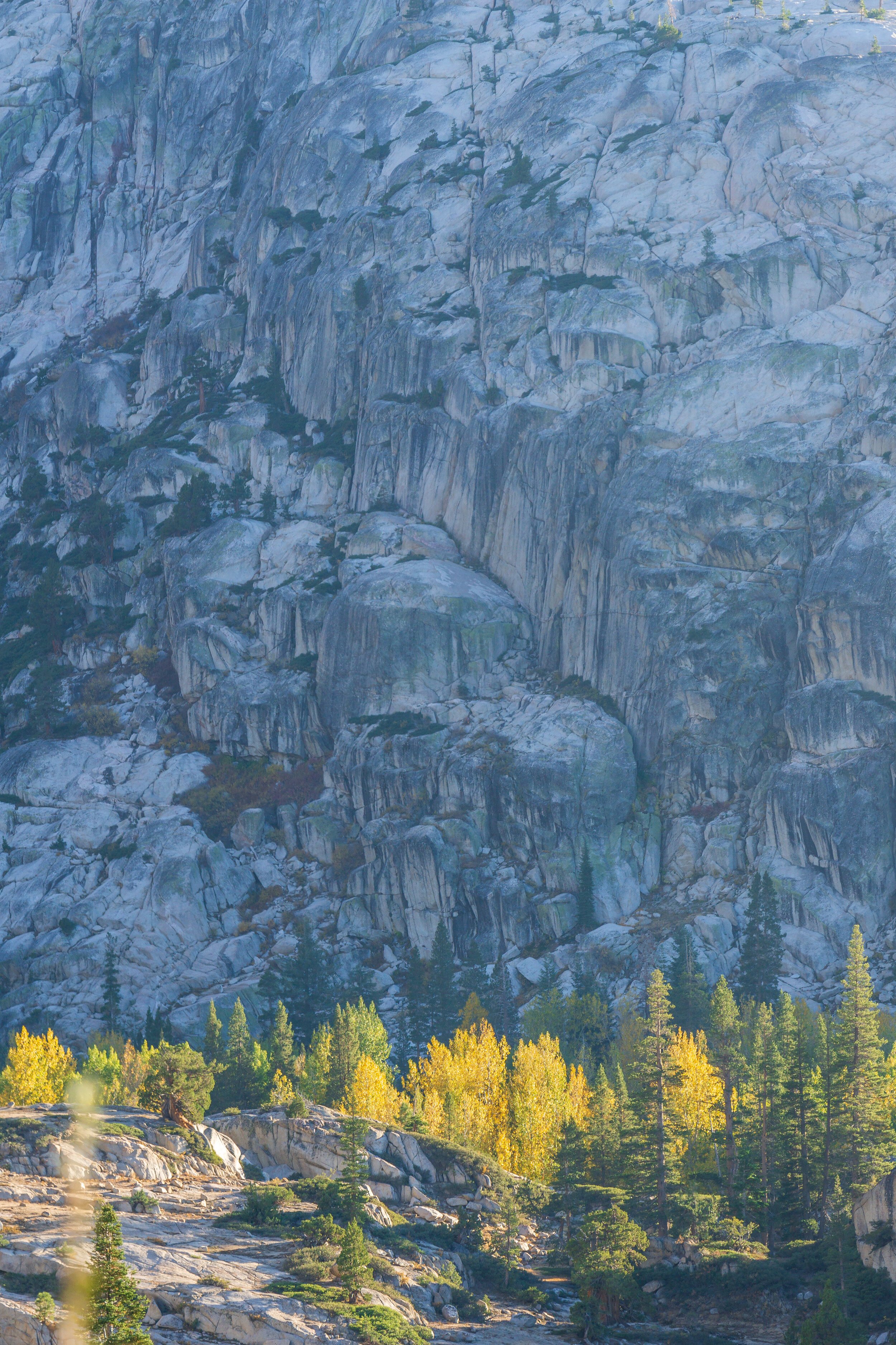
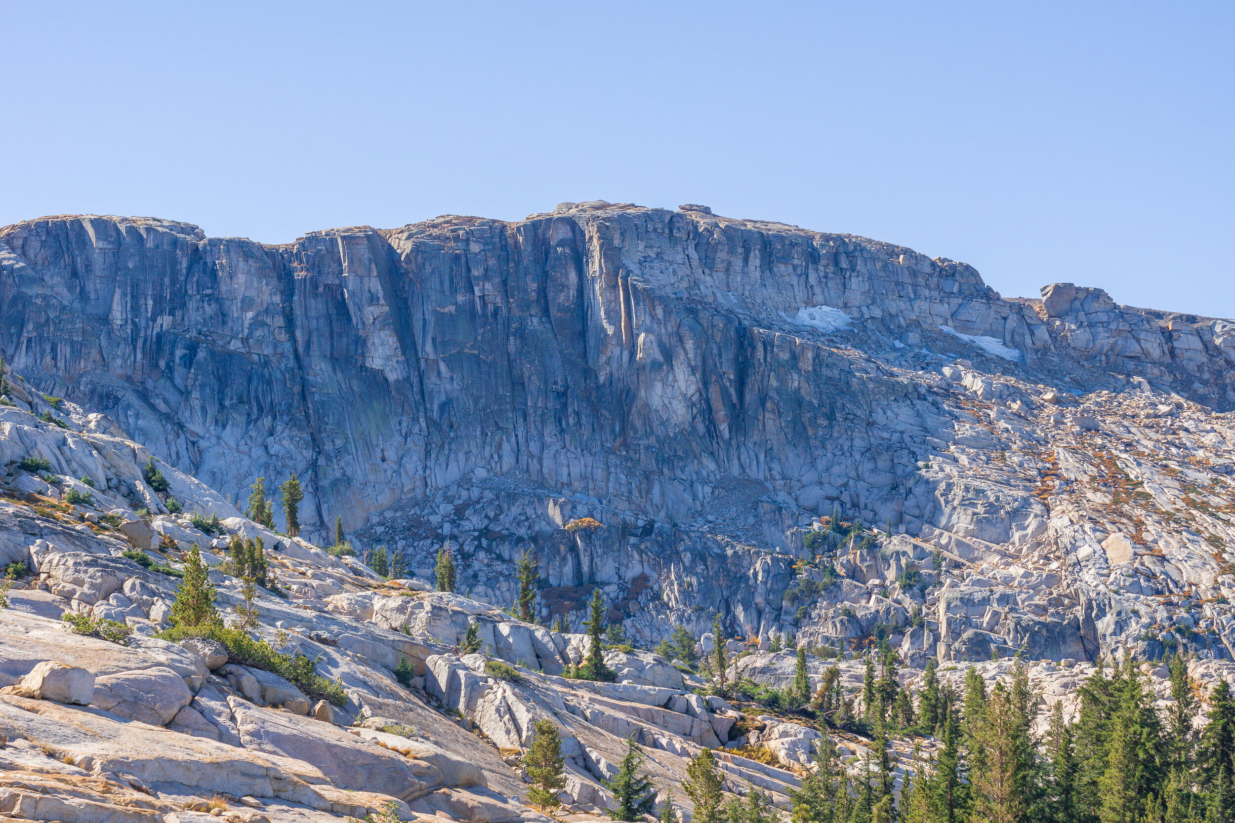
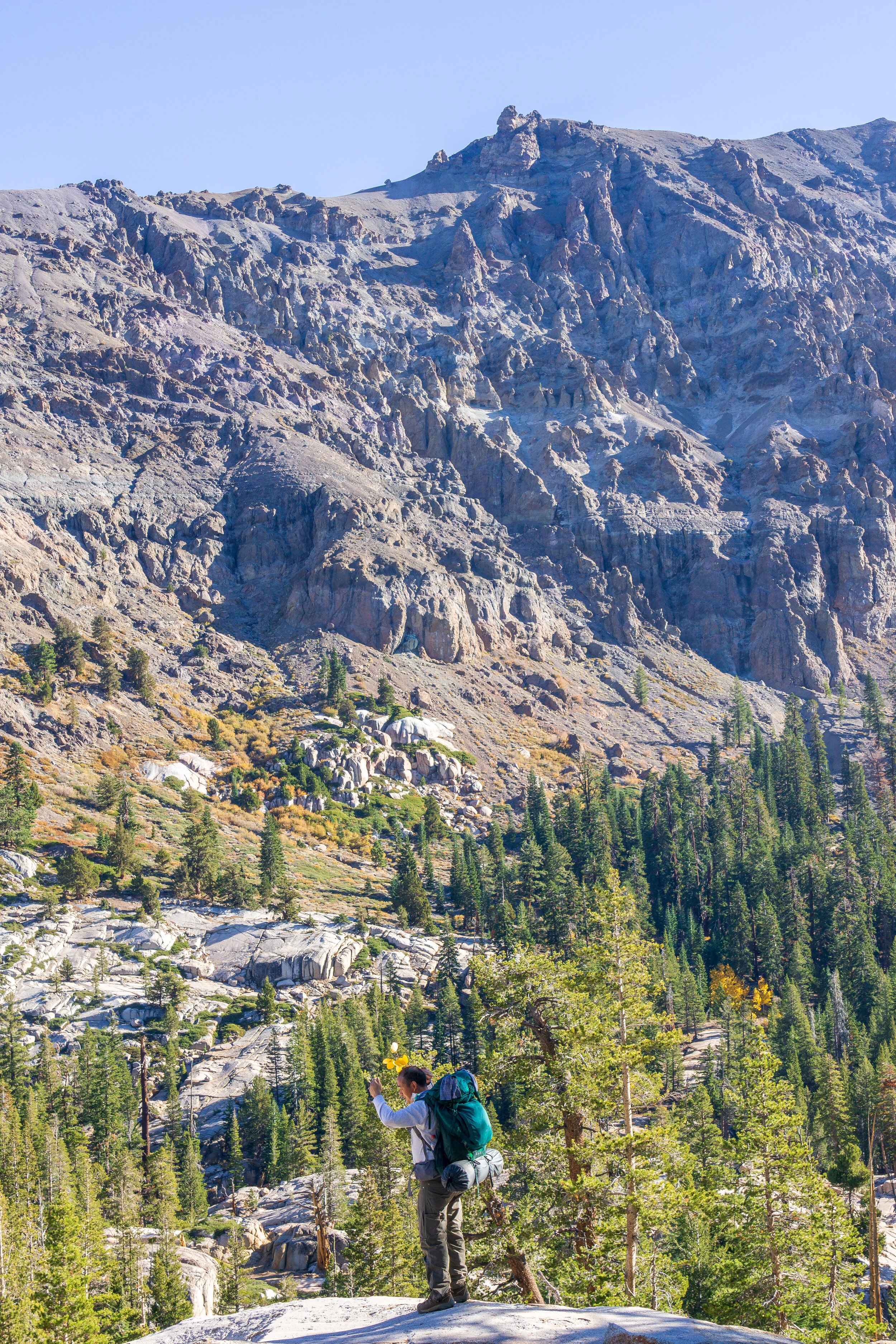
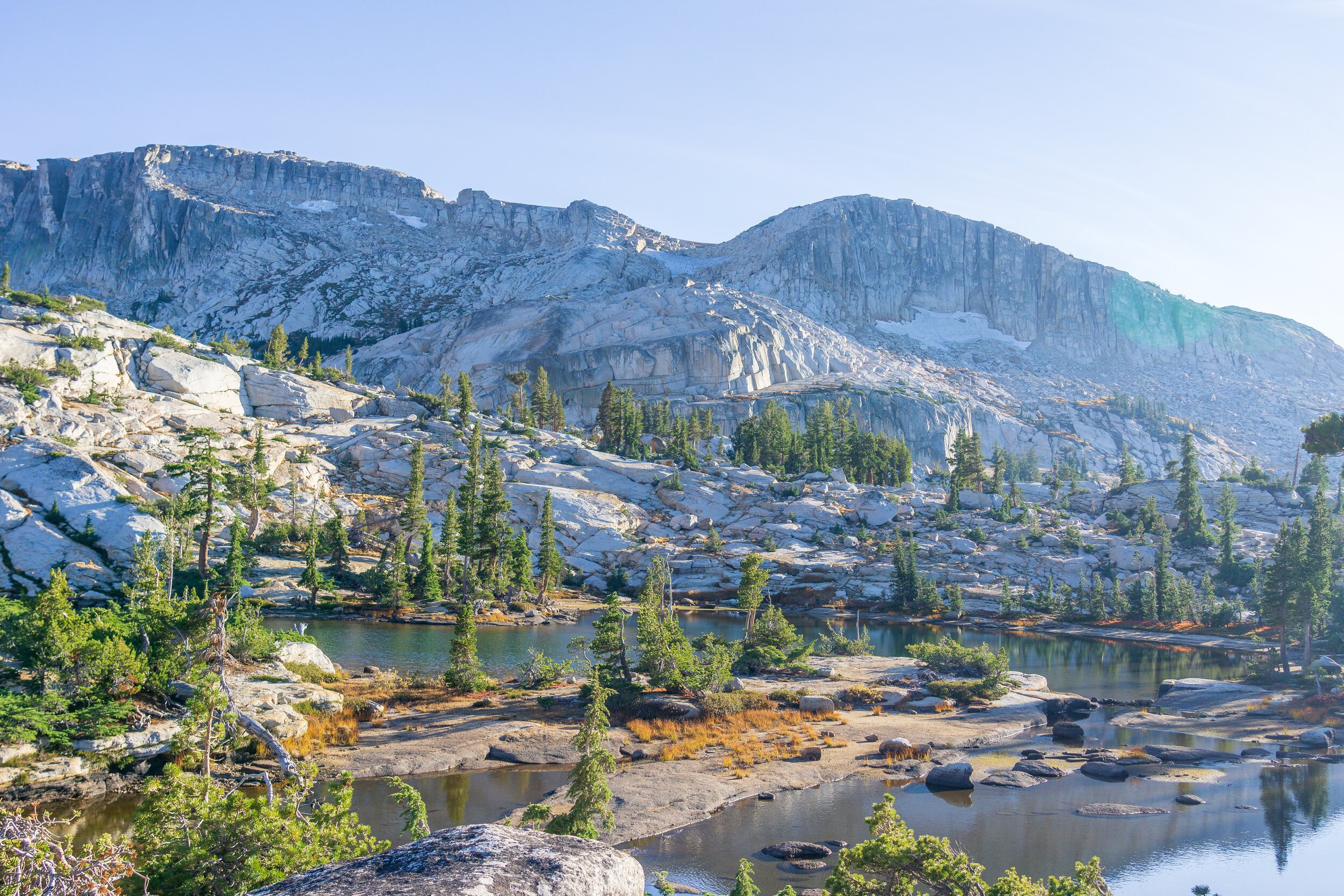
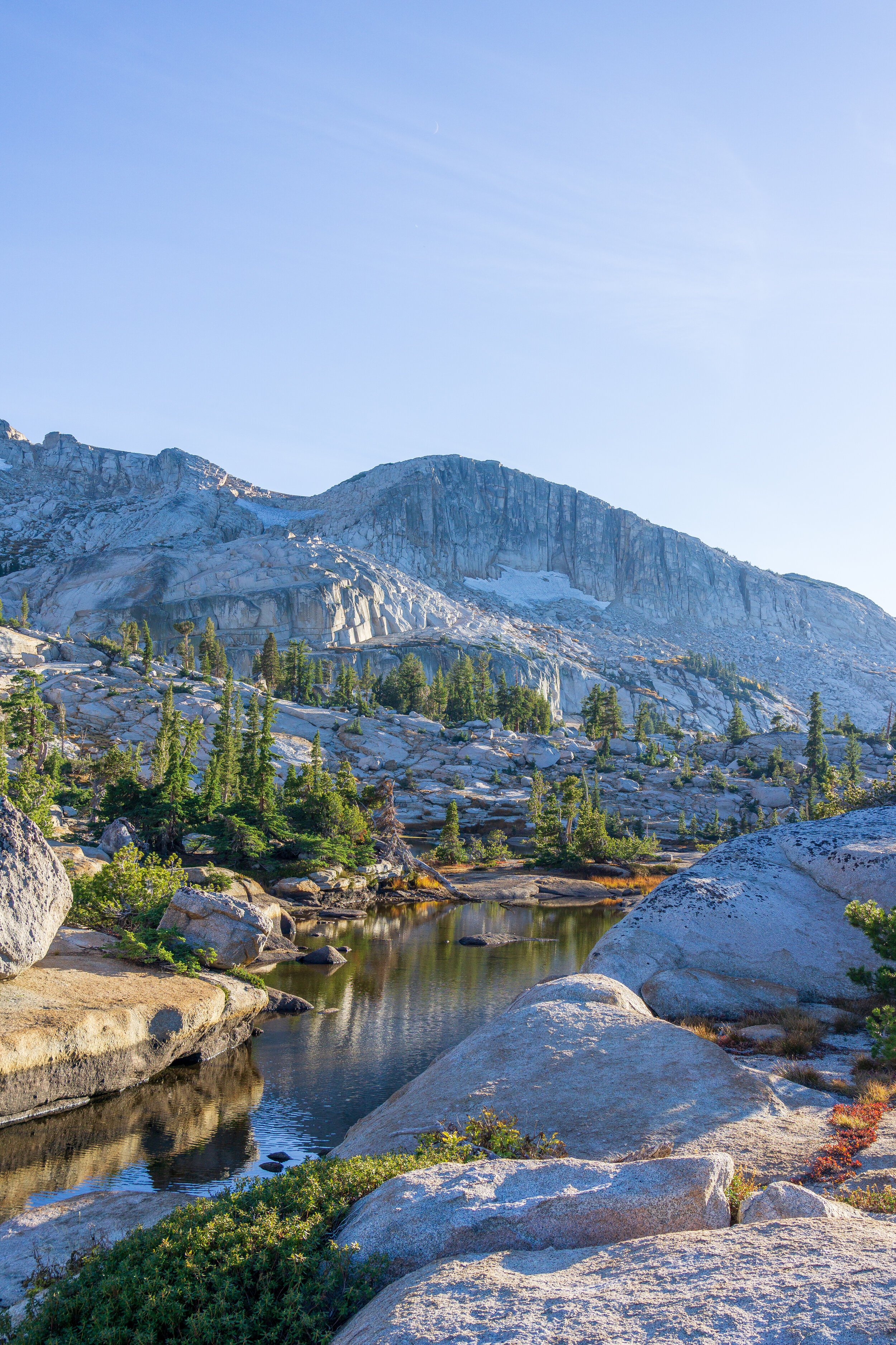
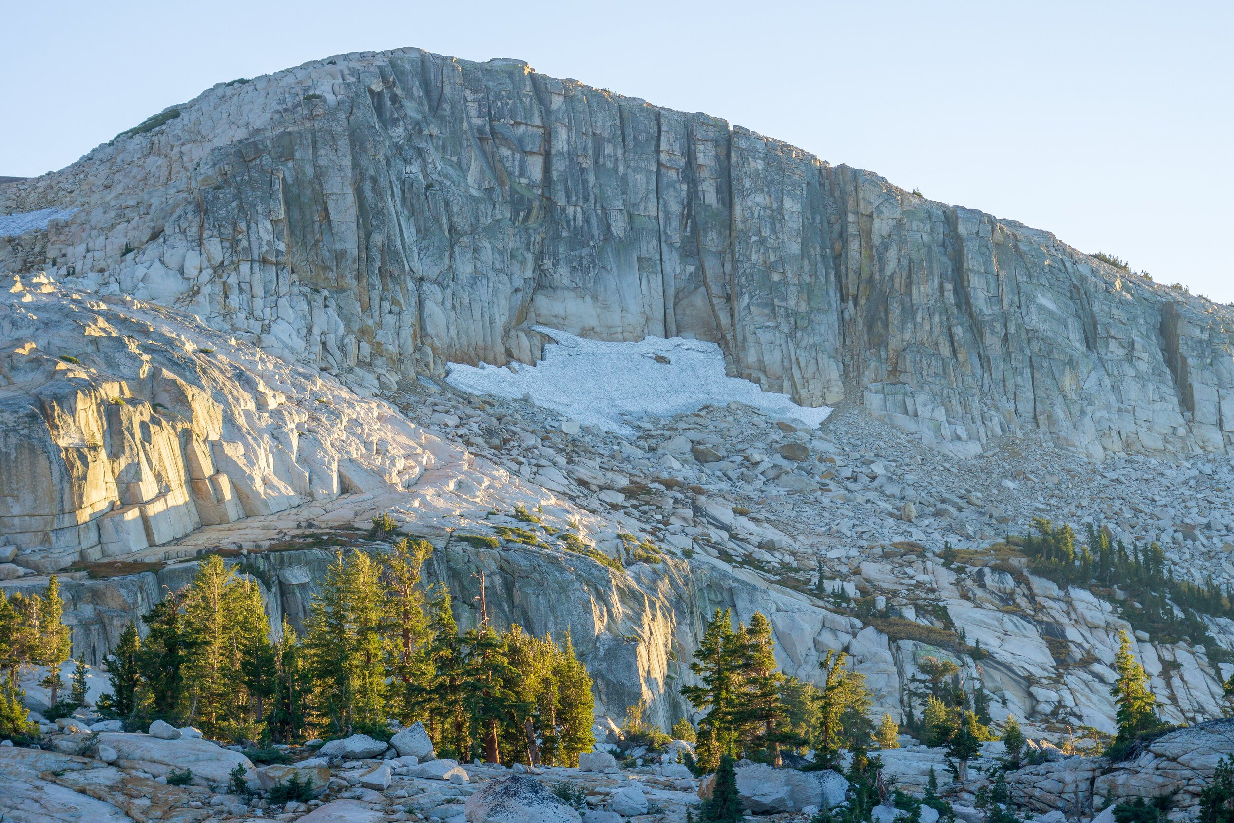
Since we had a long day yesterday, and with most of us not getting great sleep the night before we started out hike, we had a slower morning getting ready today. But, we didn’t have far to hike, so we enjoyed our breakfast and sleep. I walked down the trail a little bit more, studying the route we should take up the ridge. I decided we needed to continue down the main trail a bit more until we passed a larger granite hump on the ridge to reduce unnecessary climbing. We left the trail at a relatively obvious spot to cross the creek. There was a faint use trail, and a cairn (stack of rocks) on the other side of the creek. The hiking was a little slow going at the bottom here, since the trees were thicker, but we all spread out and tried to pick our best way up the slope. After a little up and down trying to find nice granite slopes, we were on the right track after we found another cairn. I quickly found out that cross-country travel is pretty fun: you get to choose your our route a bit, and read the terrain to figure out the best ways to go. Gradual sloping granite, YES! Patches of trees and boulders, NO! Ha. While the grade was steeper since we didn’t have nicely graded switchbacks to follow, we actually made ok time up to the top of the ridge. We sat up at the top for a while, amazed by the amphitheater of sloping granite and patchy trees. I thought we would see the lakes at the ridge, but I was mistaken.
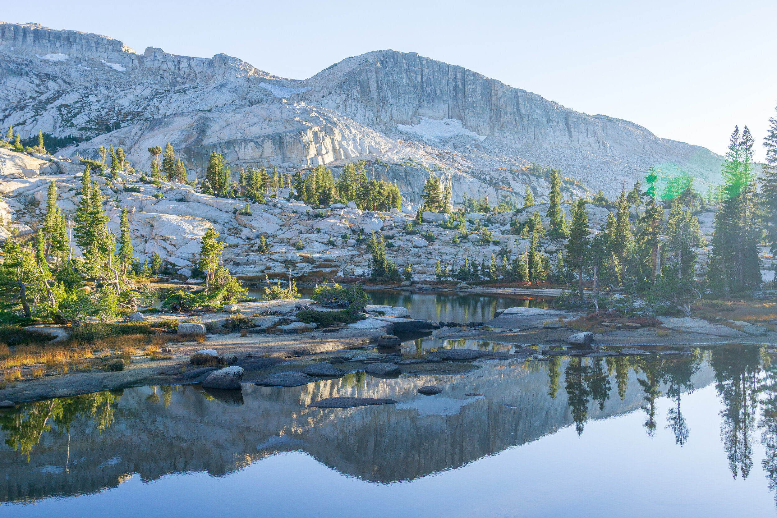
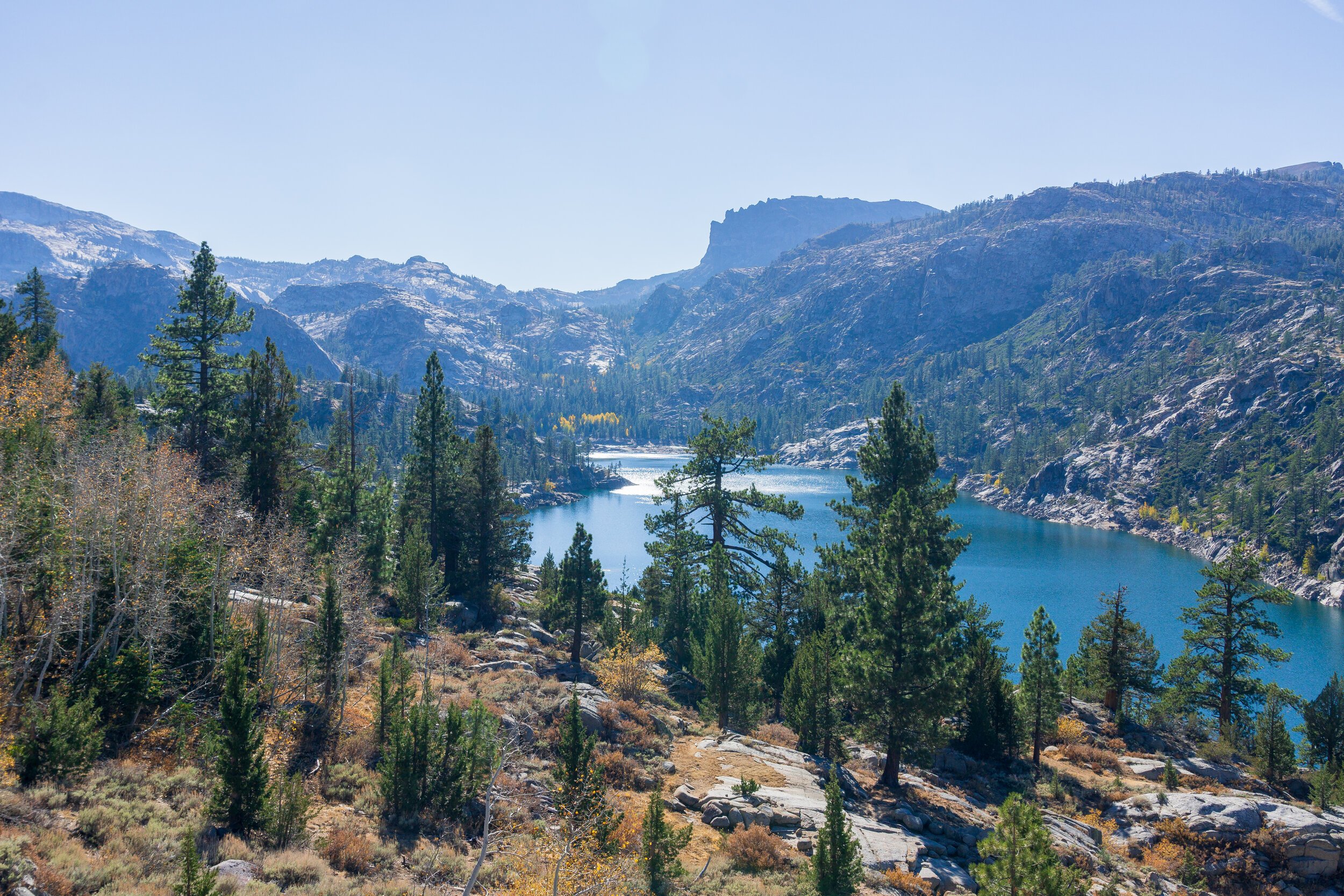
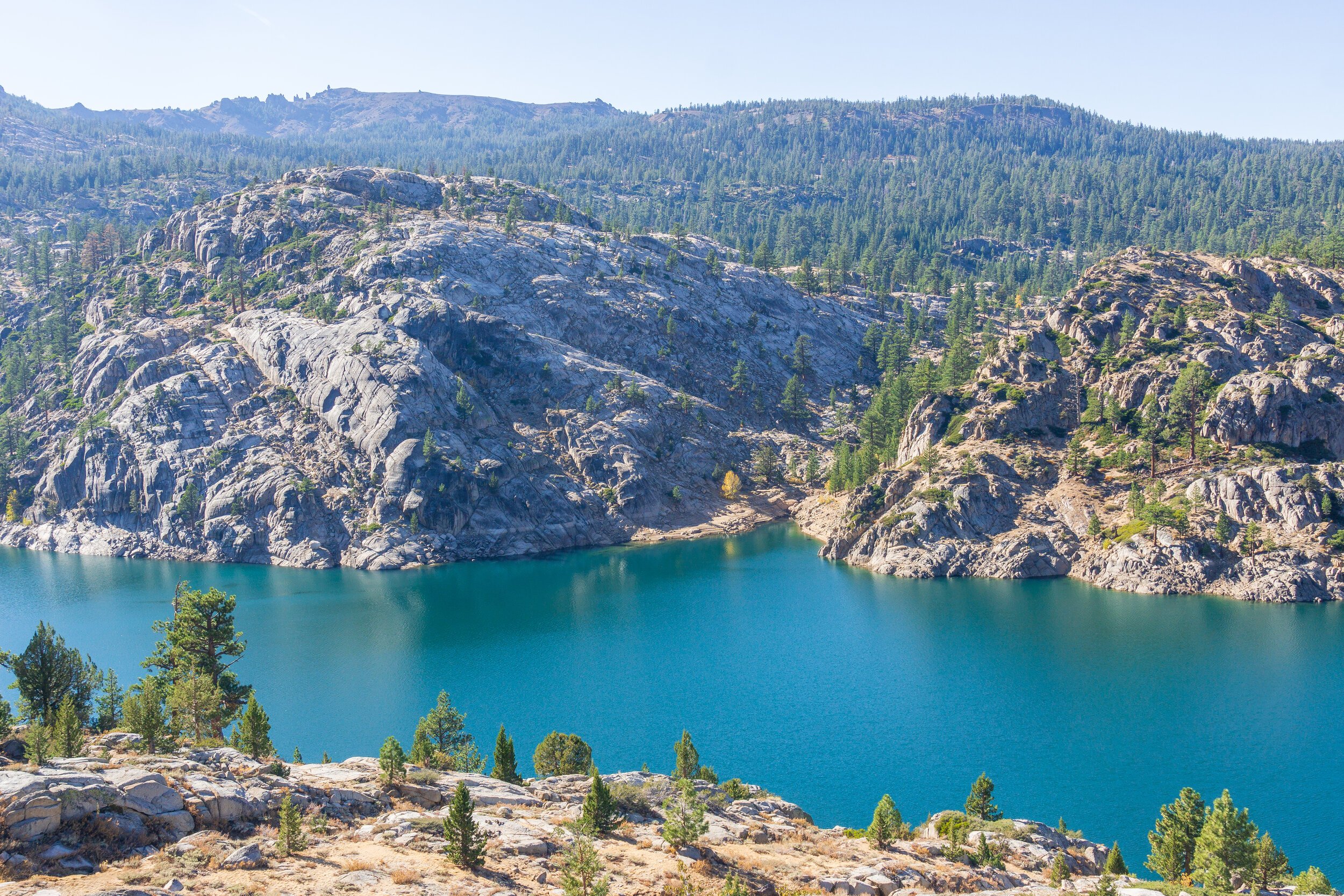
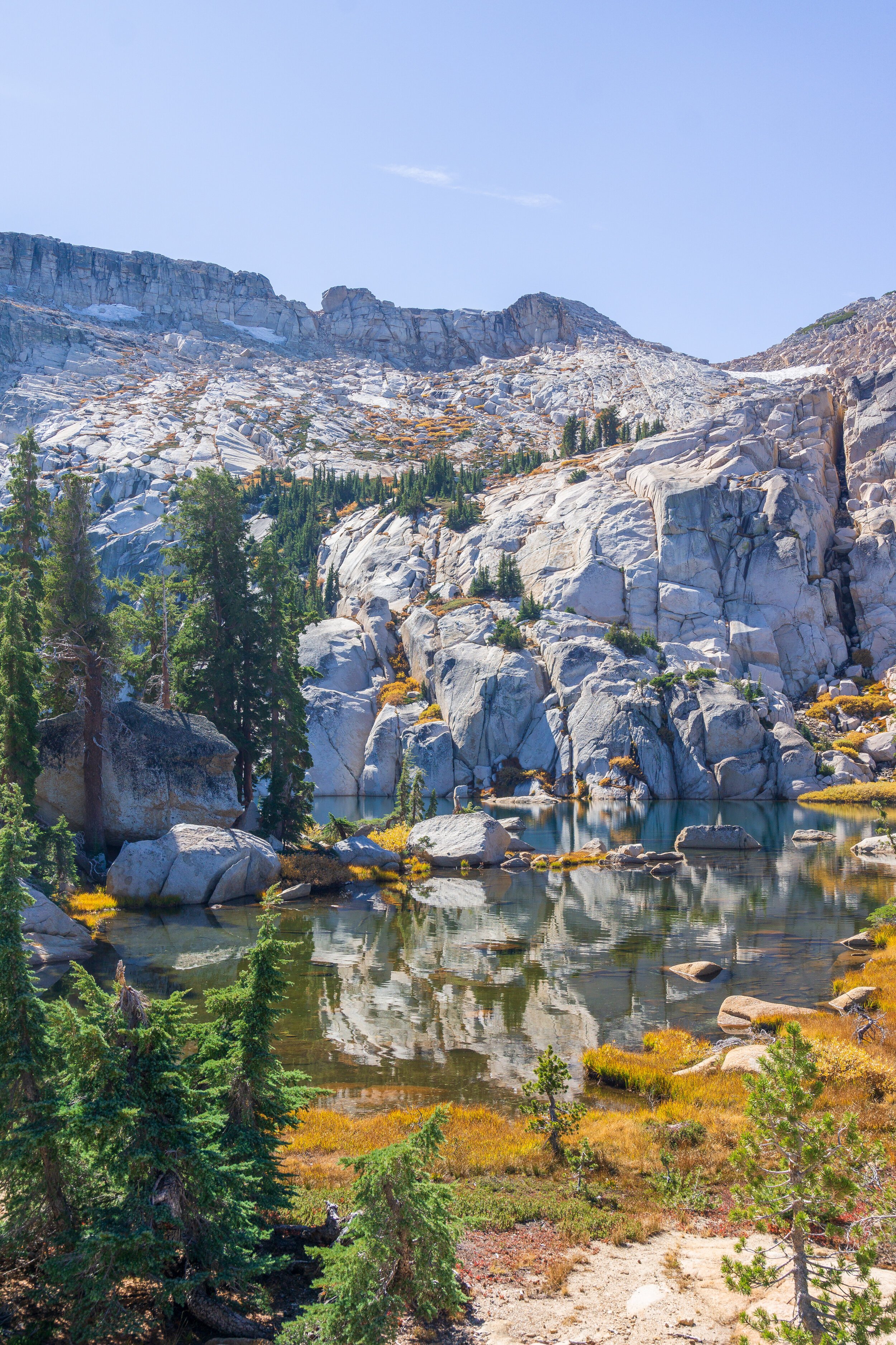
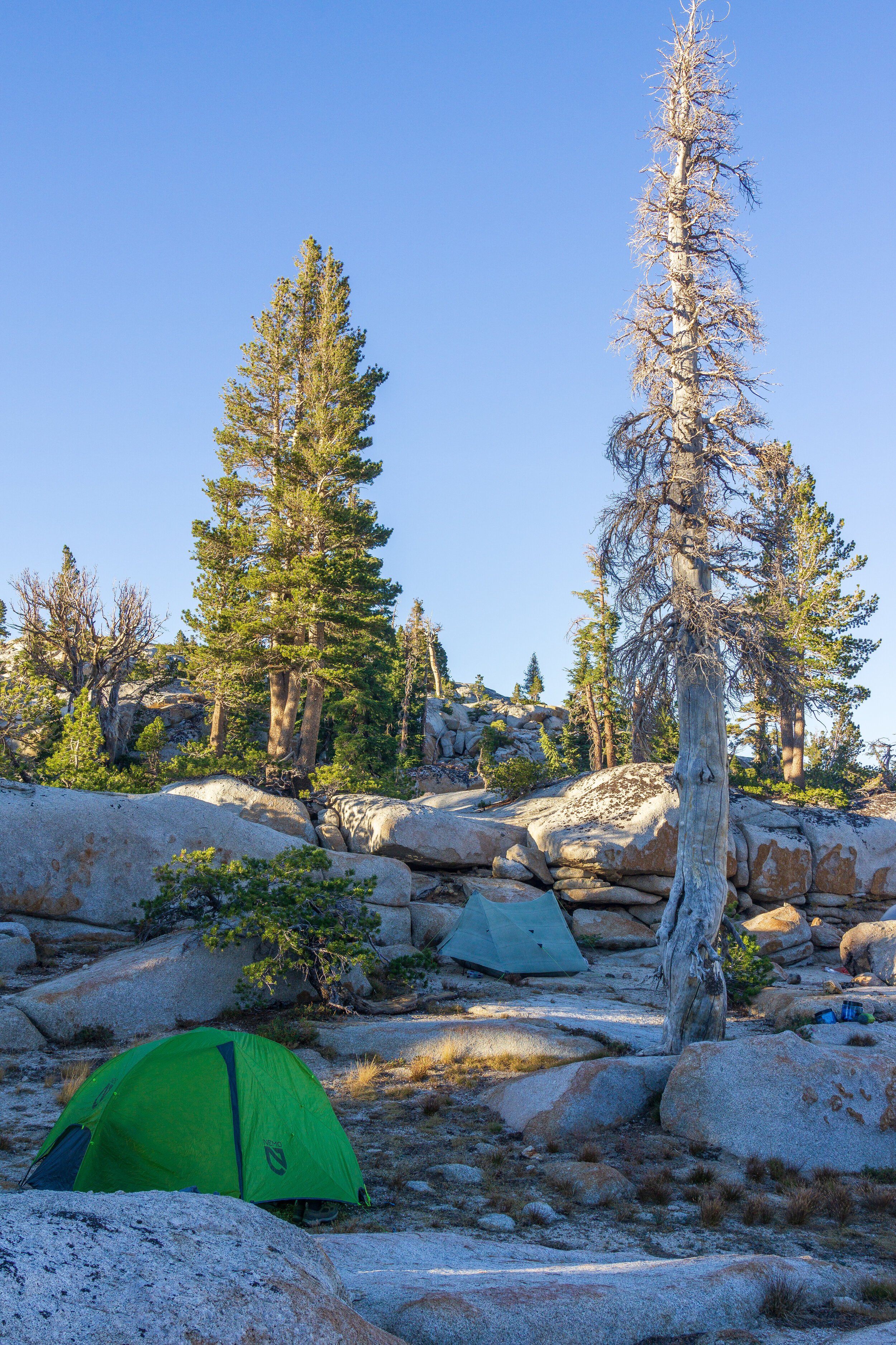
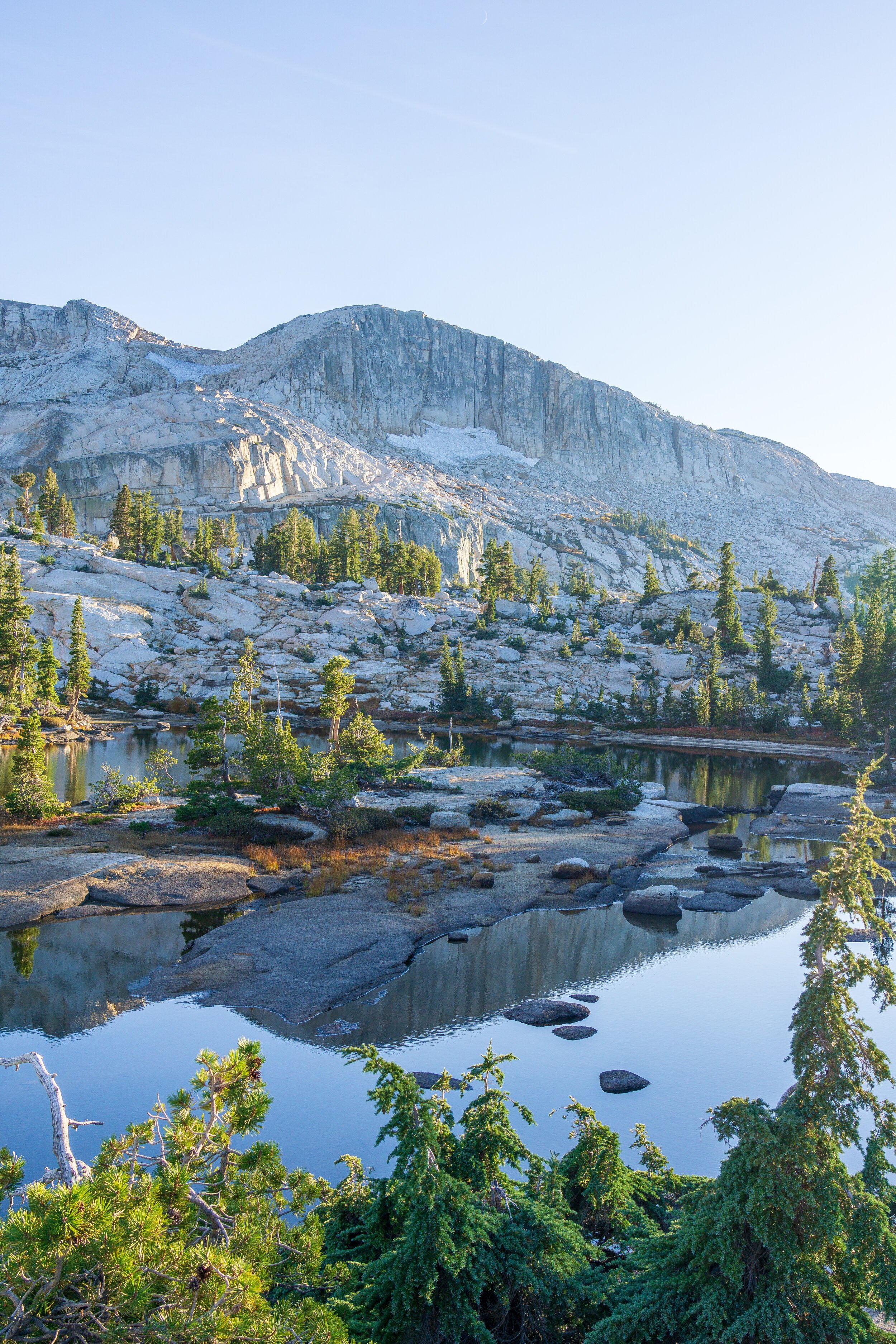
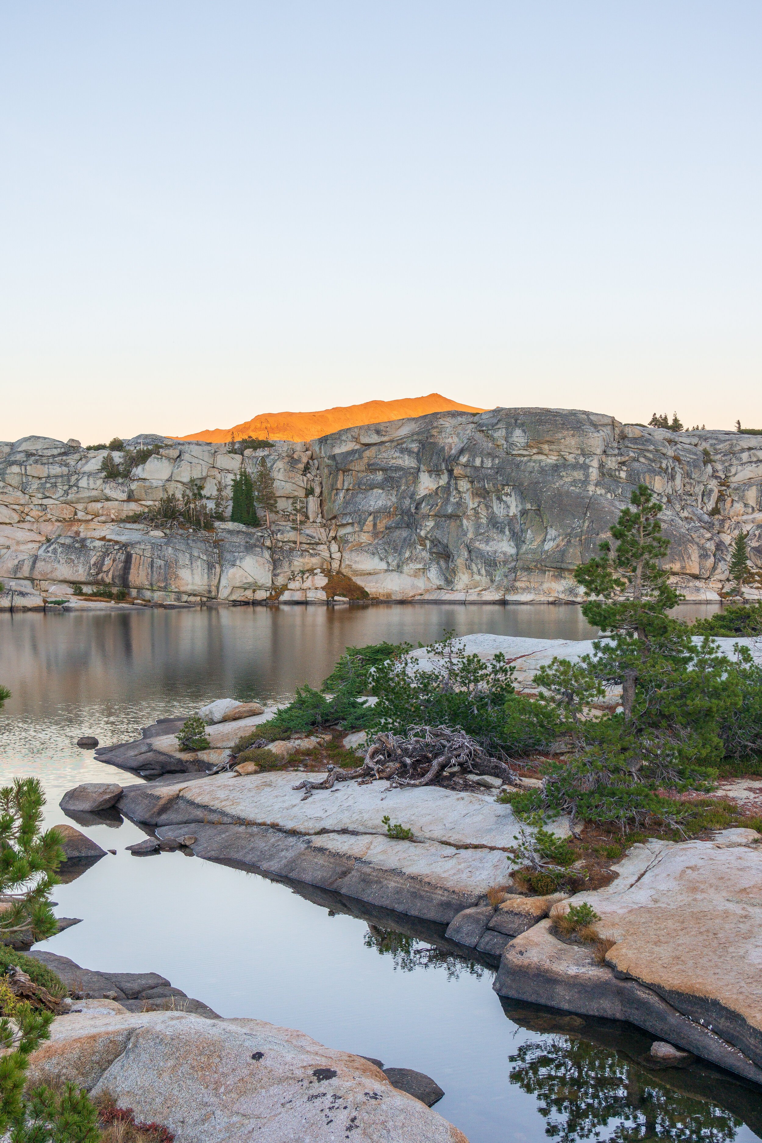
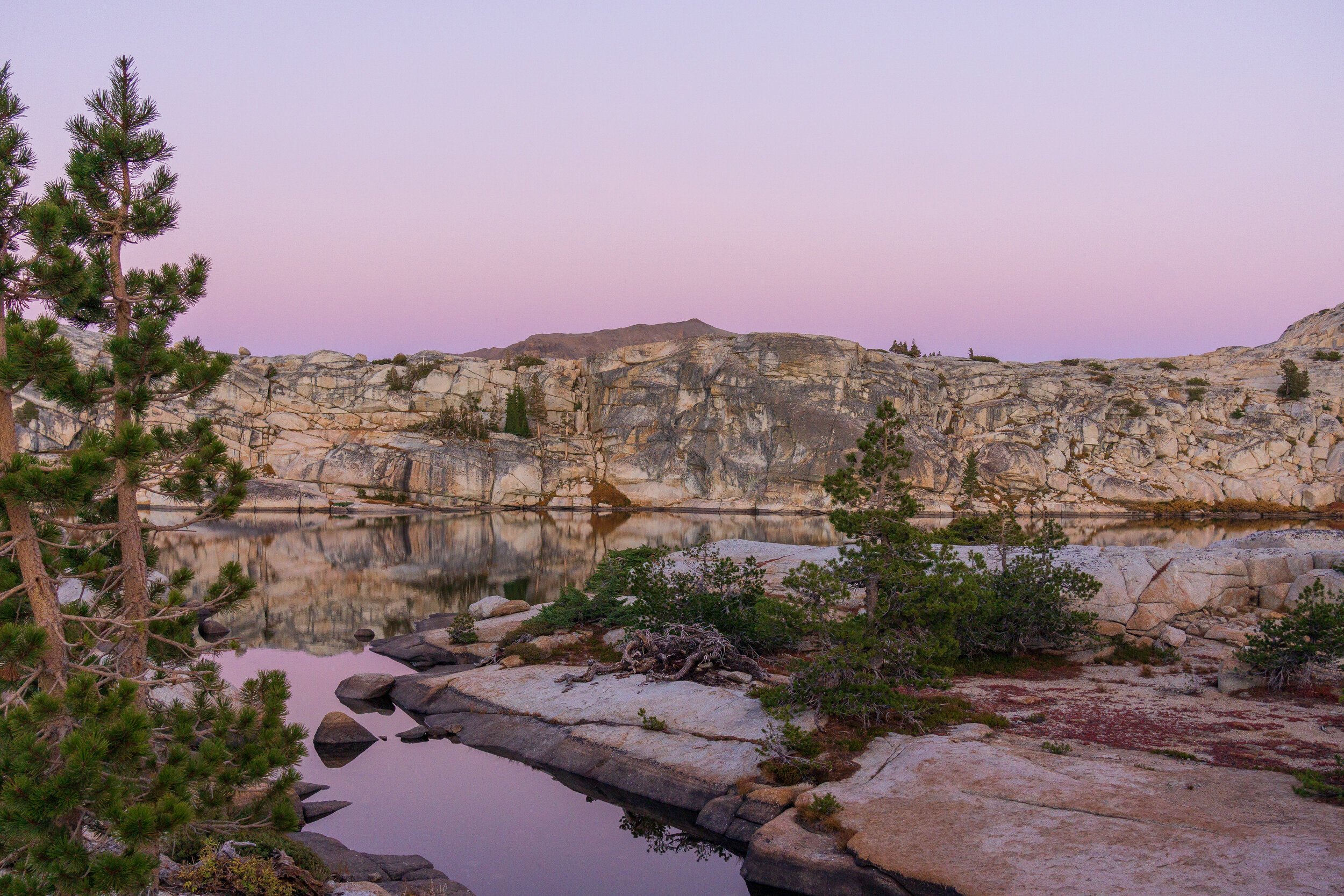
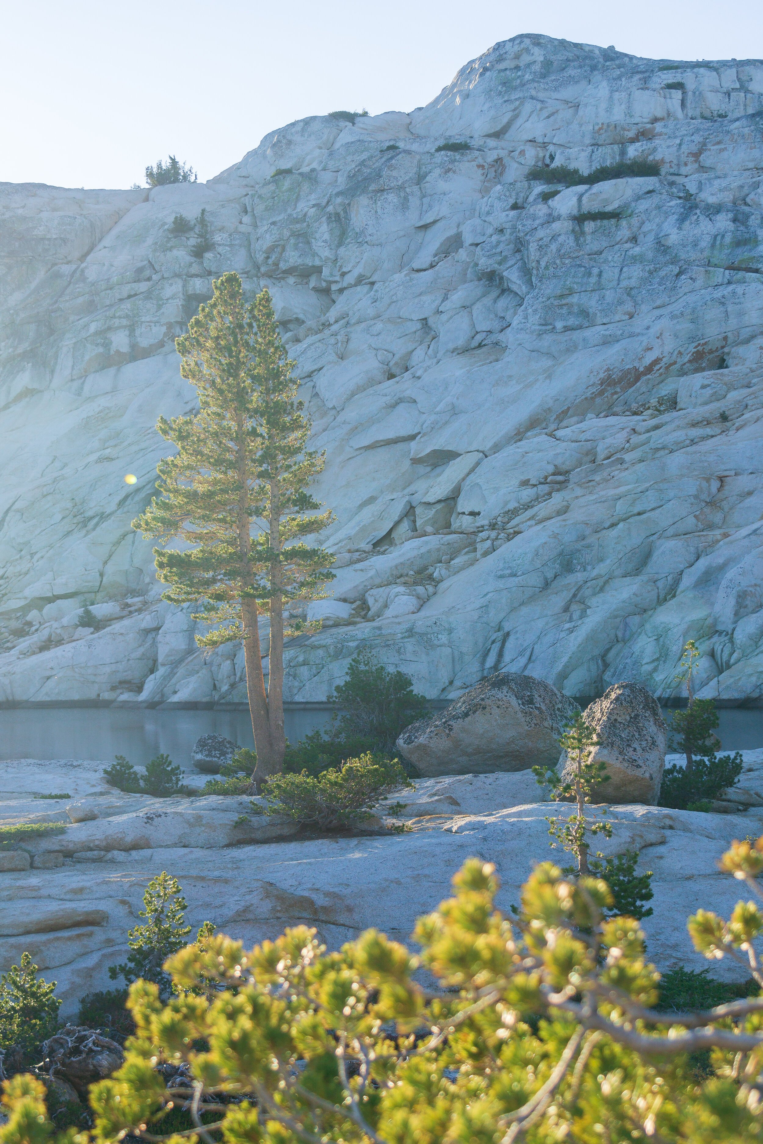
To get to the lakes, we had to hug the ridge to our left, due south west. Everyone seemed more keen to get to camp and then explore more, so we did not visit Sardella or Upper Lewis Lakes, but took a quick rest at Ridge Lake before continuing to Iceland Lake. I used my GPS a bit in this area to make sure we were going the right direction. There were quite a few hills that I didn’t want to have to unnecessarily go up only to come back down. Ridge Lake was really pretty, but due to the large size of our group, we needed more room for camp, and I had read that Iceland Lake had more space. Which it did! We passed the southern shore and set up in a little nook on the western side of the lake with a great view of Granite Dome. It is mostly granite, but there are pockets of dirt if you need to stake out your tent. We enjoyed the spot, and we had it all to ourselves! In the afternoon, we climbed up the little hill behind our camp to scope out the terrain for the next day, to possibly change our route. After studying the landscape, we found that it would be pretty easy to get down to Lower Relief Valley as long as we stayed further west on the slope, towards the meadows under East Flange Rock.
We thought we would try to summit Granite Dome on this day, but most of us were too tired, and when studying the maps, the route up looks much better from Upper Lewis Lake than Iceland Lake. So if you want to summit Granite, I would set your basecamp at Upper Lewis Lake. Another note about the route: It looks very tempting to just cut across the landscape from the ridge to the eastern side of Iceland Lake. Do not take this route, as it is a cliff down to the lake. You can’t get down this way. So continue south, passing by Ridge Lake before going to Iceland.


Day Three: Iceland Lake to Kennedy Meadows Trailhead.
9 miles, +600 -3,800 feet elevation change.
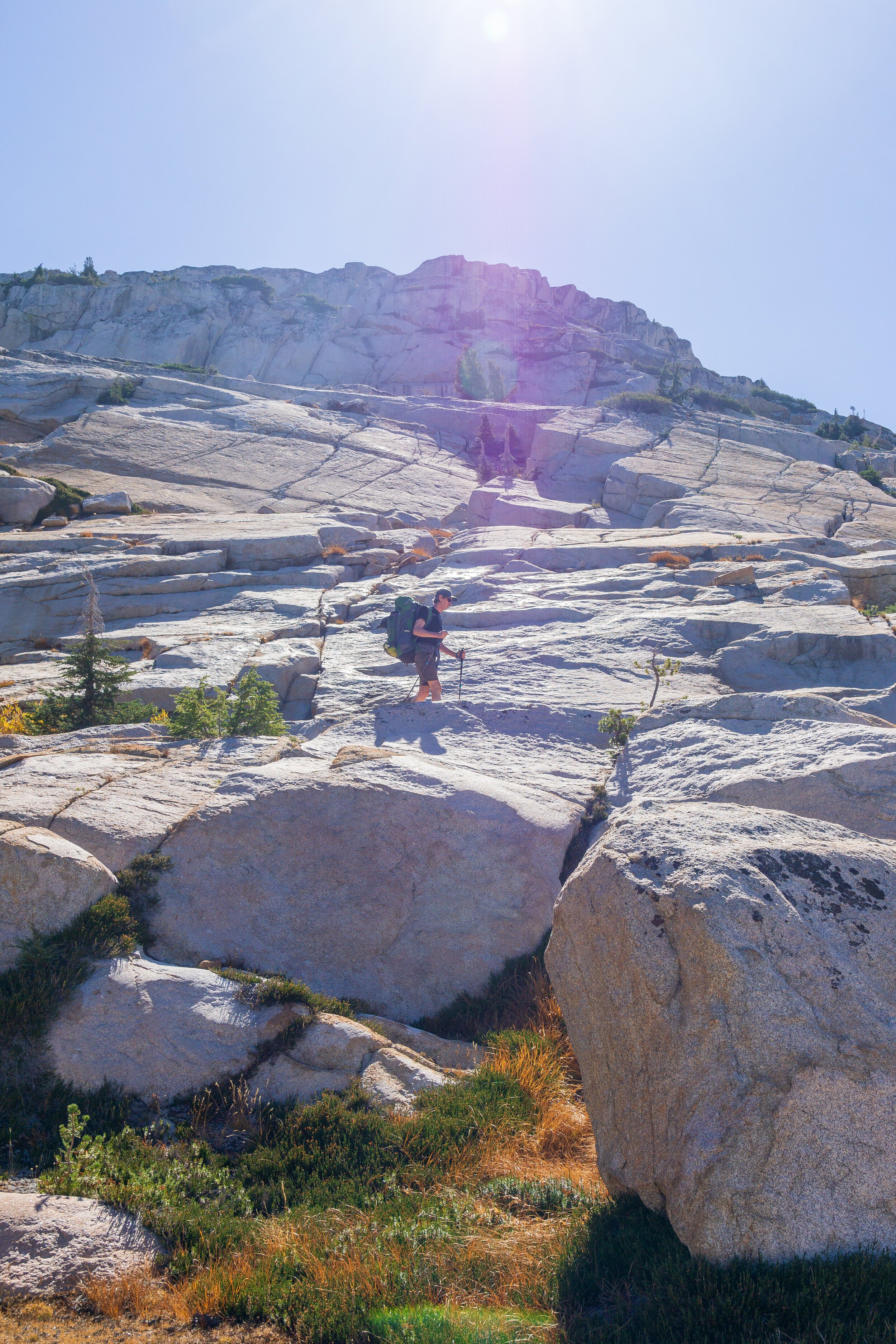
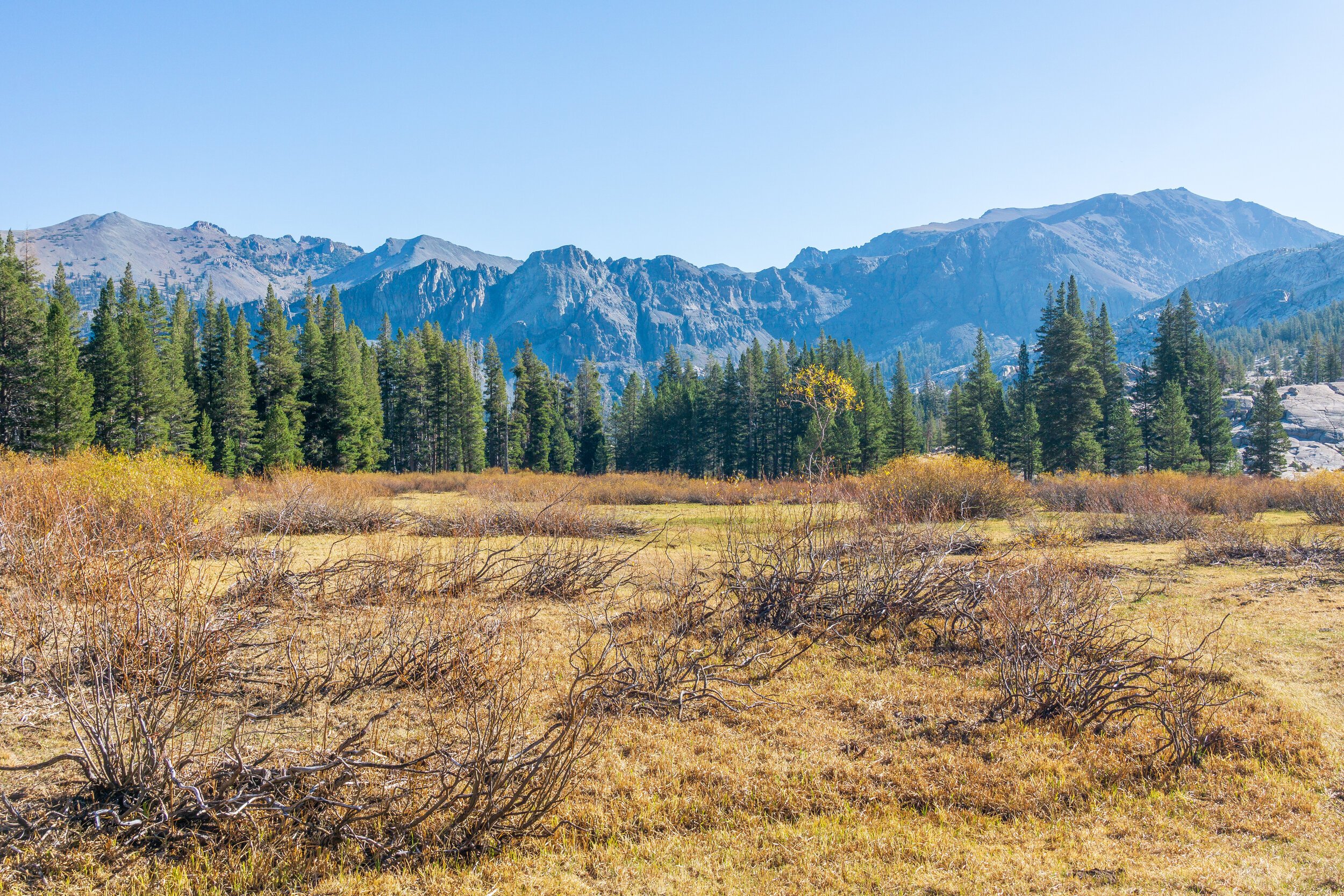
Unlike our first two days, we had to get up and hiking early today, since we had miles to hike and a long drive home ahead! And we needed a little wiggle room in case our newly planned route wasn’t successful. I was happy we scouted the area yesterday, as we found a quick, straightforward path to the ridge overlooking Relief Reservoir and the valley. We started making our way down, following the nice granite slopes. Of course, we did exactly what we should not have done: we went too far to the north east and reached a dropoff. We had identified this area from above, but still made the mistake. Thankfully, we didn’t have to backtrack too much, we just traversed the ridge to our left, westwardly, until we hit the first major creek drainage (which was dry), which was the safest way down. Once we scrambled down this bit, we found a small creek, and followed it, along a clear use or game trail. We didn’t cross the creek until we hit the meadow. Once in the meadow, we just had to walk across to the trail on the other side! We dodged a bunch of cow patties, and our group spread out to avoid stomping out a trail through the dead grasses.
After our cross-country foray, we welcomed the sight of groomed trail and our speed increased. It was also mostly downhill, which was great. The trail was really pretty, following Relief Creek most of the way. The water was so clear, we were a little sad that our day was too short to stop and soak in them. But I have to say, I could feel fall coming in the mountains. It was much cooler, especially in the shade! We stopped at an overlook right before this trail met up with the main trail that we hiked in on. I could feel the group getting tired, so we decided to keep continuing after a nice break. We hustled downhill, except for a surprisingly steep uphill right before the trail junction, again stopping for another snack/ lunch and water filtering break at Grouse Creek. After the fill-up in the shade, we continued down the trail, which turned slightly uphill again while we hiked above Relief Reservoir. Since we went slower in this area on the way in, we almost sprinted through here on the way out, just ready to get back to the cars & find some real food to eat on the drive home!
Permits
Emigrant Wilderness is great because it is super easy to get a permit, and permits are free! There are no trailhead quotas, but there are group size quotas. Normally, you’d just stop at the ranger station to pick up a permit for wherever you want to hike, but since offices were closed due to COVID, there was an easy online form to fill out, and your permit was available to print out right away.
For more information on how to get a wilderness permit for the Emigrant Wilderness, click here. And remember, you also need a California Fire Permit if you want to have a fire or operate a camp stove!
Trailhead & Parking
The area around the trailhead can be a little confusing! This is because Kennedy Meadows Resort is private property, but it edges right up against National Forest land. The signs while driving in are very clear as to where you can and can not park overnight. The resort allows parking for a fee at their discretion, but there is also trailhead parking a half mile up the road, which also allows free overnight camping to wilderness permit holders. This parking lot also has trash cans and pit toilets, and has a water spigot that was not working as of Sunday, October 18, 2020. If you are driving in from Hwy 108, the parking lot will be up a hill to your left, right across from Deadman Campground. It is a large lot with plenty of spots.
There are also two First Come, First Served designated USFS campgrounds on the road: Baker and Deadman. They were both closed by Sunday, October 18th, though were open earlier in October. Call the ranger station for more information on these campgrounds.
Leave No Trace & Cross-Country Travel
Cross-country travel can seem like the exact opposite of Leave No Trace. After all, doesn’t LNT tell us to always stay on designated trails? But, like most things in life, LNT is not black and white. But to be a good wilderness steward when you’re off-trail, there are some key points you should follow.
Rules & regulations about fires. Sometimes on marked trails there are very obvious signs that say “no fires above this elevation”. But when you go off-trail, you don’t have man-made signs to tell you that. So you need to know the regulations for where you are and make sure you don’t have fires if you reach a certain elevation. In Emigrant Wilderness, that was above 9,000 feet. By studying your maps and making a trip plan ahead of time, you’ll know where you want to camp and if you could have a fire there or not.
Travel & camp on durable surfaces. While the “durable surface” is no longer a trail, you should still pay attention to your surroundings. Rock and snow are the most durable surfaces to use while hiking off-trail. Sand and dirt are also good choices. Avoid wet grasses, meadows, and especially cryptobiotic soil. If you have to walk through grasses or a meadow, try to identify dry areas, and do not walk in a single-file line if you are with more than one person. Spread out to reduce the likelihood of creating a use trail in a delicate environment. It might sound counterintuitive, but most grasses and flowers can withstand being stood on for a brief moment of time, but will be destroyed if continually stomped on. Of course, if there is an actual trail that you can follow, use the trail to reduce impact. Camp on surfaces that are hard. Try your hardest to not camp on vegetation, and always try to look for previously impacted sites to concentrate impact. Leave No Trace Center has good guidelines for following this rule.