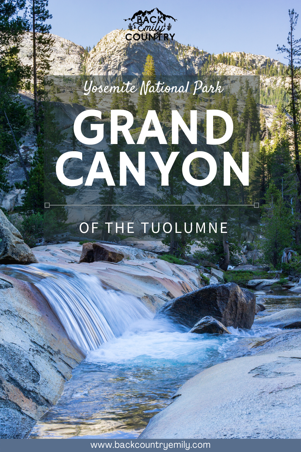
Backpacking The Grand Canyon of the Tuolumne
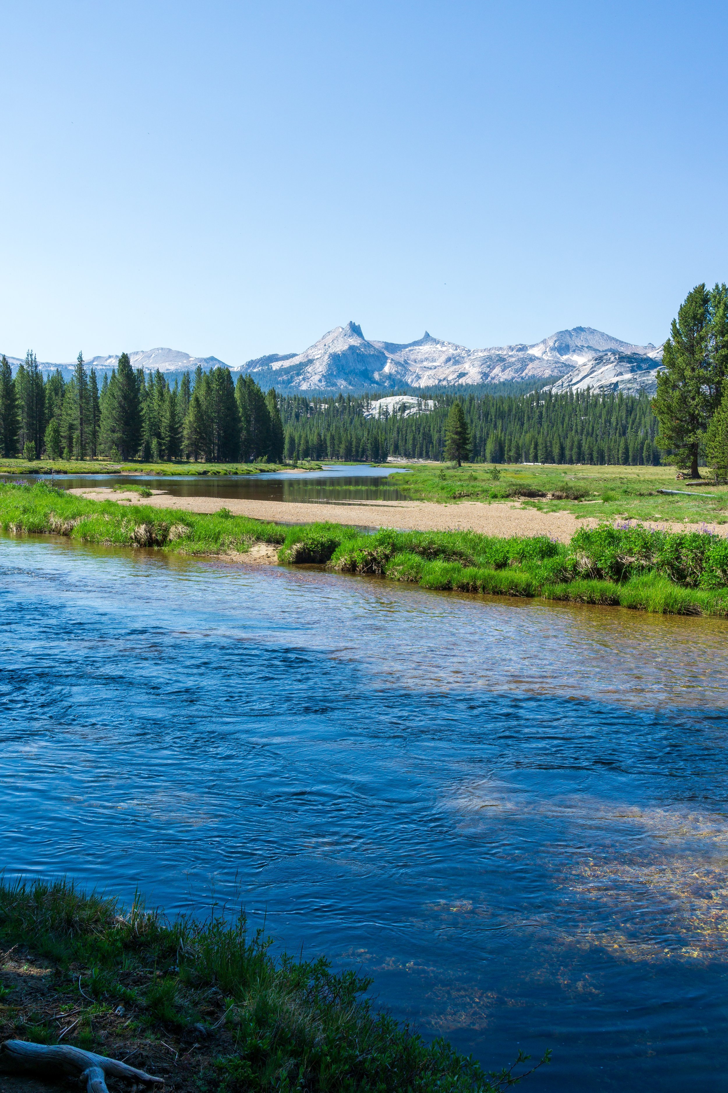
Not to be mistaken with the Grand Canyon in Arizona, the Grand Canyon of the Tuolumne is a major feature in Yosemite National Park, carved by the Tuolumne River. Towering granite walls, beautiful green-blue pools, rattlesnakes, waterfalls, and more await those who travel through this extraordinary canyon.
Note: Included in this blog post are links to the Outdoor Status permit notification website. These are affiliate links, and I will earn a small commission at no extra cost to you if you choose to participate in permit availability notifications. Thank you so much if you do use this service!

TRAIL INFO & STATS
Where: Yosemite National Park, Tioga Road/ Tuolumne Meadows
Miles: 29.5
Elevation Gain/ Loss: +7,400 -6,600 ft
Time to complete: 3-5 days
Trail Type: Point-to-Point
Permits Required: YES
Pets Allowed: NO
Trailhead: White Wolf or Glen Aulin
ITINERARY & TRIP PLANNING
Backpacking through the Grand Canyon of the Tuolumne is quite a treat, and it brings you through 3 out of the five vegetation zones of the park: lower montane forest, upper montane forest, and subalpine forest. You’ll have views of Hetch Hetchy reservoir, experience the granite temple of the backcountry, and be able to frolic or fish in the watering holes along the way. I would recommend 3 nights minimum for the average backpacker wanting to really soak in the experience, but 2 nights is doable for those who are in shape and on a tight schedule.

Day One: White Wolf to Harden Lake. 2.75 miles, +150 -450 ft
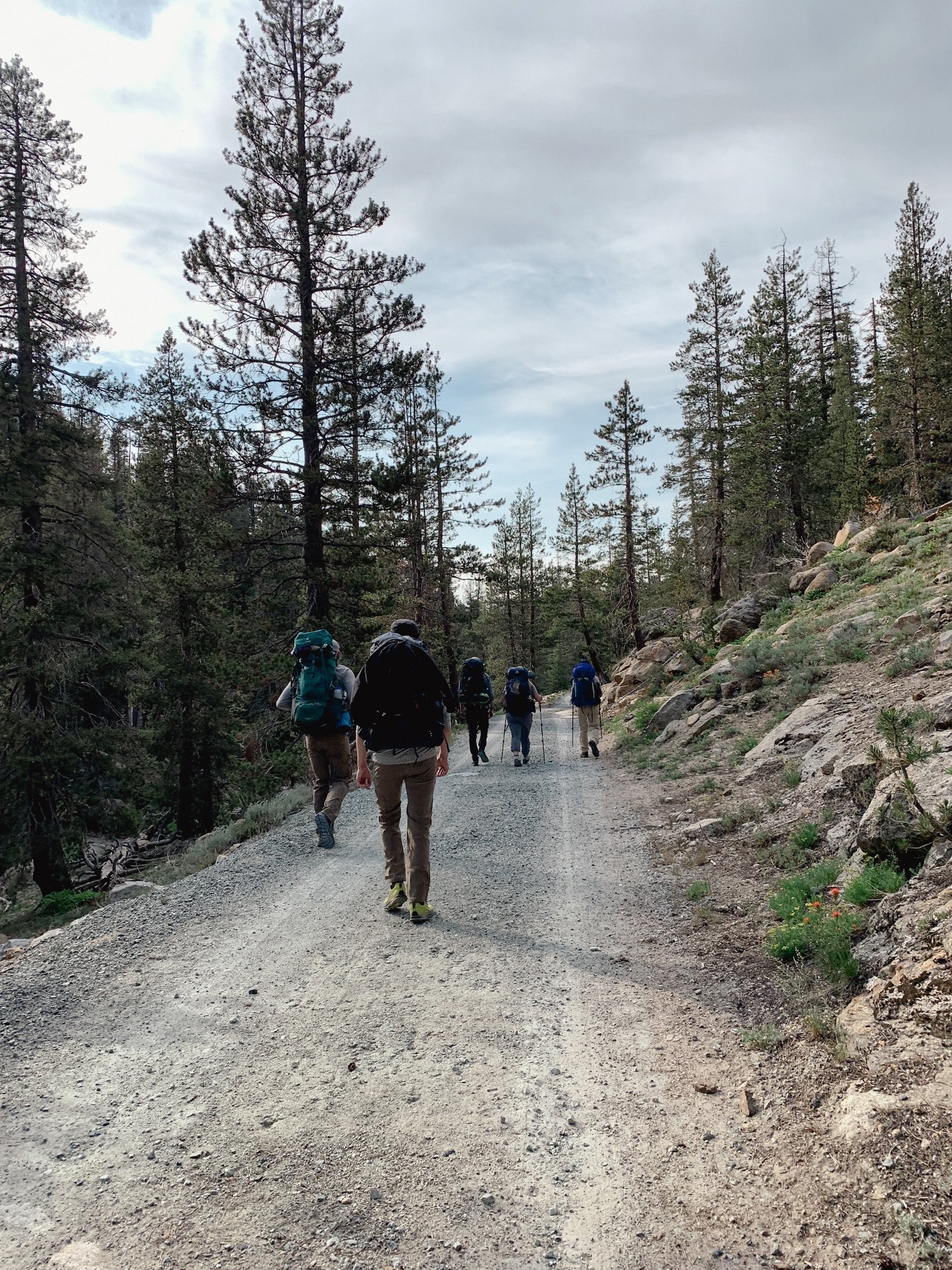
Due to the White Wolf Road being closed in 2021, we had to walk the road from the gate on Tioga Road to the trailhead, but normally, you can drive down and park in the smaller lot at the end of the road by the bear boxes. Since our permits were for White Wolf - Smith Meadow, and we had a super late start for hiking (5 pm), we were only going to Harden Lake for the night, so we continued straight down the service road past the White Wolf Lodge. The trail was very mild, mostly downhill and flat until a very slight climb for the final half mile to Harden Lake. Be sure to follow the road and signs as there are a few obvious turn-offs to employee-only areas along the way. There is nice camping on the north side of Harden Lake.
Day Two: Harden Lake to Pate Valley. 7 miles, +600 -3,700 ft
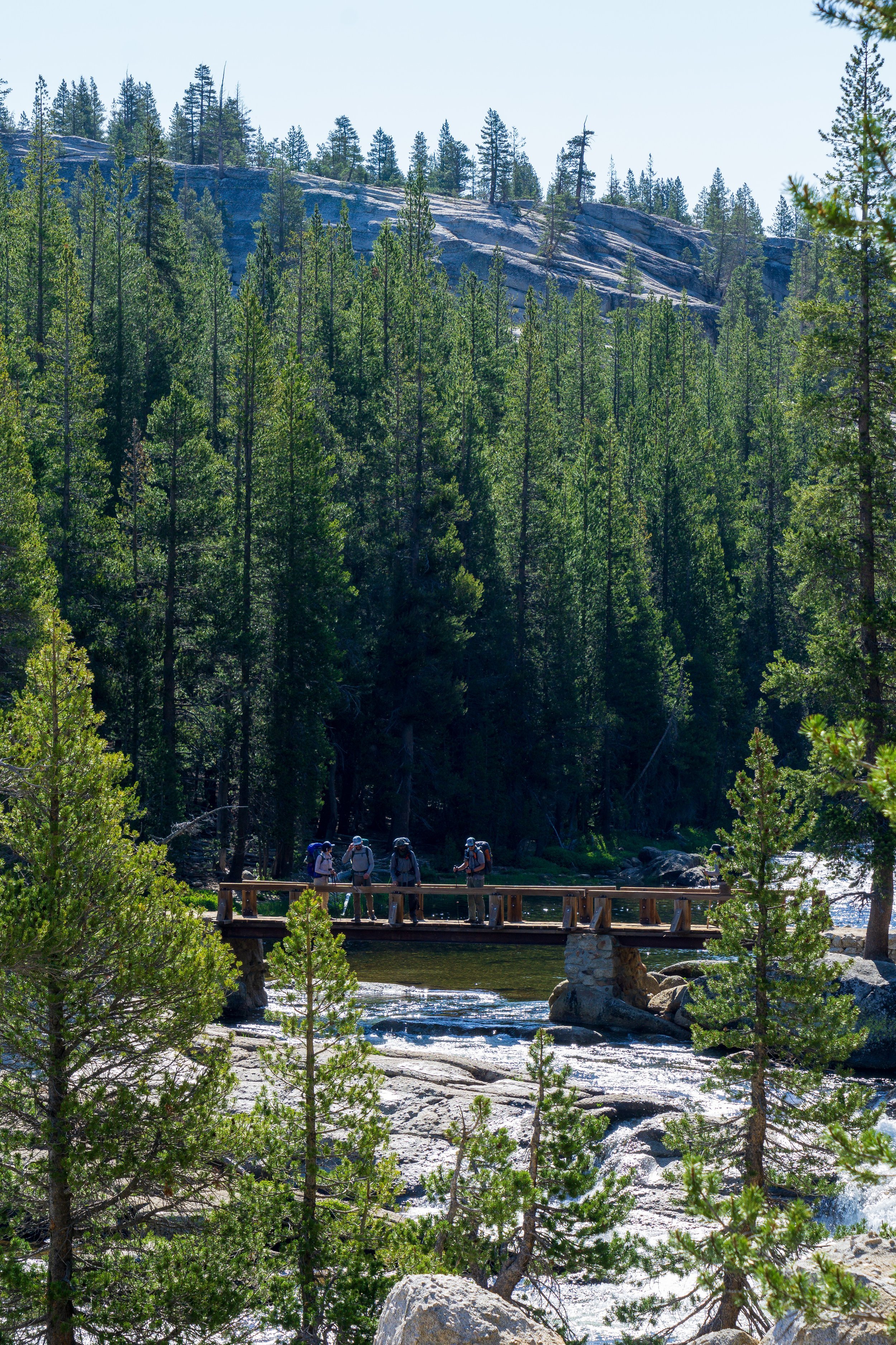
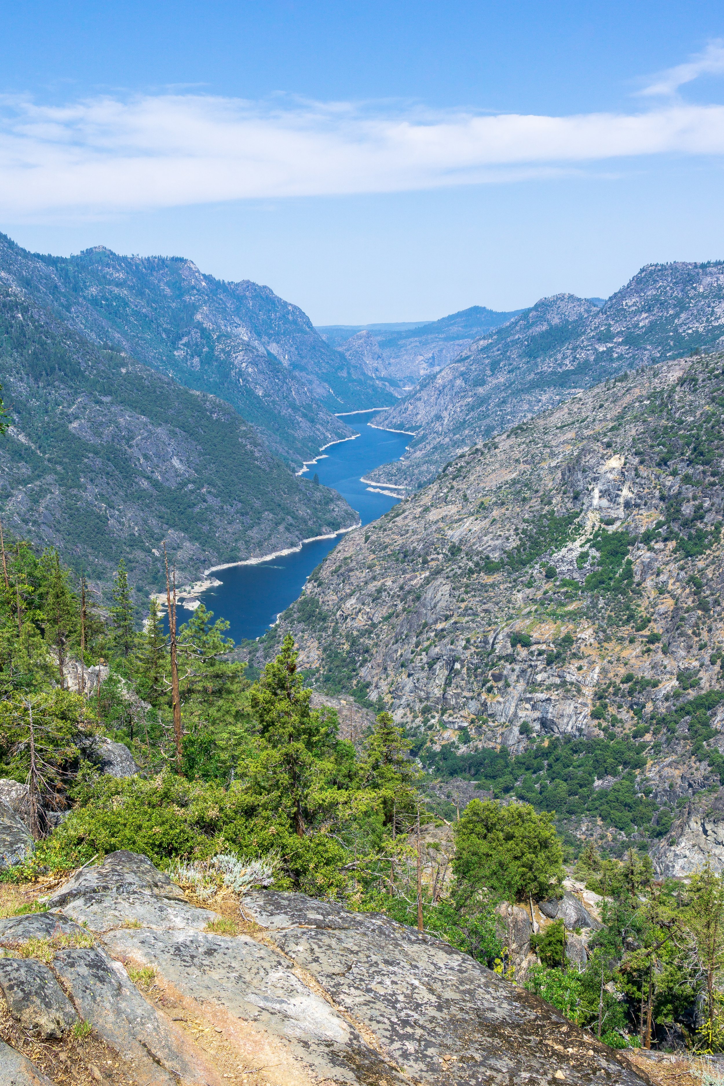
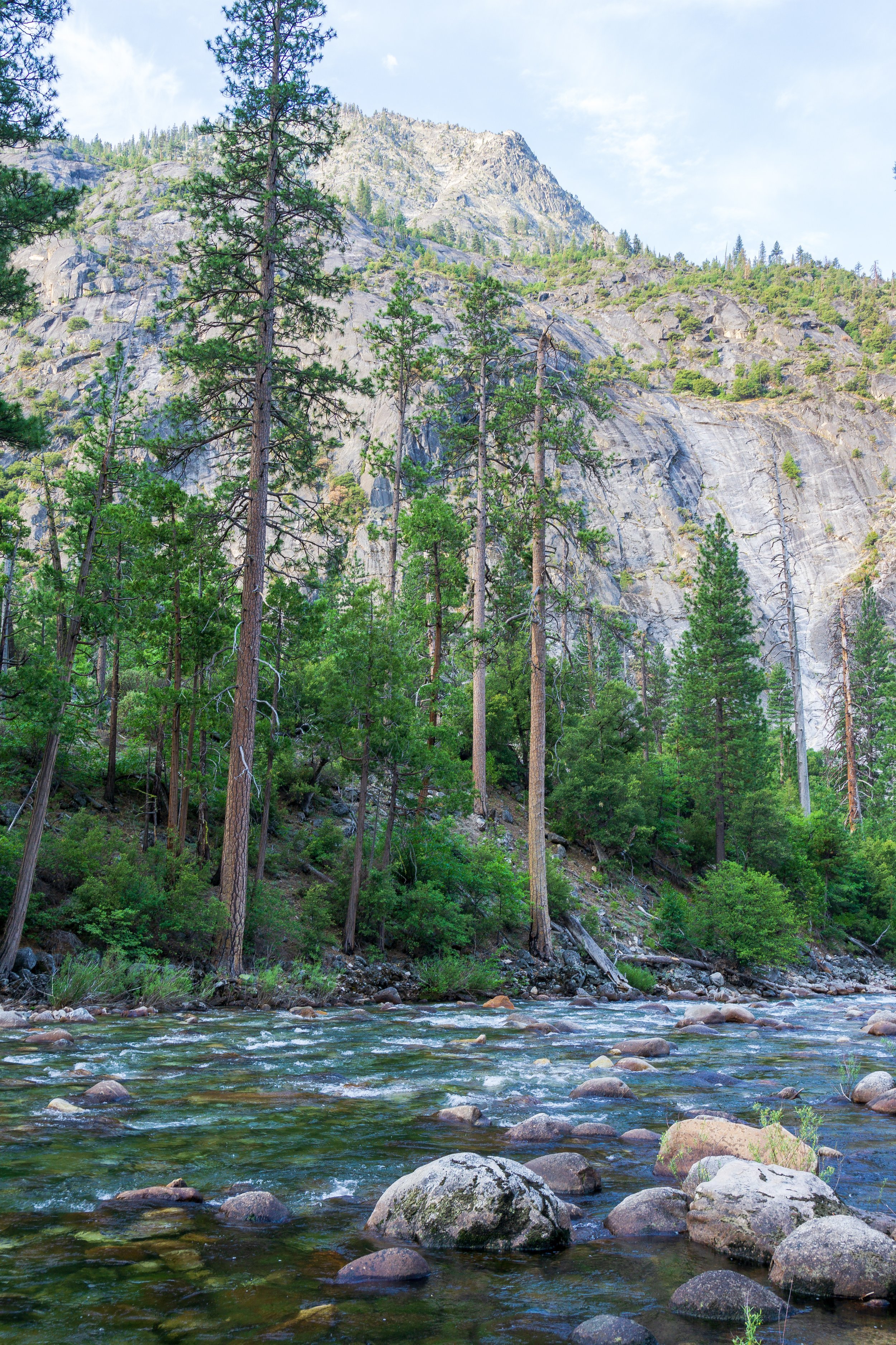
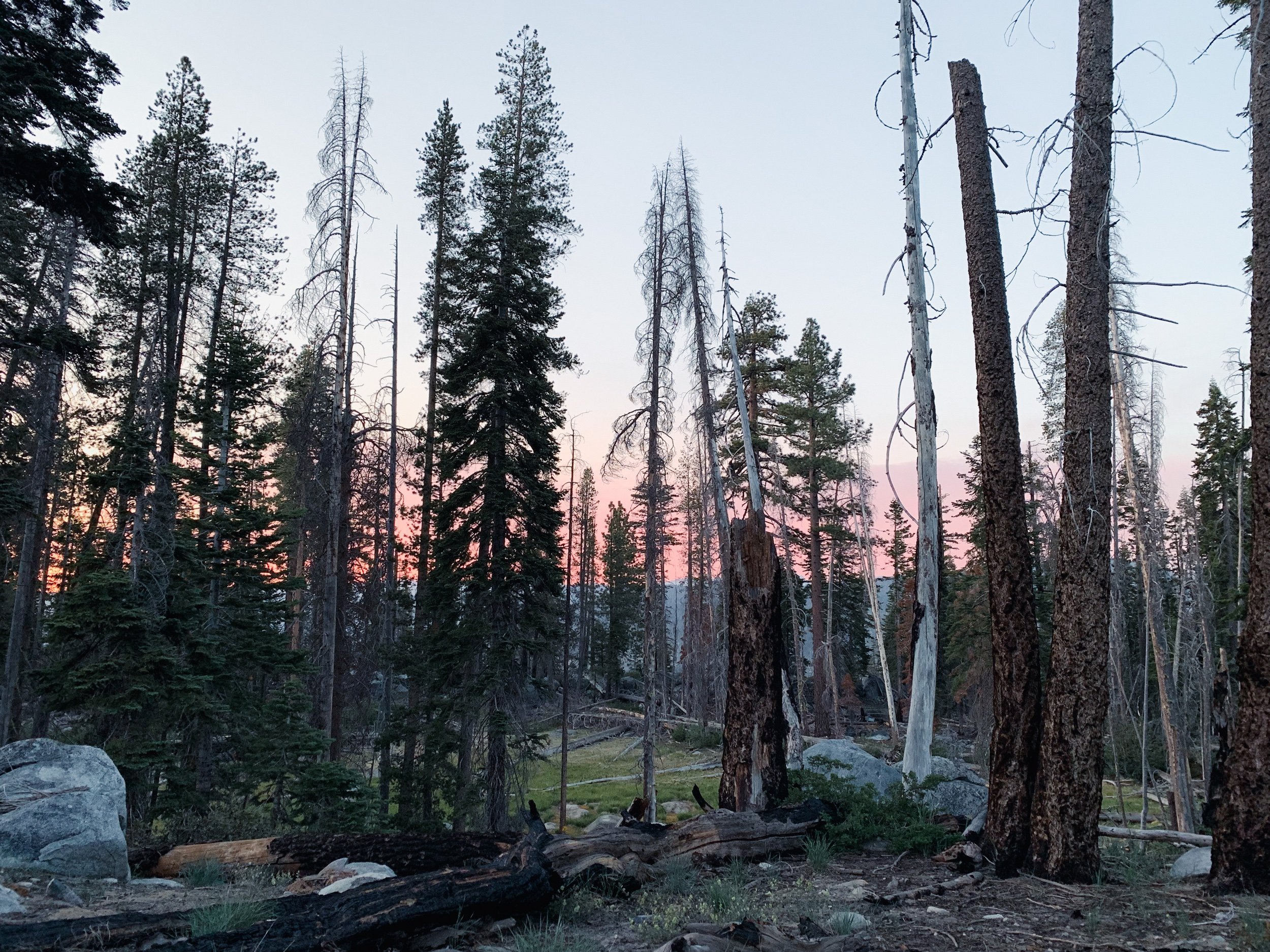
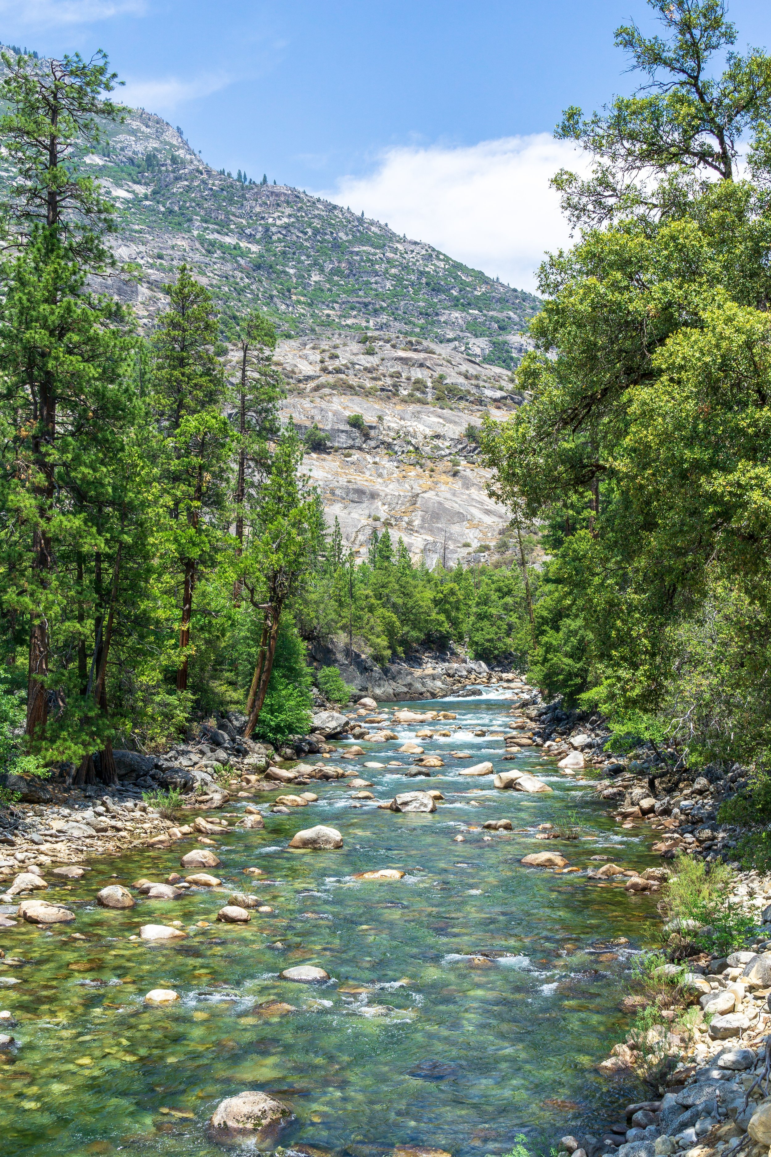
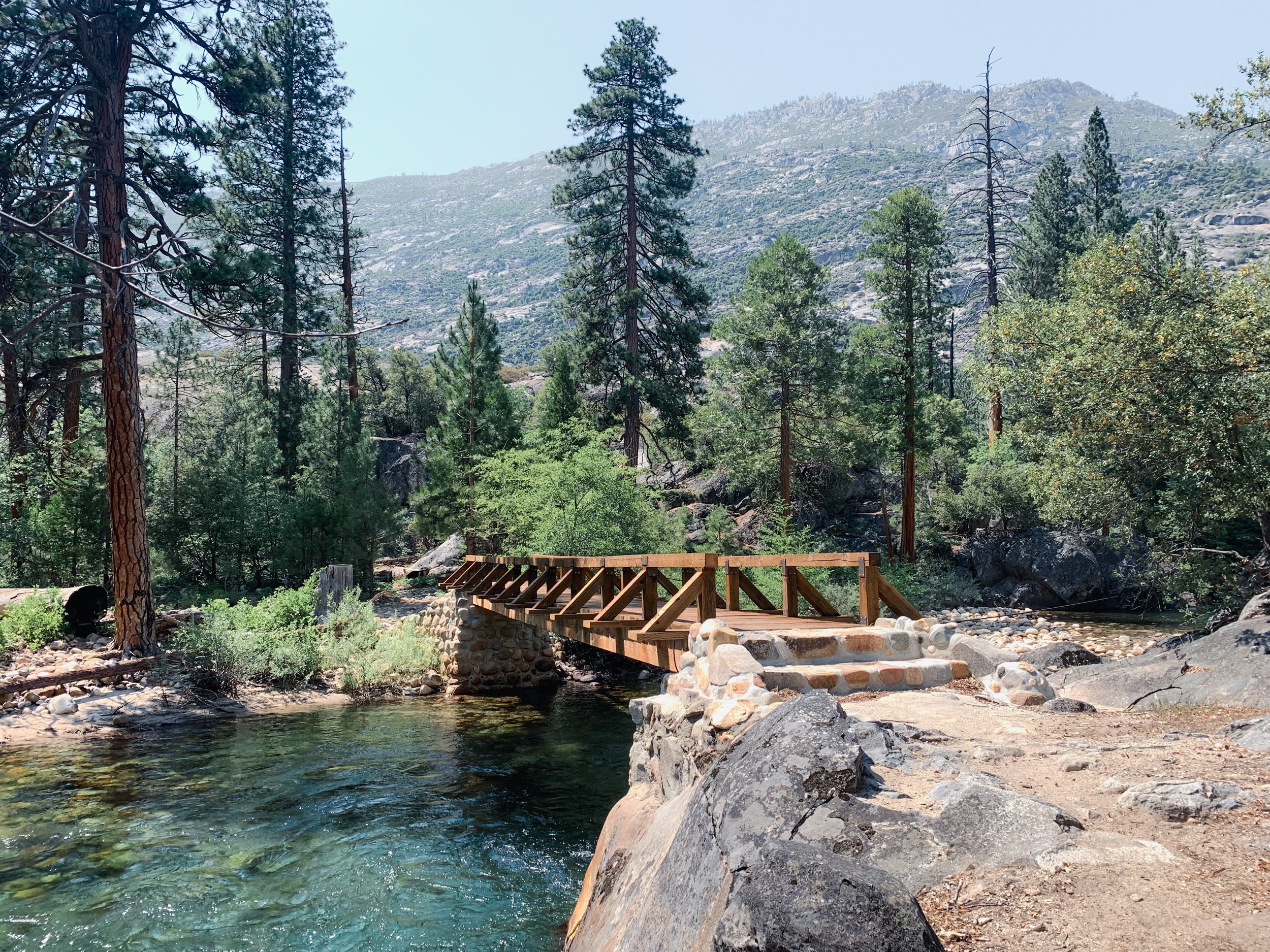
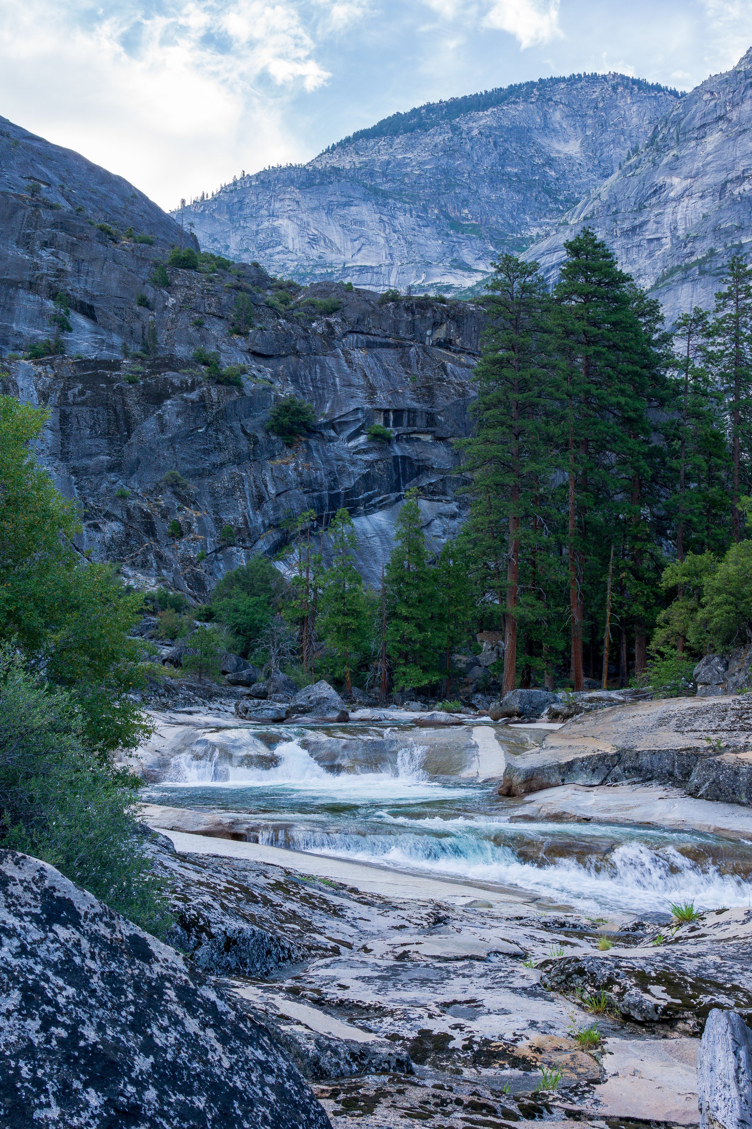
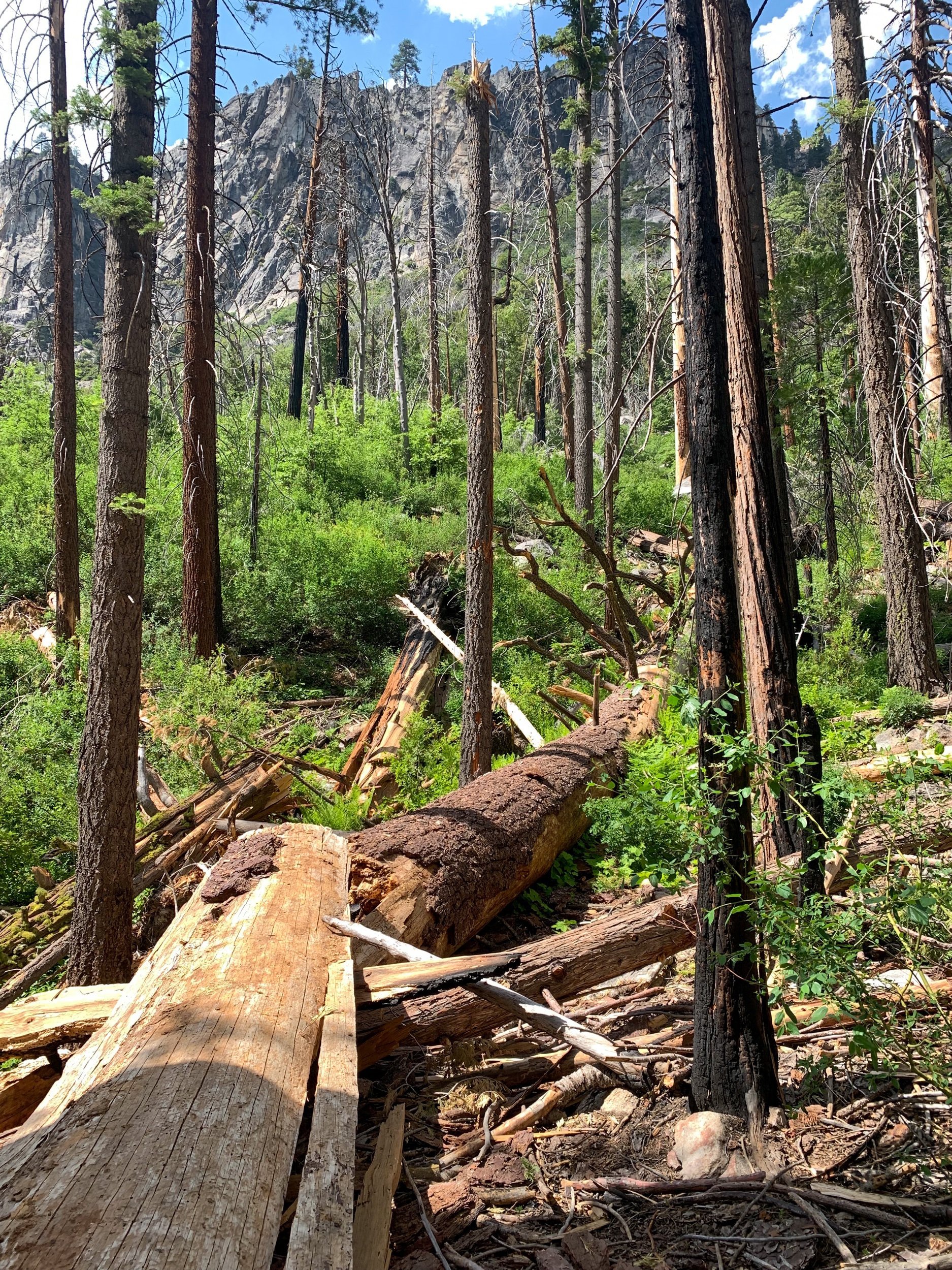
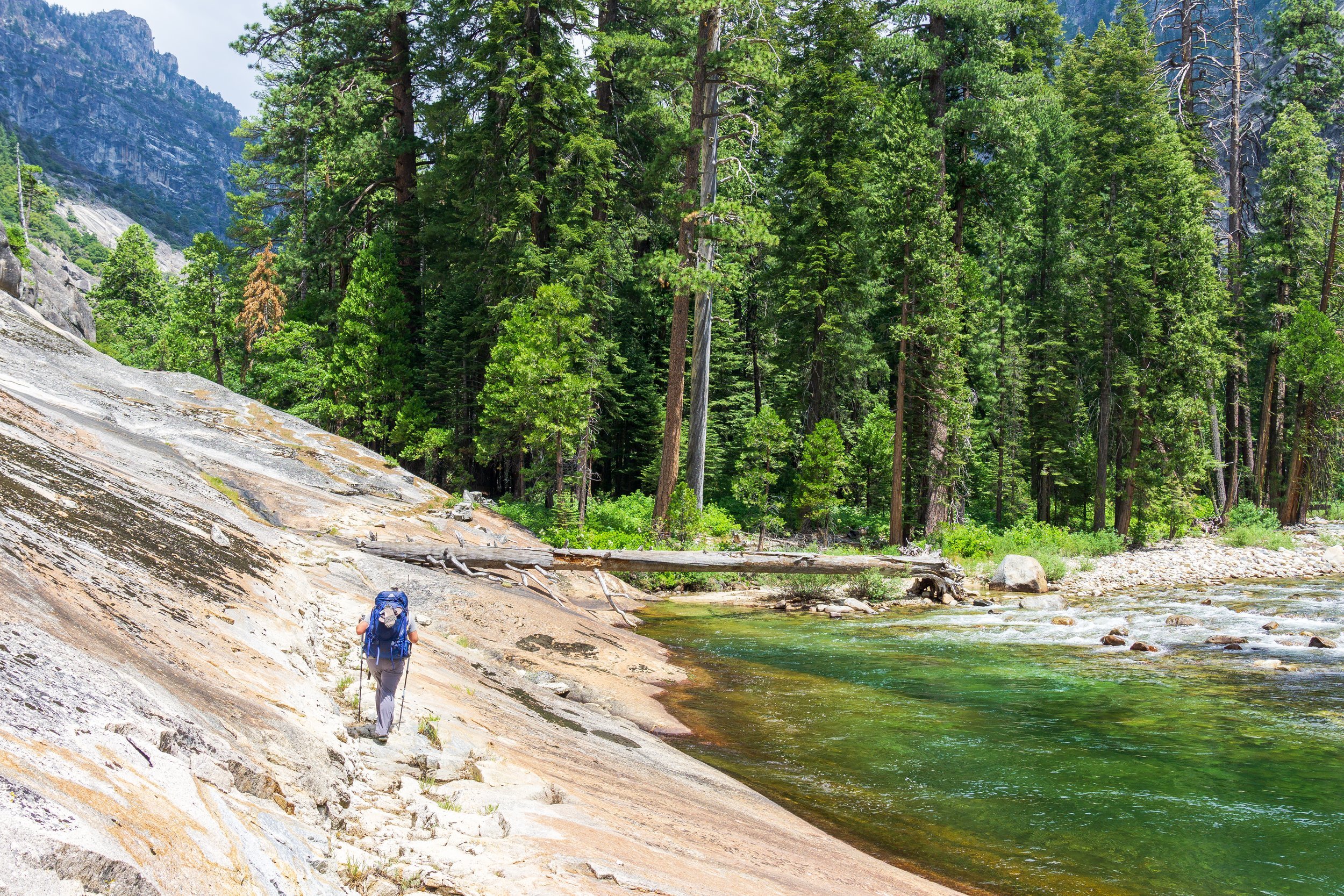
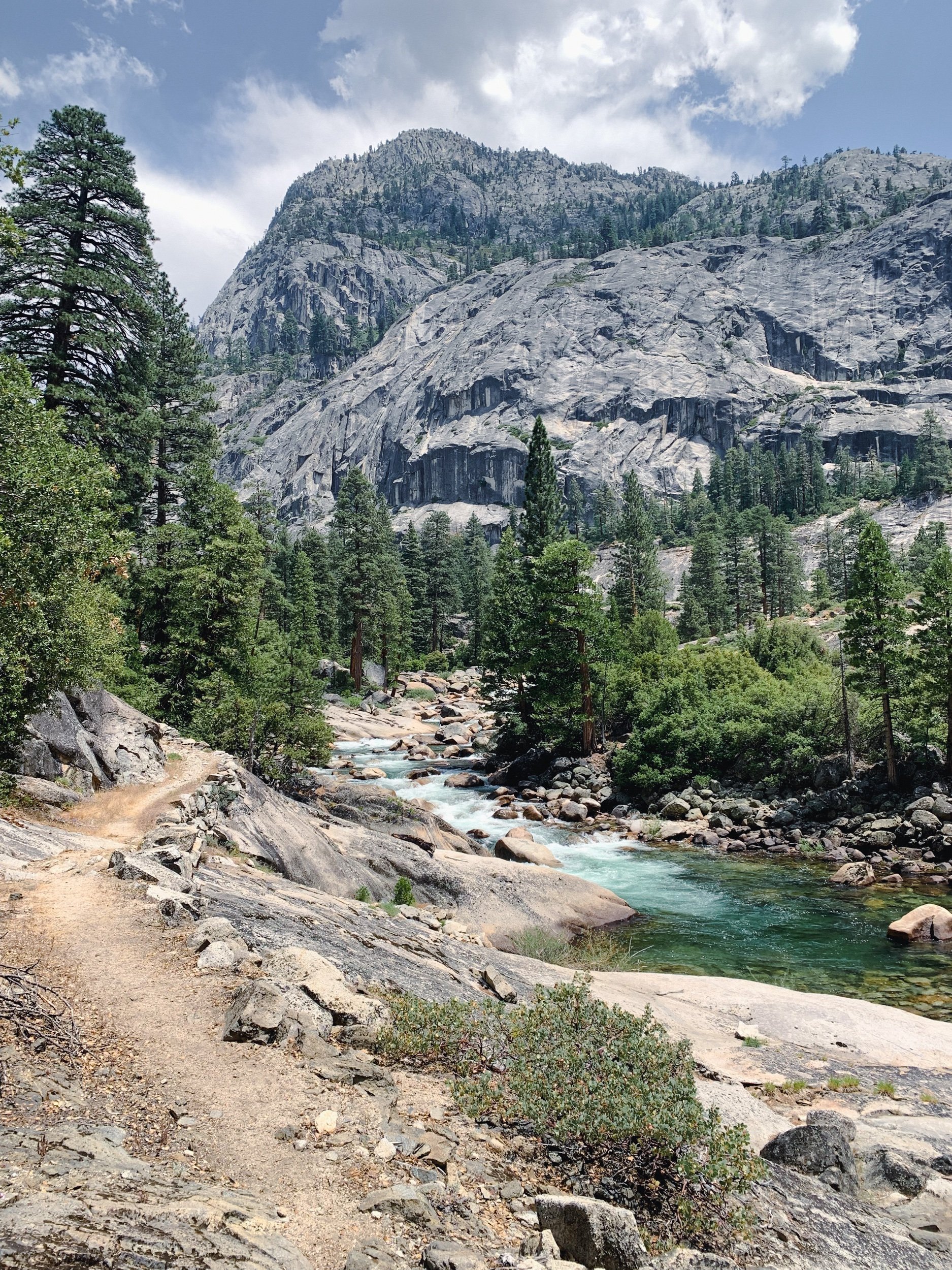
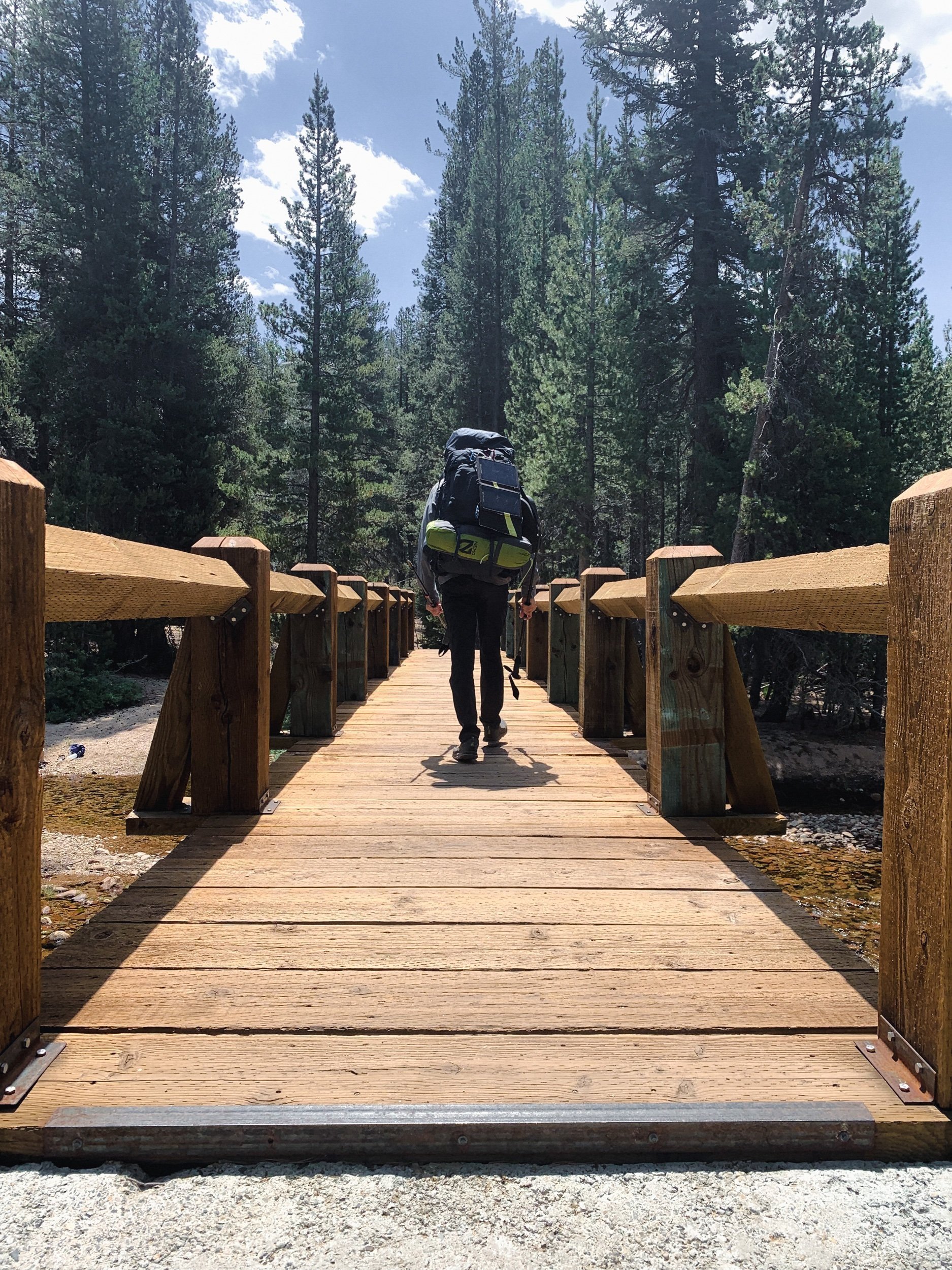
The trail departs Harden Lake to the north and almost immediately begins downhill through pine forest and lush understory. Every so often, a view of the northern Yosemite wilderness shows itself through the trees. Dirt trail will eventually give way to rocky, more exposed switchbacks after Morrison Creek, where I highly recommend filling upon water and taking a snack break. There was no water flowing on the trail after the first intersection with the creek until the Tuolumne River in Pate Valley. Be sure to pull over and catch a glimpse of the Hetch Hetchy reservoir while on the rockier switchbacks. Once the trail starts to level out a little bit more, Pate Valley is just around the corner. There is an obvious campsite to the right of the trail, but if the area on the other side of the river is available, I’d recommend camping there for easier access to the water. Cross the two footbridges, then take the use trail west. Be sure to camp in already used spots, and stay at least 100 feet away from the water.
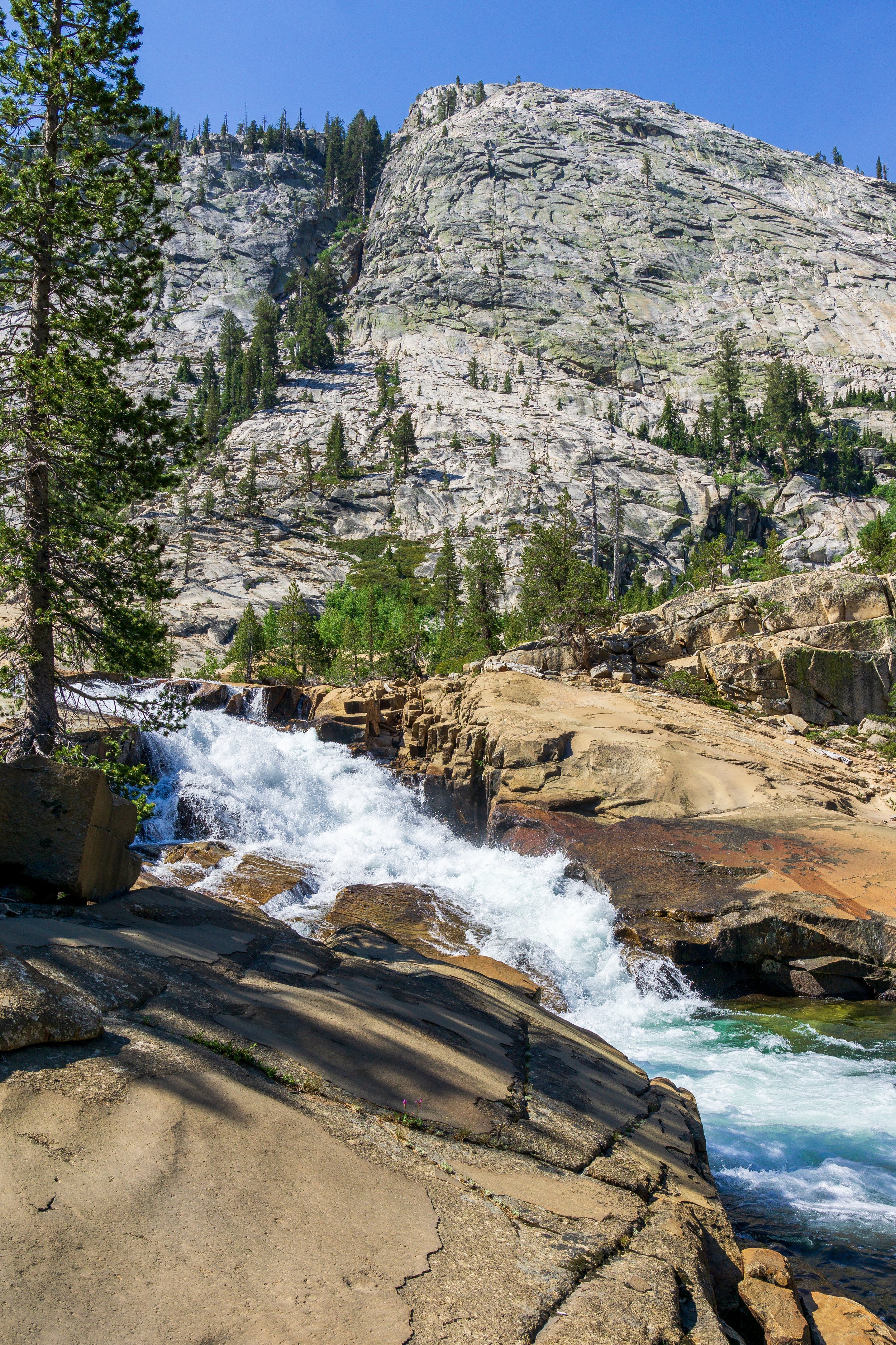
Day Three: Pate Valley to LeConte Falls. 11 miles, +4,300 -1,700 ft
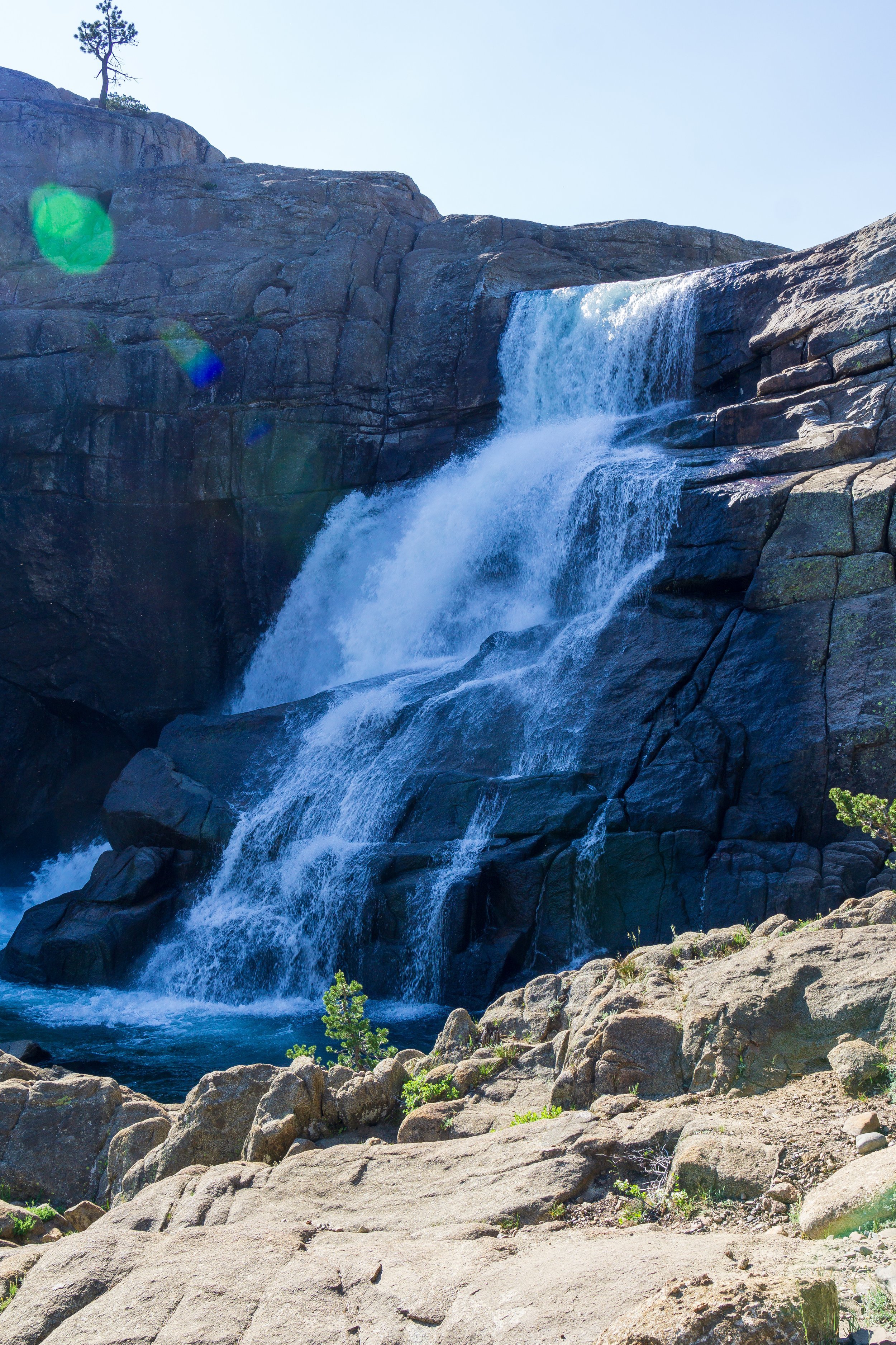
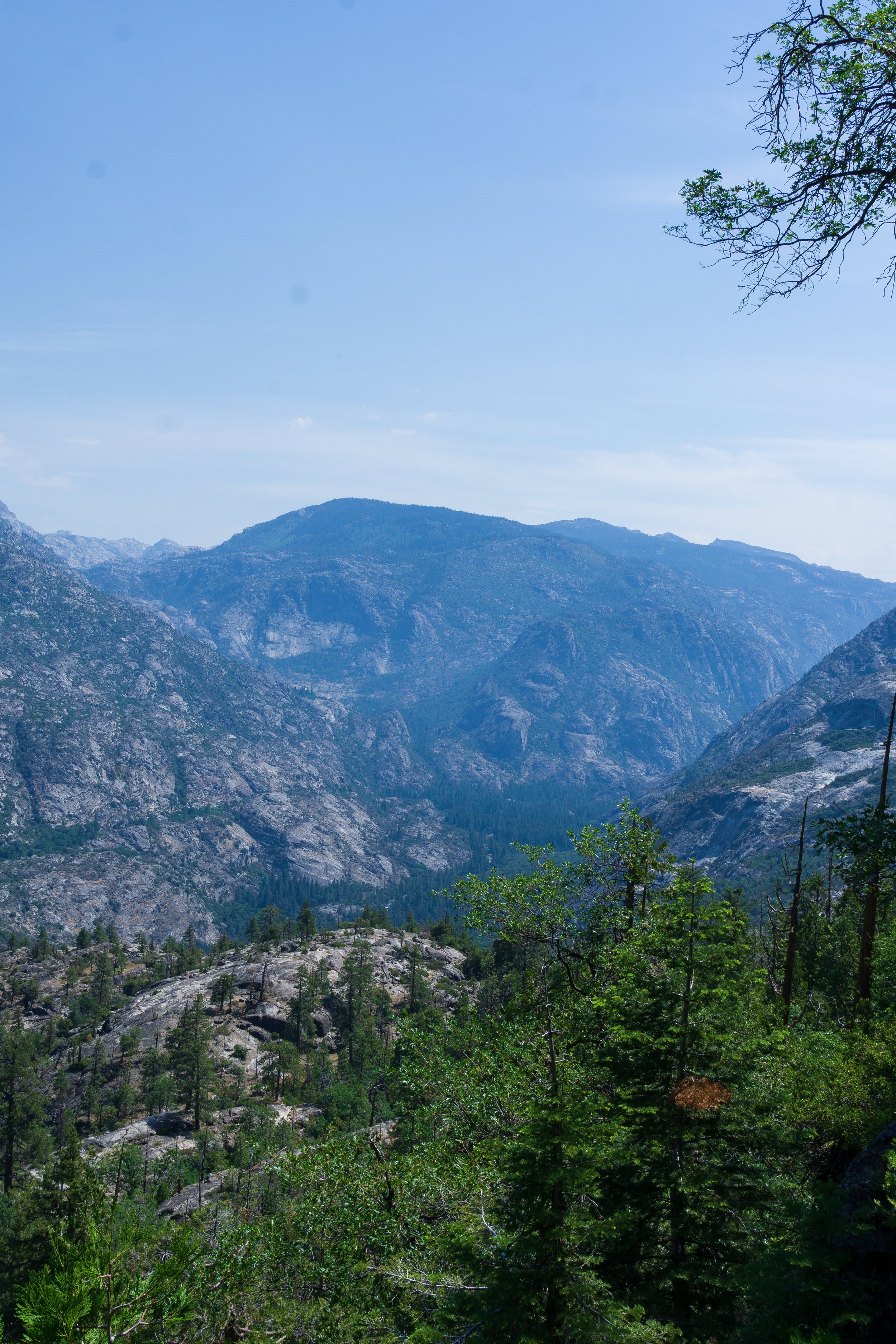
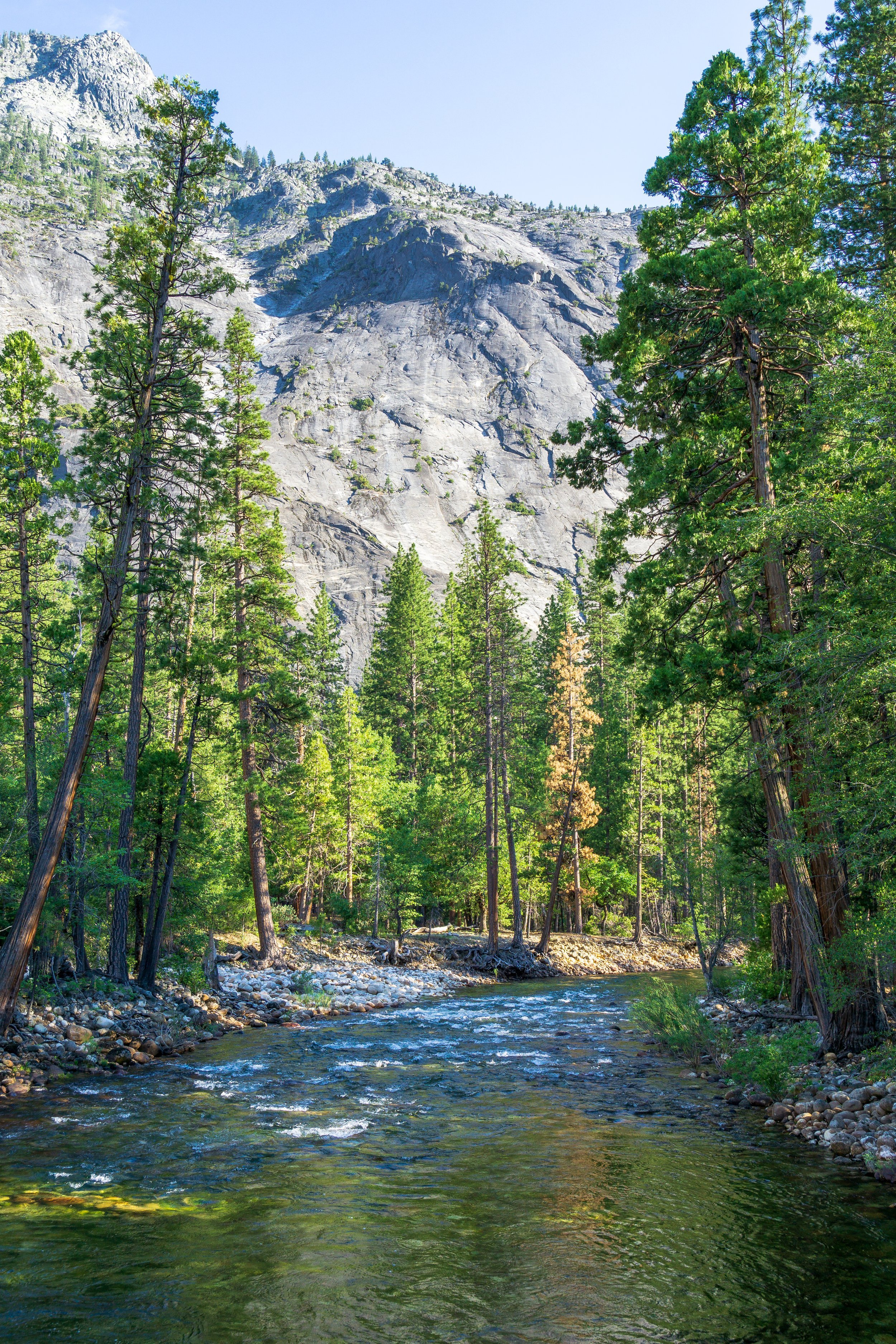
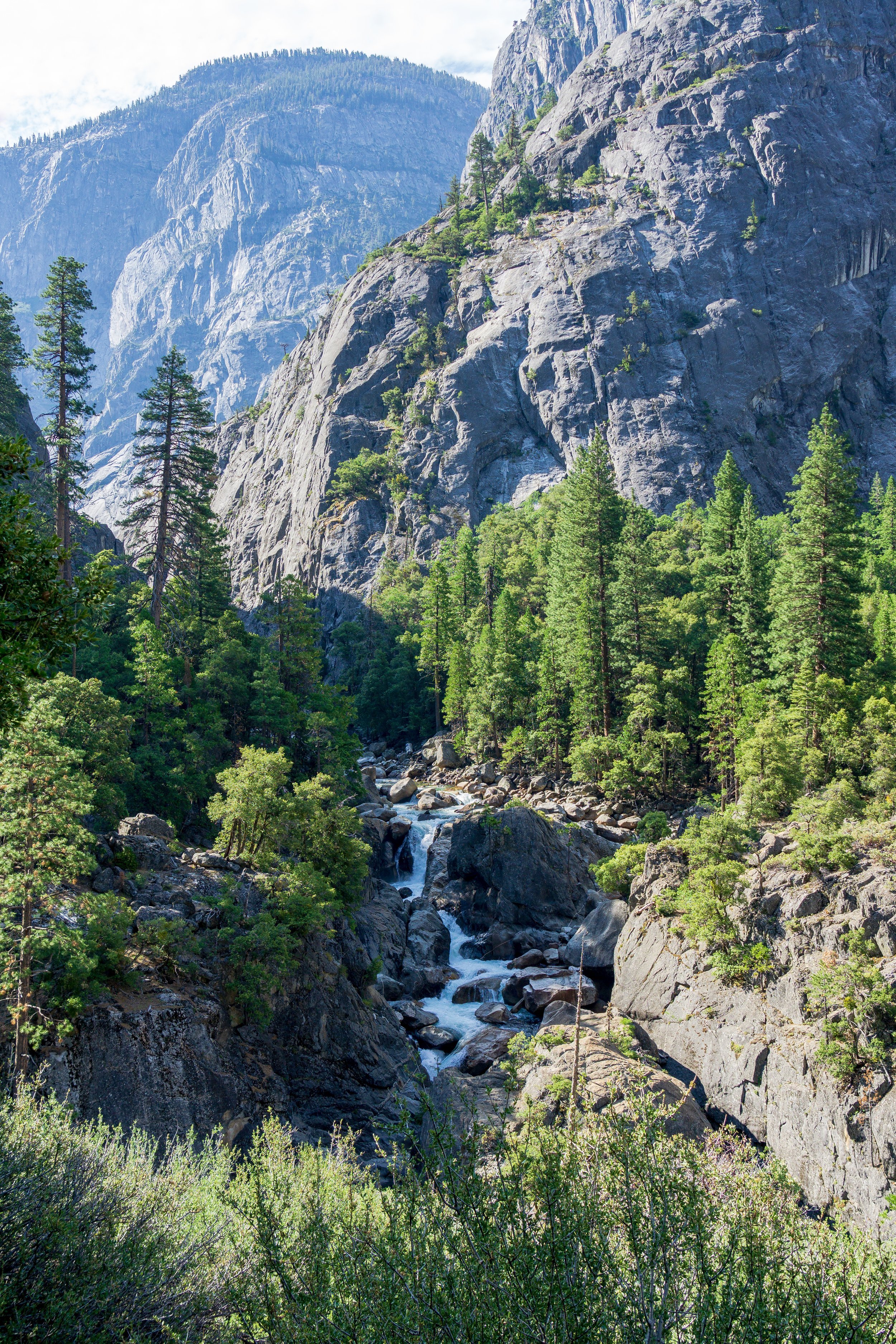
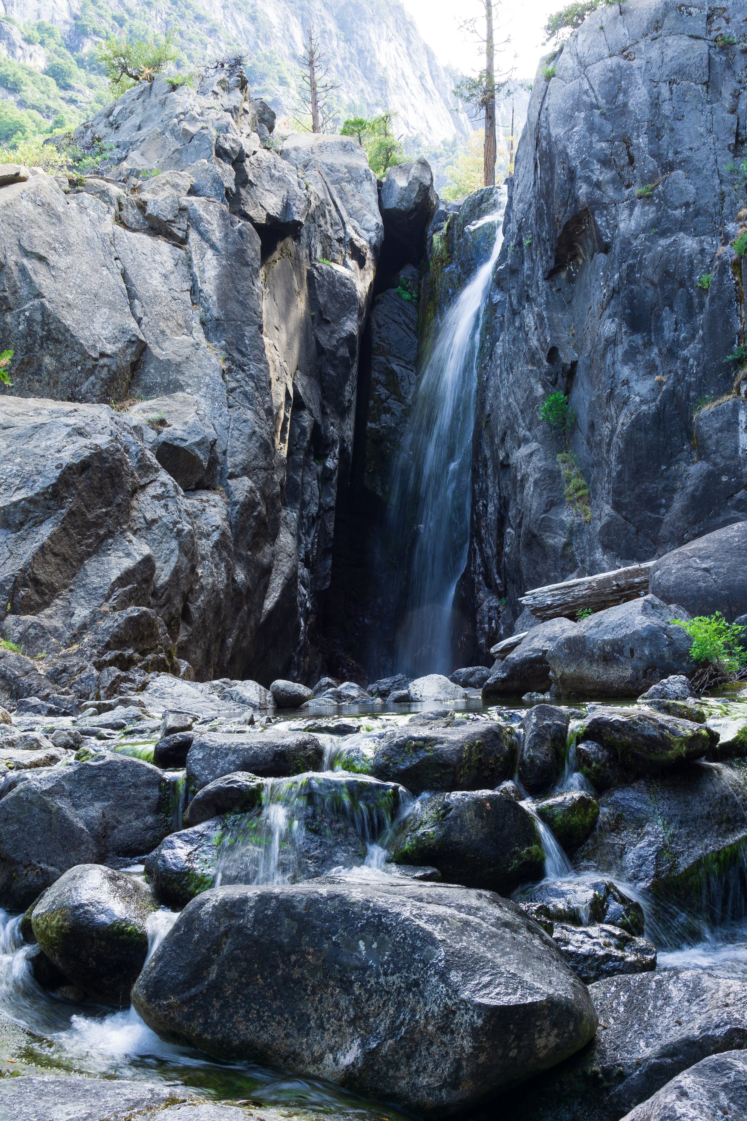
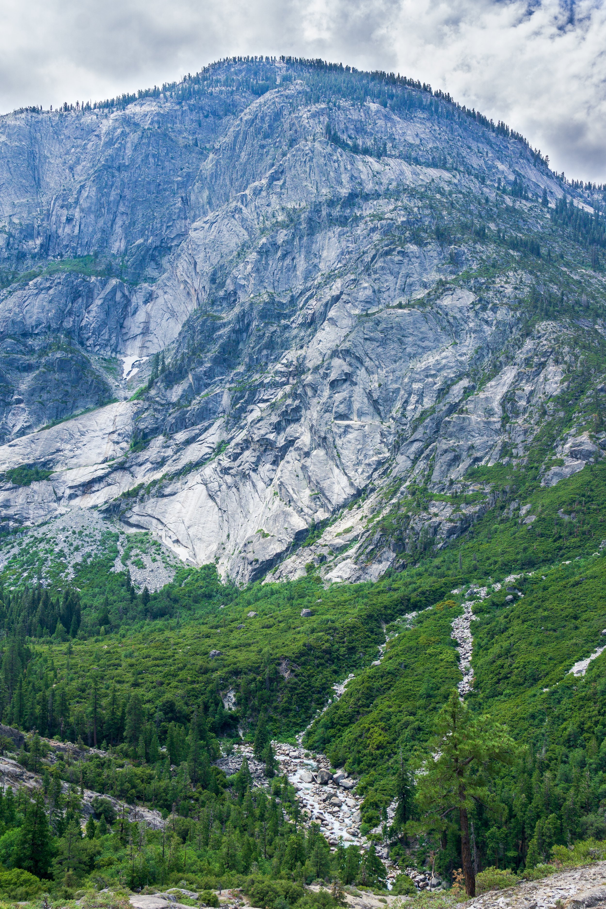
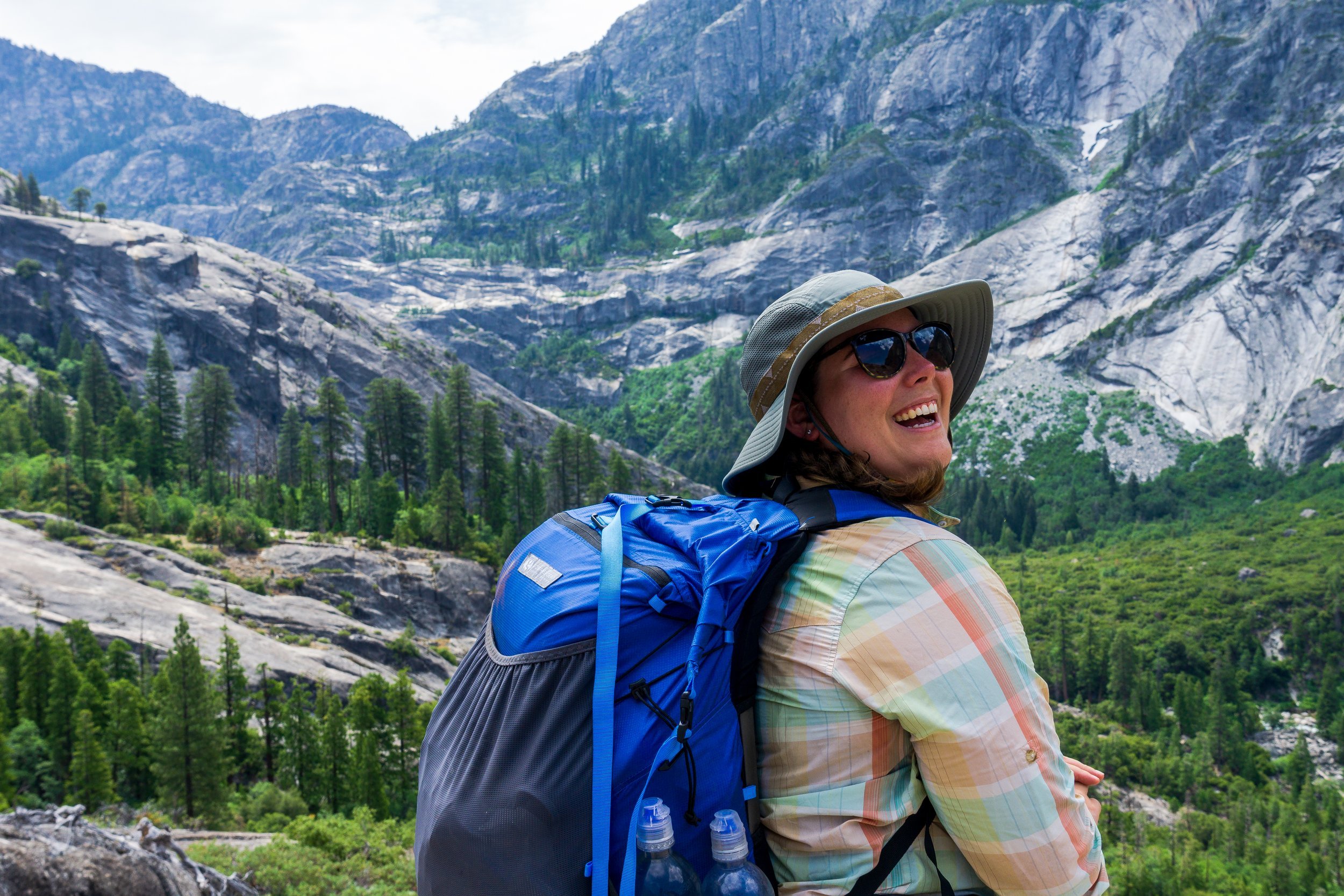
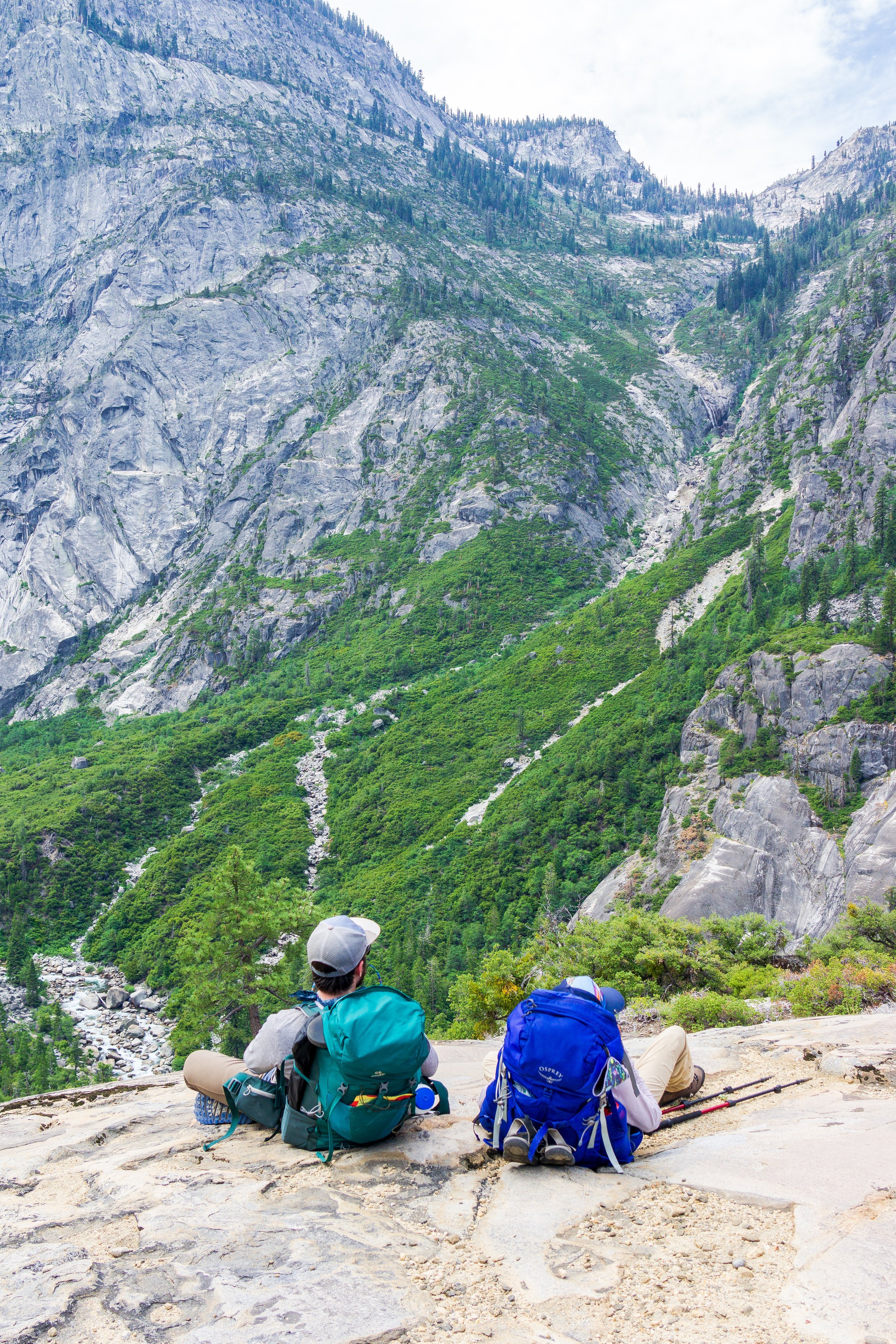
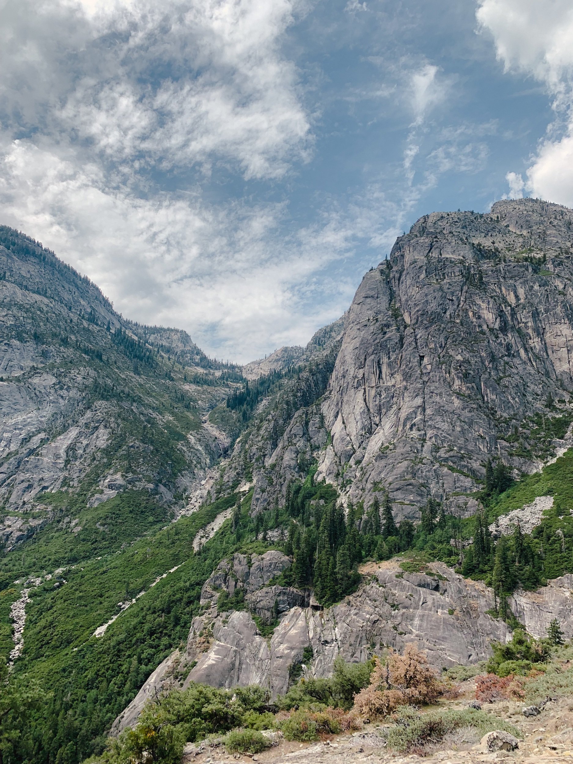
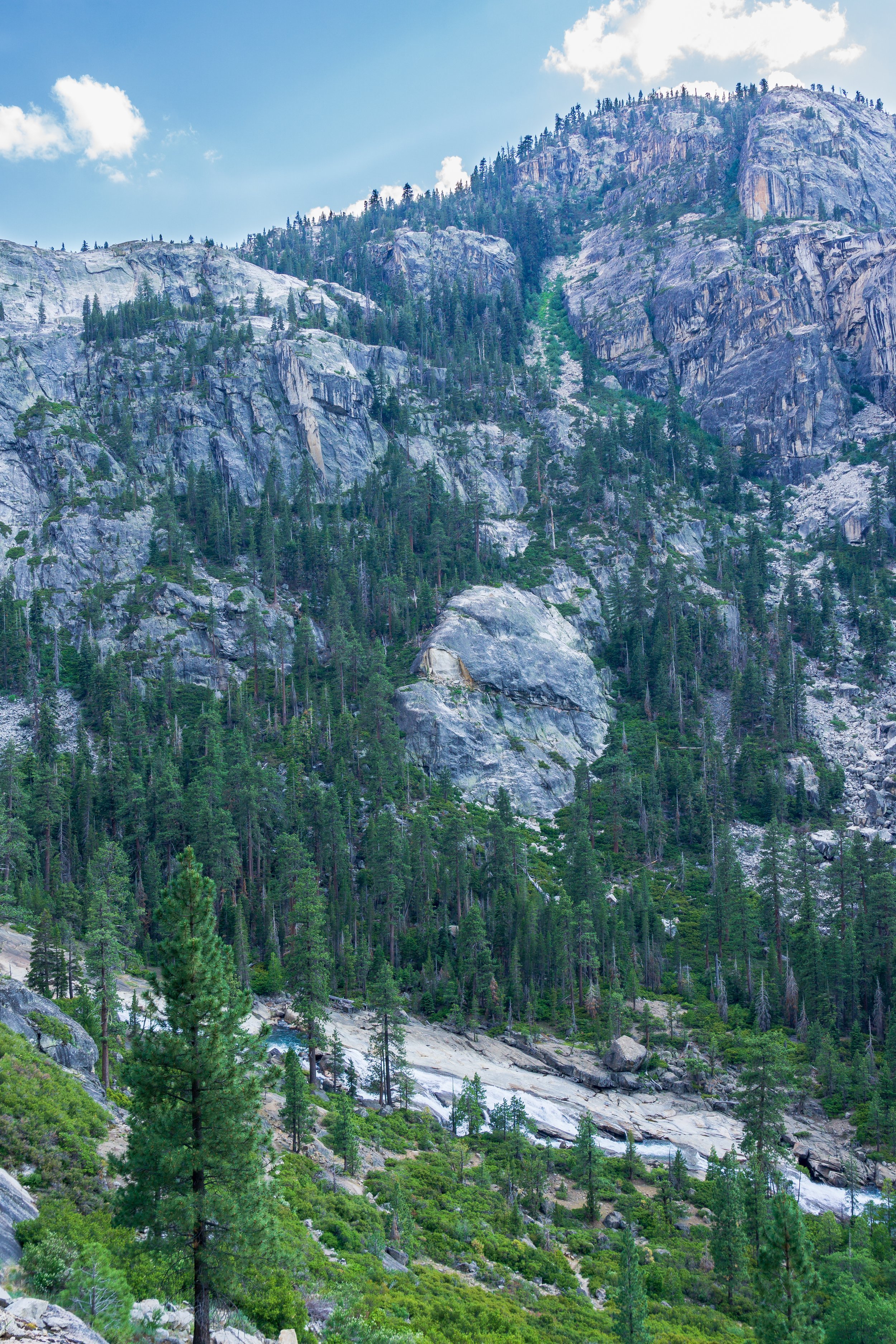
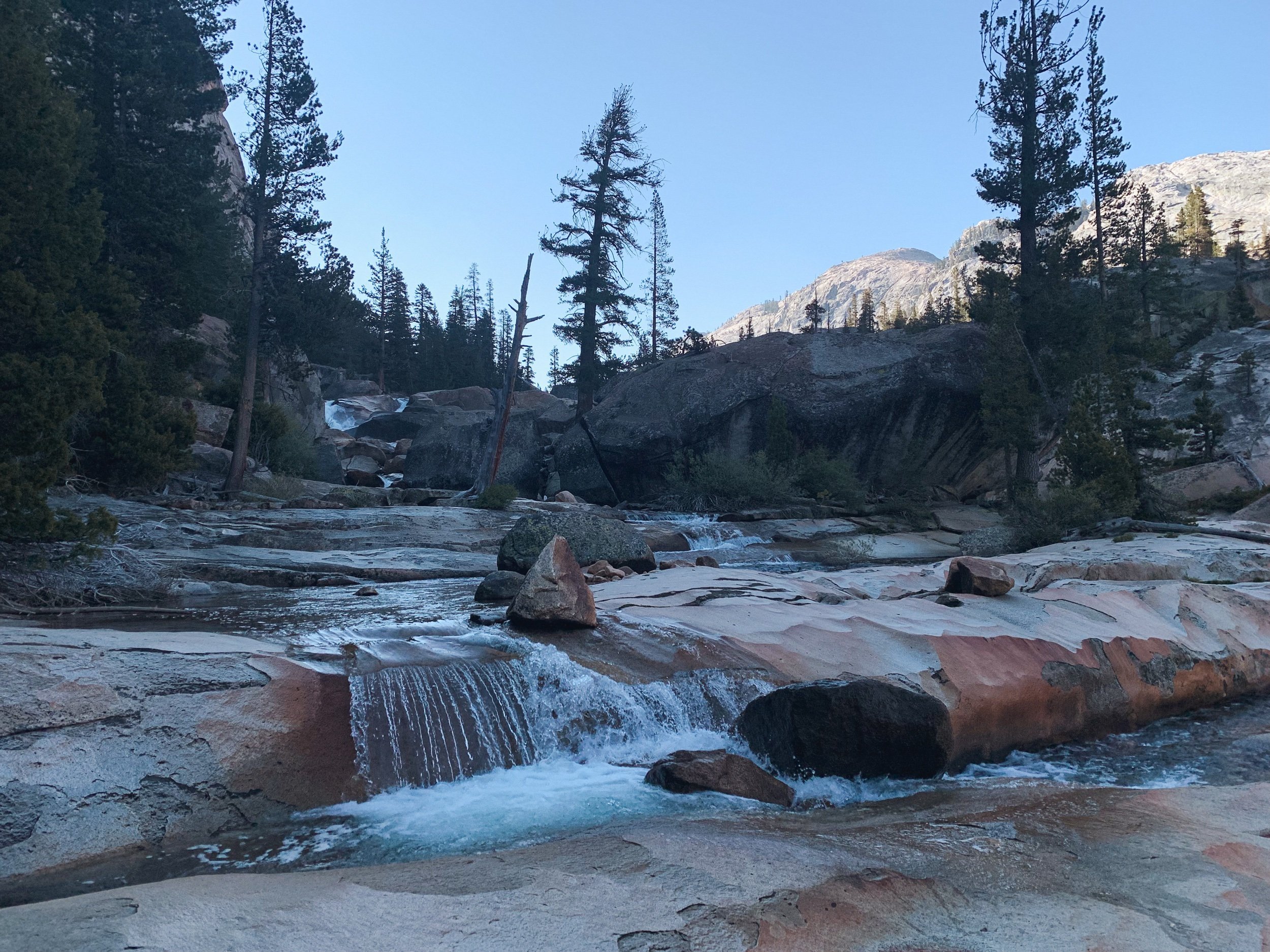
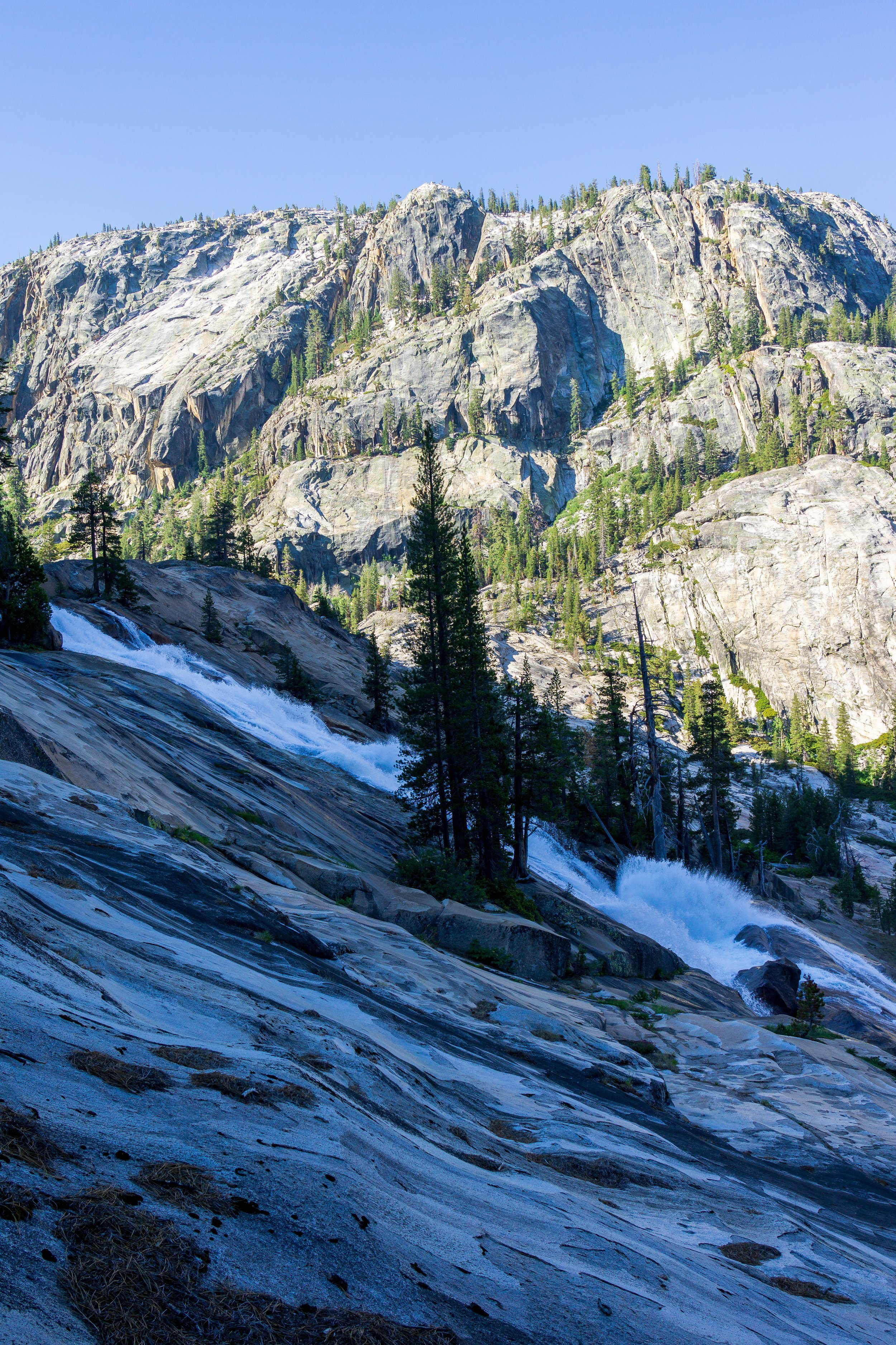
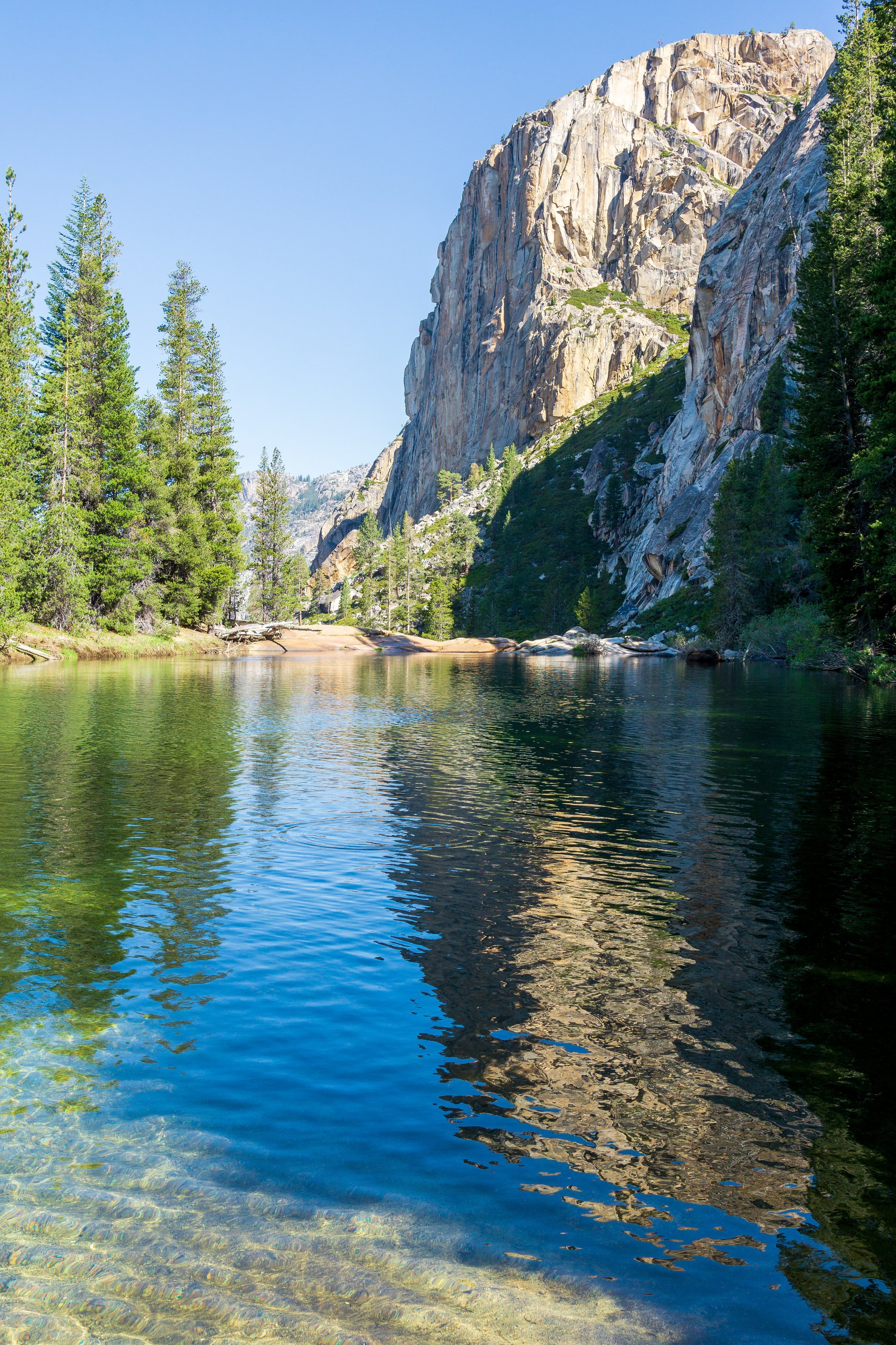
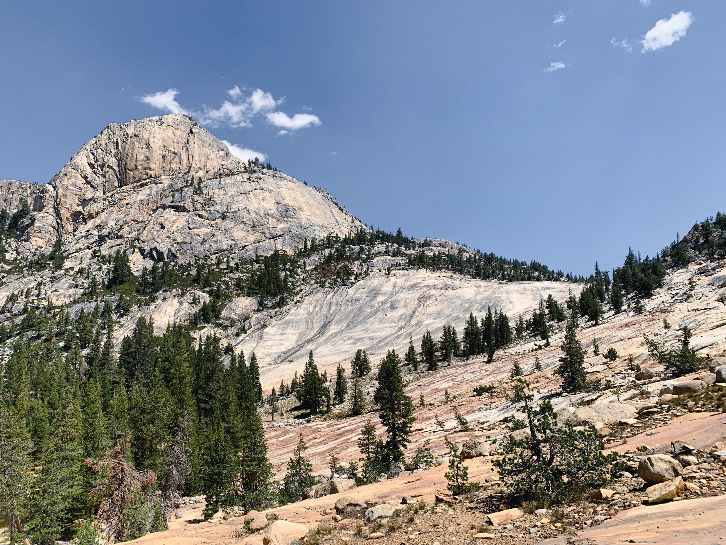
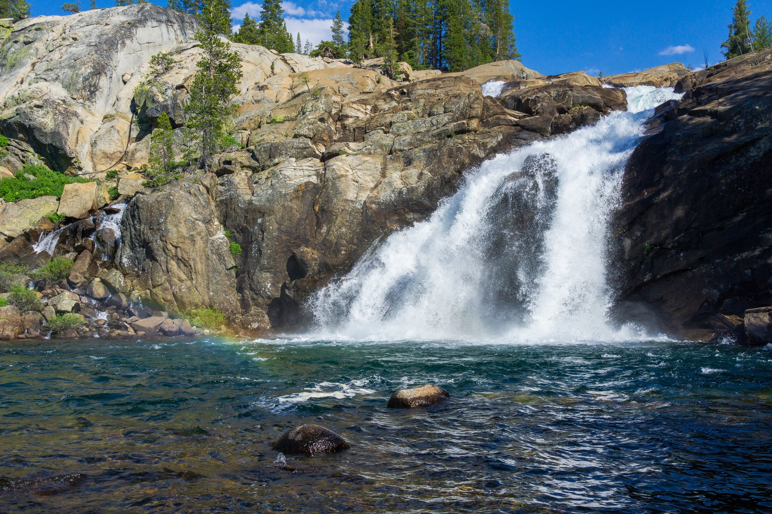
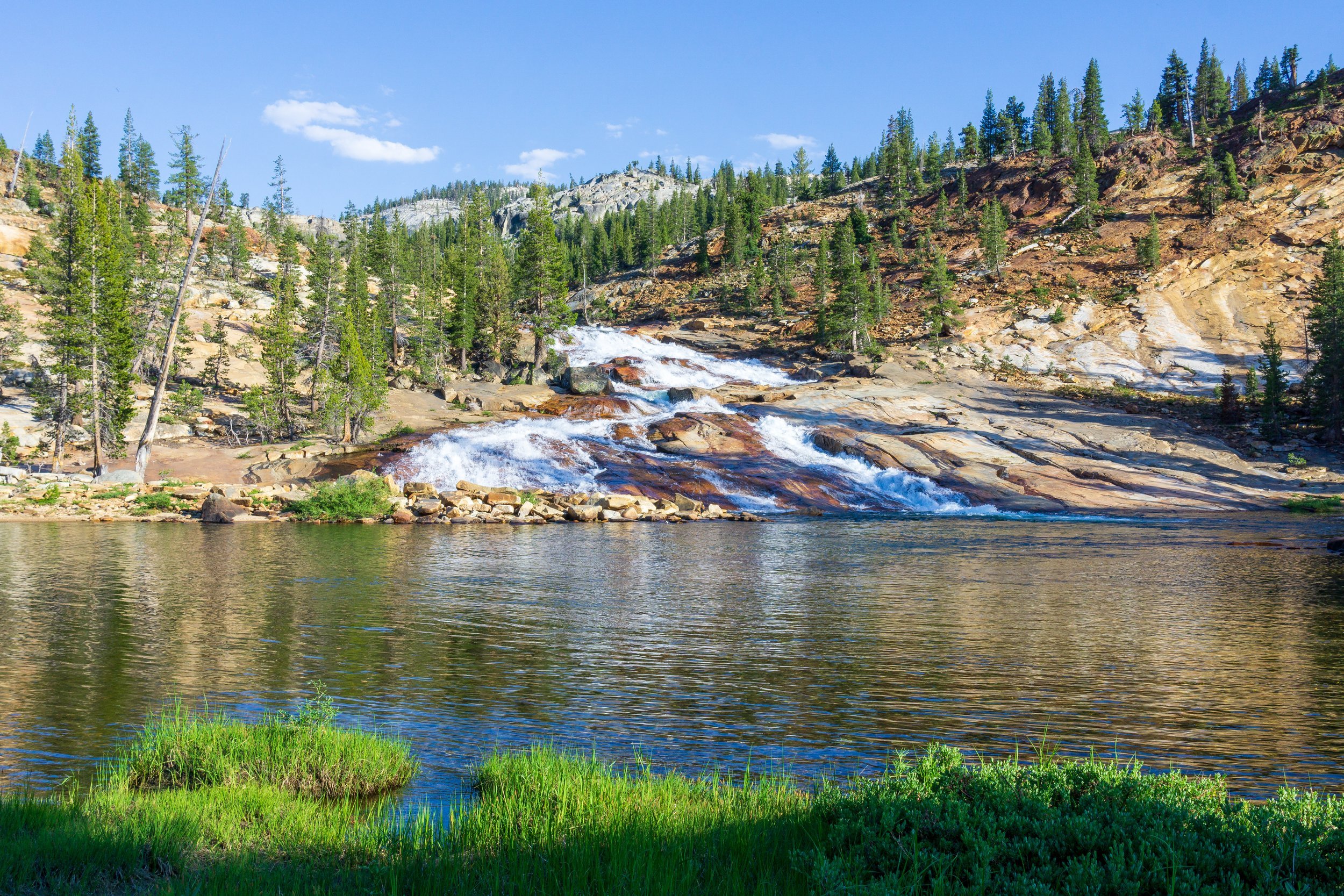
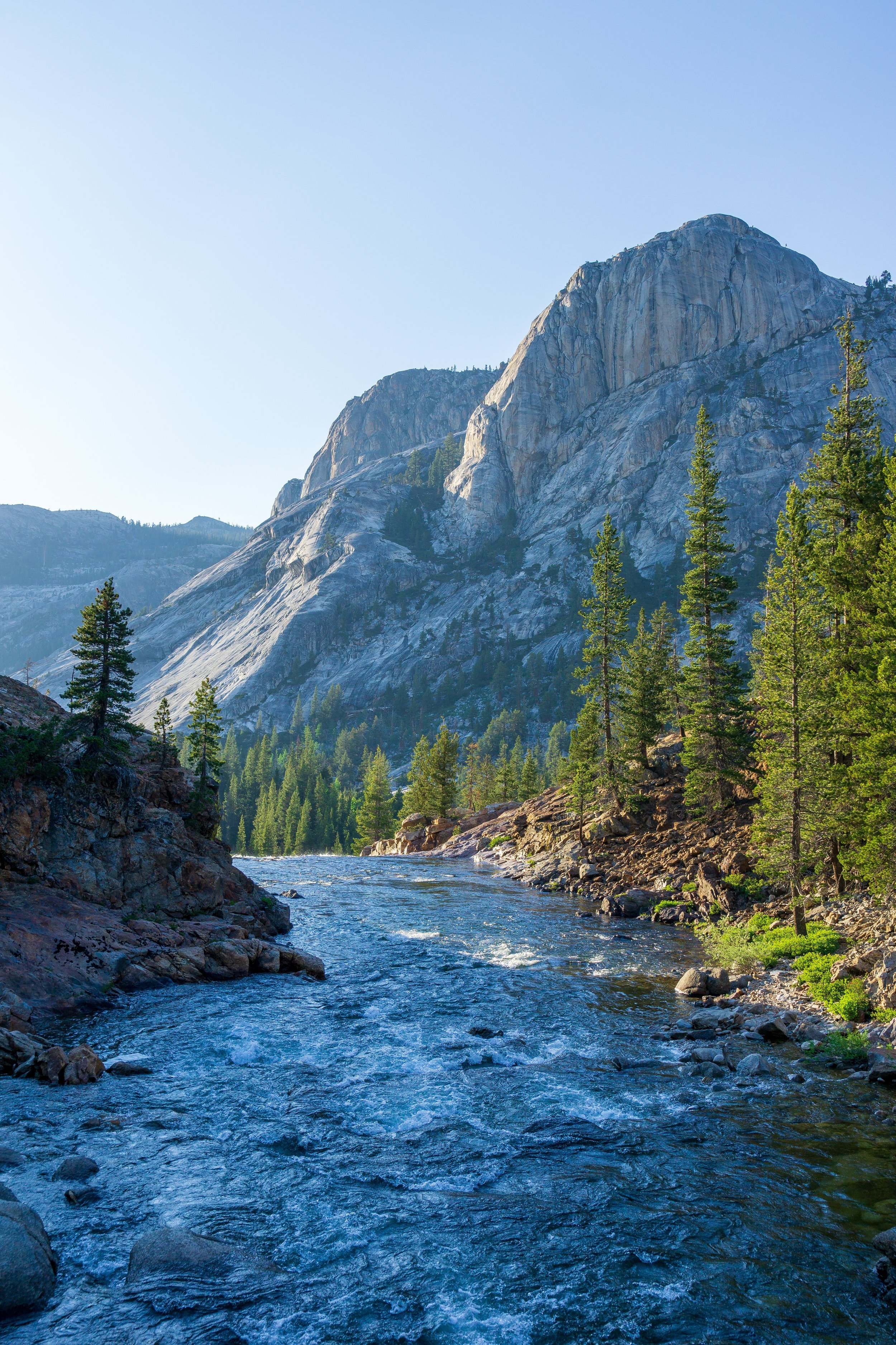
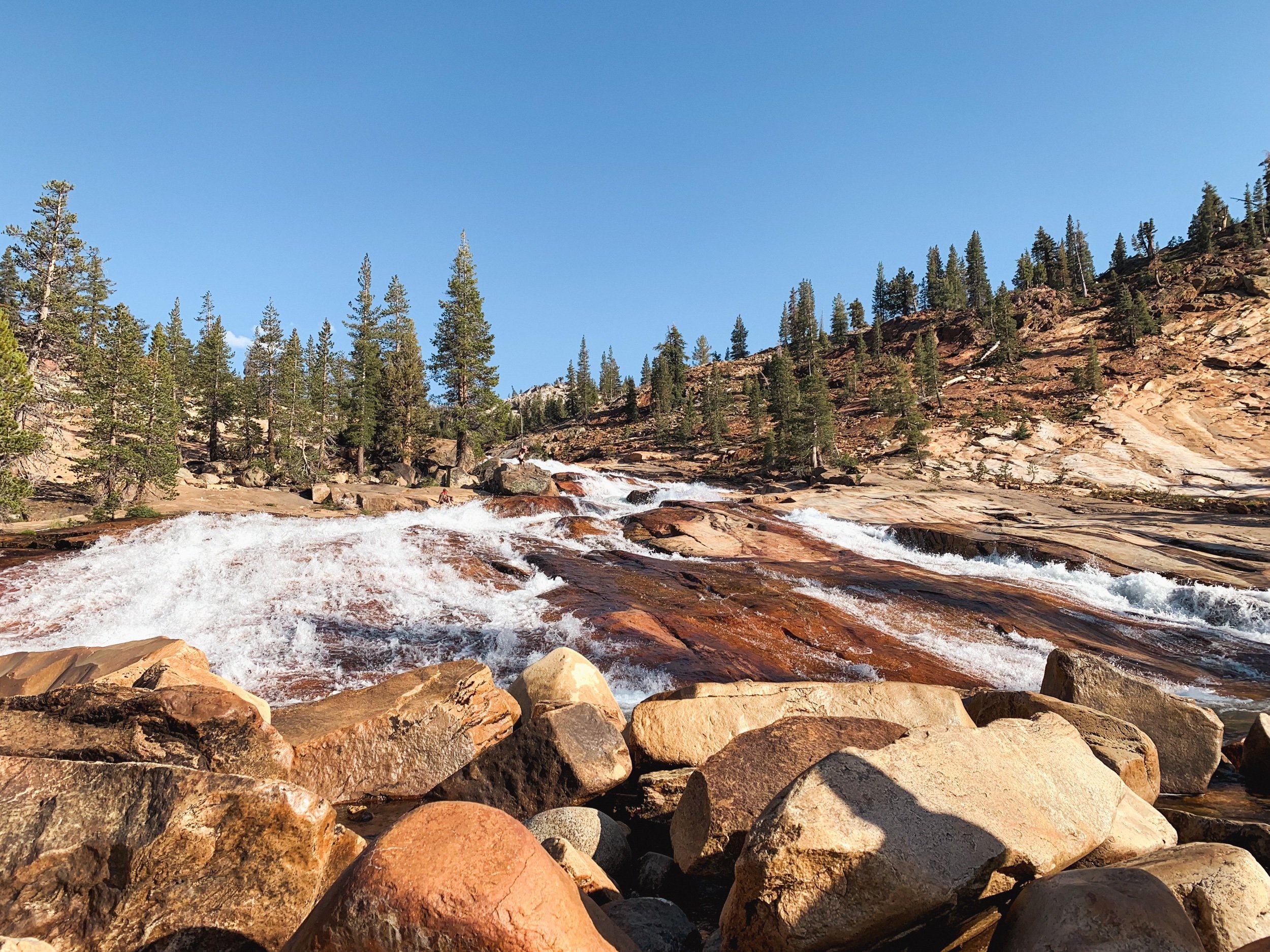
You’ll hike eastbound out of Pate Valley through some pretty dense grasses and bushes, passing another trail that goes north towards Jack Main Canyon. Stay straight. You might not even see the other trail as it is can be pretty overgrown down here. After a mile, the canyon really opens up and you are walking right next to the river. After another half mile or so, you’ll pass a really nice camp spot between the trail and the river - which could be an alternate if you don’t want to camp in Pate Valley. The trail wanders away from the river here, so water will not be available until Muir Gorge. The trail will gradually climb until the Muir Gorge area, which has steeper climbing. The first waterfall from Rogers Canyon has a footbridge, and was a nice break spot. But if you want an even better break spot, continue onto the next waterfall, Register Creek. After more climbing, you’ll exit the wooded area and emerge on the top of a granite outcropping with amazing views of the canyon. Here is another lovely break spot to really enjoy the view. The trail descends back to the river, and at the bottom is a nice area to take a rest right on the river bank. It was a great lunch spot for our group as we soaked our feet and ate in the shade of boulders and bushes. The trail meanders alongside the river and gradually climbs up to a footbridge over Return Creek. There is a large flat area here, but camping could be dicey as it is pretty much right on trail. After the bridge, the trail switchbacks up to above Waterwheel Falls. At the very large and roundabout bend of the river, and about 150 feet below the trail is a large, amazing campsite nestled in the trees. There’s a steep use trail on the right.

Day Four: LeConte Falls to Glen Aulin High Sierra Camp. 3 miles, +1,200 -300 ft
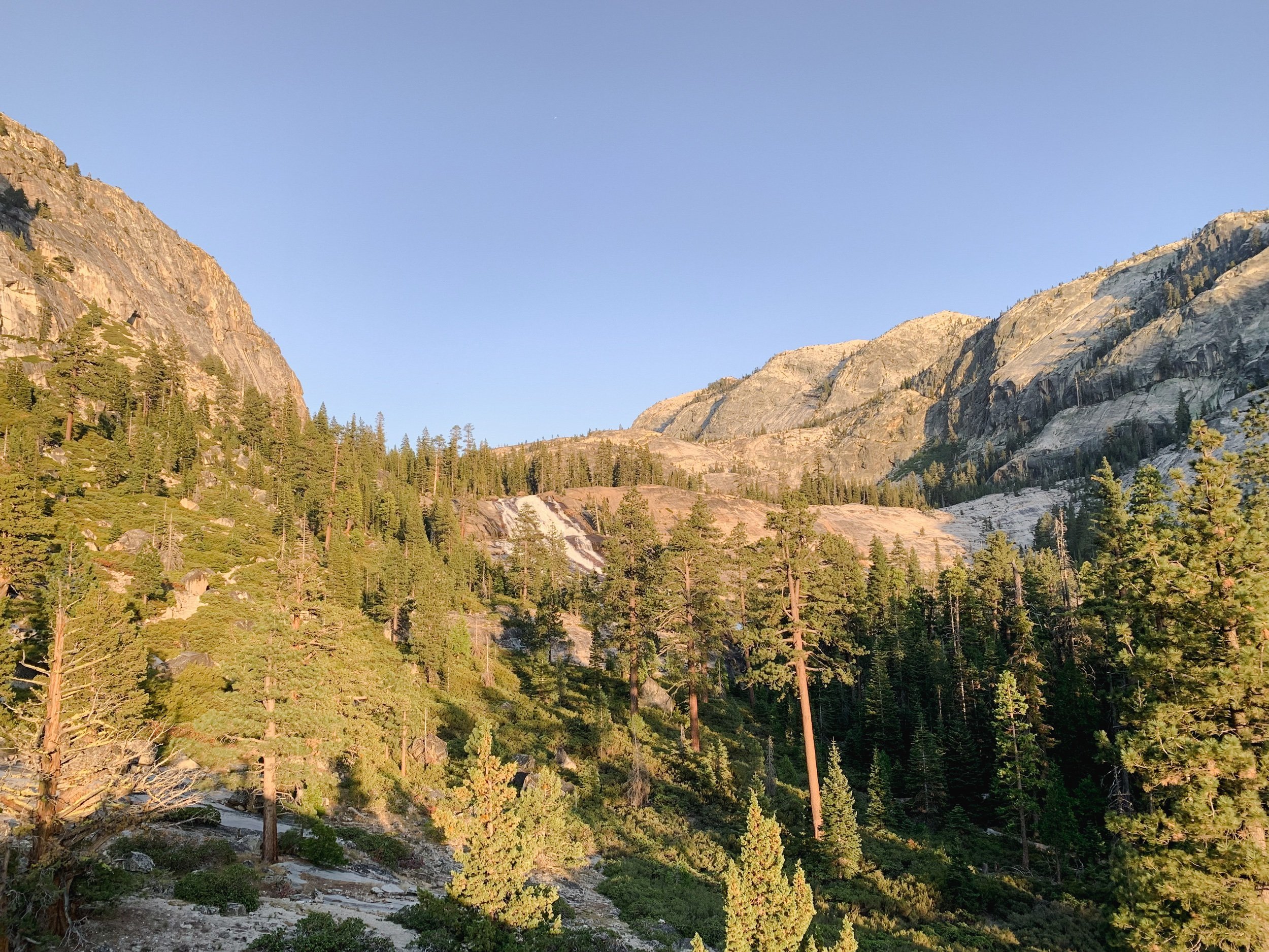
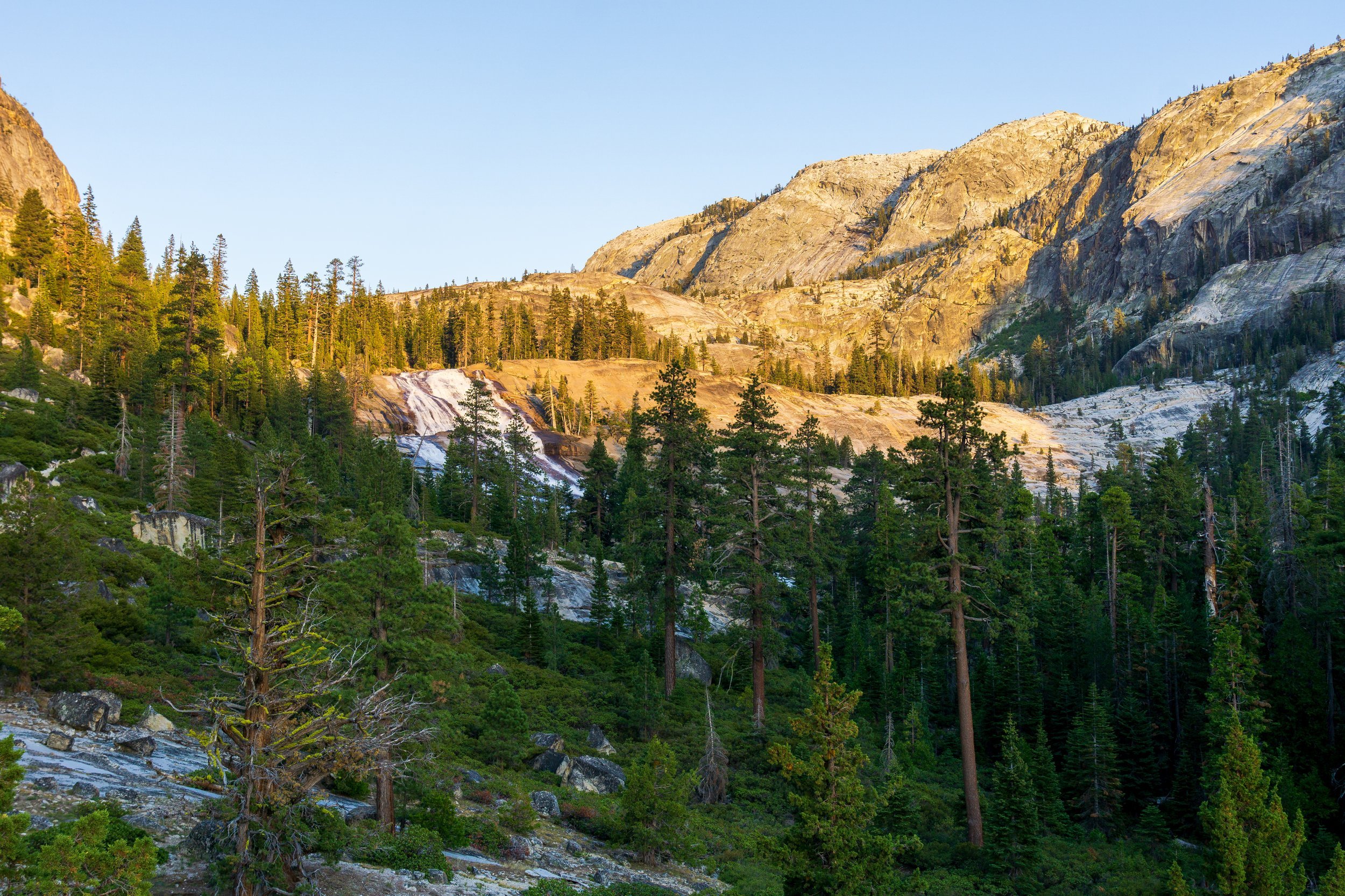
The trail continually and gradually climbs up to Glen Aulin from LeConte Falls, passing by a few other waterfalls, and a couple of camping spots. There is an extra nice beach at a slow spot in the river below California Falls, which would be lots of fun to hang out at. Climbing the granite area around California Falls is also very gorgeous. At the top of California Falls, the trail goes into the forest and away from the river, before rejoining the river’s banks on the way up to Glen Aulin.
Day Five: Glen Aulin High Sierra Camp to Tuolumne Meadows. 5.5 miles, +1,100 -400 ft
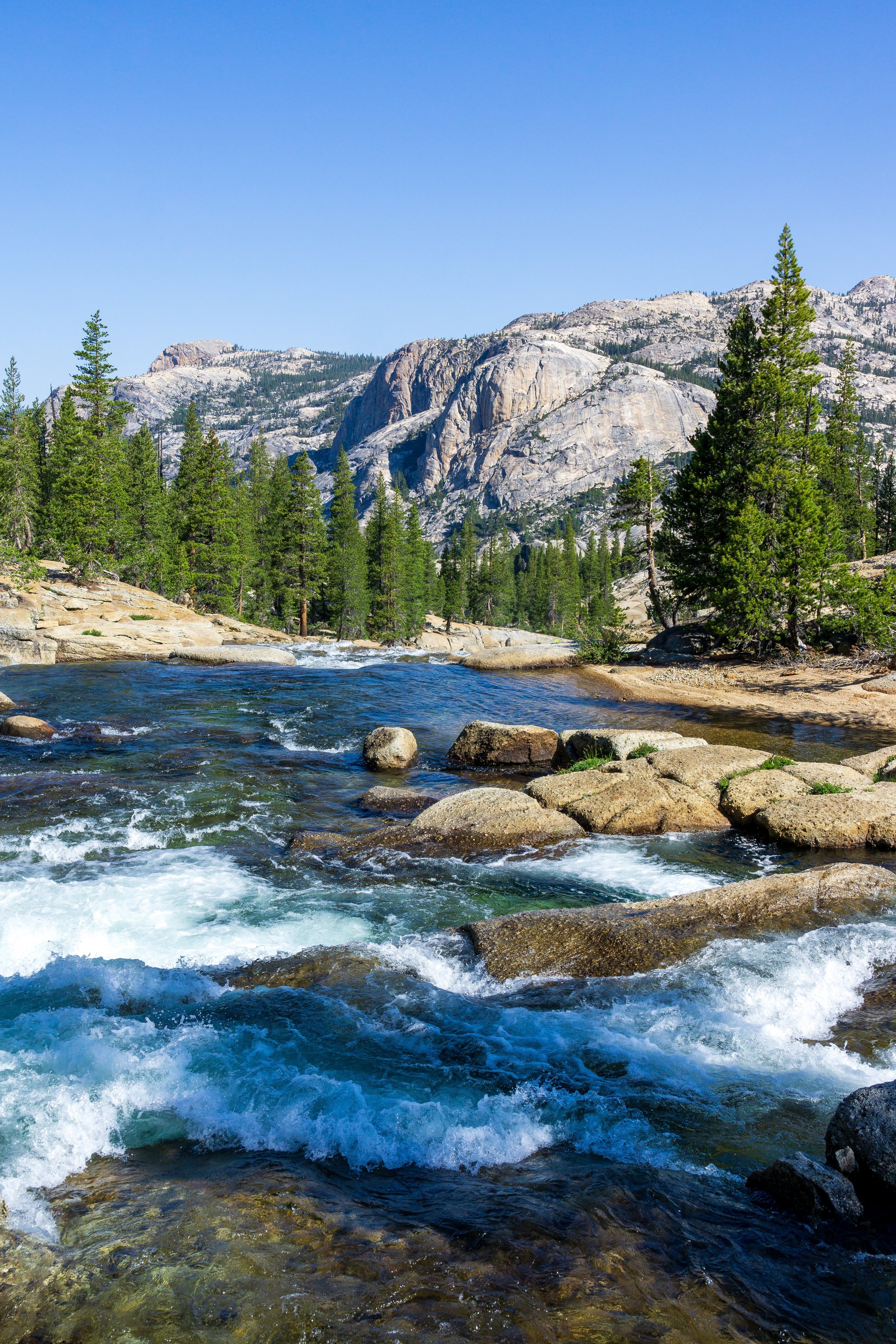
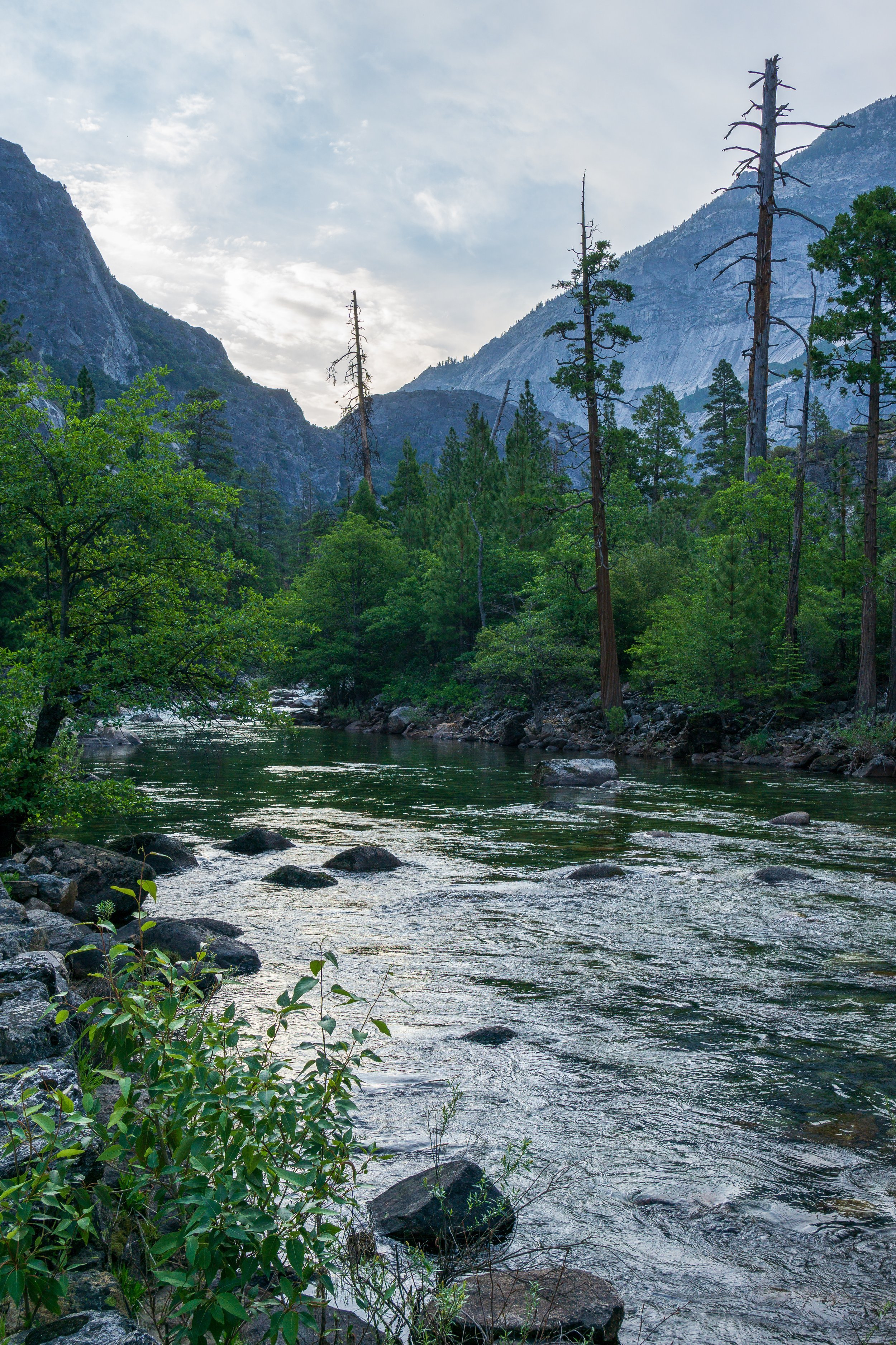
Leaving Glen Aulin, the trail crosses the outflow from White Cascade over a footbridge and then continues east, climbing a bit steeply up to Tuolumne Falls, another nice break spot on the rocks. The trail is in the most subalpine forest zone here, with baby trees trying to grow in a vast granite desert. The trail follows the river pretty closely until it disappears into the forest. Once the trail is close to the trailhead in Tuolumne Meadows, you’ll see signs for Soda Springs, a worthwhile detour on the way to the parking lot.
Direction?
I went eastbound, from White Wolf to Tuolumne Meadows. As you can see from the elevation profile above, this direction has more elevation gain, overall. It also features a very steep and short (relatively) descent down to the lowest elevation of the route in Pate Valley.
If you hate steep downhills and would prefer to just put your head down and climb up the 3,000+ feet from Pate Valley to White Wolf on your last day, when your pack is the lightest, go westbound, starting at Tuolumne Meadows.
If you have young knees and don’t mind spending your whole entire trip - after the initial descent - going uphill, go eastbound.
Permits
This route is probably one of the most known and popular multi-day backpacking routes in the park, so be sure to plan well and get your permits ahead of time. You can apply for permits 24 weeks in advance on the recreation.gov permit lottery.
There are a few entry trailhead options you can select on both ends, and it all relates to where you can camp for your first night.
Eastbound Options:
White Wolf to Pate Valley: Choose this if you will go all the way to Pate Valley on your first night.
White Wolf to Smith Meadow: Choose this if you need a super short day and will camp at Harden Lake your first night. This is what we did.
Westbound Options:
Glen Aulin: Choose this if you want to camp your first night at the Glen Aulin backpacker’s campground.
Glen Aulin Pass Thru: Choose this if you will camp at or past California Falls on the Tuolumne River for your first night.
This map is super helpful when deciding how to choose your trailhead for all Yosemite backcountry trips.
Seasons & Weather
Tioga Road in Yosemite closes to overnight parking on October 15th every year, and the opening date widely varies due to the winter snowpack. You can view the opening (and official closing dates) of every year and it’s corresponding winter snowpack amount on this chart.
Due to the lower elevation of this route, you can generally hike it safely once Tioga Road opens for the season. There could be some leftover snow in wooded areas near White Wolf and Tuolumne Meadows. The main risk you run by going earlier in the season is lots of downed trees on the route.
Because of the lower elevation and general exposure, it can get very hot in the canyon - it was nearly 100* in Pate Valley when I was there in mid-June. Be sure to avoid hyperthermia or hyponatremia by limiting your hiking to early in the morning and later in the evening and drinking water with electrolytes added. Luckily, there are many swimming opportunities along the river to enjoy to keep yourself cool. But of course, be vigilant and possibly avoid the river early in the season if it has been a high snow year. And never swim above a waterfall. Drowning is the #1 killer in Yosemite National Park!
Car Shuttles
This is a point-to-point hike so there are some vehicle difficulties. If you have multiple cars in your group, having one at the Lembert Dome parking lot and one in White Wolf is the easiest option.
If you only have one car, and the shuttle service is running, you can take the Yosemite Valley - Tuolumne Meadows Hiker Shuttle (click on the correct shuttle at this link), which has a stop at White Wolf. Be sure to call the information number about reservations.
Of course, hitchhiking away from or back to your car is always an option, and what we did. People are generally really friendly in the national park, and non-uniformed park employees are also known to be helpful with rides.
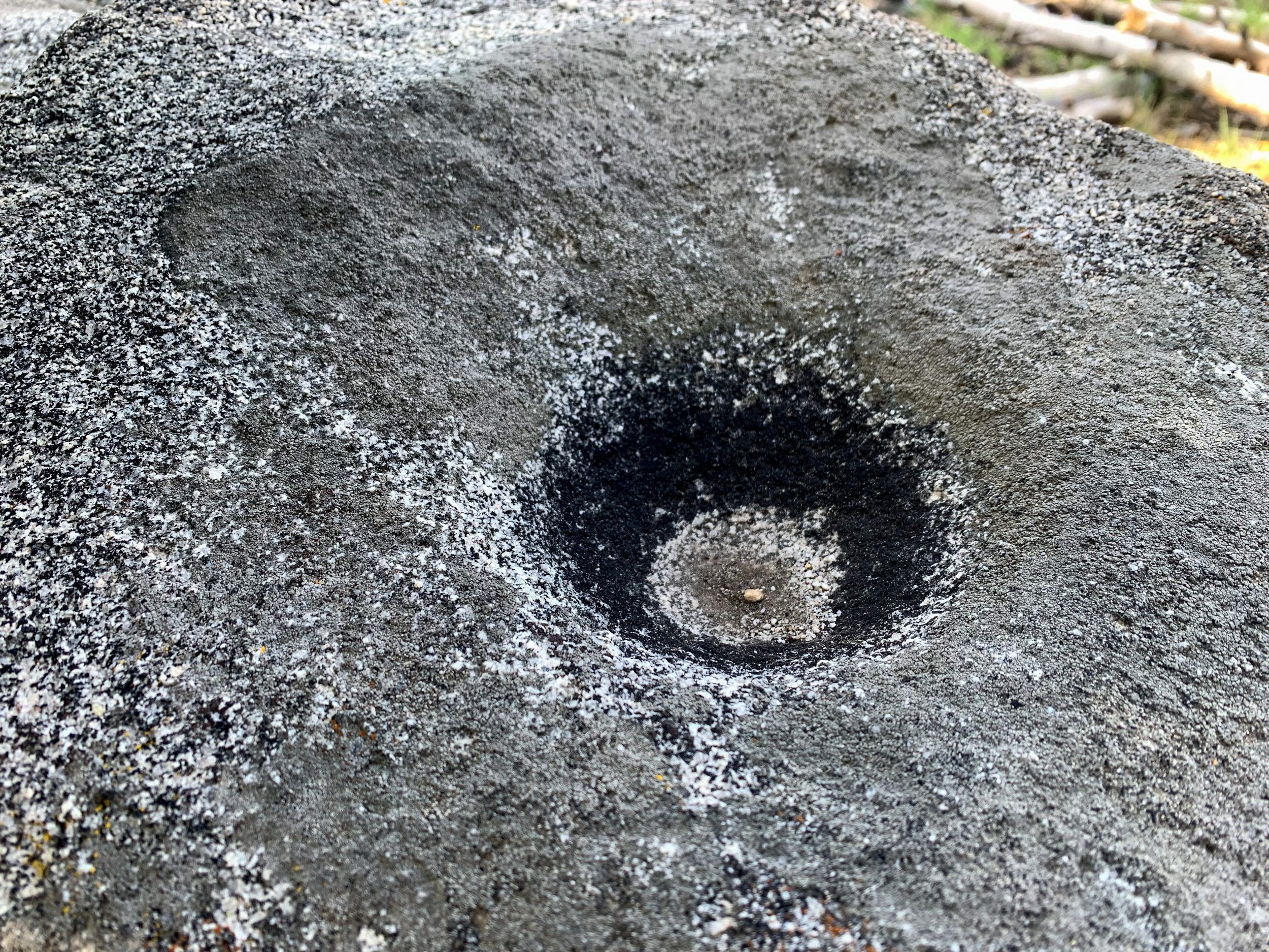
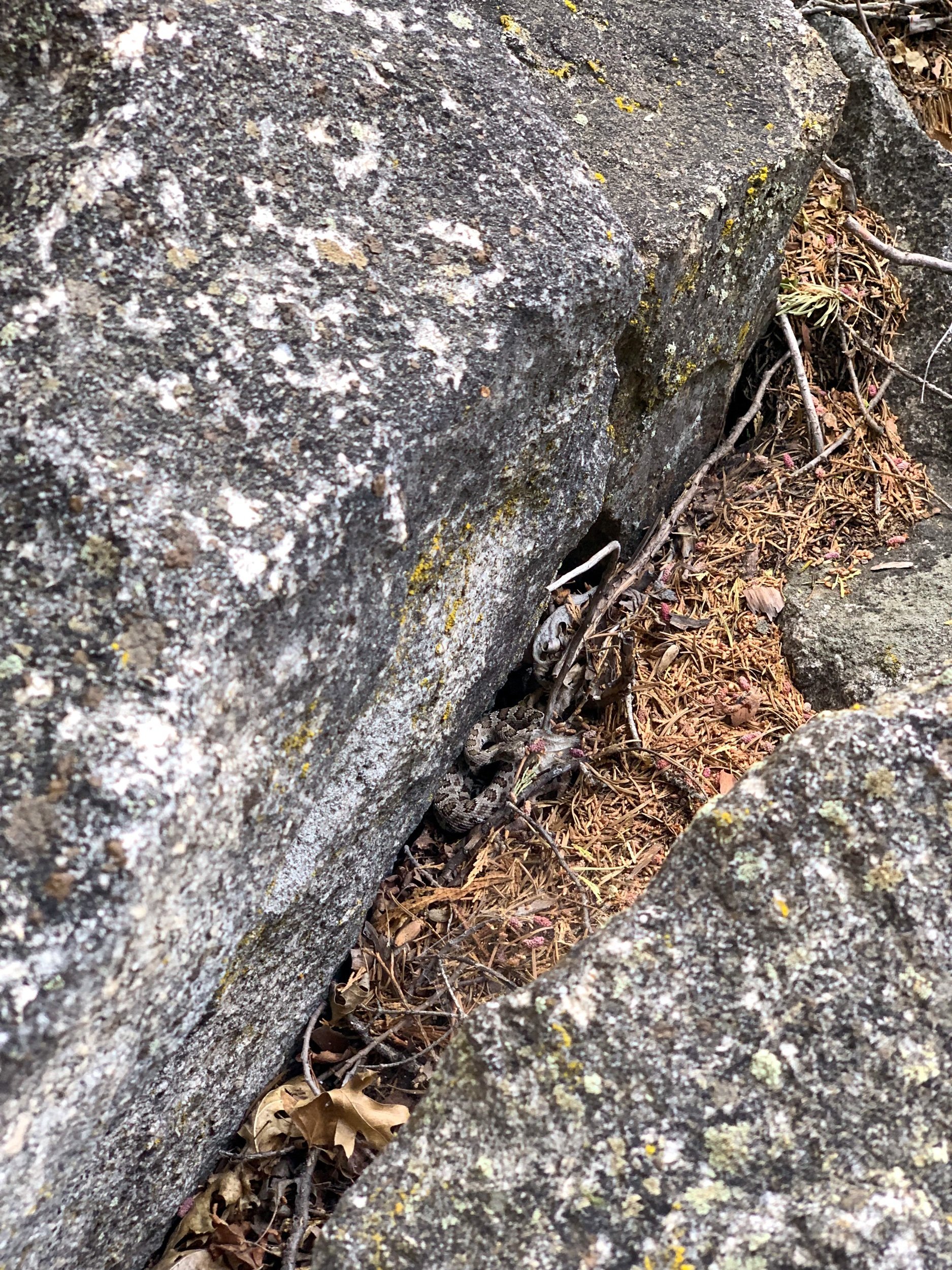
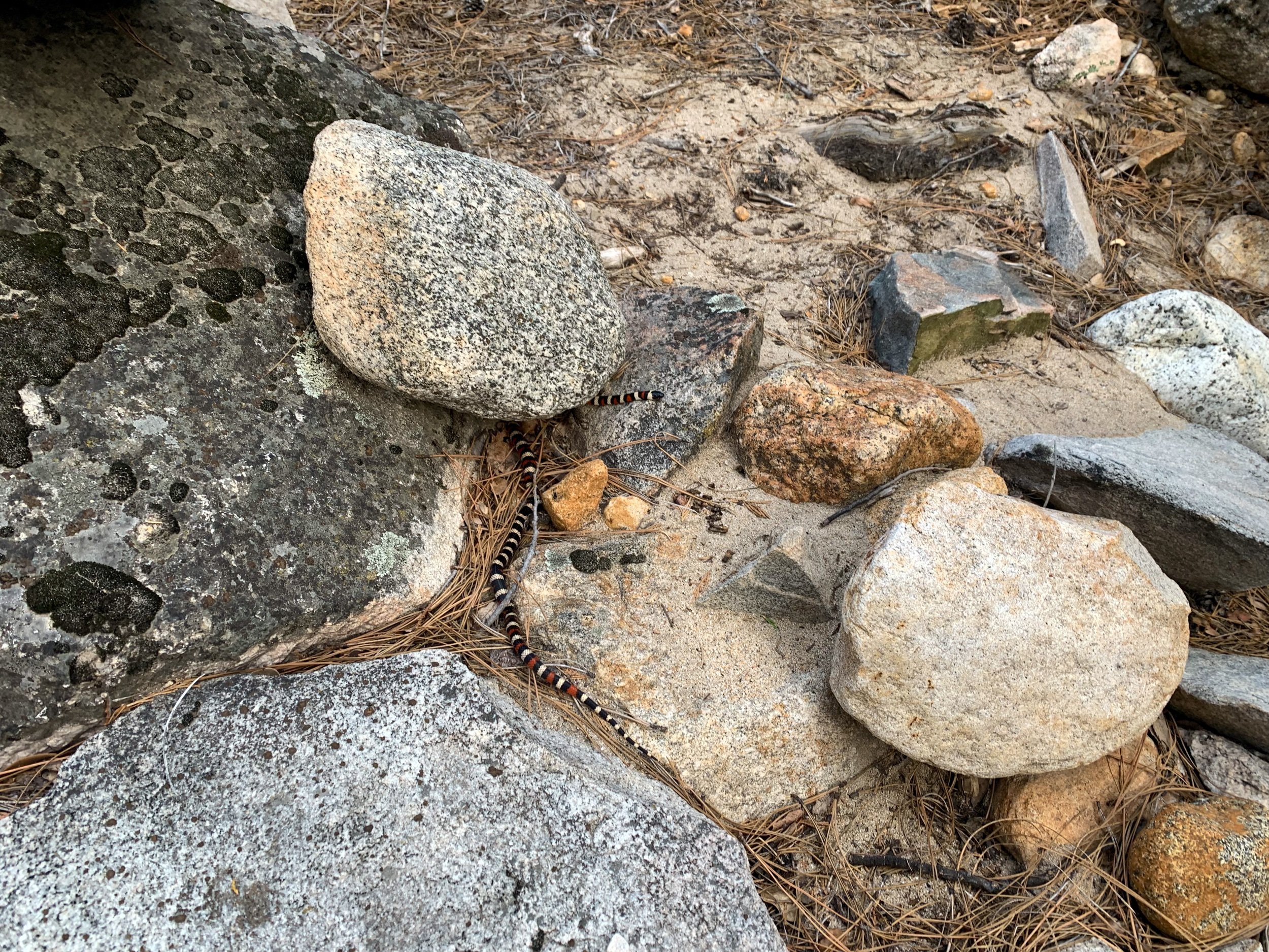
Rattlesnakes
Yep, you read that right. The canyon is notorious for having lots of rattlesnakes, especially below 6,000 ft. We ran into 3 rattlesnakes at various points! Be careful in the daylight hours, check over rocks before stepping, and keep your eyes and ears peeled. Don’t disturb them, and if you hear a rattle, back off (or jump in the air and scream, like me).


Trip Report
Day one:
We got a not too early start leaving the Bay Area, knowing that we only had to hike to Harden Lake for our first night. We met up with (nearly) the rest of our group at Tenaya Lake, hung out for a bit, and then drove back to the White Wolf trailhead. Since the road to White Wolf was actually closed, we had to park at the gate on Tioga Road, along with a half dozen other backpacker cars, and walk the road. It took a bit to get everything situated, but we finally started hiking around 5 pm.
The road walk was fine - mostly slightly downhill (already not looking forward to walking that back to our cars), and we took the shortest way to the lake by the service road, which was actually nice as the trail/ road paralleled a nice creek, and the hike was mostly flat.
We made great time, and found a nice sparsely wooded area on the north side of the lake to camp. Harden was pretty low on water, so it was kind of difficult collecting water since there was a decent amount of scum and pollen to dodge.
After setting up camp and doing our chores, we ate dinner as a group while the sun set behind us, then got ready for bed.
We were still waiting on our last group member to join us: he had mandatory work training and didn’t end up getting to the trailhead until 10 pm! Thankfully he loves night hiking, and we woke up when he arrived to welcome him to camp, and attempted to fall back asleep.
Day two:
We thought a long day of downhill wouldn’t be the worst, but spoiler alert: it was the worst. Or at least, really draining.
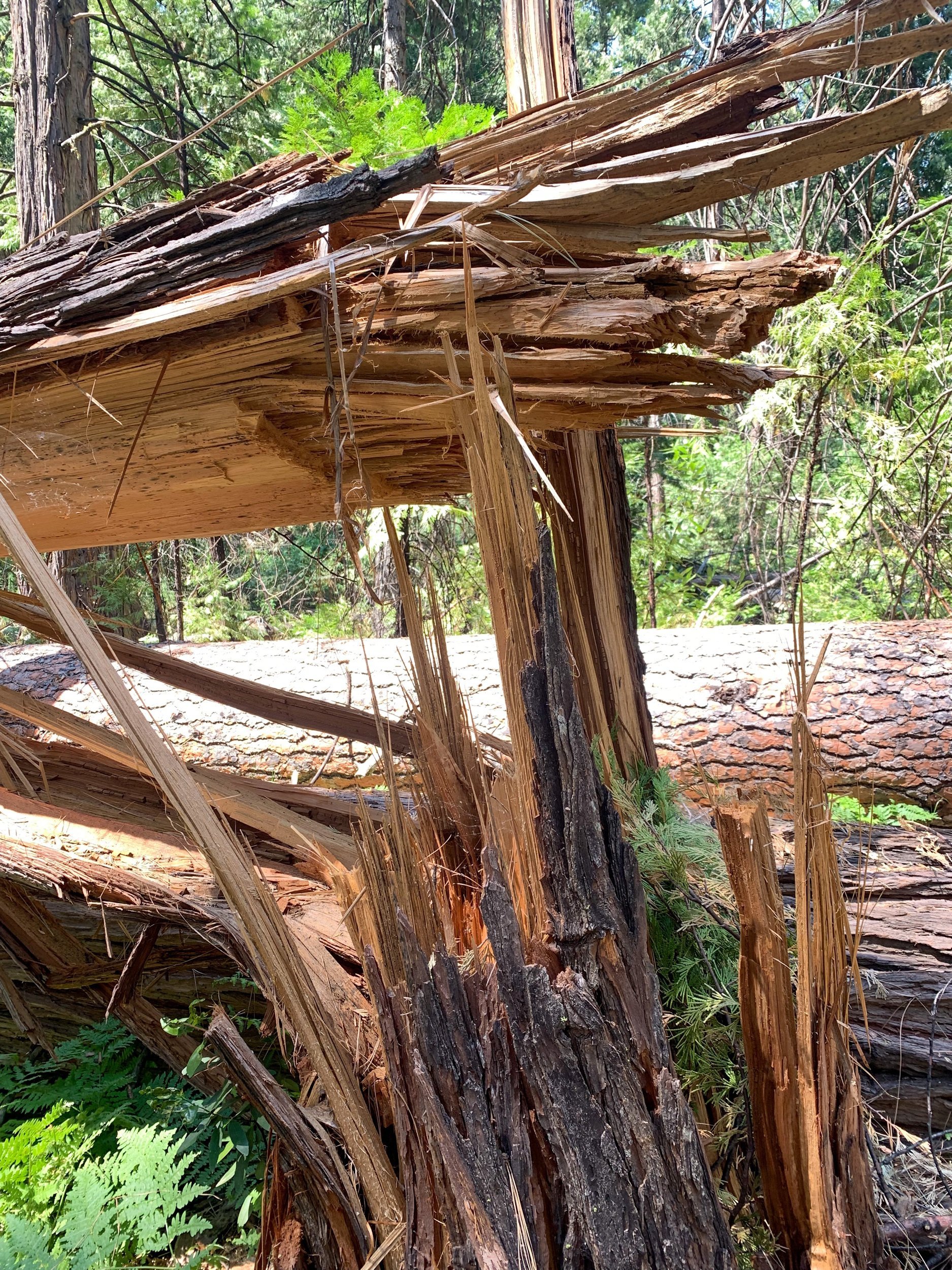
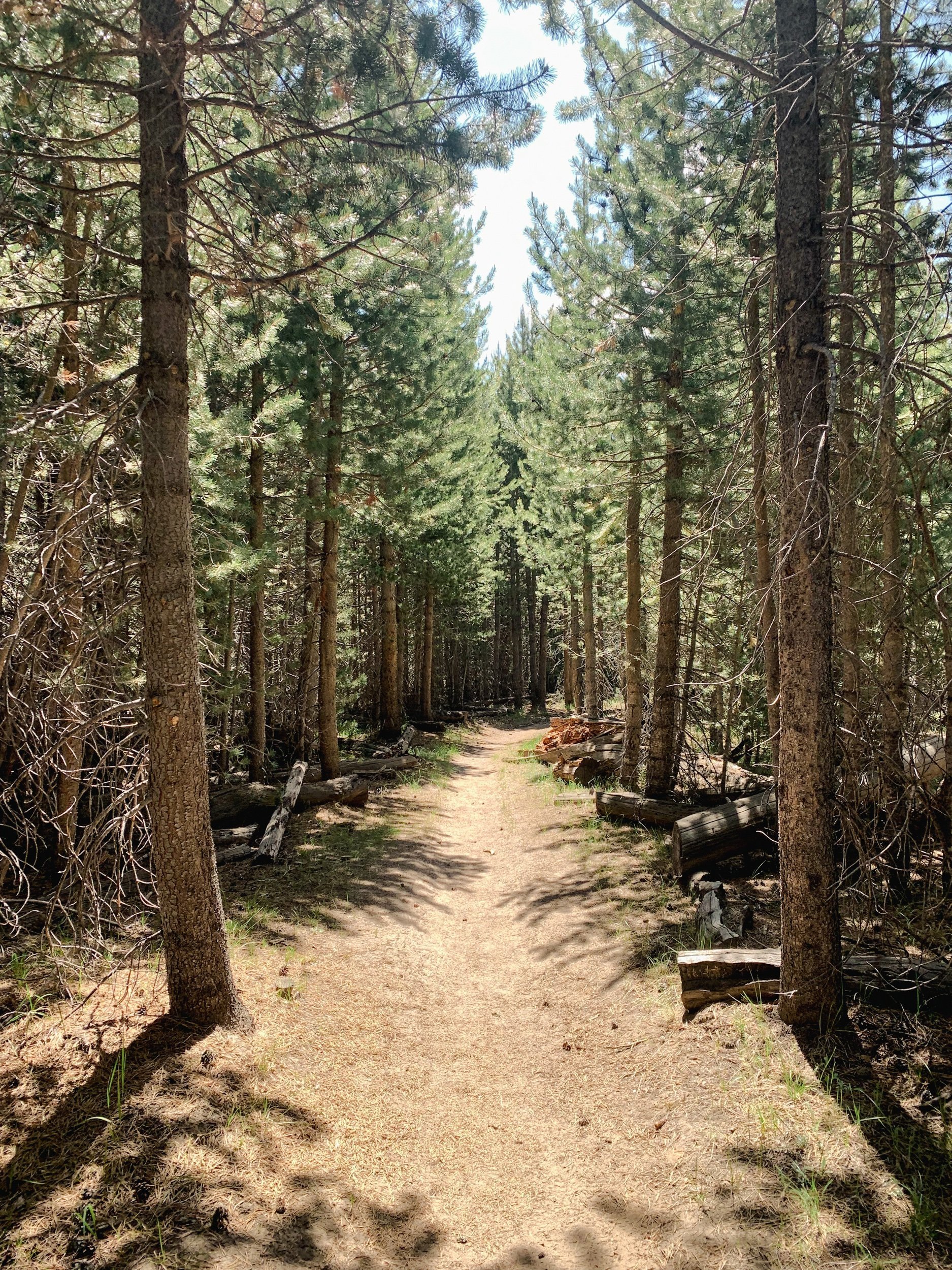
We got a slow start in camp, not leaving until 9 am, when it was already starting to get pretty warm. The trail was a pretty relentless downhill, with some flatter spots, and lots and lots of debris on the trail, including blowdowns to navigate. We’d been warned by the ranger that trail-clearing crews hadn’t done work yet, and we experienced that today!
We ran into a couple of groups on their way up (yikes) and wished them well.
We started to get really cool views of the northern Yosemite mountains as we descended the southern walls of Hetch Hetchy Reservoir.
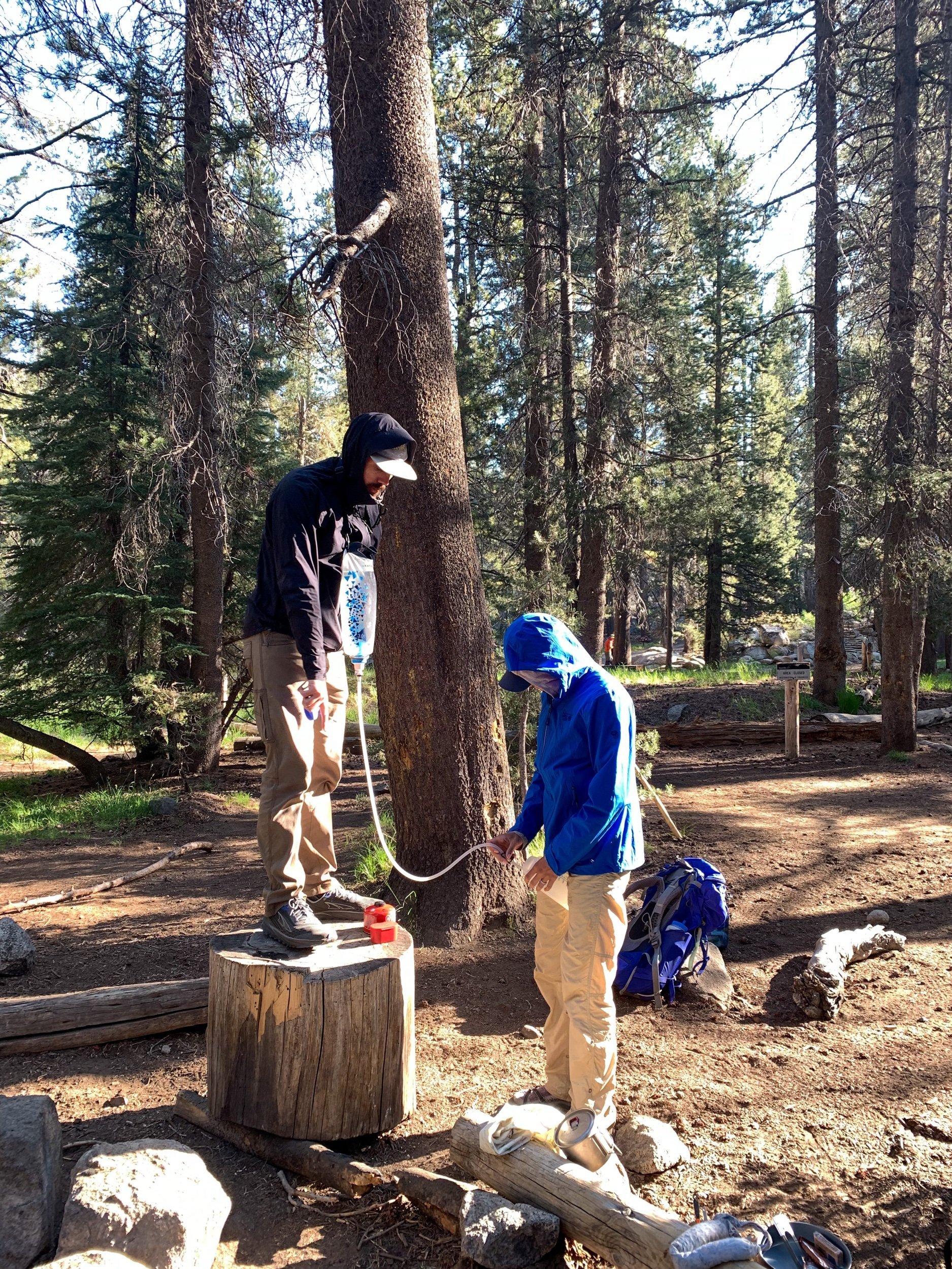
Our bodies were screaming for a break by the time we reached the shaded oasis of Morrison Creek. We dunked our hats and shirts as we filtered water and ate snacks in the breezy, cool shade. It felt absolutely amazing, until we started walking again and then it felt way too short.
The trail spit us out into more exposed terrain, but we started getting better views of the Grand Canyon of the Tuolumne, where we were headed. We also got a pretty spectacular view of Hetch Hetchy.
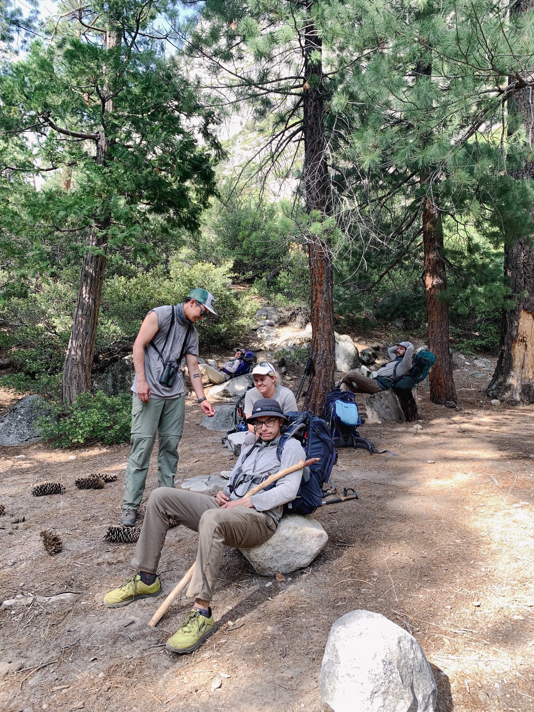
After another not so great break, we really started hurting. Wanting to eat lunch at water and in the shade, we trudged along to the next creek on the map. Bummer for us, all of the seasonal streams were not flowing. We eventually plopped down in shade to scarf down some lunch, and resigned ourselves to another mile until we could get water in Pate Valley. Of course, we had another obstacle course of overgrown trail, and massive blowdowns to navigate in that mile, before reaching the beautiful Tuolumne River. We found a great camp area with beach access to the river, and plenty of shade. Basically the campsite lottery. We had considered hiking further into the canyon to make tomorrow easier, but since we were so exhausted and beat up, we decided it was better to camp in Pate Valley, hydrate, and rest, and wake up very early in the morning to tackle the hottest part of the canyon in cooler temperatures.
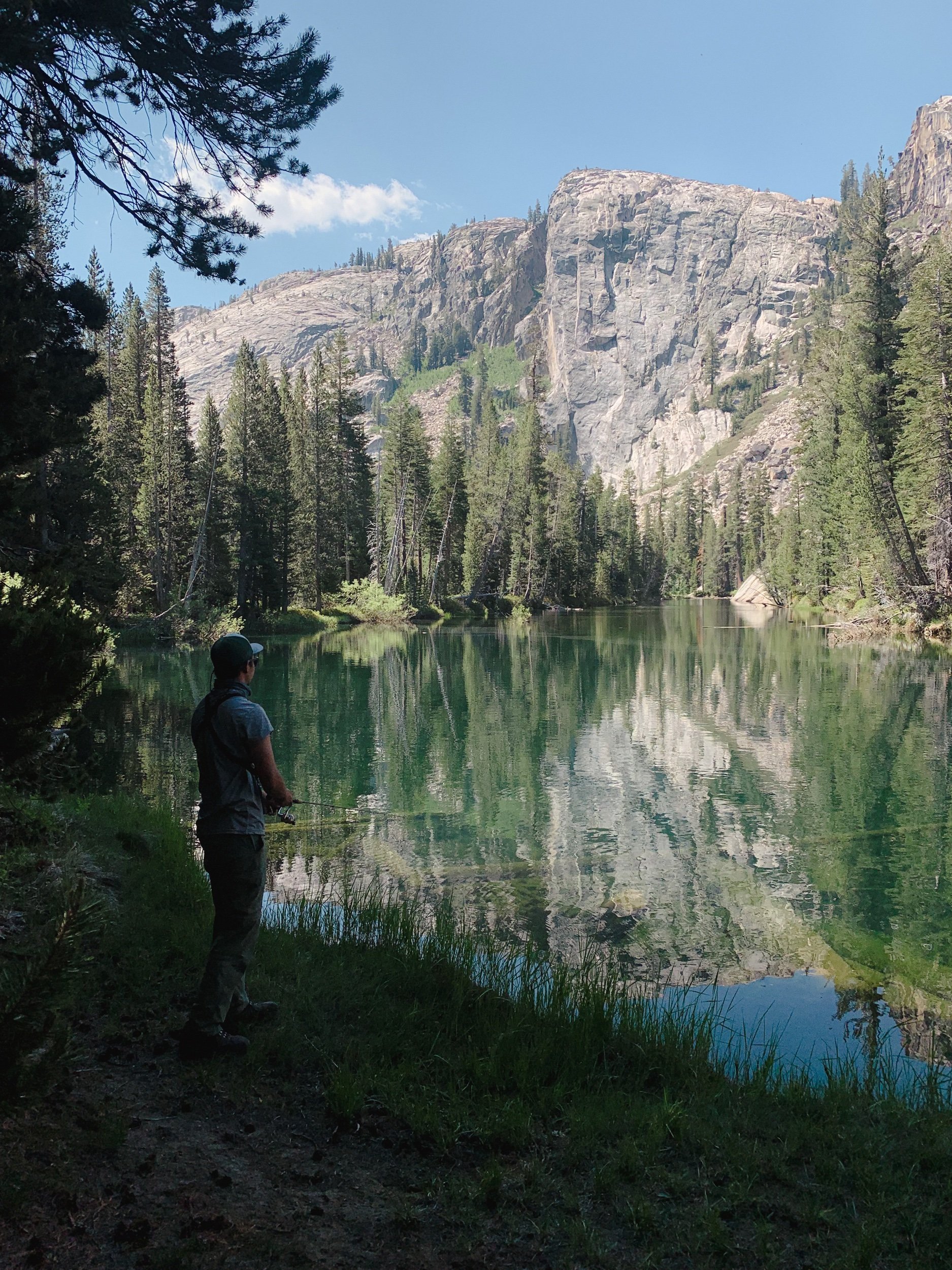
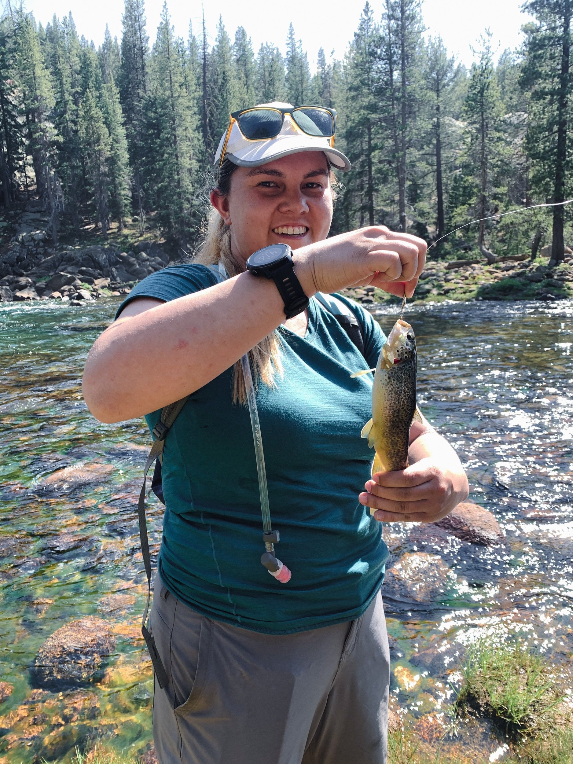
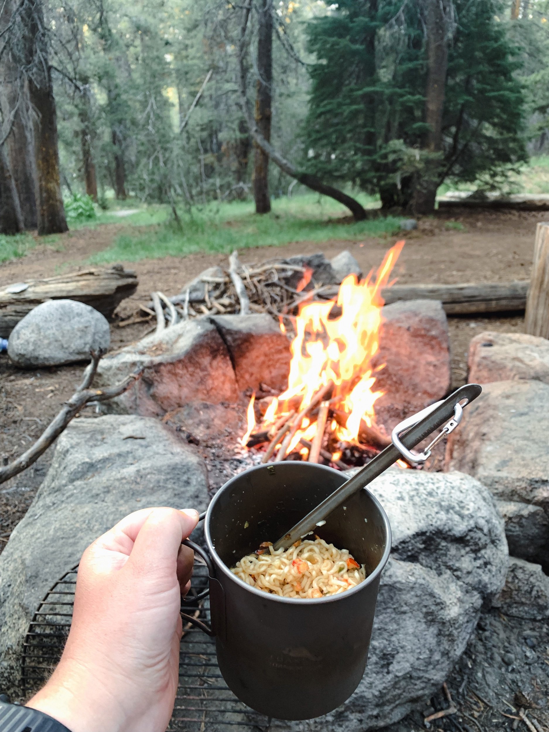
Our afternoon & evening were very relaxing. Laying down, soaking feet, and drinking tons of water were the only things on my agenda. Holly brought her fishing pole and fished - and she caught a Brook Trout after only 5 minutes! Crazy. It was such a pretty fish!
After all that lounging, we ate dinner and turned in for bed right at hiker midnight (9 pm). It was still soooo hot, I couldn’t even lay my quilt over my body, and I had to sleep in my base layer bottoms and bra. It was probably 70* at least as we were falling asleep. Way too hot. I hope I’m able to get sleep tonight!
Day three:
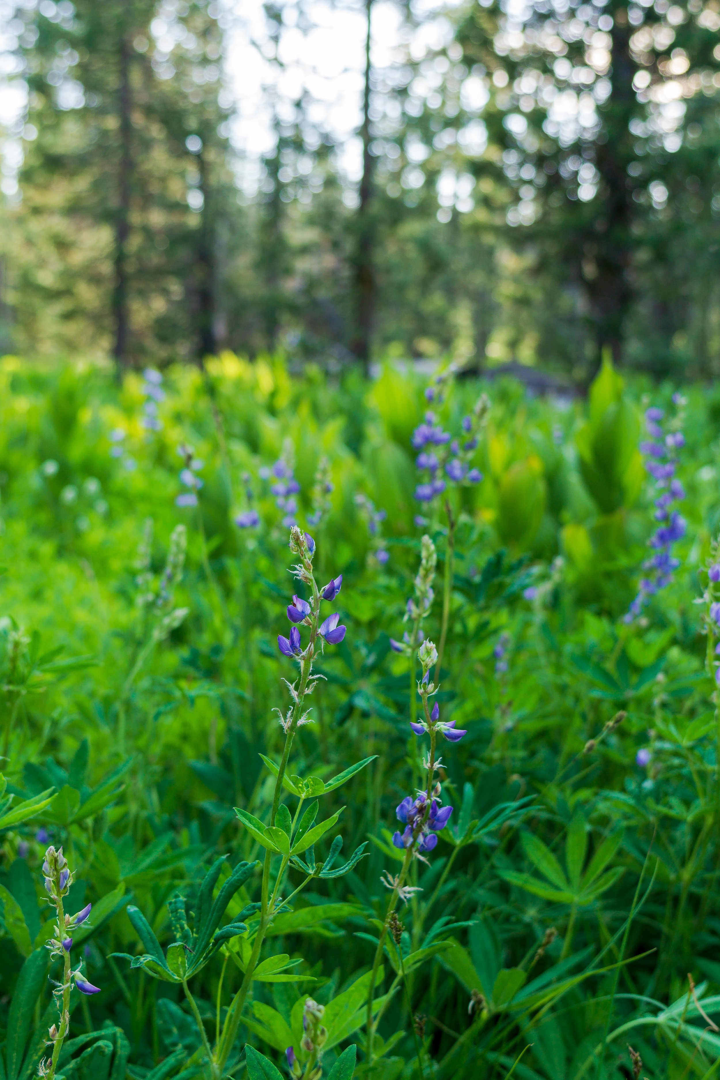
Wow today was a doozy! We got started early in the morning: hiking by 6:30 am. We knew we would need it as it was super warm already. The first 2 miles were pretty chill. We hiked through lots of trees and grasses and wildflowers and then were spit out onto the Tuolumne River. We were officially in the Grand Canyon!
We started gradually climbing, and took a few breaks to enjoy the view, but we were mainly just trying to get to Muir Gorge - a portion of trail with a big climb and very removed from the river - before it got too hot. It was already getting kind of hot though when we got there. Thankfully, there was an amazing waterfall and bridge that we took a long break at to hydrate ourselves, eat snacks, relax, and enjoy the view. Once we got going again, we passed an even better waterfall and break spot! Oh well, we had to keep climbing. We had a 700 foot gain ahead of us. Thankfully, some clouds were moving in front of the sun, giving us a little relief. At the top of the climb, we had such an amazing view of the canyon and the surrounding mountains. We hung out for a bit and took pictures before starting our descent from the gorge.
Thankfully, we found an amazing lunch spot with super easy water access and shade! I soaked my feet in the river for nearly our whole lunch break, trying to relieve the heat my feet were feeling from the scorching ground.
Lunch went so quickly, but we really needed to keep hiking. And it was slooowww moving after lunch. All of us were pretty tired, and it got so much hotter. The trail also went inland even more, taking us away from the breeze and beauty of the river. We also had so many blowdowns to navigate at one point, that it just sucked all the energy out of me. After a decent group break in the shade after all the blowdowns, we got moving again.
We didn’t make it very far, stopping again at a nice spot next to the footbridge over Register Creek and getting a little more water.
Then, we had a 500 foot climb up to our hopeful campsite near Waterwheel Falls. That’s where things really started falling apart, tiredness wise. I started slowing down a tooon, and another group member was also having a hard time. Most of the group went ahead to scope our campsites, and we found that there weren’t any sites where we wanted, as another group had basically taken over a whole peninsula down by the river.
After lots of scoping later, we ended up in a pretty subpar spot and kind of scattered, but it worked. And we were so tired, so it all worked out eventually. We also talked about bailing early since many of us had some sort of problem: not pooping yet, blisters, the heat, and not enough food without rationing.

Day four:
It was actually chilly this morning when we woke up! There was a strong breeze through the canyon, and I was wearing my puffy throughout getting ready & eating breakfast. Holly and I started hiking before the rest of the group, since we are the slow pokes, and we had a bit of elevation to gain. As we were walking, we only saw two campsites, so we were feeling better about our non ideal campsite the night before. We took our first break and waited for the rest of the group at a beautiful swimming hole with cascading waterfalls all over. It was such a beautiful spot, and we were in no rush to leave, since we decided to bail at Tuolumne Meadows and just finish the Grand Canyon of the Tuolumne.
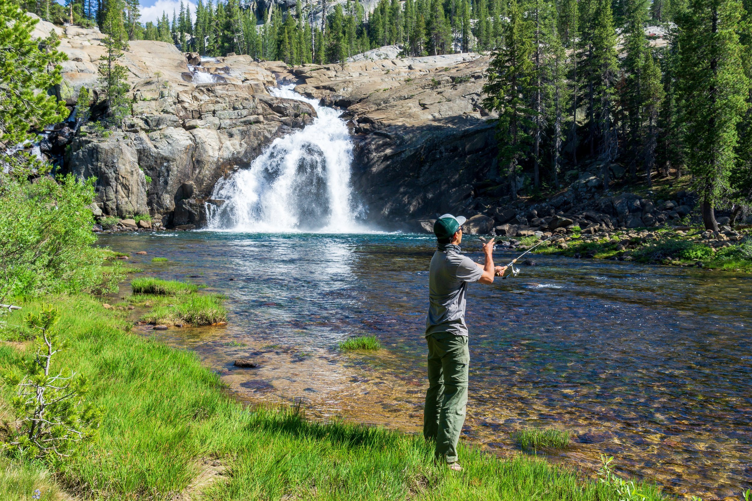
After the break, we kept moseying along, stopping to take in all of the views. This part of the canyon was soooo much prettier overall than the bottom part of the canyon, in my opinion, so we wanted to soak it all in. Eventually, we came to a nice spot in the river for fishing, so Holly and Shaun spent some time fishing, and I was very content to just watch and enjoy the spot.
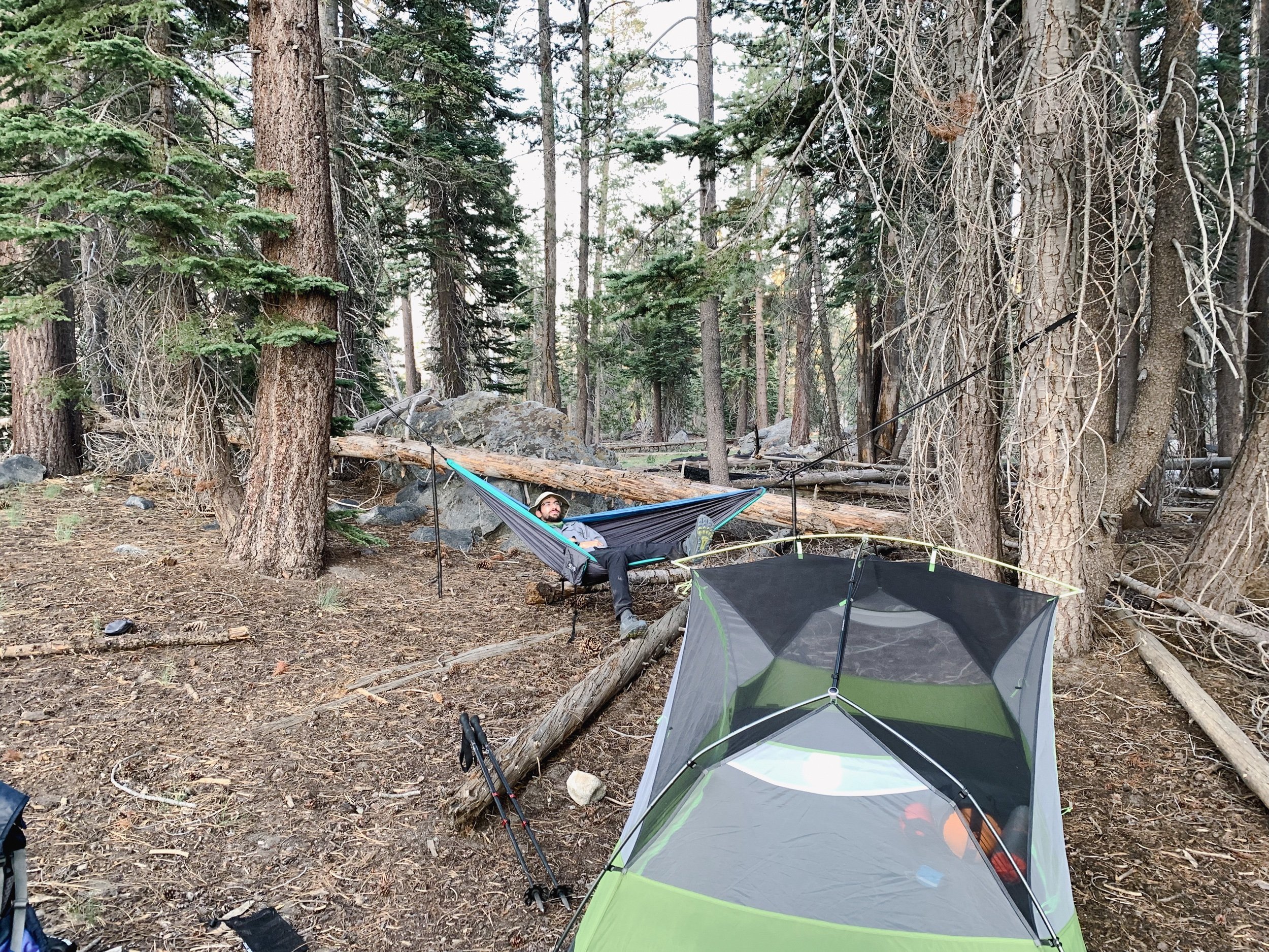
We kept slowly climbing up the canyon, enjoying all of the views of the unnamed waterfalls, until we finally reached the top of the climb and landed in Glen Aulin High Sierra Camp. Here was where we were spending the night, after only 3ish miles for the day. We found a great campsite with a fire ring, set up, and then went down to the swimming hole to eat lunch, soak our feet, and of course, take a dip in.
Many more people turned up, including a few PCT thru hikers, which was always great to see and chat with them. Two of them, QB and Endless were eating next to us and we were chatting about their hikes and my upcoming ones. And they knew my friend Mouse from the PCT! They met her in Washington on their section hike back in 2018, and they just saw her in Tuolumne Meadows - she’s doing the JMT SOBO! I can’t believe I’m 5 miles away from her and she doesn’t even know it! Anyways, it’s such a small world, and one of the many reasons I love the thru-hiking community.
We took a break from the water and got some camp chores done, and then got ready for watching Holly and Shaun fish. We did that for a few hours, including walking back down the trail to a slower spot in the river. Holly caught one fish right at the beginning, and then nothing! Fishing is frustrating.
After our evening excursion, we went back to camp, got a fire going, and ate dinner. We invited other backpackers & thru hikers to the fire ring to avoid all of the mosquitos that were swarming, and had a really great time chatting, playing trivial pursuit, and slapping mosquitos away.
It was a great night to end our trip on, and I was happy to be bailing out the next day.
Day five:
We woke up at a relatively early time and packed up all our things before going back to the fire pit to eat breakfast. I was feeling much more rested after our relaxing day yesterday, but still a little sluggish with hiking. The first climb up to Tuolumne Falls was a little slow, but the rest of the morning hike was just really enjoyable. I’d now hiked this portion of trail three times total, but this was my first time doing it in the eastbound direction, and I felt like I was able to really take it in more, going uphill.
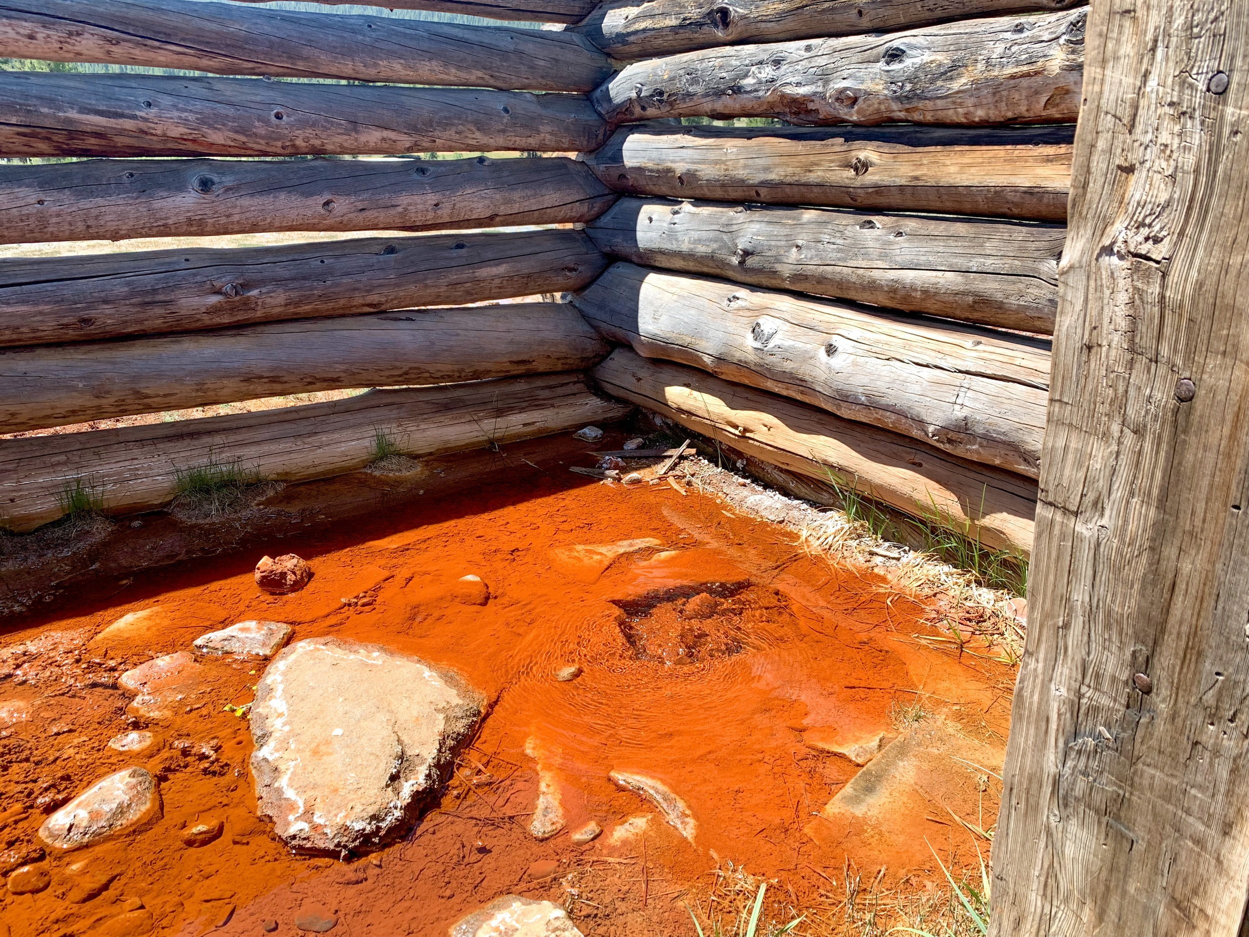
Shaun, Holly, and I were the slow pokes again and took our time walking along the river, just savoring the perfect summer day we had. Eventually, we reached the soda springs hut and walked over there so they could see them for the first time. It’s always so cool to see the bubbling water just coming out of the ground!
When we were almost at the parking lot, we passed an older ranger on horseback, who told us about a rescue a could of days ago down at Glen Aulin. The hiker had broken their leg and had to be taken out on horseback since there’s nowhere a helicopter can land well down there! The sounds like a painful 5 miles. Once in the parking lot, we reunited with the group, and I fan-girled at seeing Timothy Allen Olson’s support van - he was napping in the back while in the middle of his Pacific Crest Trail FKT. His team was so nice as they answered my questions, and my friends gave me flack for being such a fan-girl haha. We walked over to the grill, ate burgers, and chatted with PCT thru-hikers while a few of our group hitch-hiked to the cars at White Wolf.