

Backpacking the Five Lakes Loop in Mineral King
2023 Update: No road access until August of this year, possibly later, due to winter storm damage.
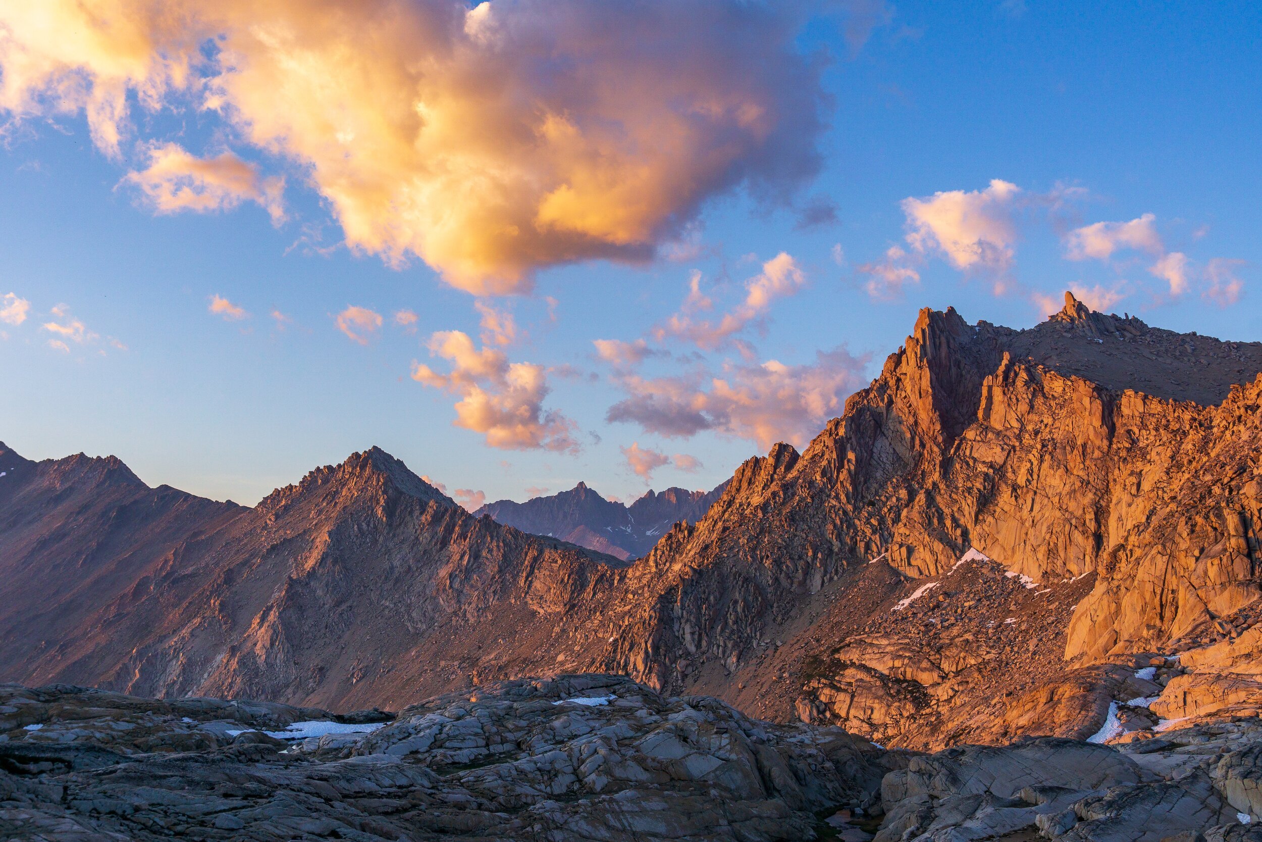
The Mineral King Valley in Sequoia National Park is at the southern end of the Sierra Nevada Mountain Range. Don’t let that fool you though: the mountains are high and the scenery is just as grand as the central Sierra. There are many loops in the Mineral King area to explore, but I’ll be describing the Five Lakes loop, with Little and Big Five Lakes being the stars of the show.
Note: Included in this blog post are links to the Outdoor Status permit notification website. These are affiliate links, and I will earn a small commission at no extra cost to you if you choose to participate in permit availability notifications. Thank you so much if you do use this service!
Trail Info + Stats
Where: Sequoia National Park, Mineral King
Miles: 30
Elevation Gain/ Loss: 10,000 ft
Time to complete: 3-5 days
Trail Type: Loop
Permits Required: YES
Pets Allowed: NO
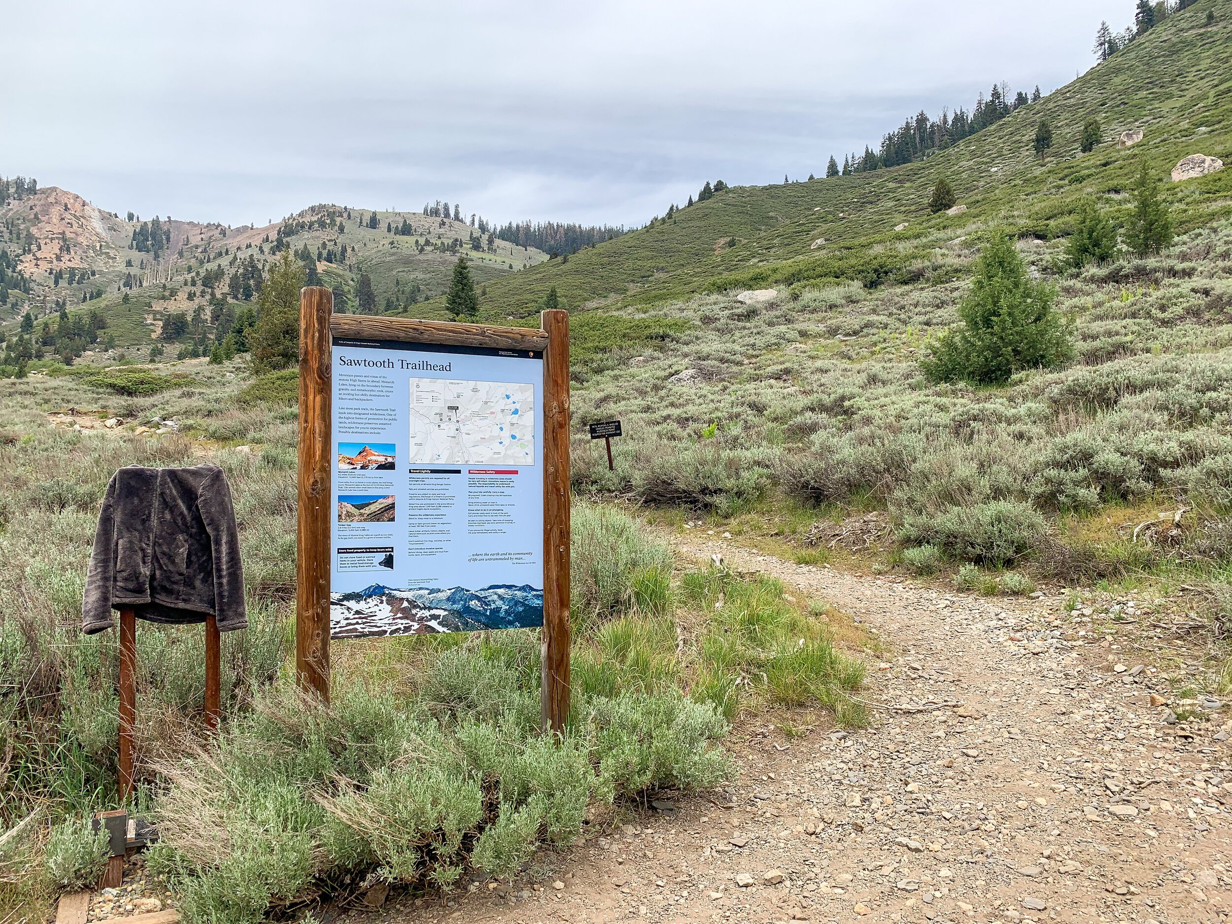
Trailhead: Timber Gap/ Sawtooth Pass
Itinerary & Trip Planning
This loop is not for the faint of heart. While it is certainly doable for most backpackers (and even first-timers), there is a lot of climbing involved and some key campsites you need to plan around to make your trip successful. If you are looking for a more laid-back trip, I would take 4 or more nights to enjoy the loop.


Day One: Sawtooth Pass Trailhead to Pinto Lake via Timber Gap. 8 miles, +3,700 -2,800 ft elevation.

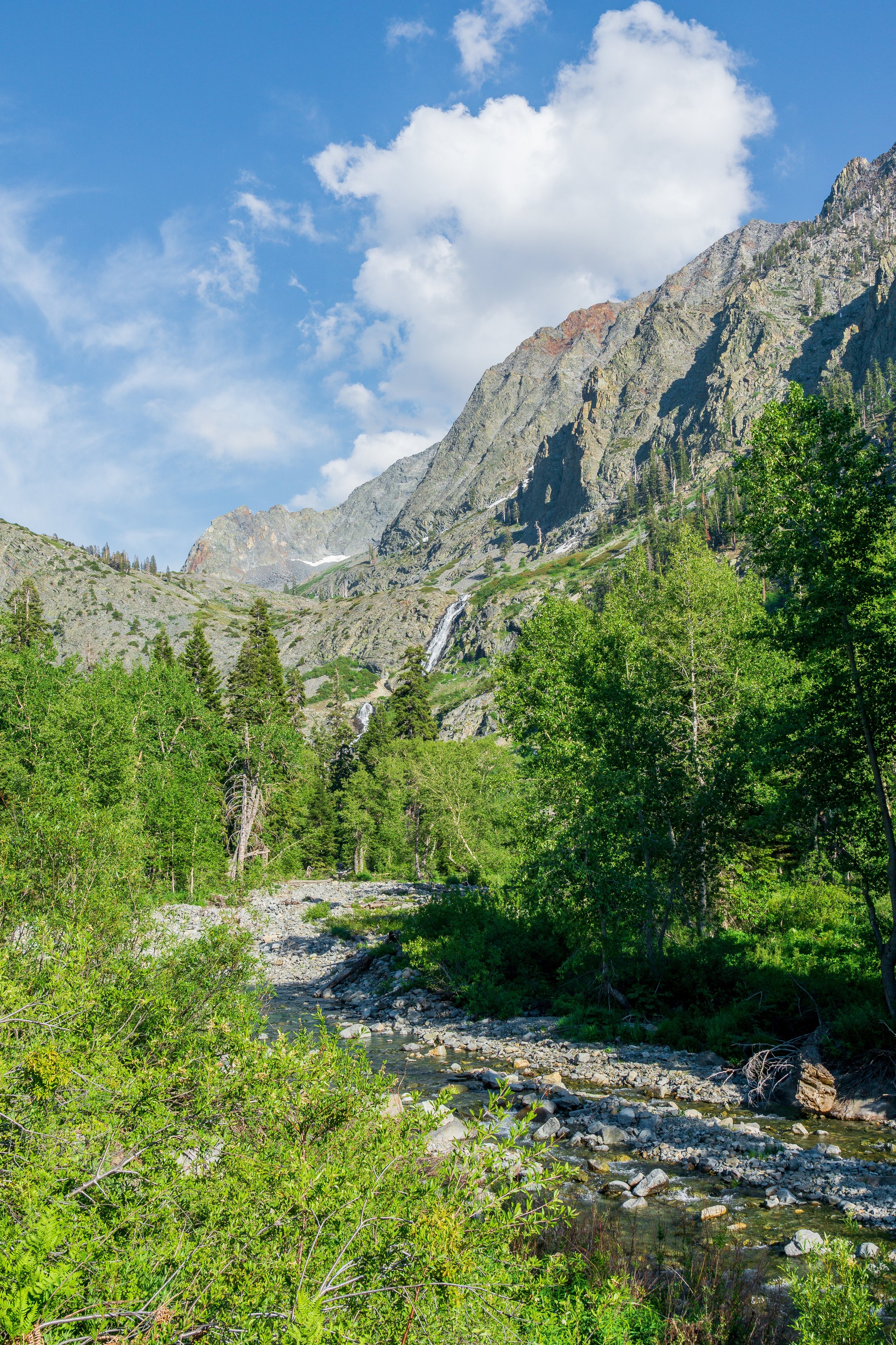
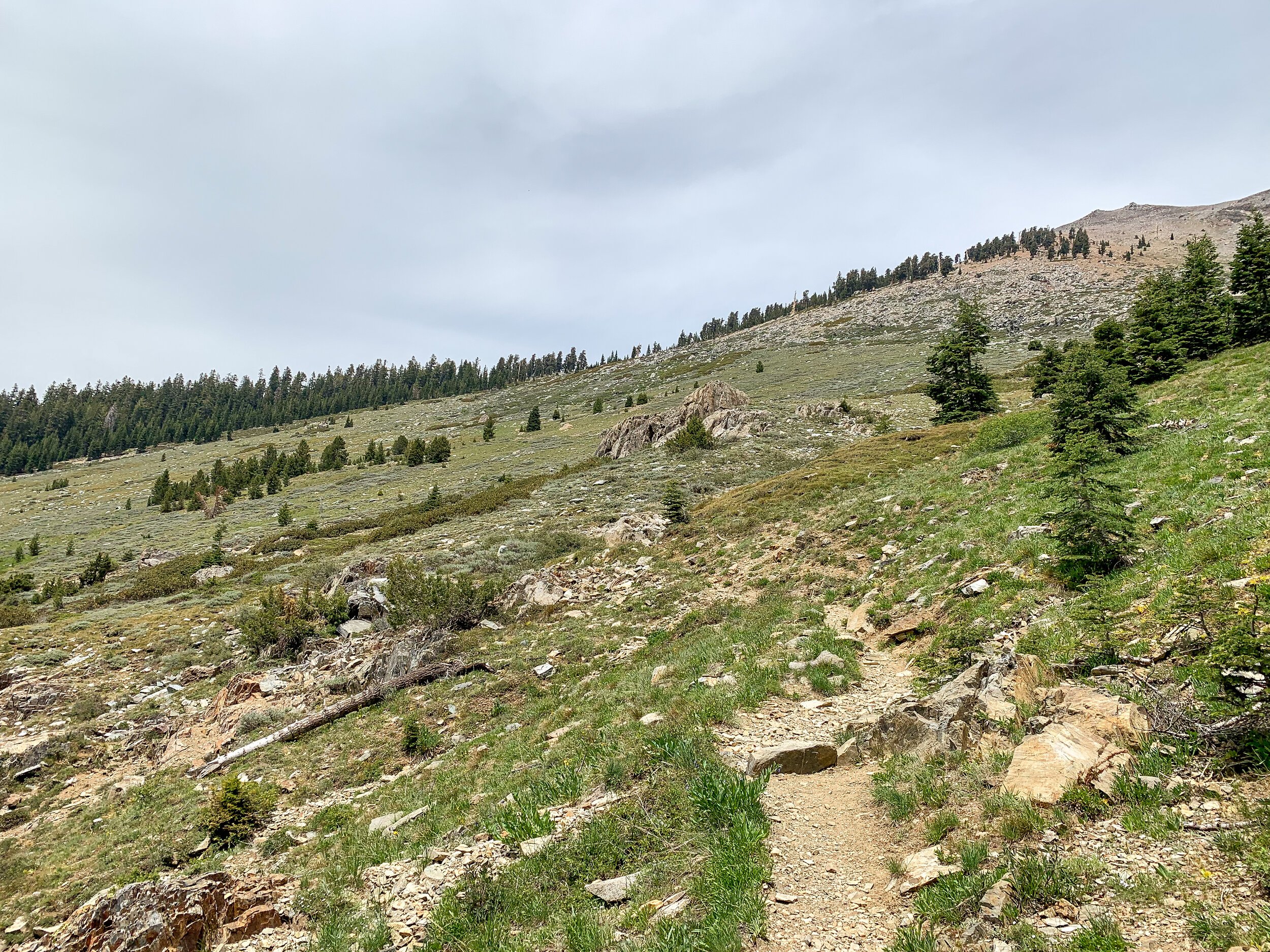
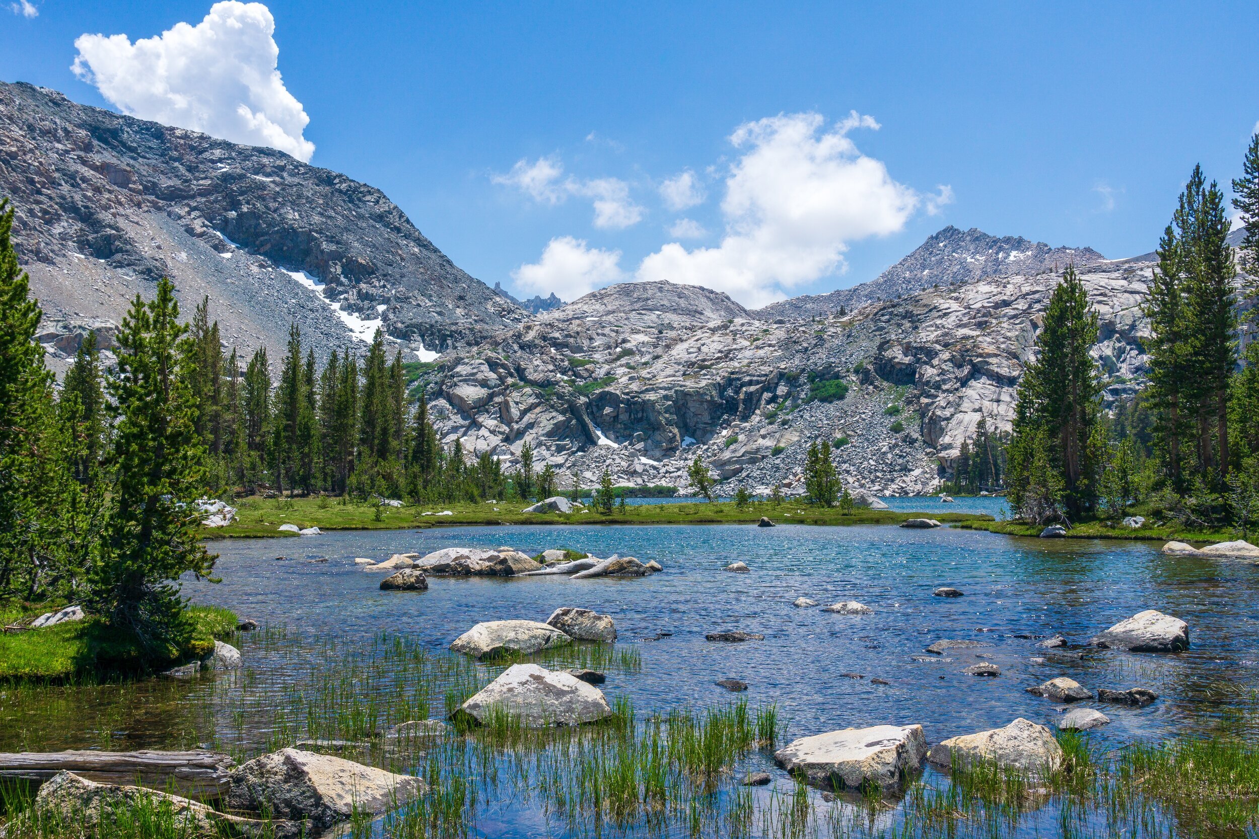
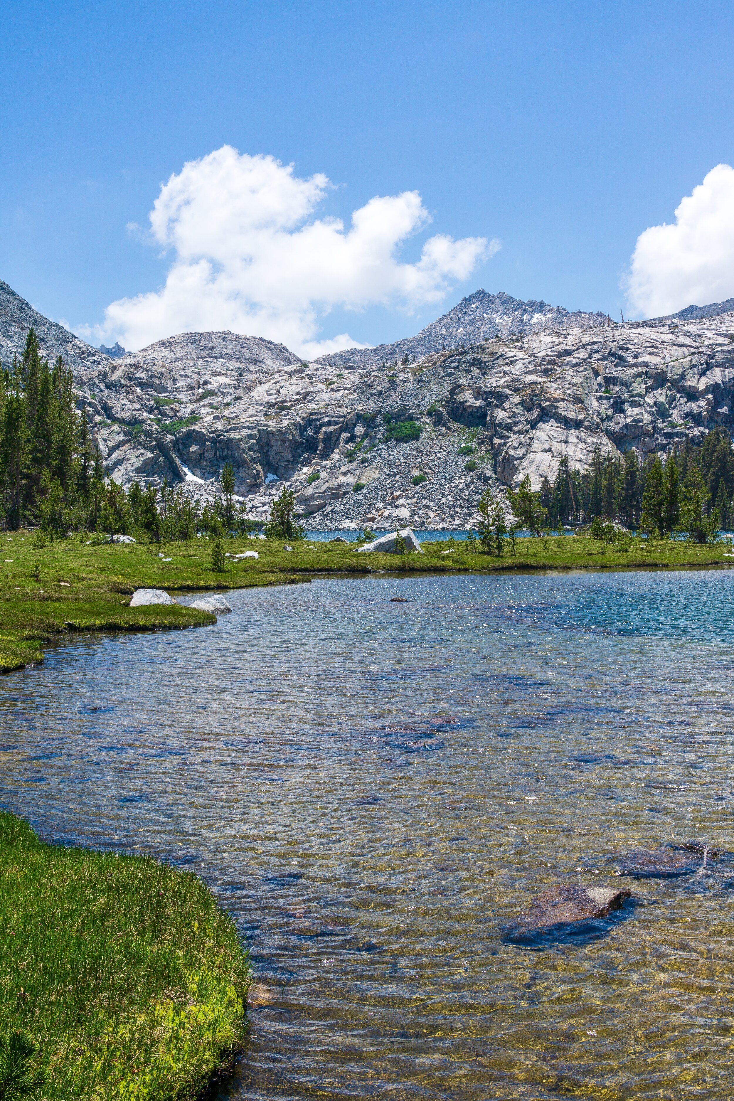
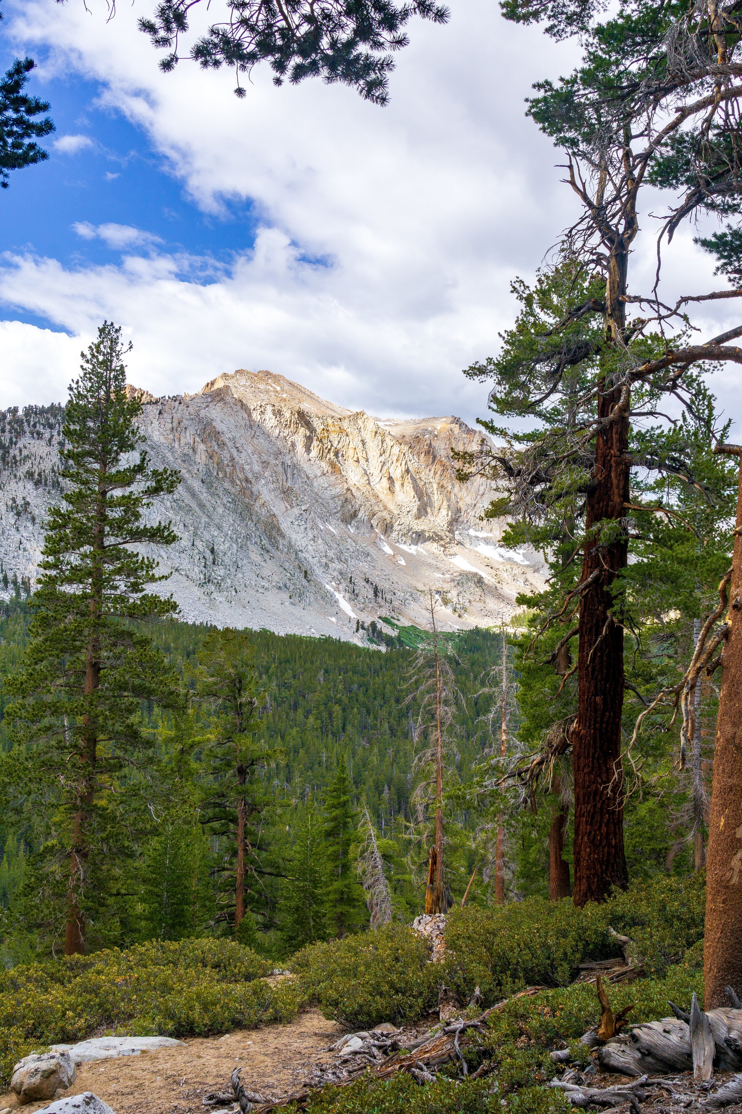
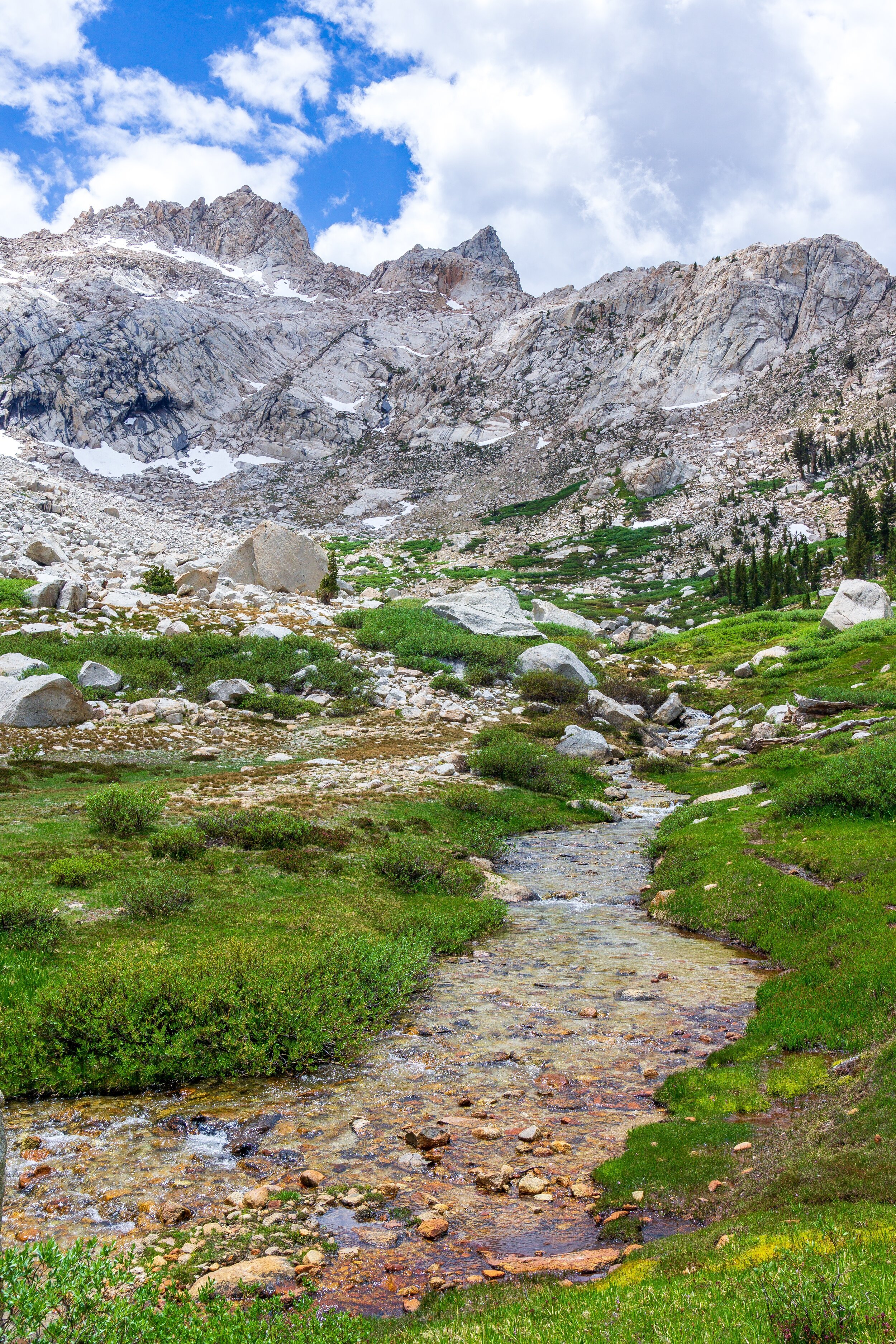
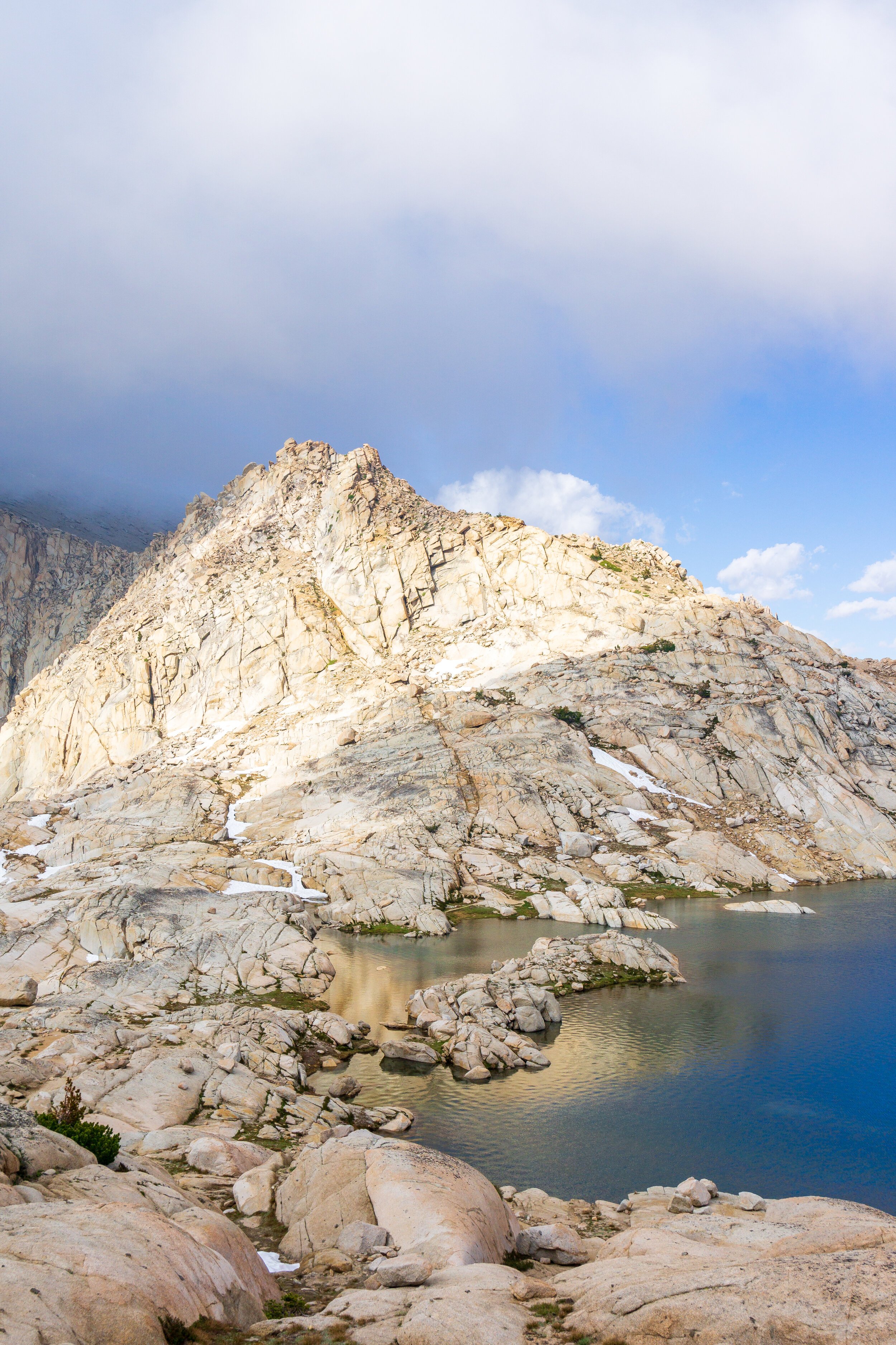
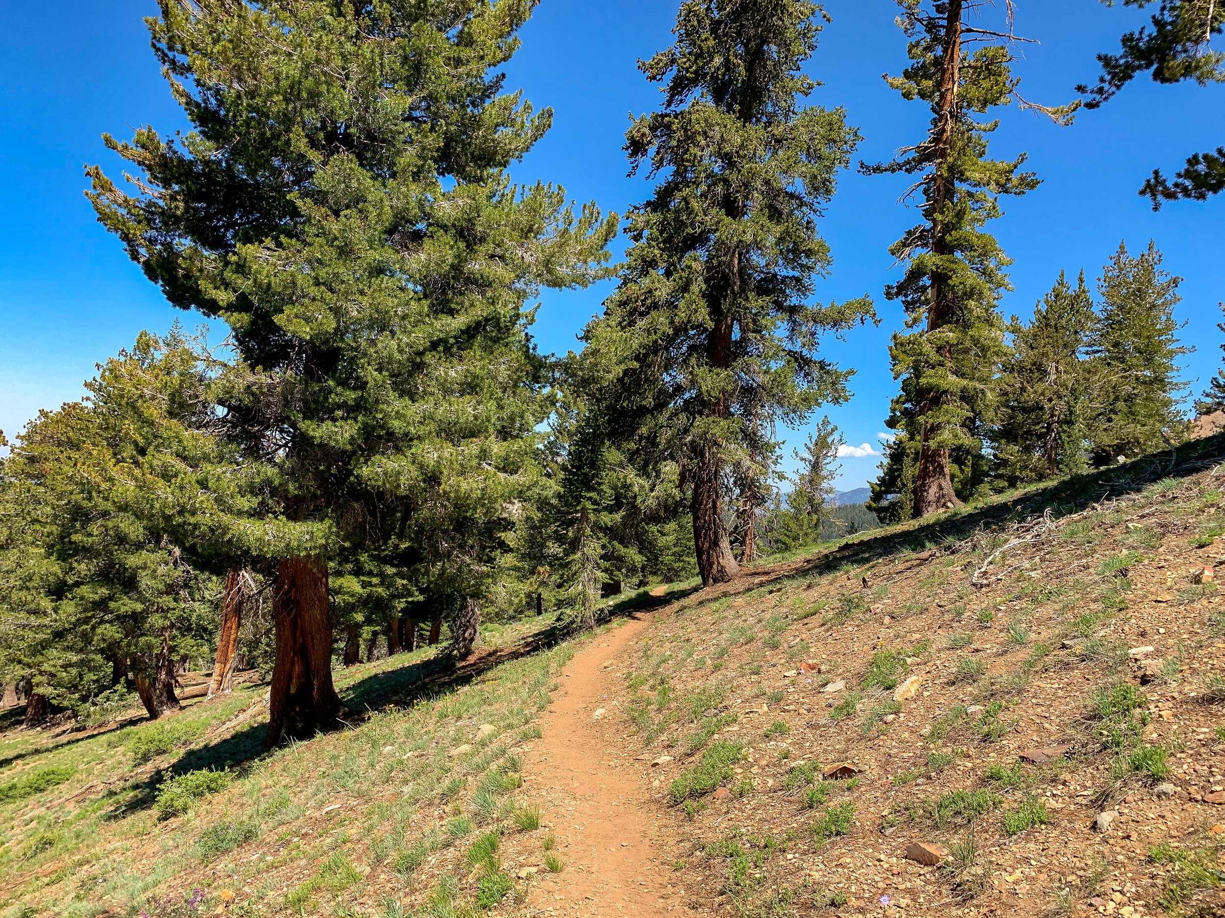
Starting at the trailhead, the trail climbs through mixed open shrub and tree patches for about two miles, with ever-increasing views of the mountains to the south, until reaching Timber Gap. Timber Gap is a great rest spot with views of the Great Western Divide, flat ground, and shade. It is also the first viable camping spot on the loop. The trail then switchbacks down for 3 miles to Cliff Creek. It is a lovely trail with lots of wildflowers in the early season. After crossing Cliff Creek, which was a shin-high crossing for myself, you’ll see the campsites with a bear box. You could camp here (I would camp here if taking 5 days), but if you have the energy and a shorter itinerary, it is better to push on to Pinto Lake. You’ll steadily climb for another 2.5 miles through trees and then an exposed wash paralleling Cliff Creek to the Pinto Lake campsites. The last uphill push is draining at the end of the day, but it sets you up well for the climb in the morning. The campsites aren’t directly at Pinto Lake, which is off-trail, but water can be obtained from Cliff Creek behind the campsites. The views of the unnamed peaks in the distance are really stunning from camp.
Day Two: Pinto Lake to Middle Big Five Lake. 7.5 miles, +3,500 -2,000 ft elevation.
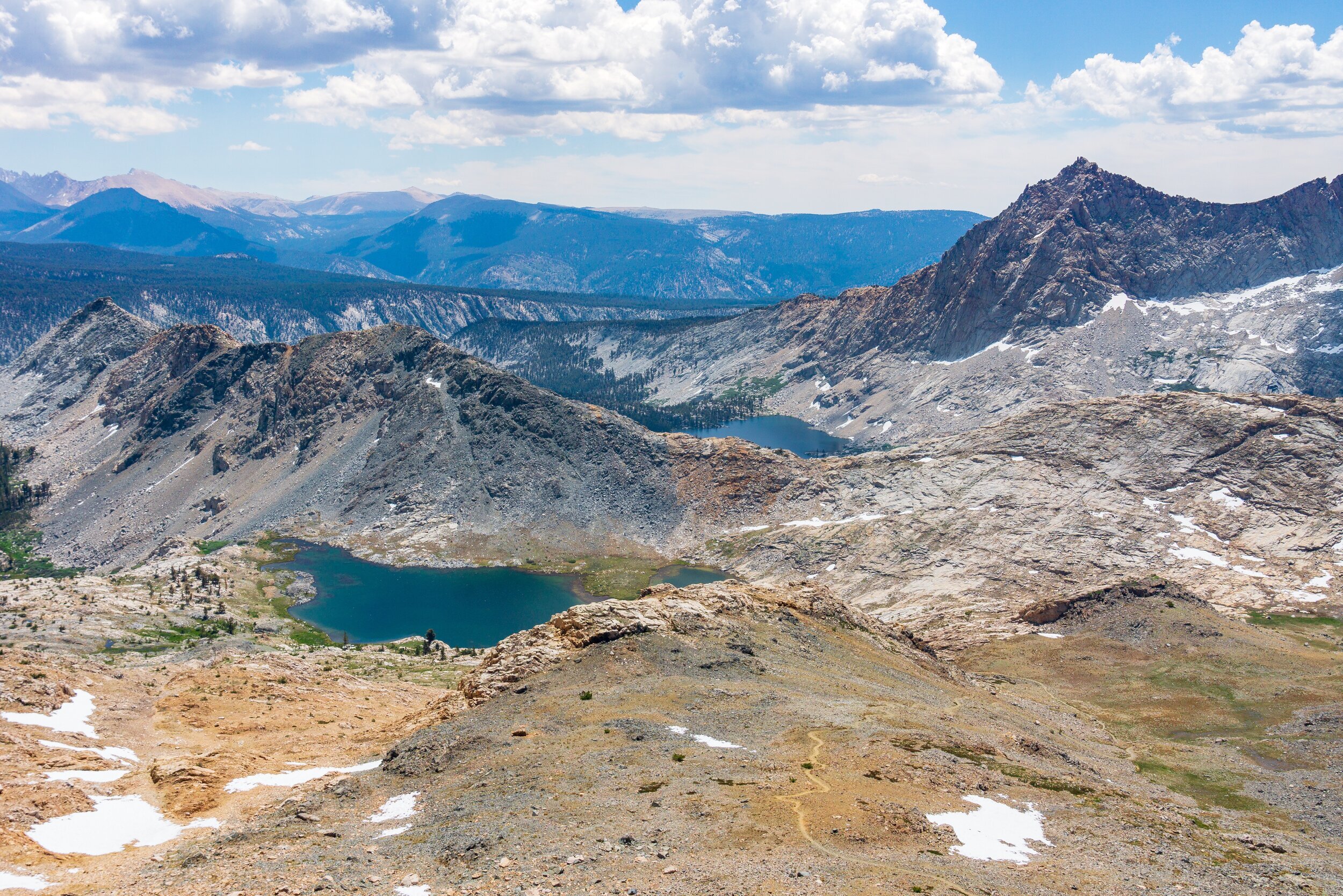
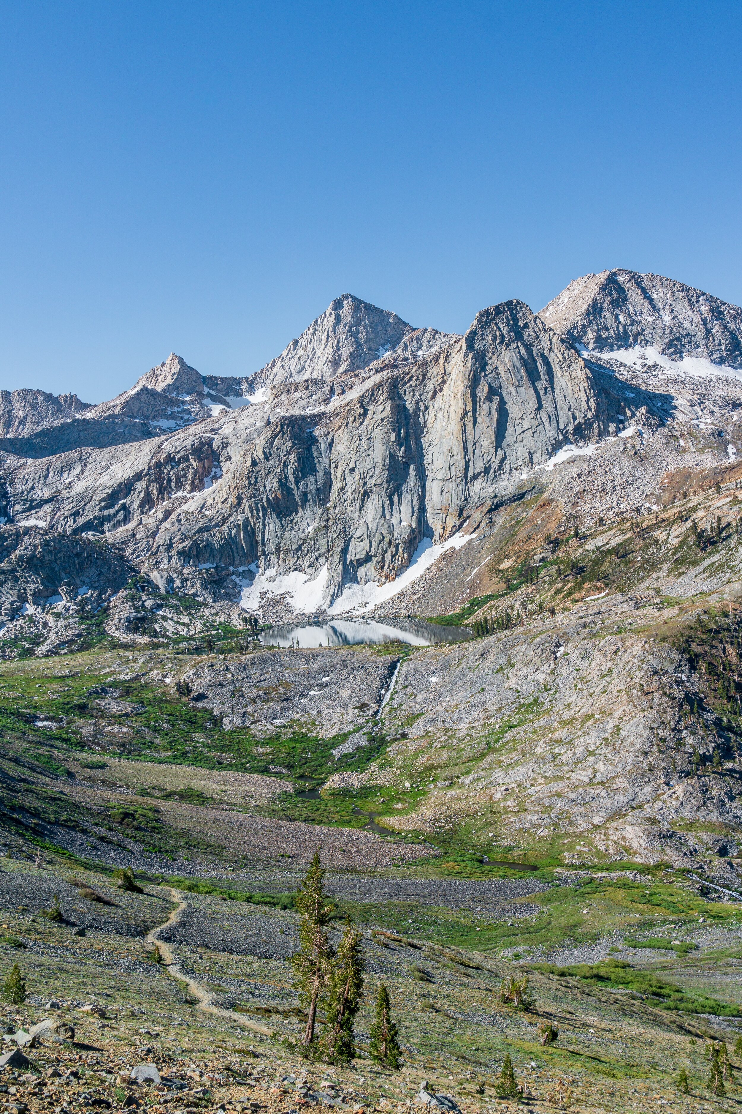
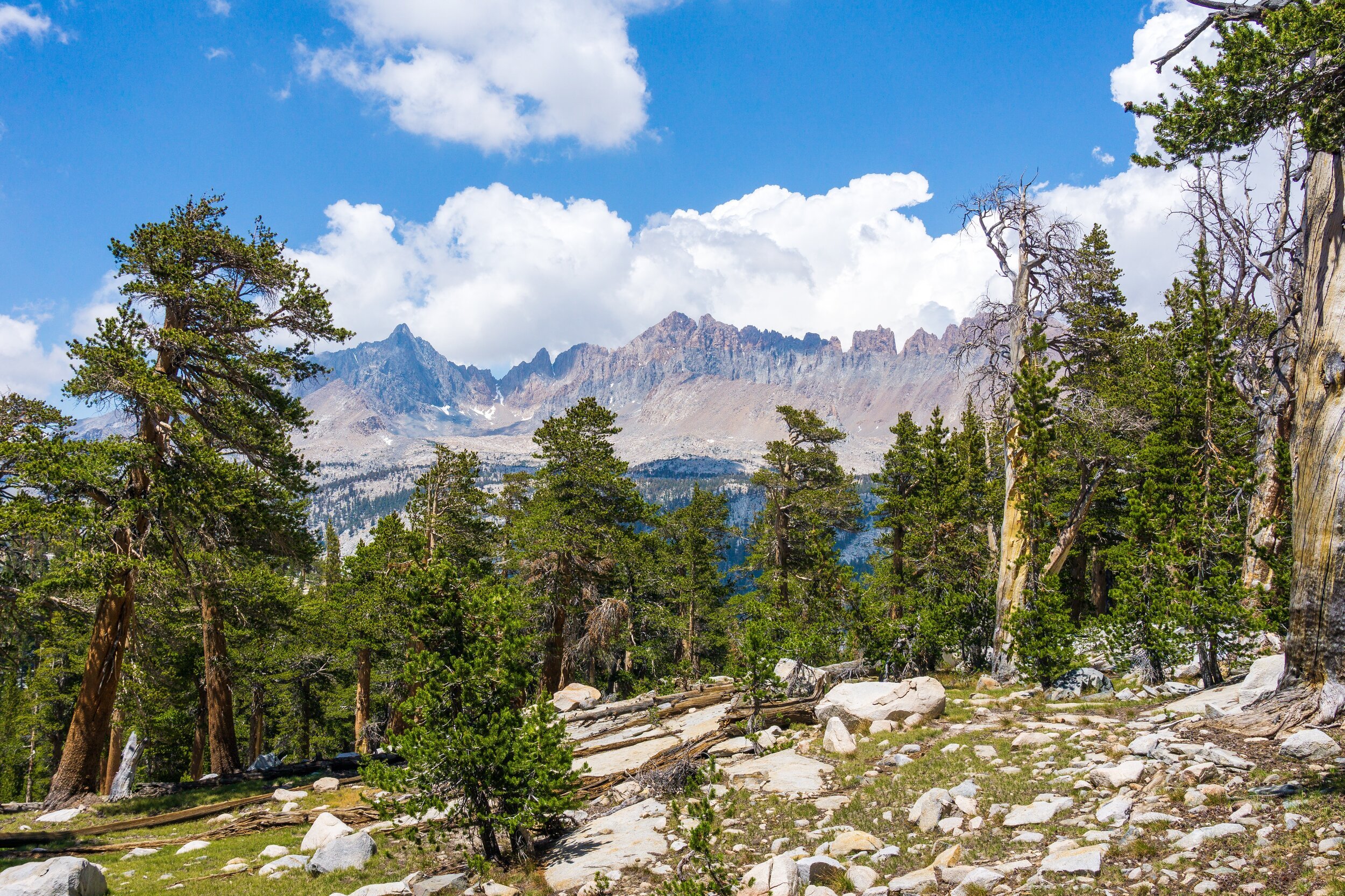
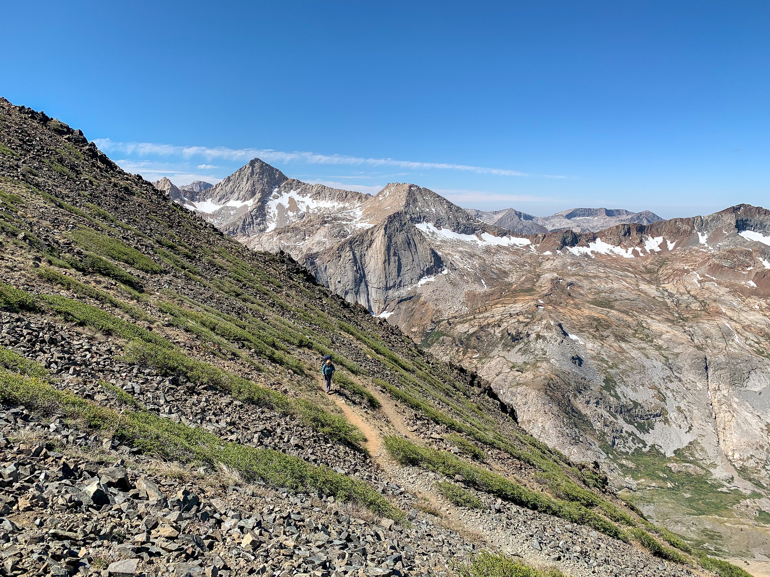
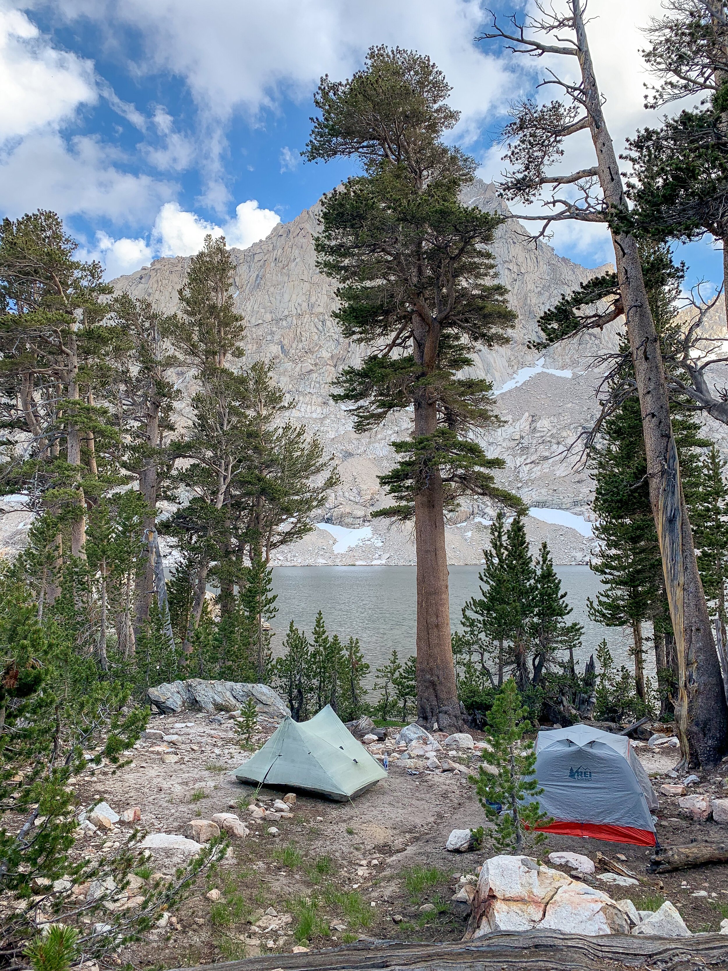
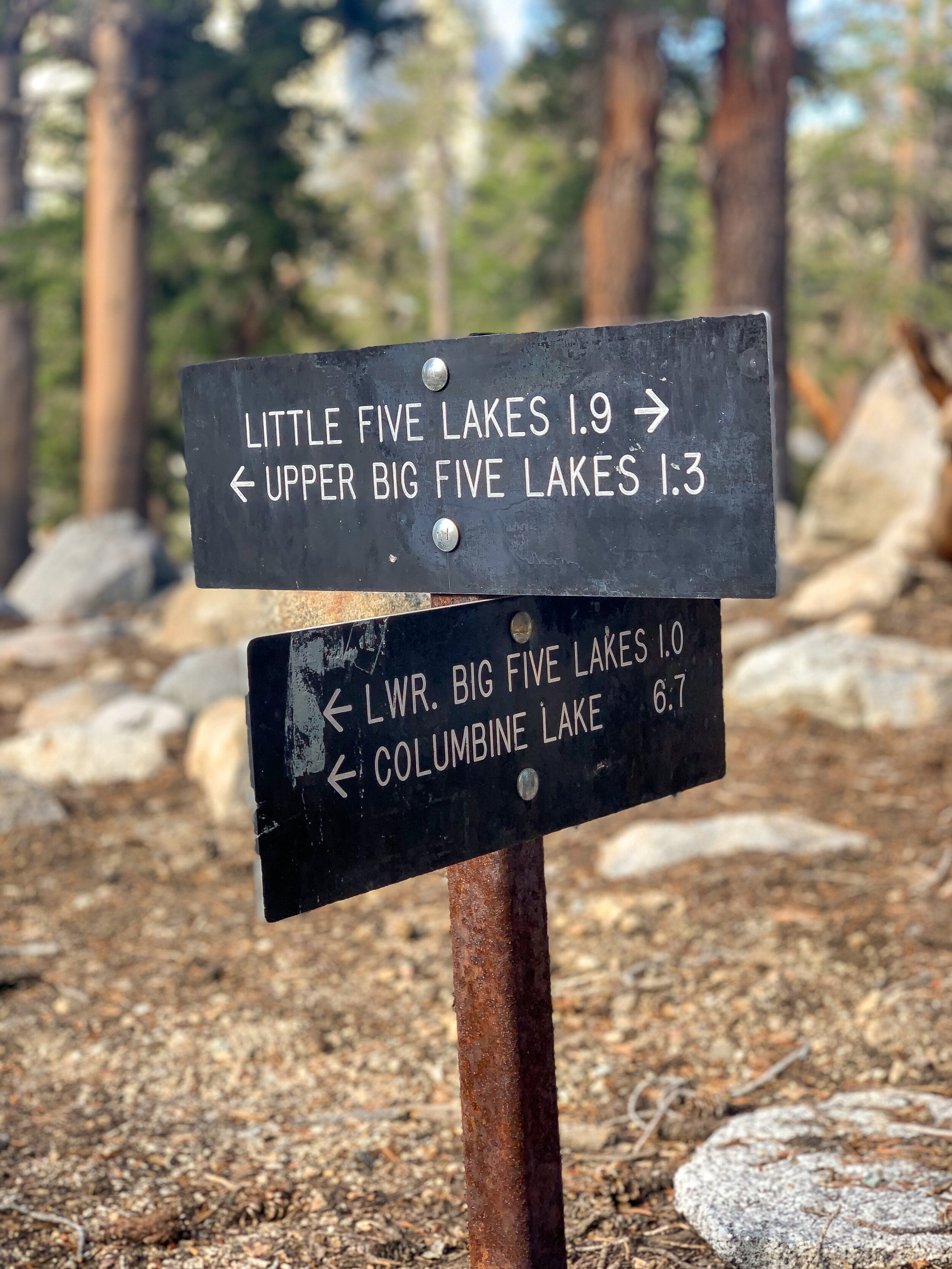
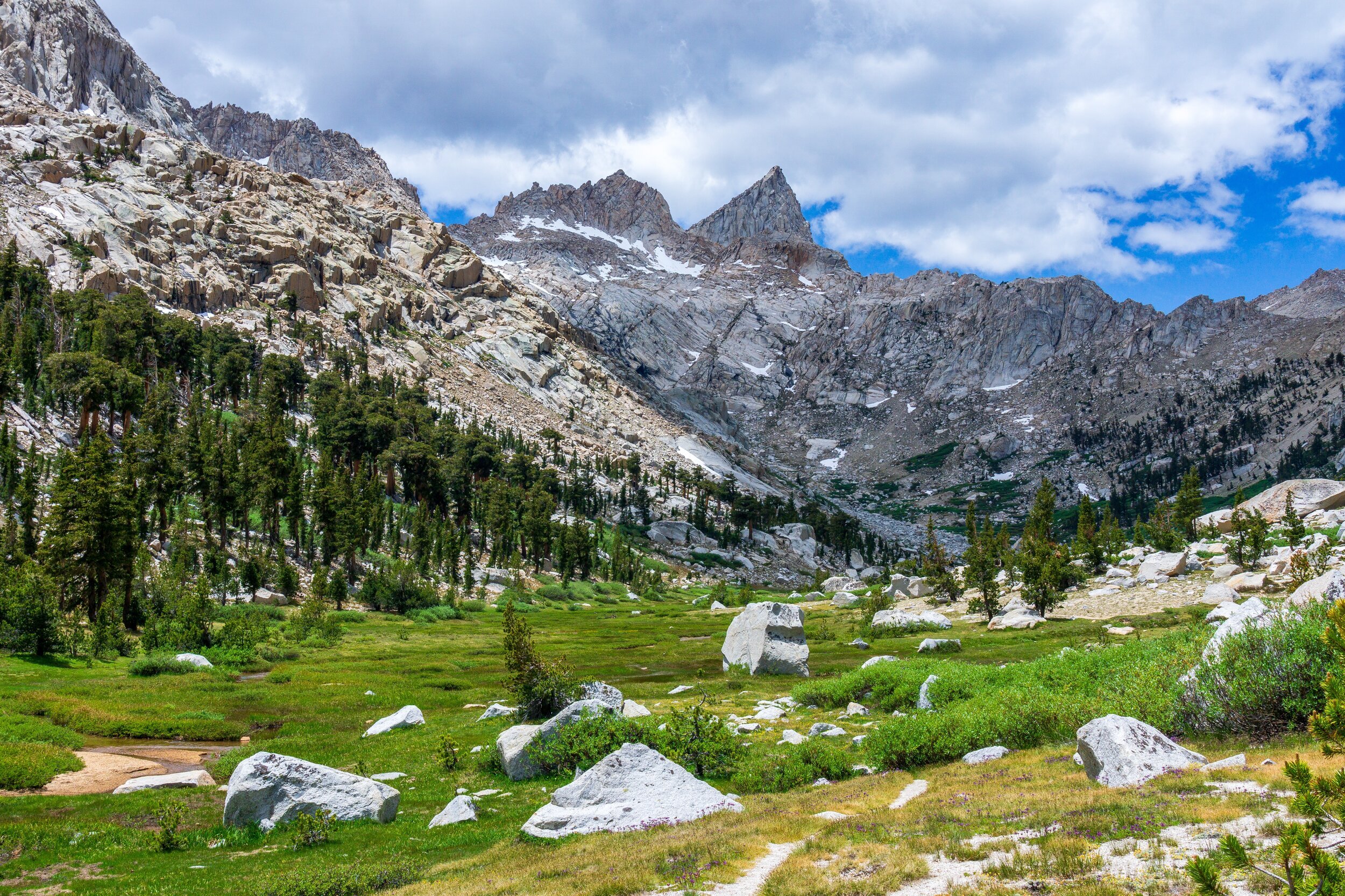
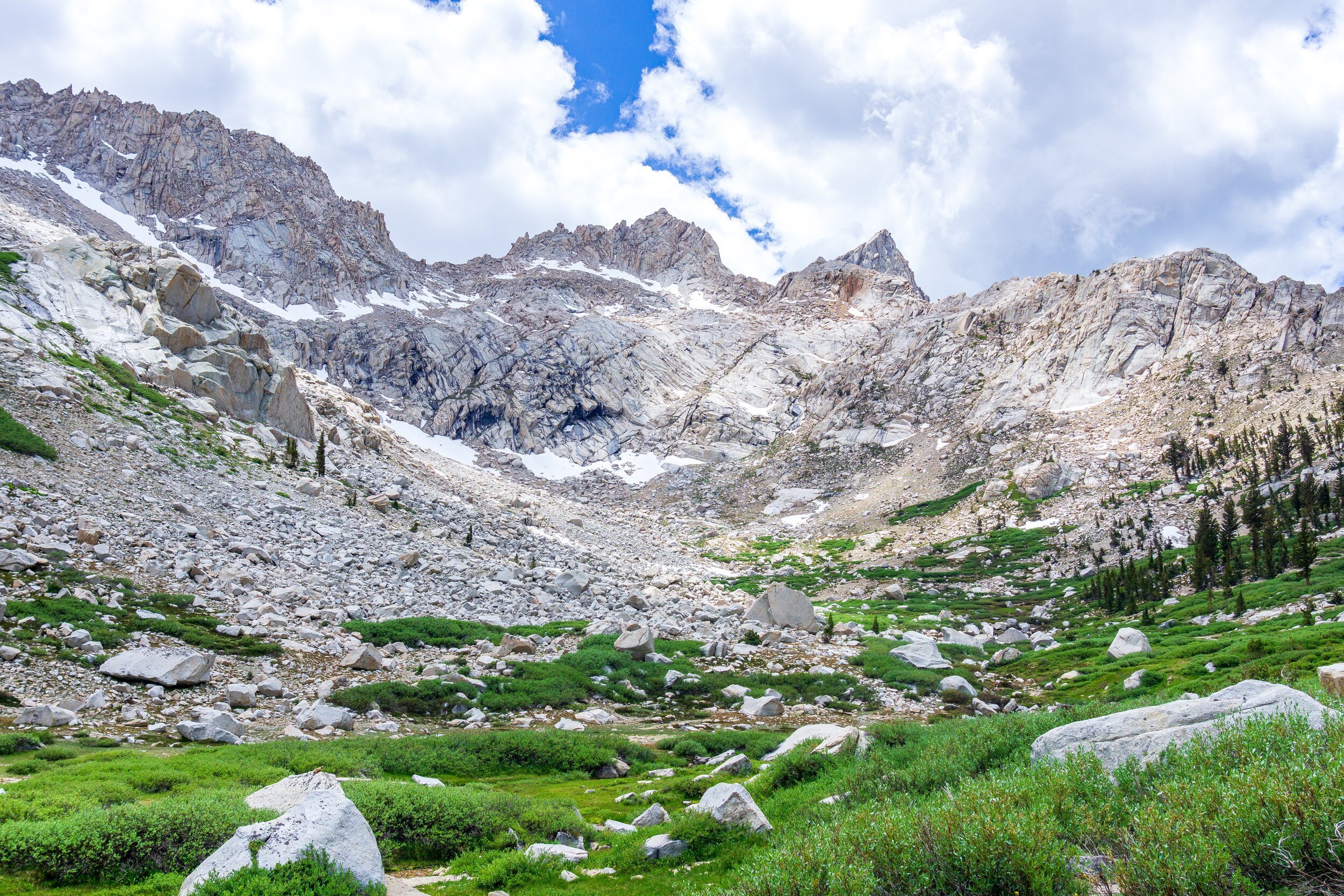
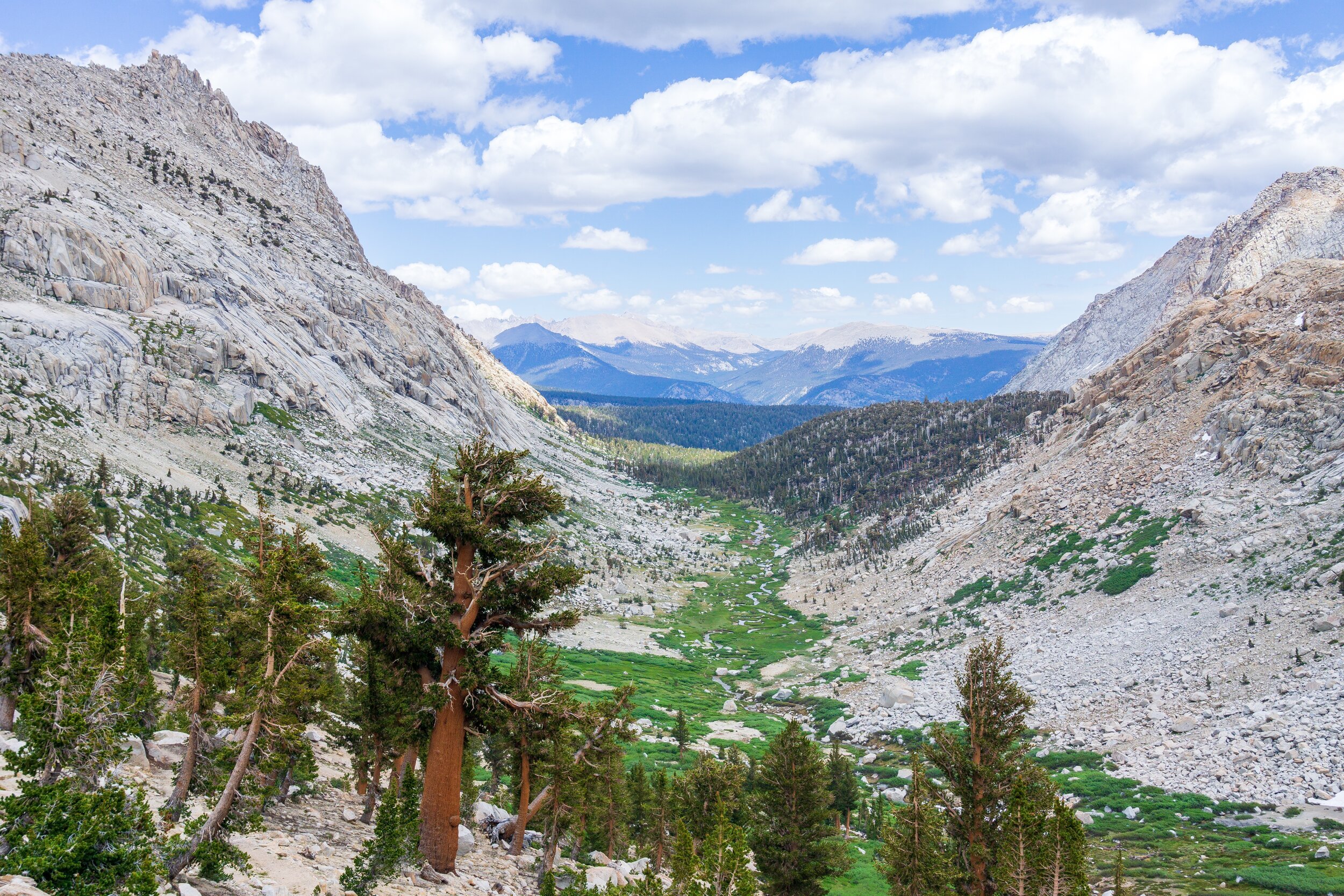
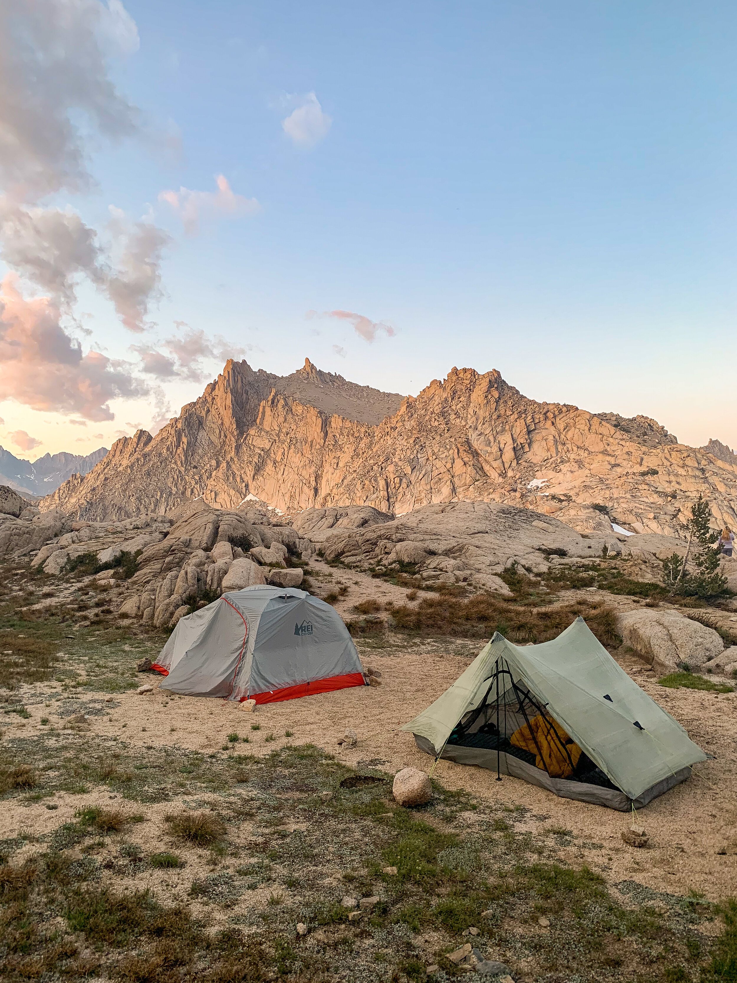
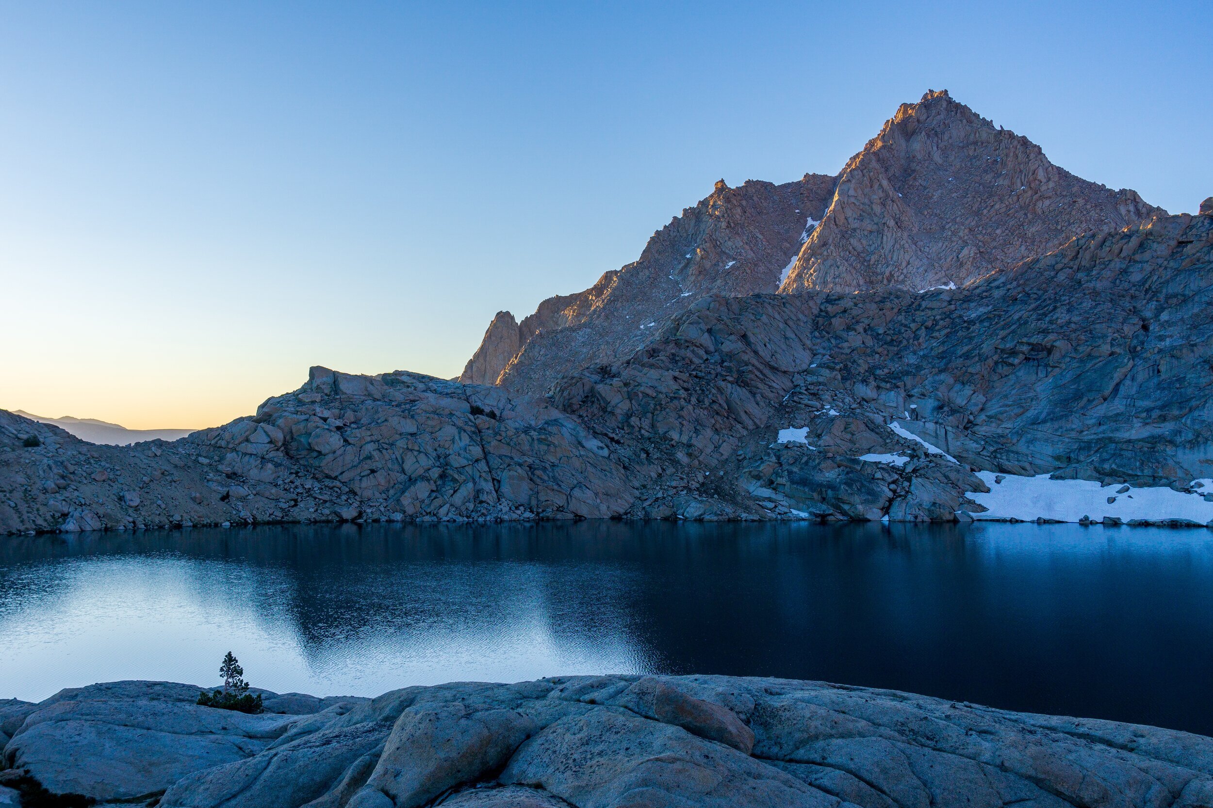
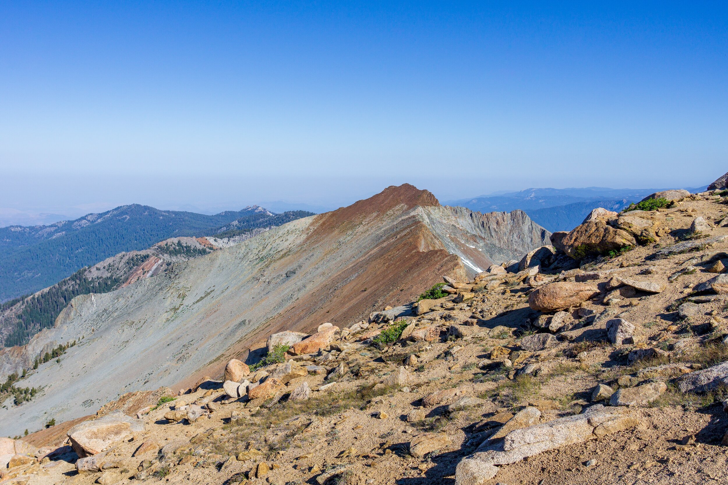
Wake up as early as you can to tackle Black Rock Pass. The climb up is in the shadow of the sun, as long as you can get up before the sun rises over the mountains. The trail climbs 3,000 feet in the 3 miles to the pass. Not being acclimated to the altitude, and on the first mountain trip of the season, our pace was less than 1 mile per hour, taking just under 4 hours to reach the top of the pass. Good thing the views are stunning, they made breaks great for picture-taking. There was minimal water availability on the climb. Cresting Black Rock Pass, you’ll have expansive views of the Kaweah Range, the Little and Big 5 Lakes, Sawtooth Peak, Chagoopa Plateau, the contours of the Big Arroyo and Kern drainages, and even Mt. Whitney and Mt. Langley in the distance. The views are incredible, and worth spending some time on the top. You’ll quickly descend from Black Rock towards the Little Five Lakes. The hike seems to take longer than it should, but eventually you’ll arrive at the big camping area at the largest Little Five Lake. If you want to lengthen your trip, I’d choose this area as a campsite. We didn’t do much exploring, but there are more lakes in the area, and from the top of Black Rock Pass, it looked like prime cross-country territory to find some solitude. After a big pointless up & down, you’ll arrive at the junction for the upper Big Five Lakes. I’d highly recommend going to the Upper Lakes, unless you insist on having a fire. We opted for the middle Big Five Lake, about .75 miles off of the main trail. You can continue up to the higher lakes too, following the northern sides of the lakes.
Day Three: Middle Big Five Lake to Columbine Lake. 7.9 miles, +2,500 -1,700 ft elevation.
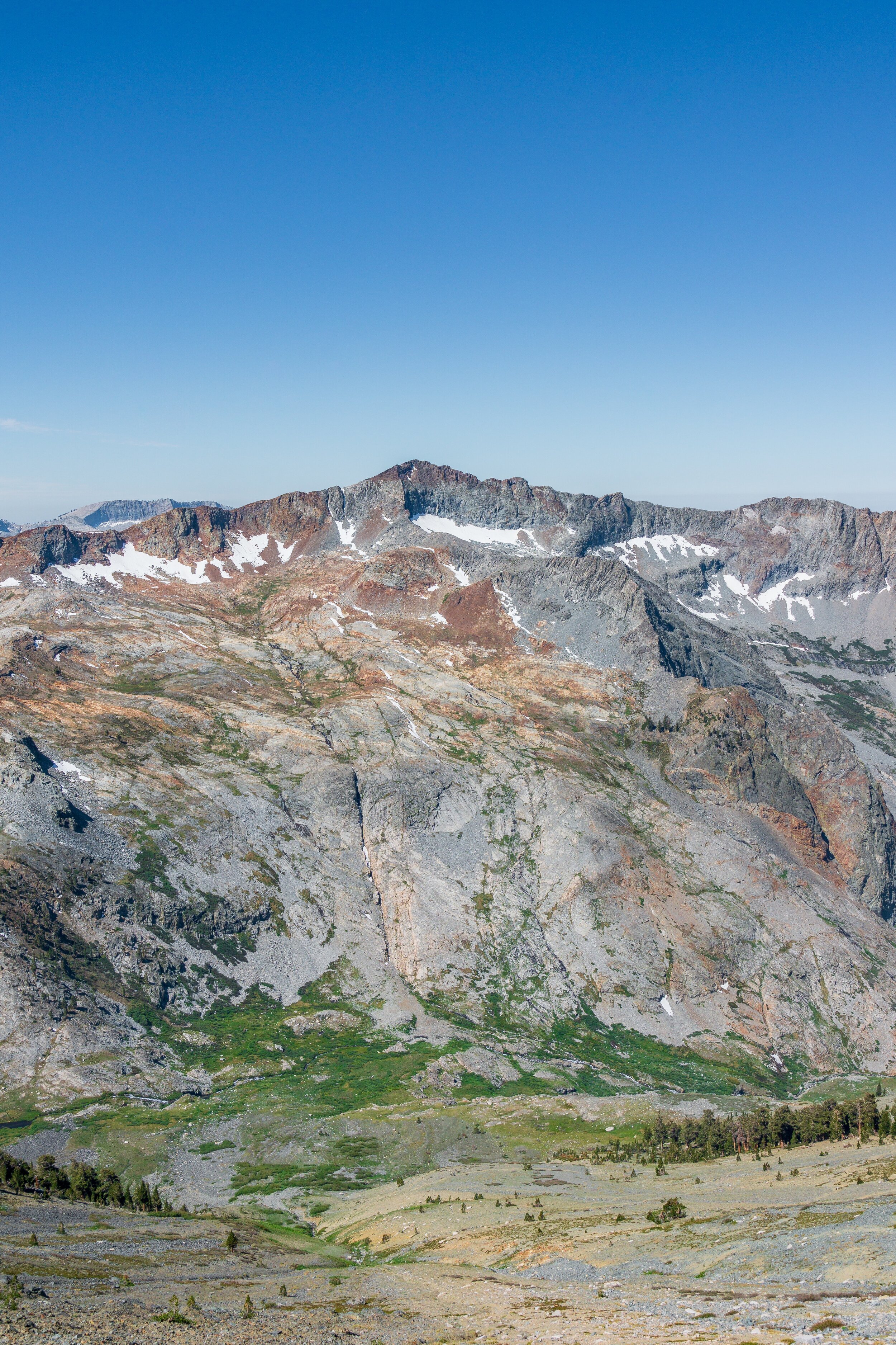
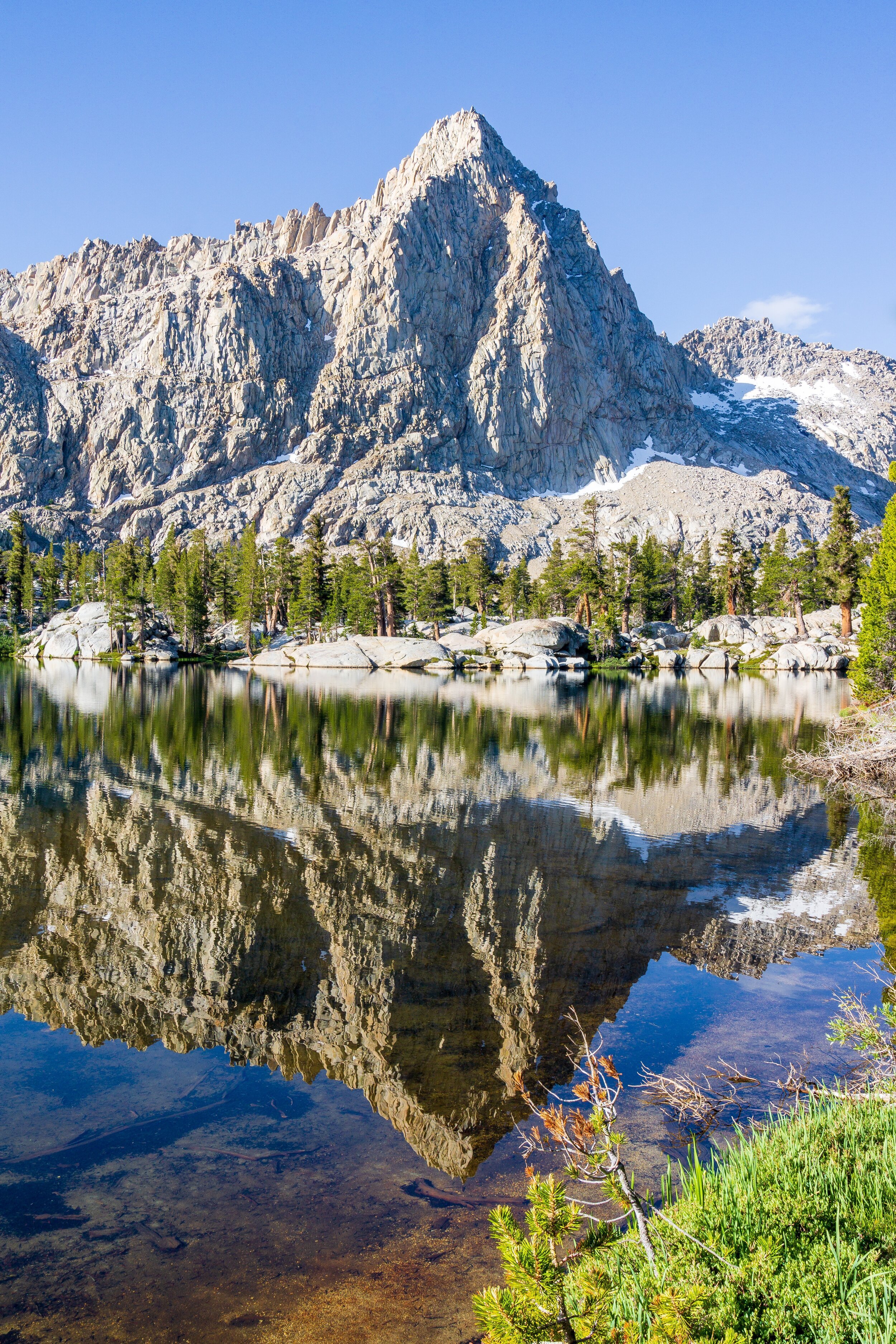
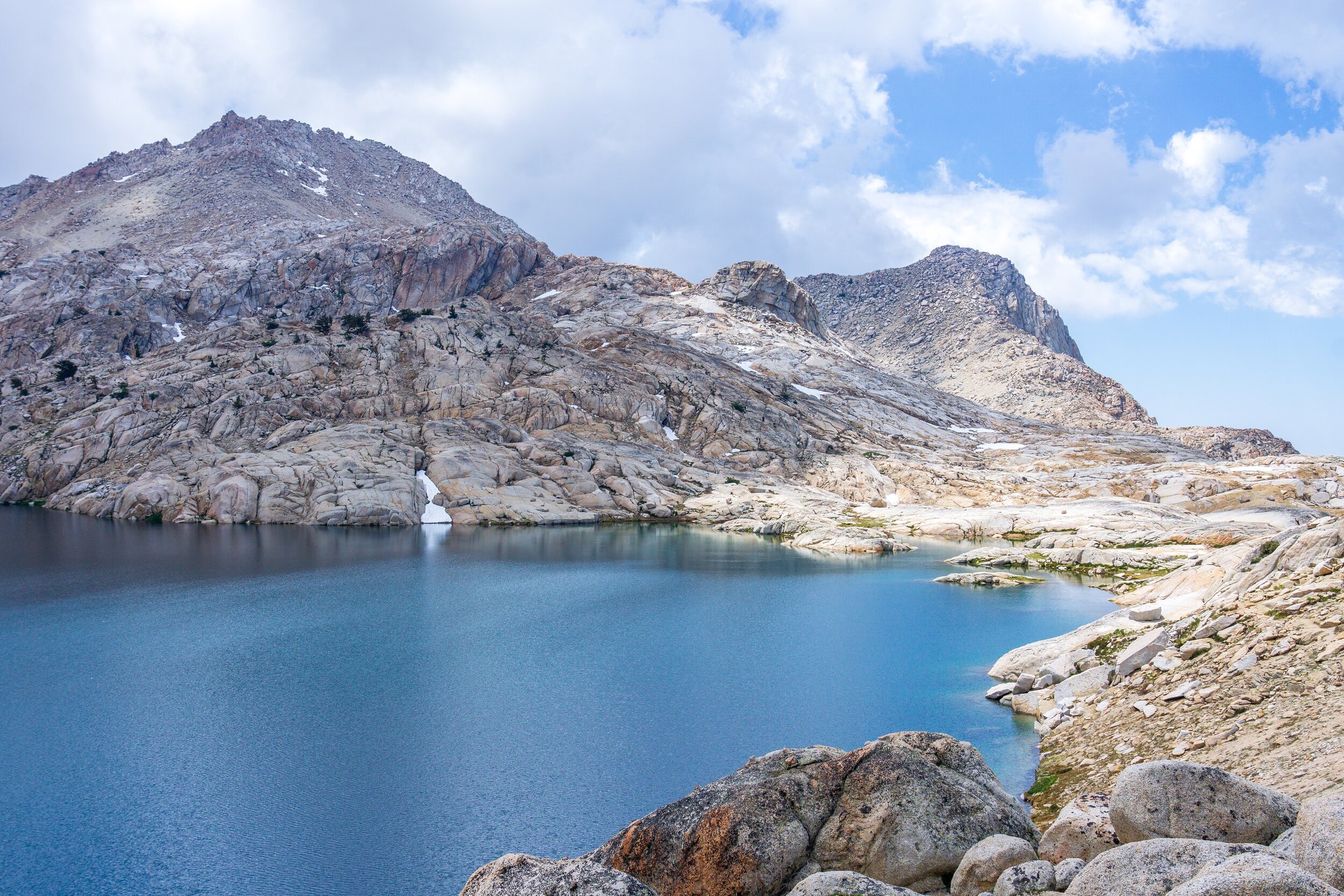
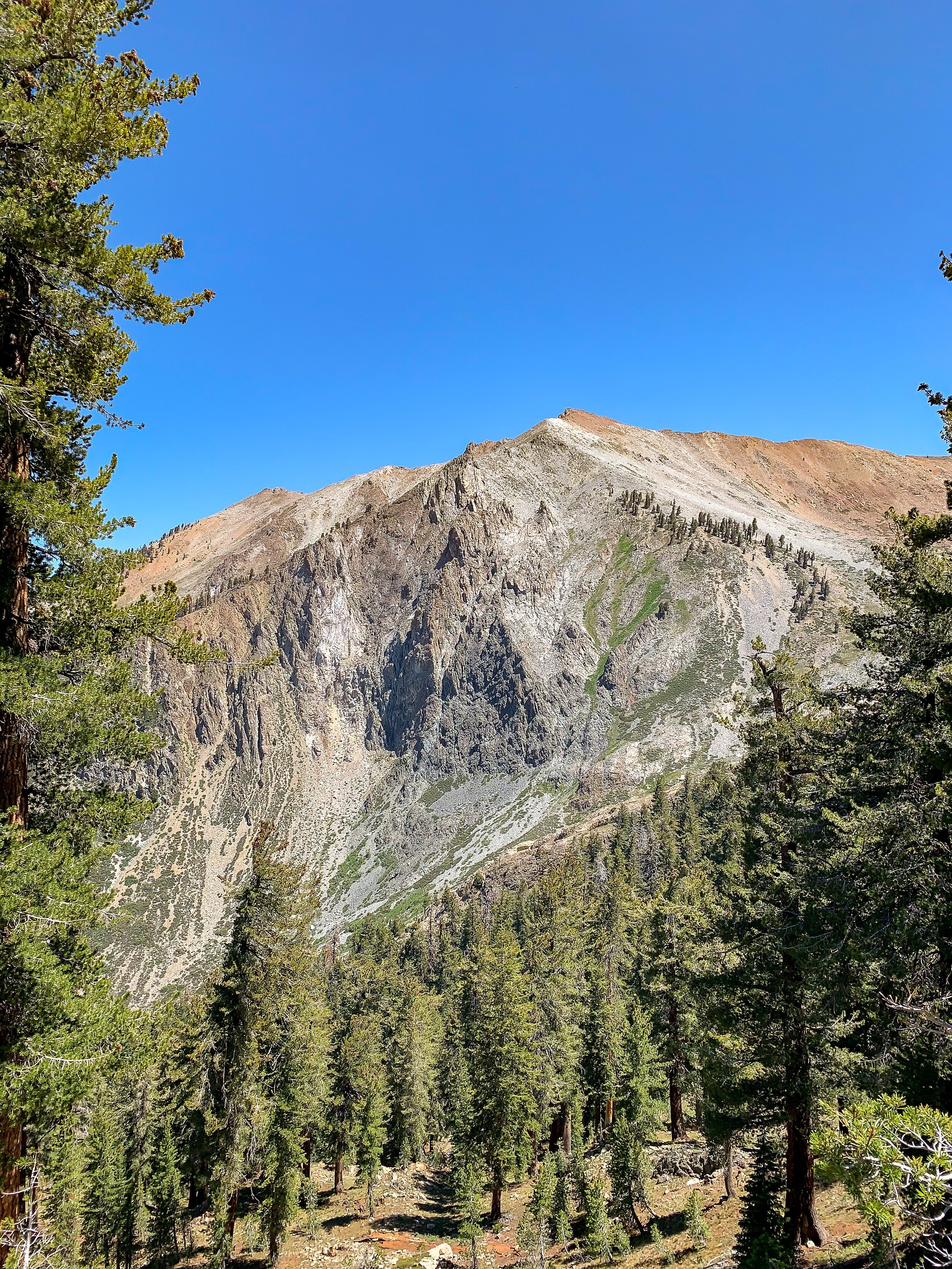
You’ll backtrack to the main trail from the upper lakes and switchback down to the lower Big Five Lake. There is a large camping area here with bear boxes. After passing through, I was happy we stayed at the upper lakes, as the views were better higher up. After a short climb up a ridge with views of the Kaweahs, we again descended, this time to Lost Canyon Creek. The trail steadily gains and follows the creek up, which was very pleasant. There were many camping opportunities along the way, but the scenery gets really spectacular once the trail breaks away from the forest. Once out of the trees, the trail opens up to a gorgeous alpine meadow, with Sawtooth Peak dominating the skyline. We had a hard time not stopping every 10 steps to soak in the views. Once you approach the end of the canyon, there are some obvious campsites to the right of the trail, which I would camp at in the future. We kept climbing though, to Columbine Lake. Apparently there is some controversy over the ability to camp here. There are many spots, including where we pitched our tents, that are 100 feet from the water, but the environment is very fragile, and you have to hold your #2s for before or after. The rangers haven’t explicitly said “no camping”, but also don’t want you to camp there, from what I heard from other hikers. The location of Columbine Lake is very convenient for both directions of the hike: halfway up the climb to Sawtooth Pass, or the first viable camping after tackling the monstrous Sawtooth Pass. Because we weren’t given explicit “camping is prohibited” instructions, we camped here. Proceed at your own risk though, and I wouldn’t be surprised if the park closed the lake to camping, due to the egregious LNT errors we witnessed.

Day Four: Columbine Lake to Sawtooth Trailhead. 6.3 miles, +1,250 -4,400 ft elevation.

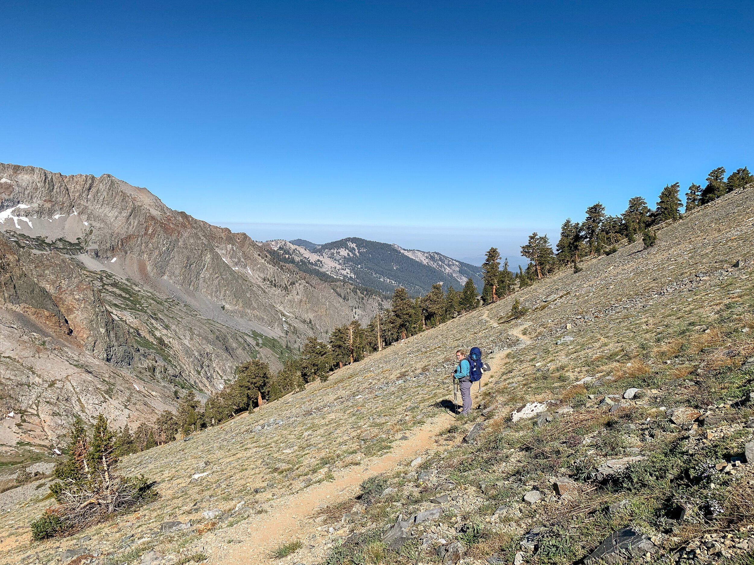
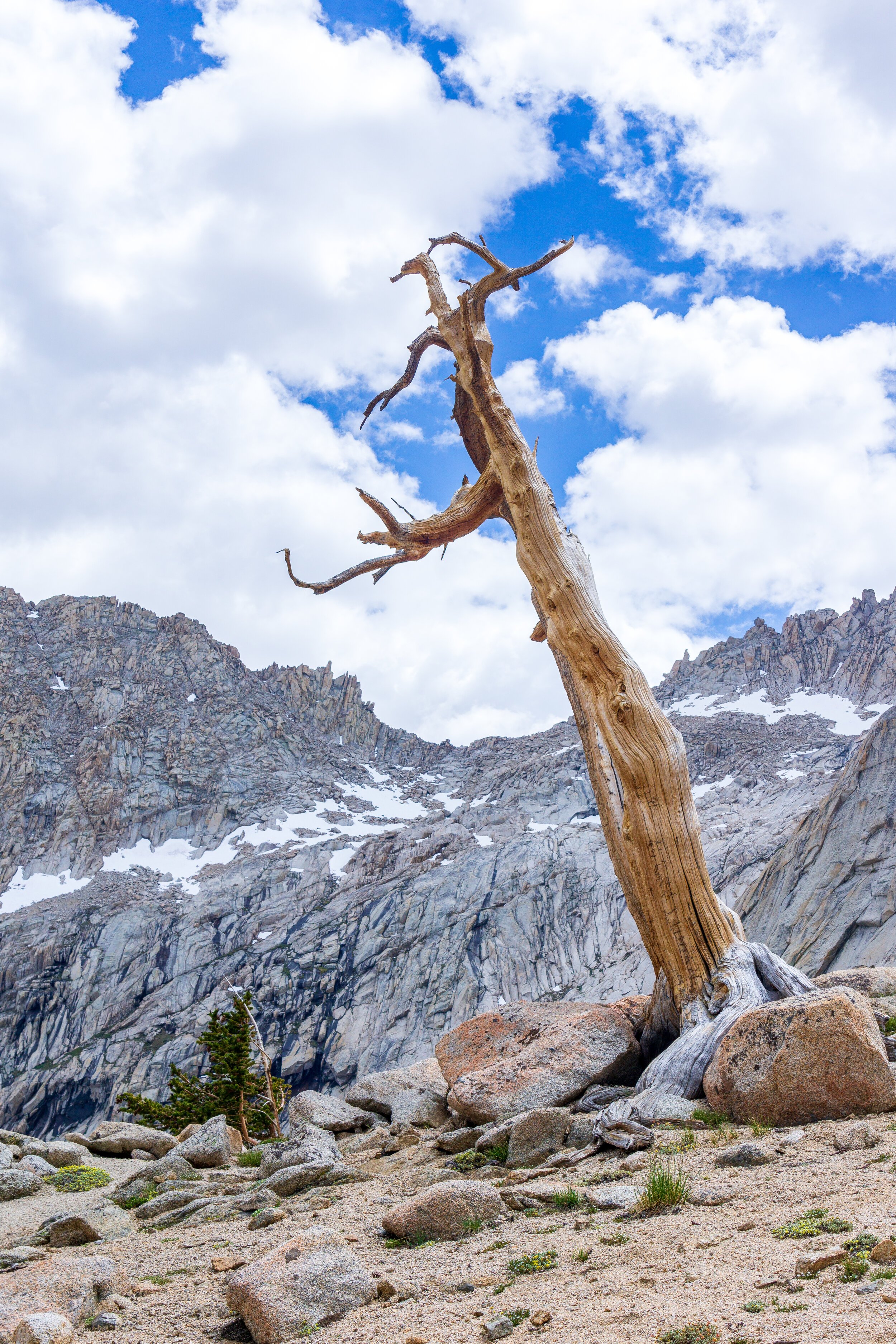
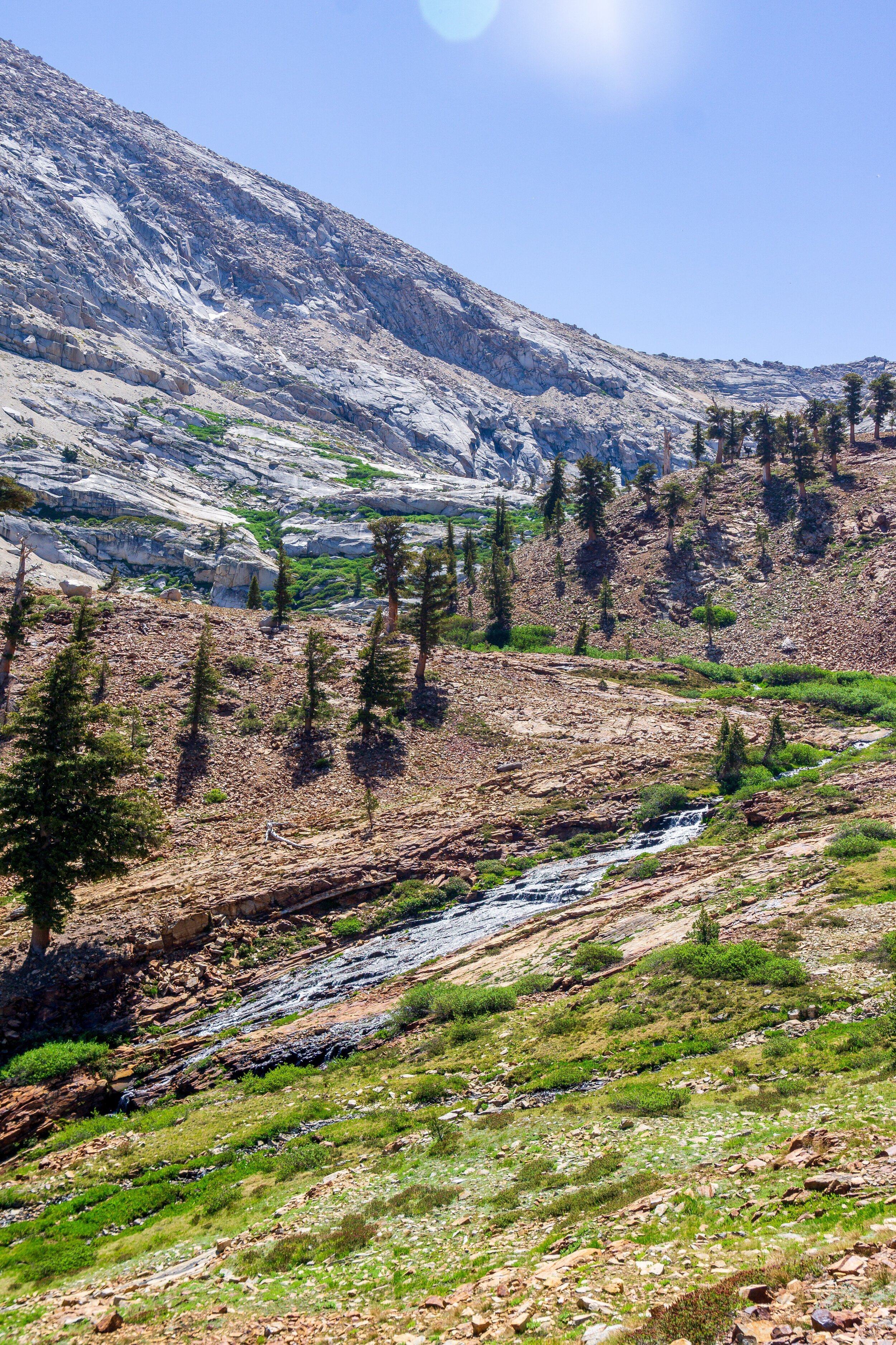
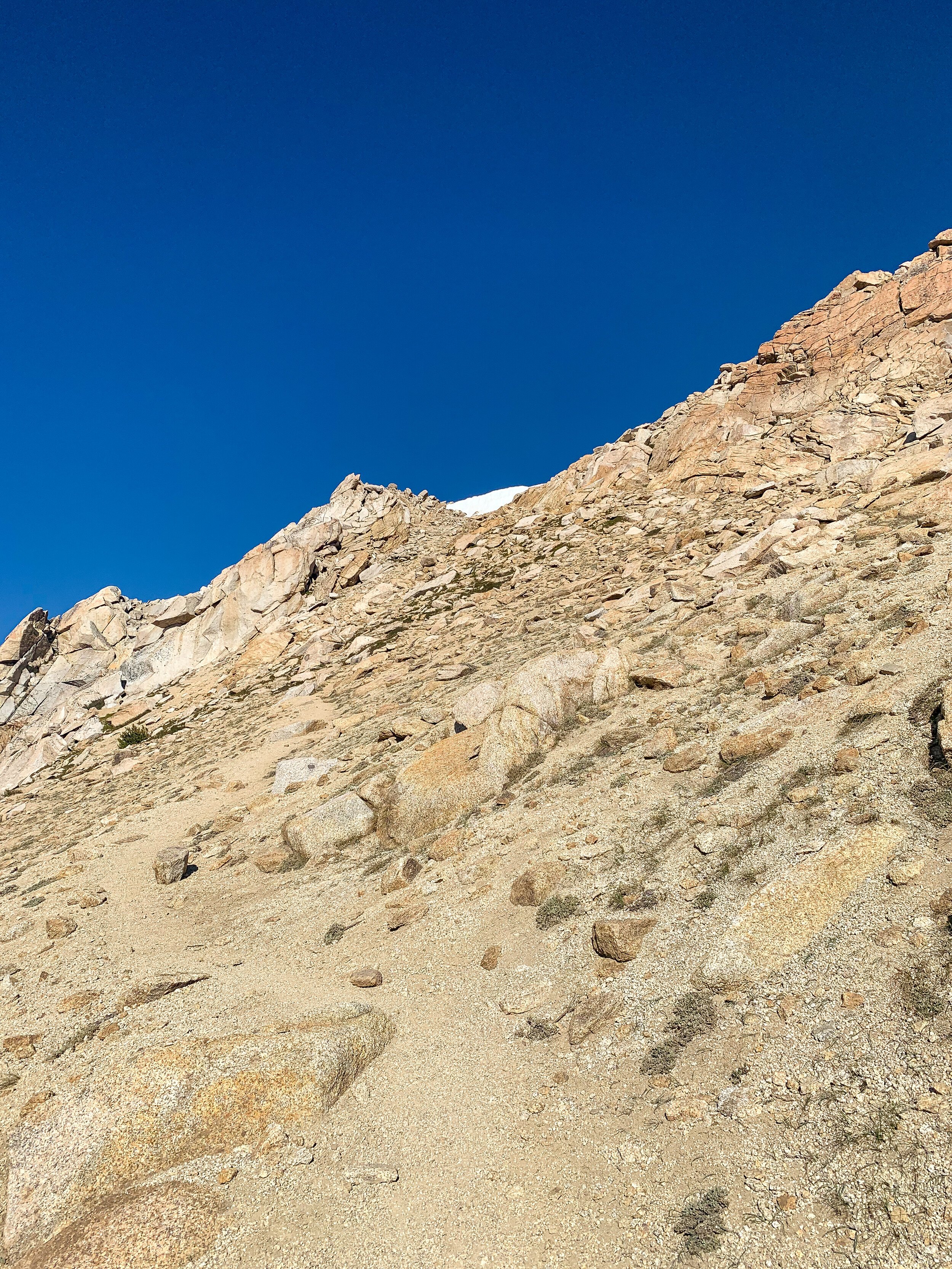
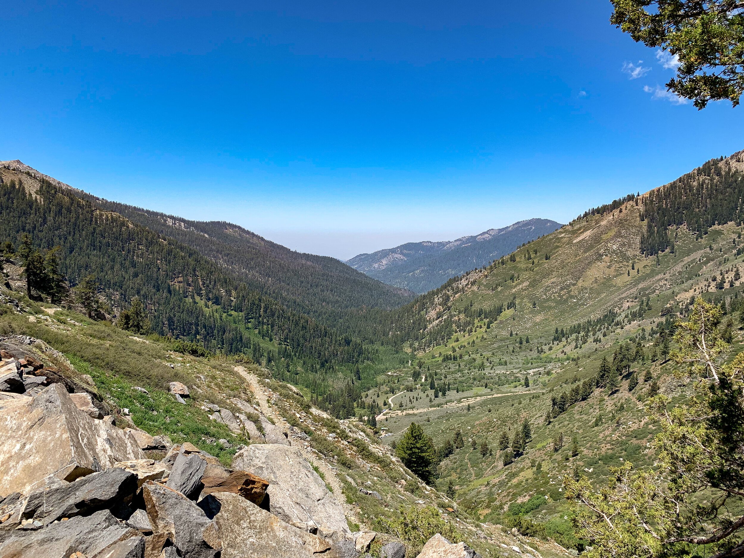
The “trail” continues up and up to Sawtooth Pass. Be sure to keep an eye out for cairns to help guide you. There is real trail in certain areas, but it can be easily missed. The trail gains about 700 feet in 0.75 miles, making this a steep push to the top of the pass. It is also possible to scramble up to Sawtooth Peak from this pass, something that we did not have the energy to do on this trip. Savor the top of the pass, looking back across the Great Western Divide towards the East Side, before studying the route down to Monarch Lakes. When you are descending, stay to your right (away from Monarch Lakes) as much as possible before making tight switchbacks down towards the lake. The beginning and end of the descent are easy to identify, but the trail vanishes a bit in the middle. You’ll be practicing a little boot skiing down this section, as it is mostly sandy scree. After losing 1,300 feet in 1 mile, you’ll finally reach Monarch Lakes and have the chance to empty the sand from your shoes and use the open air pit toilet, which is interestingly located right in the middle of camp. Privacy, Shmivacy. It’s a great toilet though! If I was doing the loop in reverse, I would probably camp here before tackling Sawtooth Pass. The trail is pretty home-free for the descent back to the car. It is a little long, and the switchbacks seem never-ending, but the forest is a nice break from the intense sun.
Clockwise or Counterclockwise?
Sawtooth Pass is arguably the most challenging part of this whole trip. You can either do it at the beginning or end of your trip. In my opinion, Sawtooth is more difficult than Black Rock Pass because Black Rock has full trail, while Sawtooth looses trail tread a little bit and turns into a scramble and scree ski. I did the trail clockwise, and despite the slog up to Timber Gap and down to Cliff Creek, I thought it was the best way to go for my itinerary and how I was approaching the trail. If you are into brutal elevation slogs right off the bat, counterclockwise might be great for you, but honestly, I wouldn’t really want to do the climb from Cliff Creek to Timber Gap at the end of my trip. That seems like more of a mental slog to me, as the views aren’t as great.
Marmots & The Trailhead
This trip starts at the Timber Gap/ Sawtooth Trailhead. There are pit toilets and garbage bins at the dirt parking lot. You might be surprised to hear that the Mineral King valley has a marmot problem. Why there is a marmot problem here, specifically? Who knows. Out of all the places I’ve been to in the Sierra, I have never received warnings about wrapping my car because of the marmots destroying electrical wires and hoses, except for the Mineral King parking lot. There is even a whole webpage dedicated to this on the NPS website. This is only an issue earlier in the season, so after mid-July, you shouldn’t need to wrap your car. I used a large 15’ x 30’ blue tarp with grommets and bungee cords to wrap up my 2020 Subaru Outback. This system worked really well with the built-in rails. I saw other people just closing the tarp into the trunk, hood, and door frames. As long as you cover the wheel wells and undercarriage, you’re golden.

Permits
Permits are in relatively low demand in the Mineral King area, even during the quota season (late-May thru late-September), which makes doing this trip easily attainable! Permits can be obtained up to 6 months in advance at Recreation.gov. Advance reservations cost $15 plus $5/person for each trip. In non-COVID-19 times, walk-up permits are available at the Mineral King Ranger Station the day before and of the date you want to start your trip, and are free.
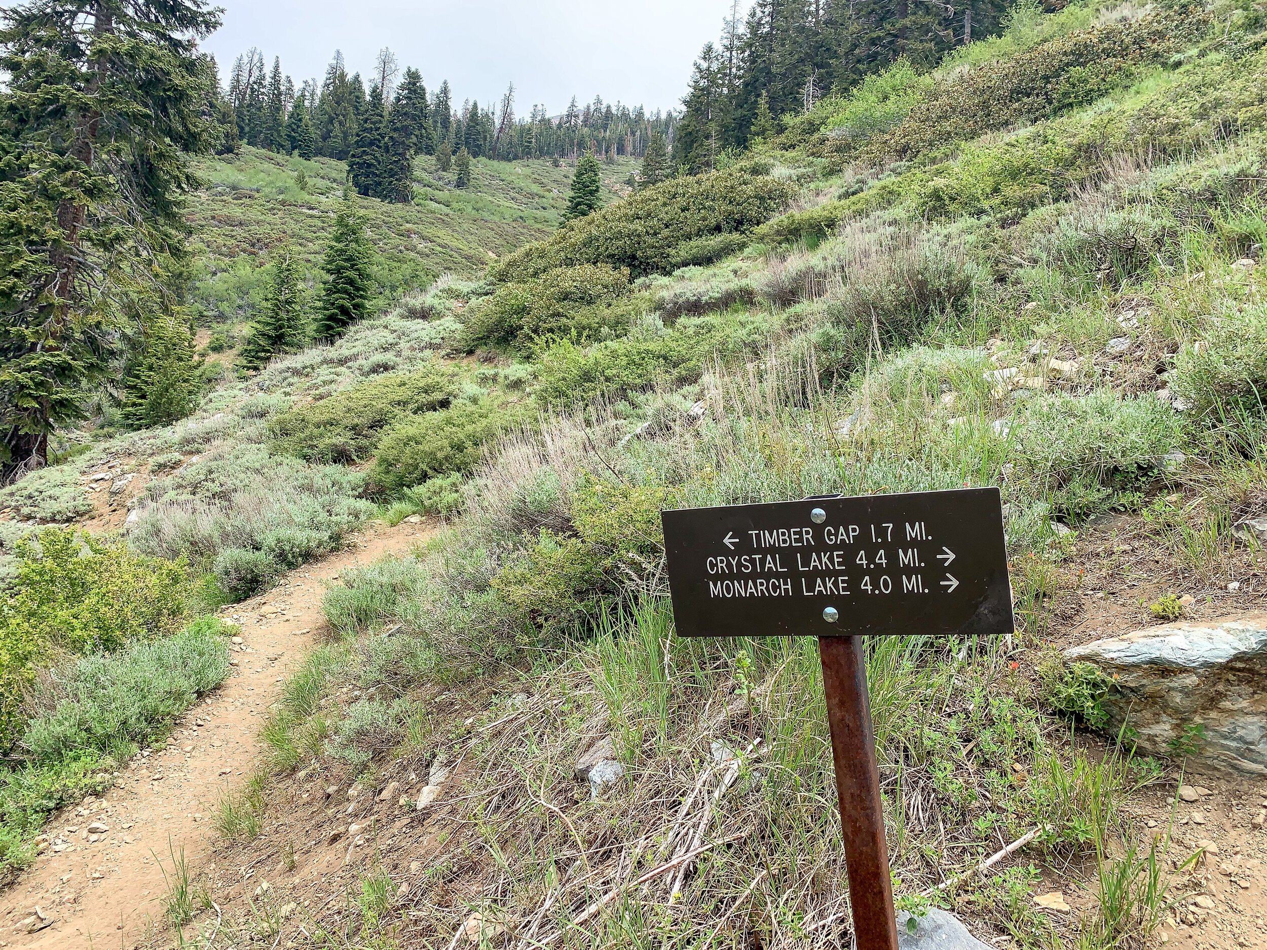
For this trip, your entry trailhead is Timber Gap. Exit trailhead is Sawtooth Pass.
If you plan on using a stove or making a fire, be sure to obtain a free California Fire Permit.


Trail Journal
Day One:
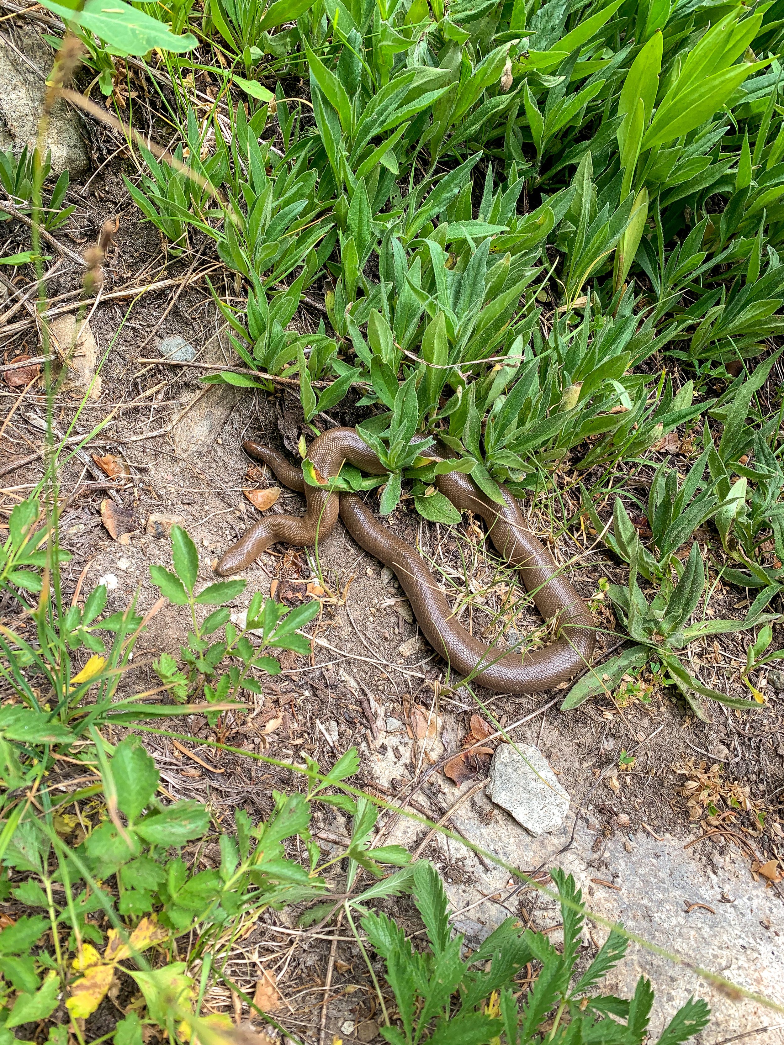
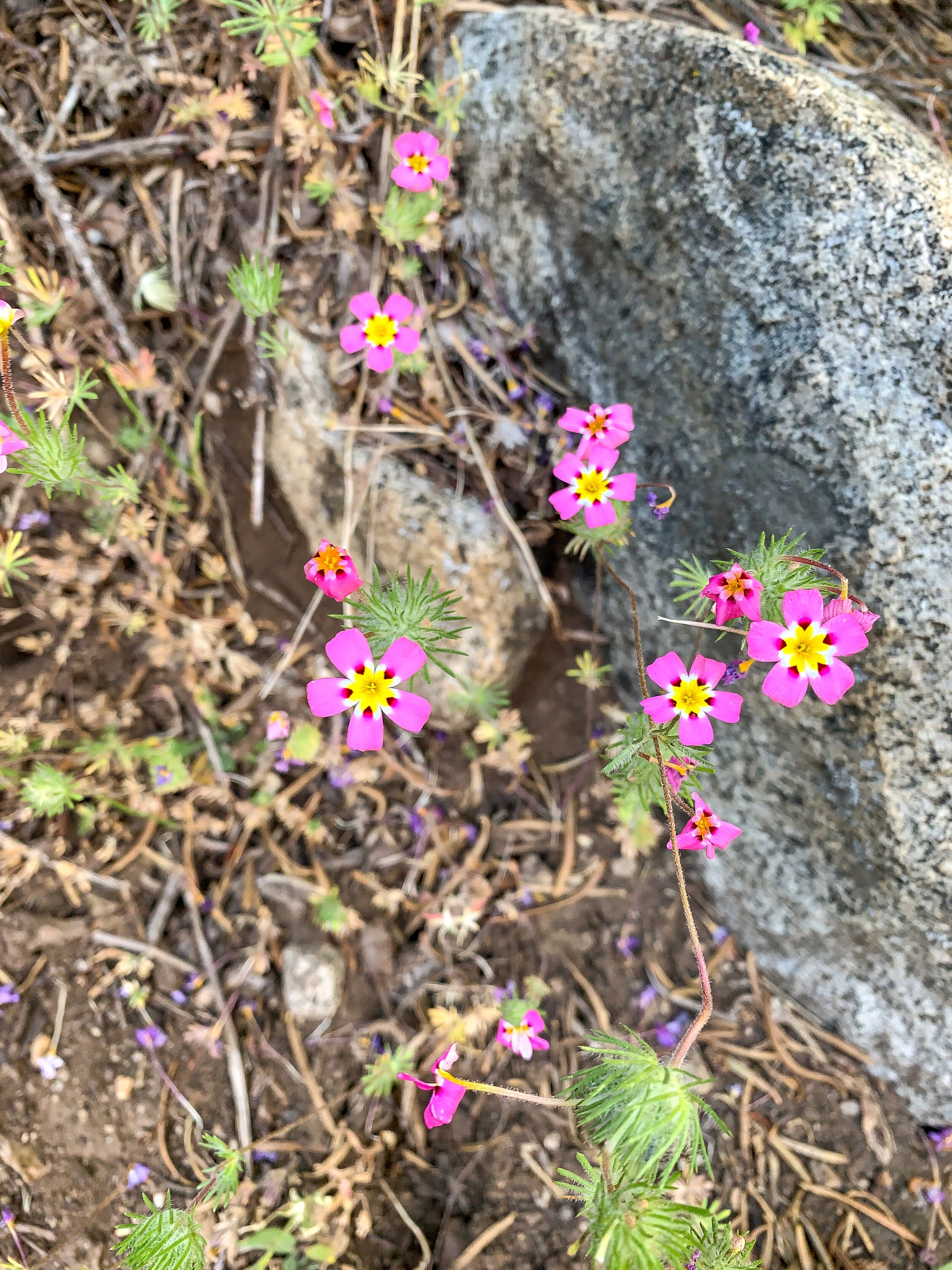
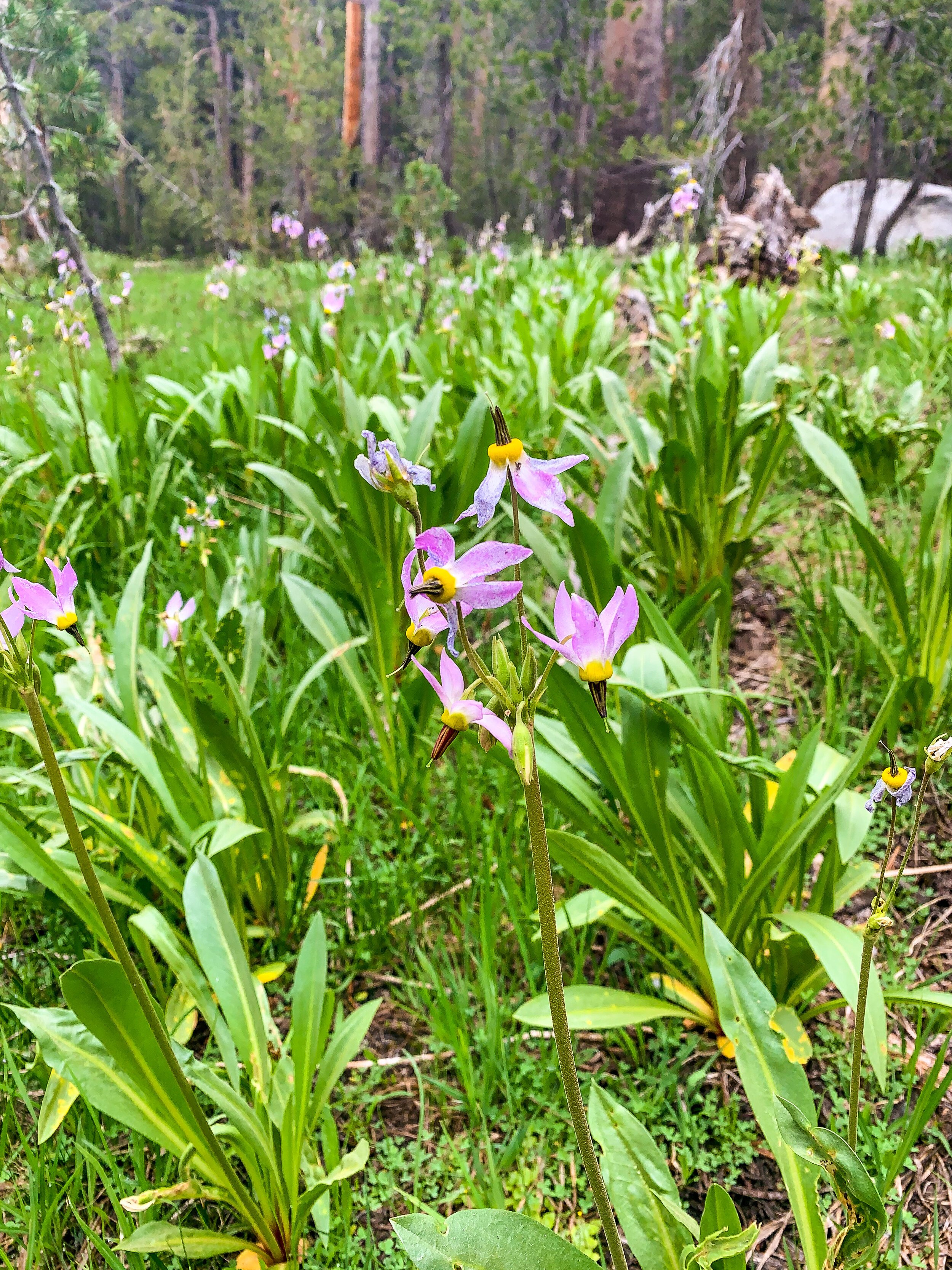
After a 4:00 AM wake-up call, a 5.5 hour drive and a late start at the trailhead, we were off up to Timber Gap. The trail gained about 1,700 ft in a little over two miles. Needless to say, it was a rude awakening as we had just come from sea level and had to huff and puff up to almost 10k feet. The views of the Mineral King Valley were just amazing though. And there were quite a few wildflowers blooming.

After the trek to Timber Gap, we took a short break and snacked at the top, looking over at mountains across the valley. After snacking we had to descend everything we just gained AND MORE to Cliff Creek. By the time we finished this downhill, we were getting pretty tired. Unfortunately we only hiked 5.6 miles and we really wanted to go higher up to make our ascent of Black Rock Pass tomorrow more manageable. We ran into a nice ranger at the Cliff Creek campground who checked our permits and gave us some information about the trail ahead. She encouraged us to push to our planned campsite at Pinto Lake as it would make our second day much better, and since we weren’t feeling too terrible (just tired), we pushed on.

The first mile wasn’t too bad, but the trail was pretty overgrown and steep in some places. But there were so many more wildflowers, which was a joy. We crossed a lot of washes next to Cliff Creek. The rocks were tiring! The pain started in the last 750 feet of gain we had. It was super sunny and hot in the evening sun, and the trail was just so steep and rocky. Every few steps I needed to take a break. I was also sooo hungry and probably a little dehydrated as well. I did not plan food well enough for this day. Once we finally topped out at the steepest part of the climb, I thought we were nearly there, and we were, but the last half mile or so seemed to drag on forever. I was thirsty, lightheaded, my stomach was growling, and my feet were hurting. When we finally got to the Pinto Lake campsites both Holly and I were slightly delirious. We grabbed the first campsites we could find and I immediately sat down to drink water and try to get food into my stomach. My stomach really, really didn’t want food despite my hunger, which was frustrating. But after eating really slowly I finally got some real food (aka not Fritos) down.
It took us 8 hours to hike 8 miles, which was humbling. Coming from sea level, only getting 5 hours of sleep, and not being in hiking shape due to the pandemic & trail closures reminded me of my limits. Thankfully, this day ended well, but we were in bad shape at the end of it. I almost instantly crashed as soon as my head hit my inflatable pillow.
Day Two:

Little Pinto Lake in the distance
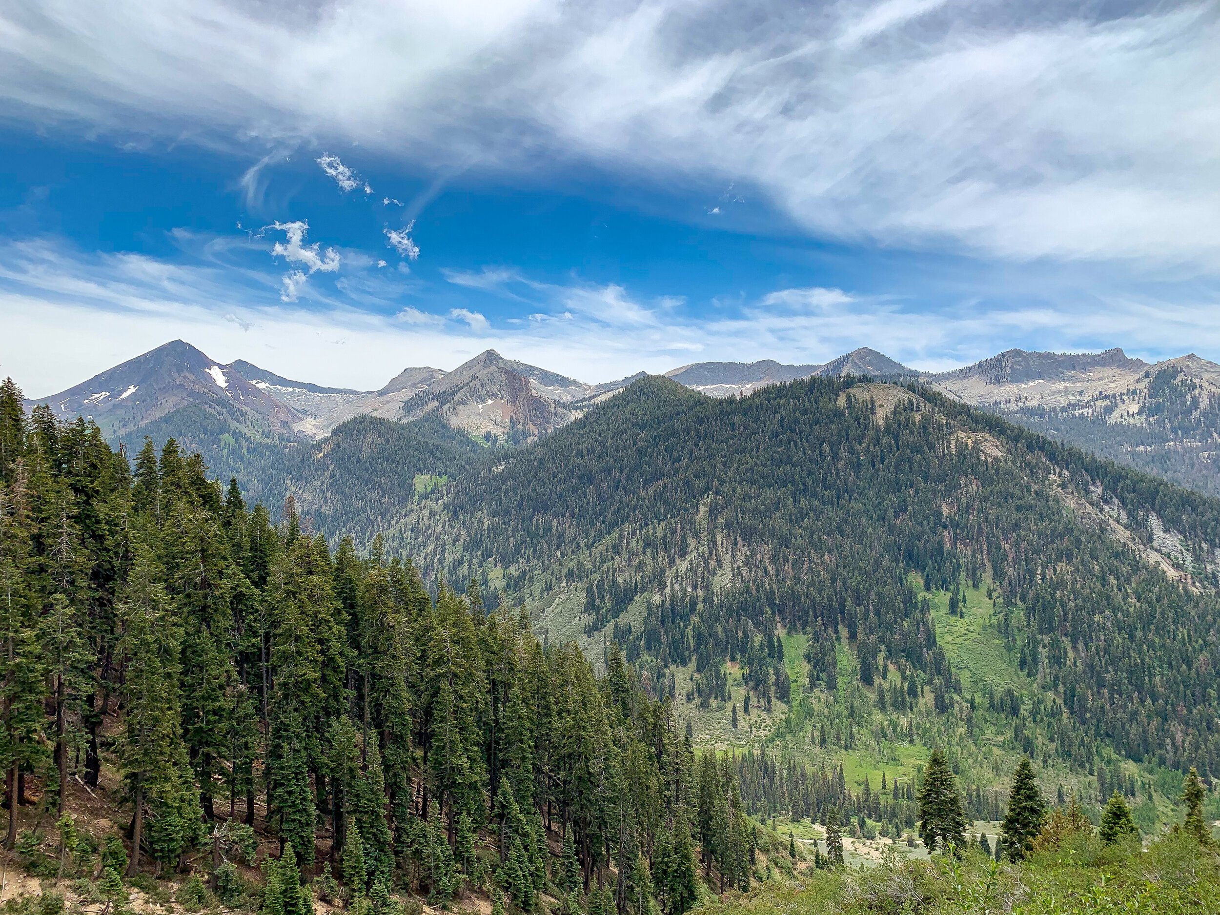
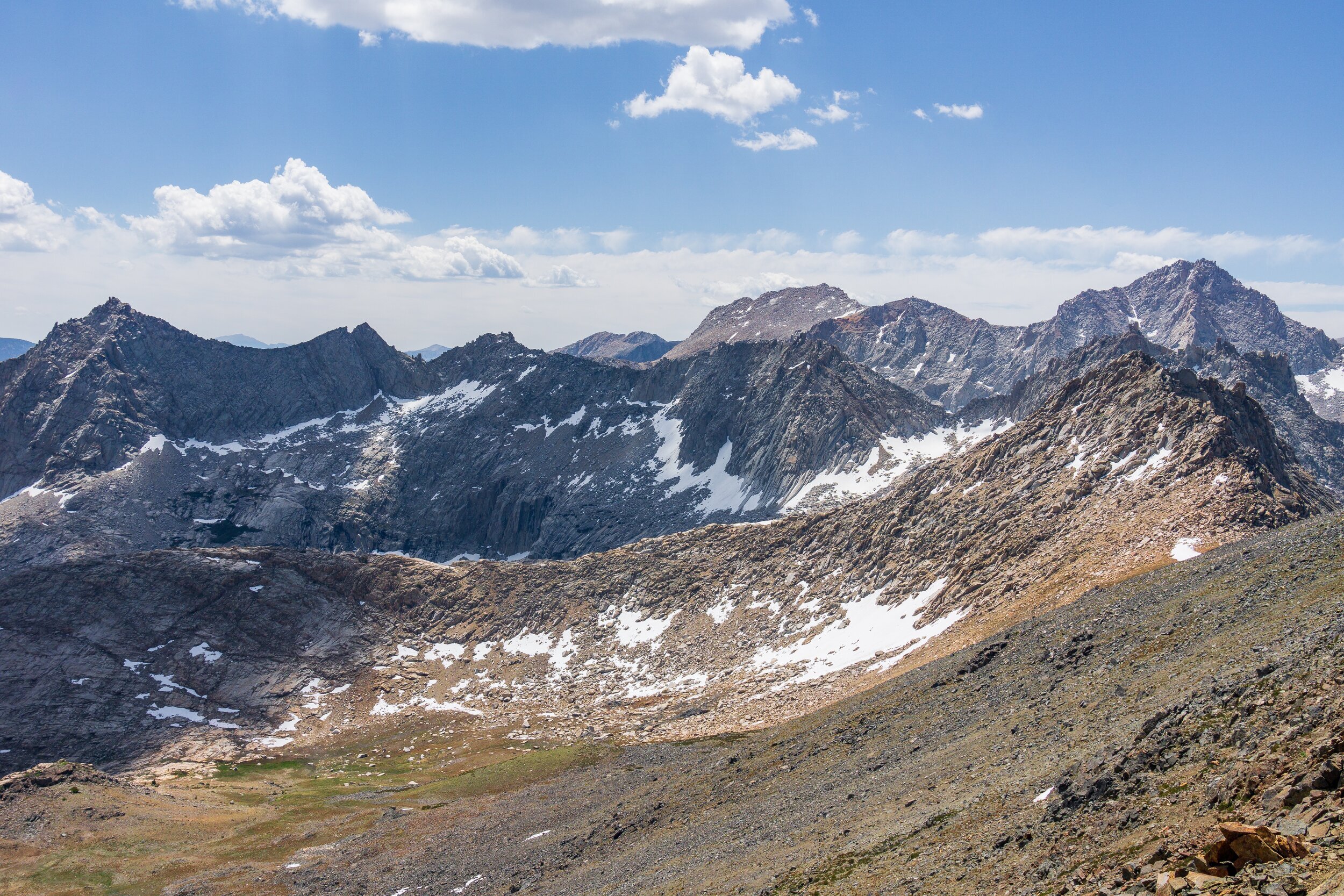
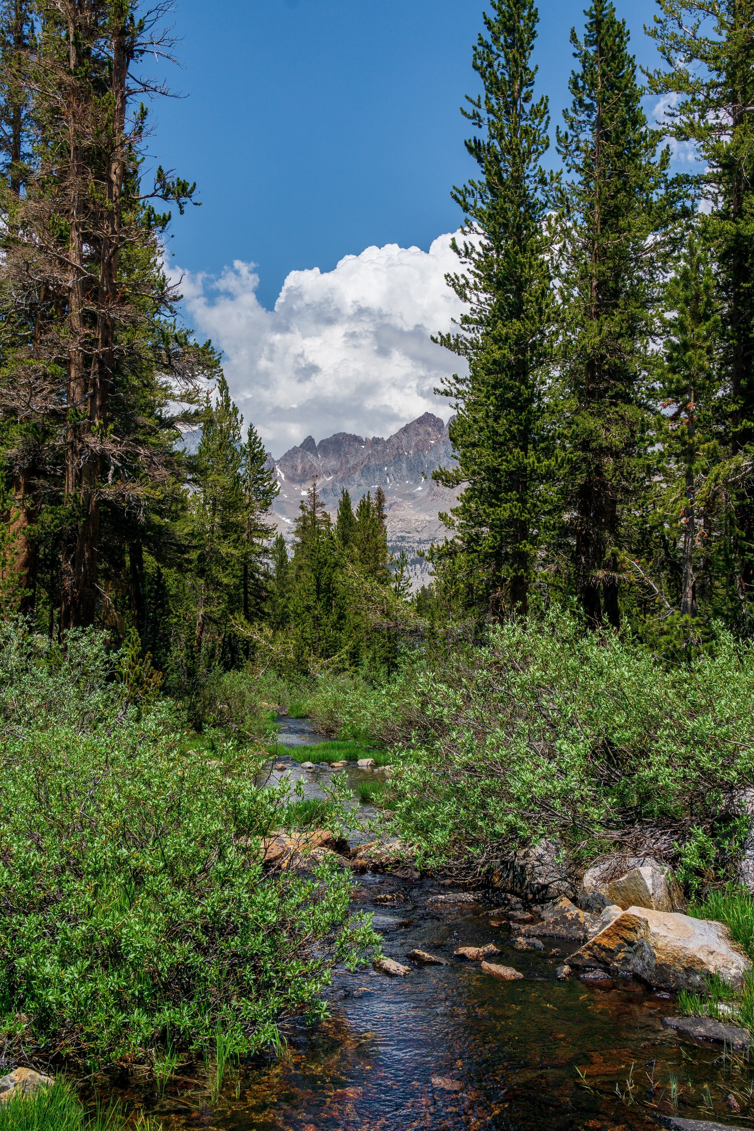
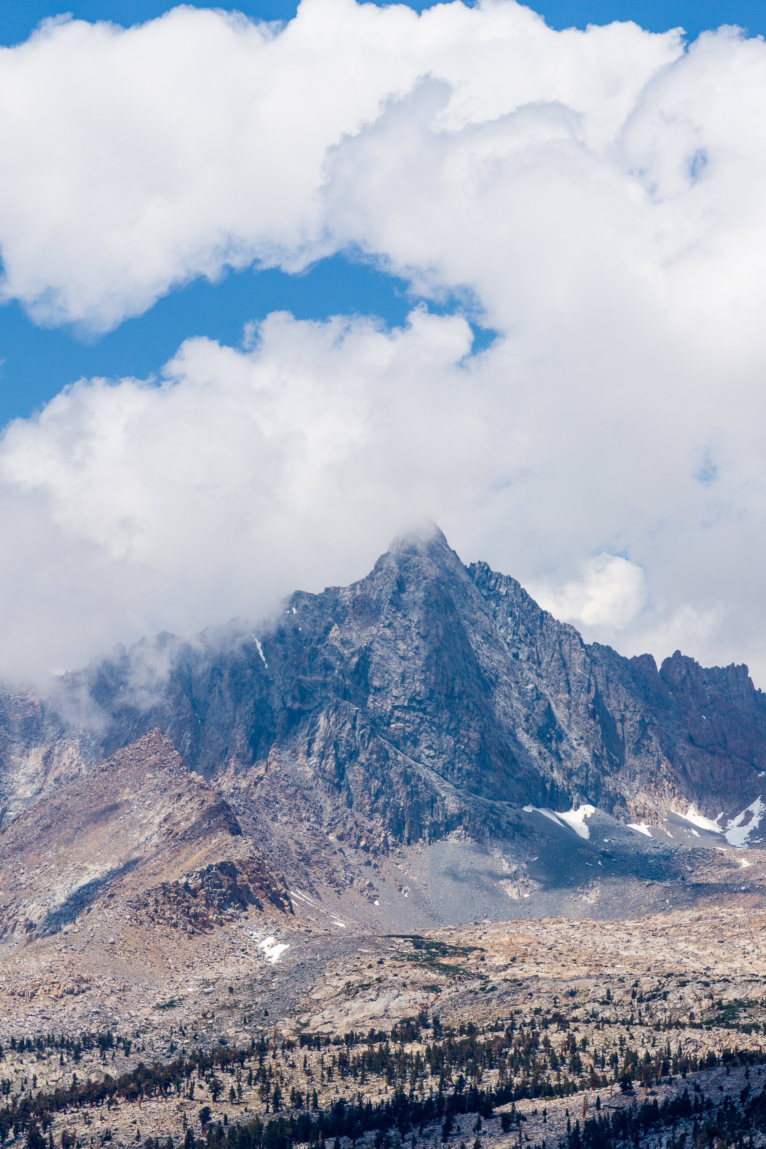
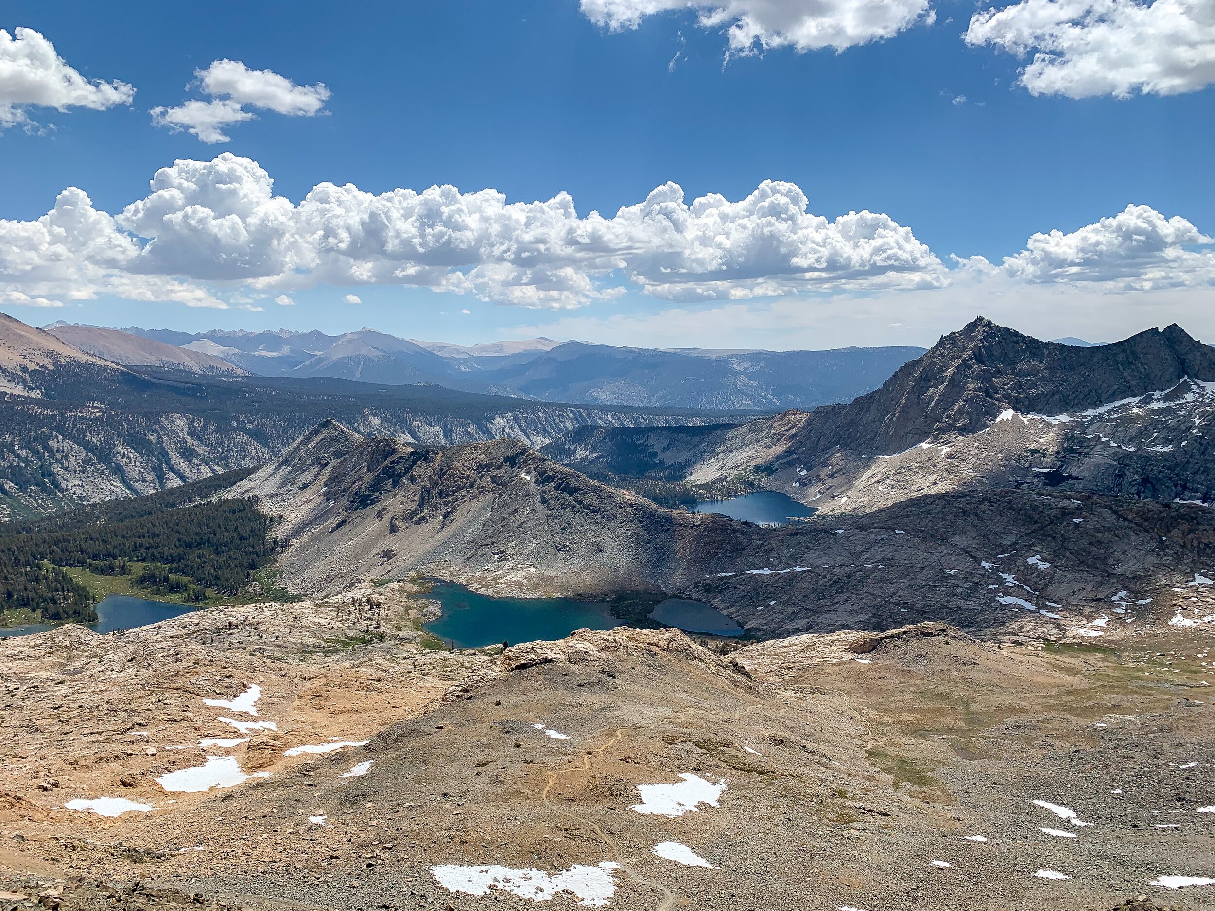
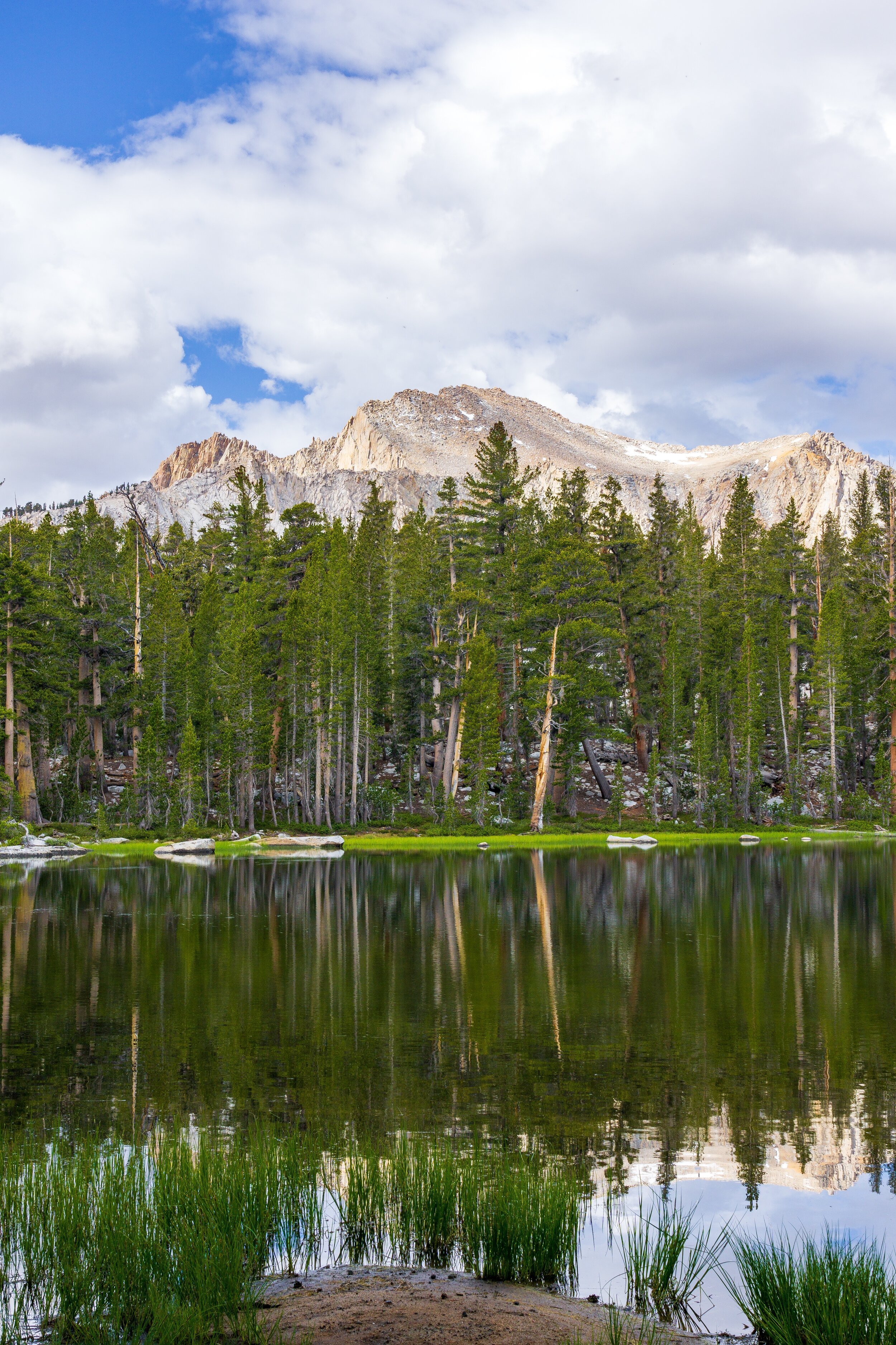
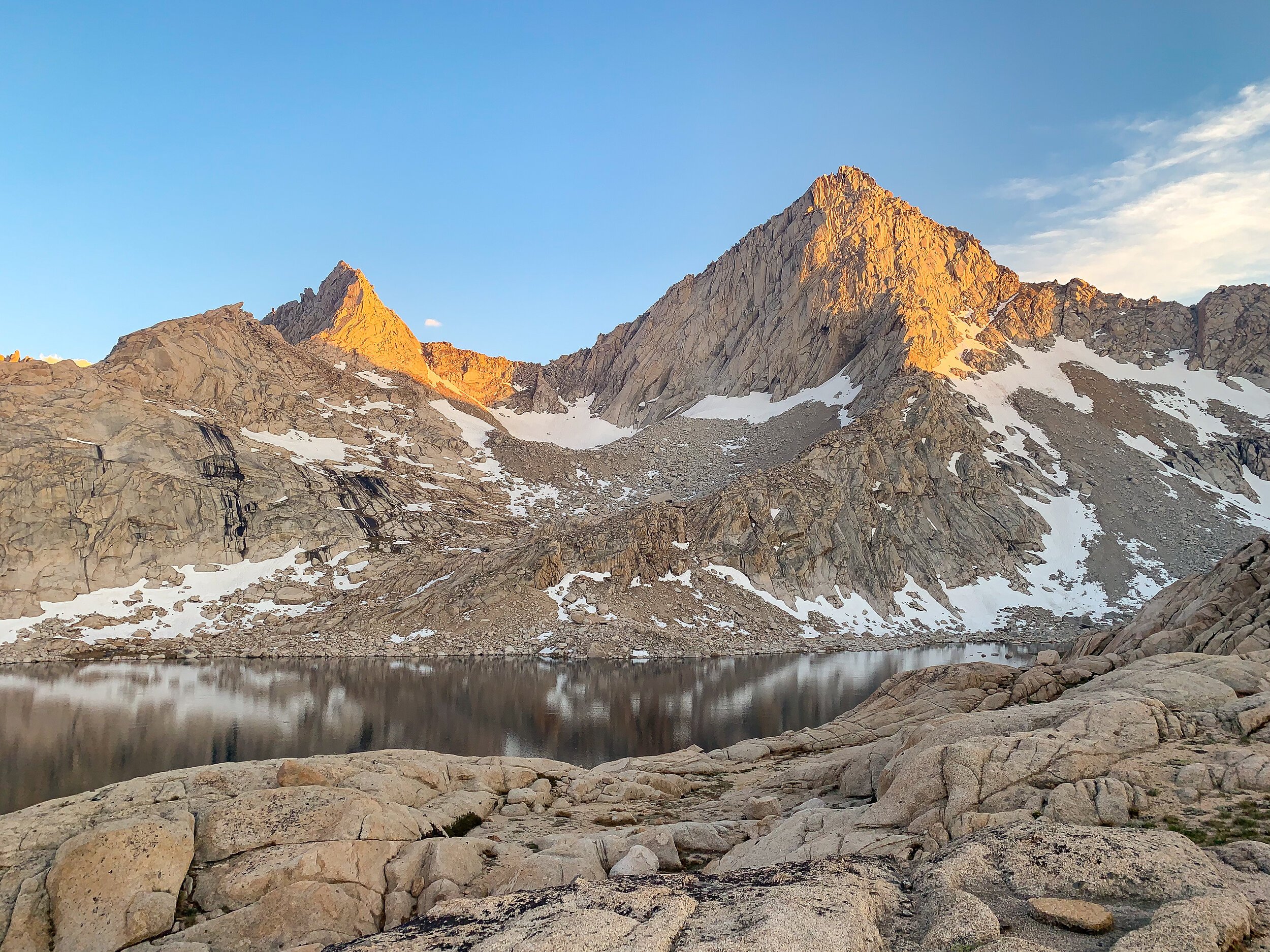
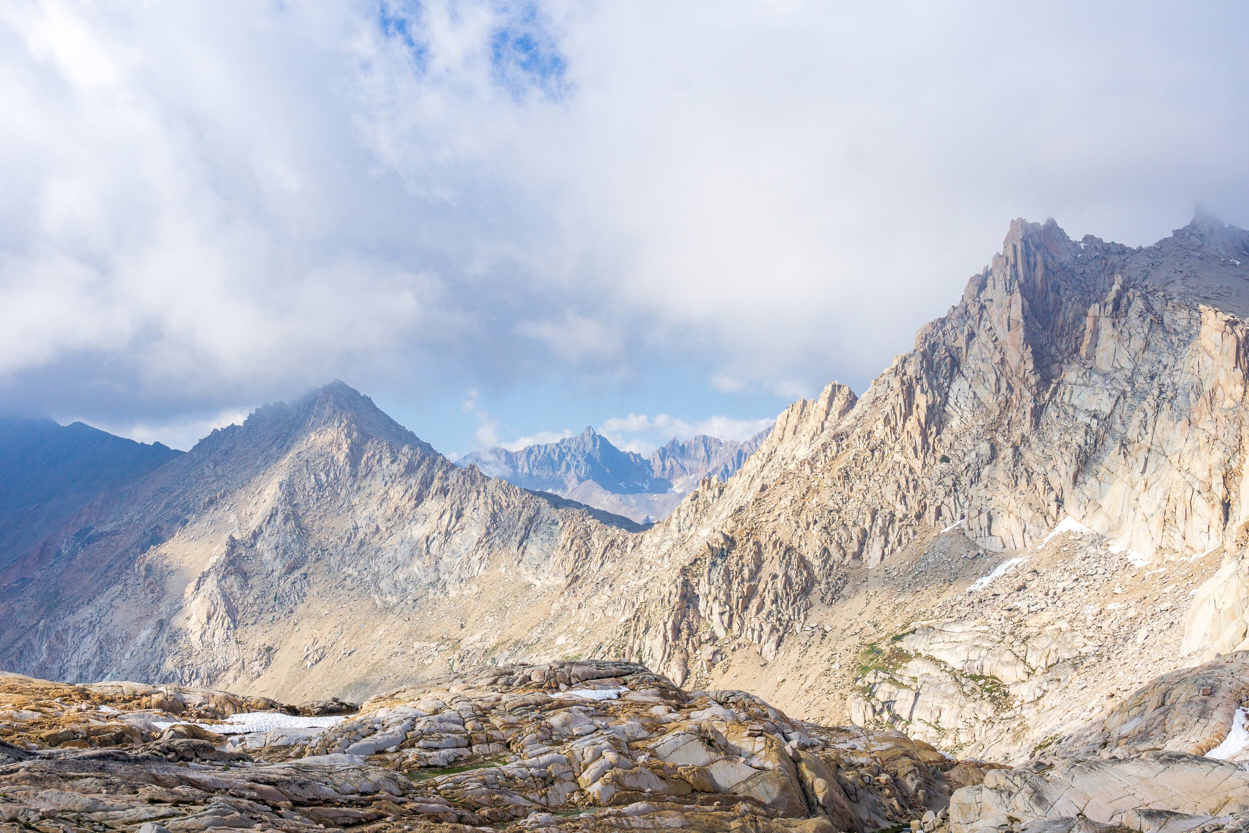
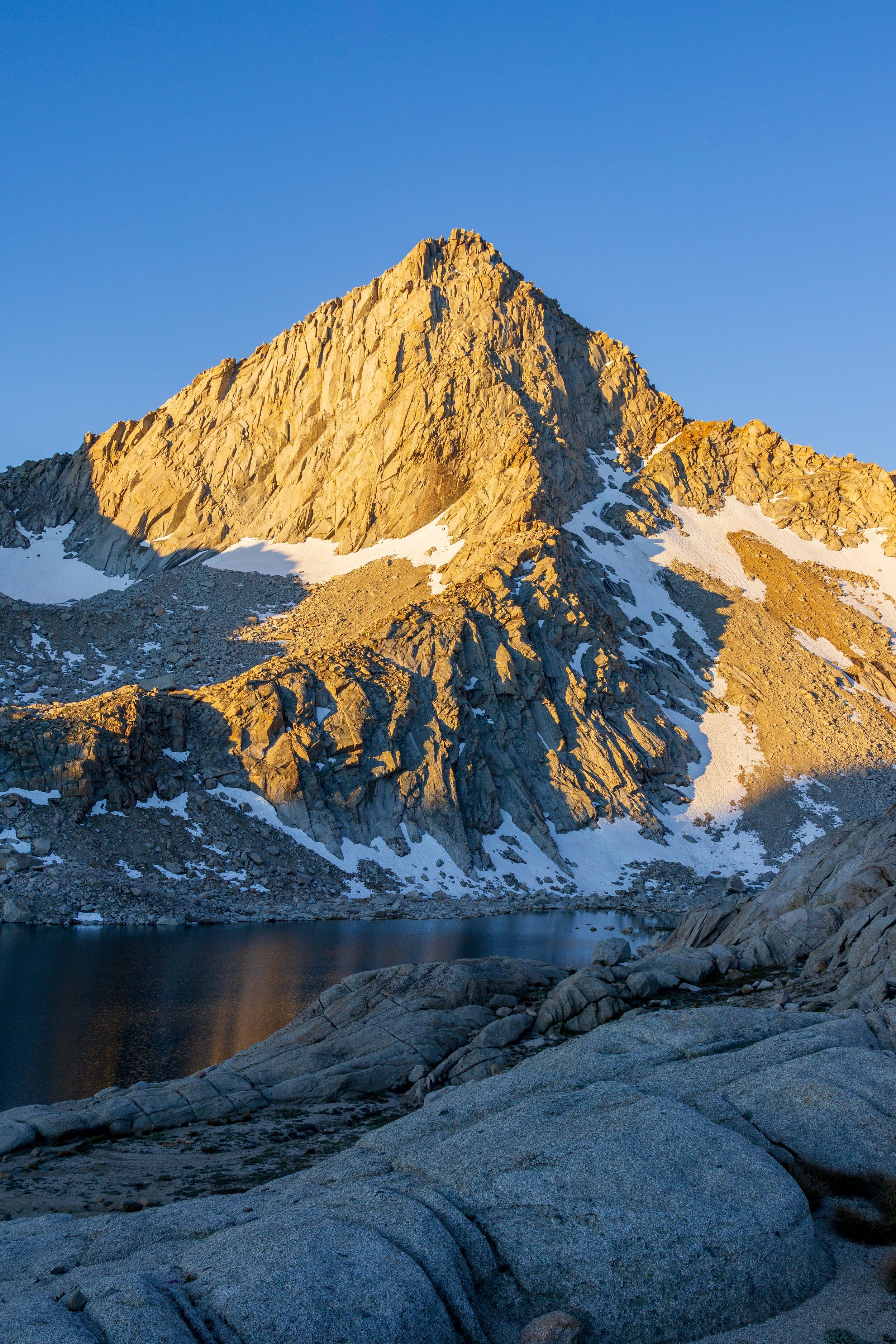
Feeling much more rejuvenated and not crazy dehydrated after yesterday’s ordeal, we got hiking around 6:30 am to try to do most of our climb up Black Rock Pass in the shade. This climb was a doozy. It was 3,000 feet of gain in less than 3 miles. Again, I was starting to question my ambition and trip plan after a slow start to my hiking season. The first part of the climb went pretty well. We were able to do the first 1,000 feet in the shade and the views were just spectacular. Mountains all around! As the trail climbed, it seemed to get steeper. The next 1,000 feet were on long, exposed, and rocky switchbacks. I forgot how much walking on hand-sized rocks sucks. They just roll around and slide and are generally uneven. The last 1,000 feet had incredible views. The lakes that were once hidden behind mountains came into view: Spring, Cyclamen, and Columbine Lakes were all visible beneath Sawtooth Peak, Needham Mountain, and countless other unnamed peaks, all towering at 12,000 feet high.

Finally, after 4 hours of hiking the pass, we were at the top. It was so rewarding to finally get up there. And the views were jaw-dropping. The whole Kaweah Range was front and center. Little and Big Five Lakes were visible and you could even see down to the bottom of some of the lakes. And the big clouds were casting dramatic shadows over the whole landscape. We took an hour lunch break at the top of the pass, soaking in the views and greeting others who crested the top. After lunch, with our water supply very low, we took off down the trail towards Little Five Lakes. From the pass, it looked like the trail should get to the lakes pretty quickly, but it was actually like 2 miles away and I had only 3 sips of water left and it was hot! We finally got down to the lake, and took another hour break to relax at a nice campsite, filter water, have a bathroom break, and take pictures. Once we were finished, we took off again, headed to Big Five Lakes. This part of the hike felt like it dragged on. It was a big PUD (pointless up and down - but in this case, down then up). At least the views of the Kaweah Range were incredible during the ascent.


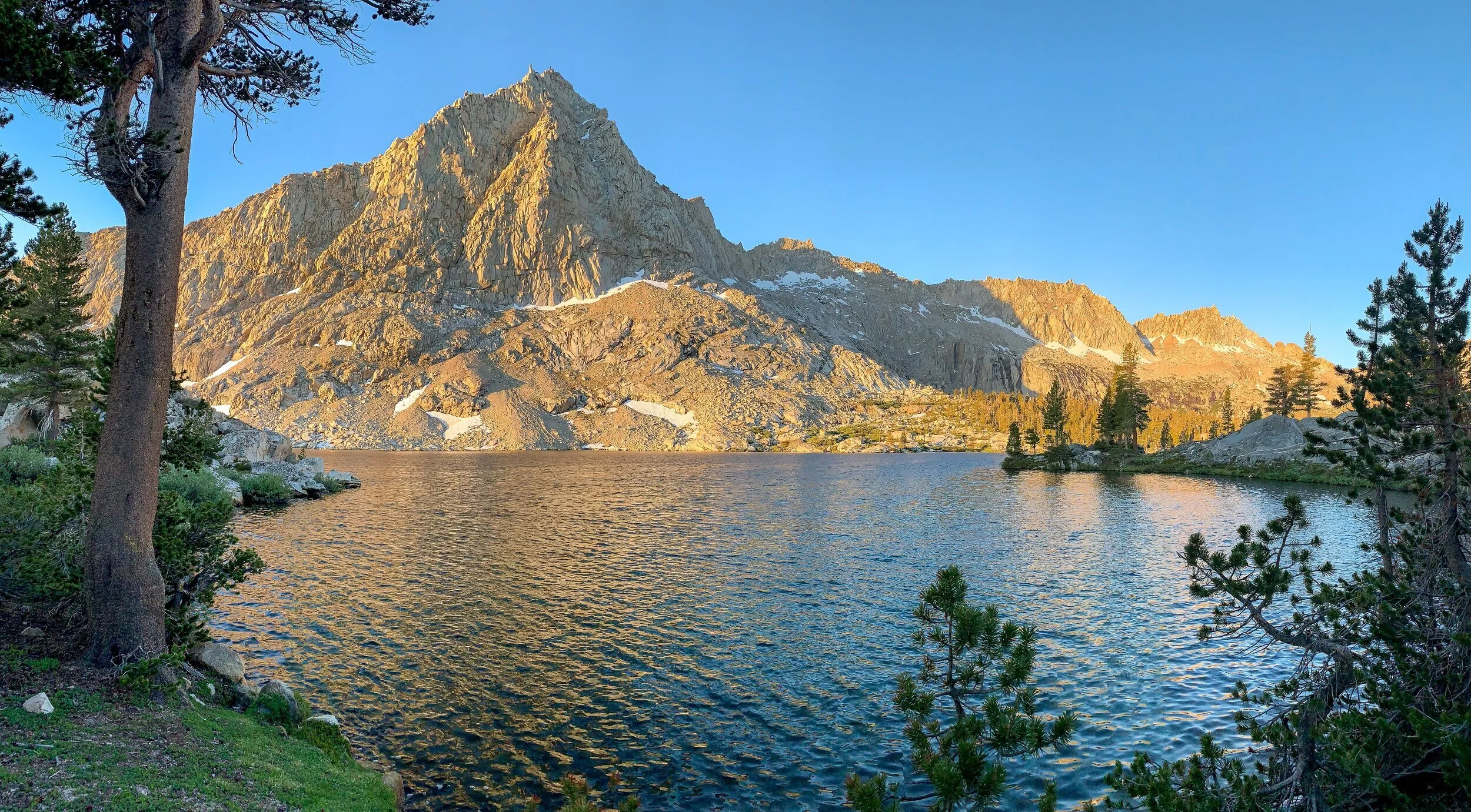
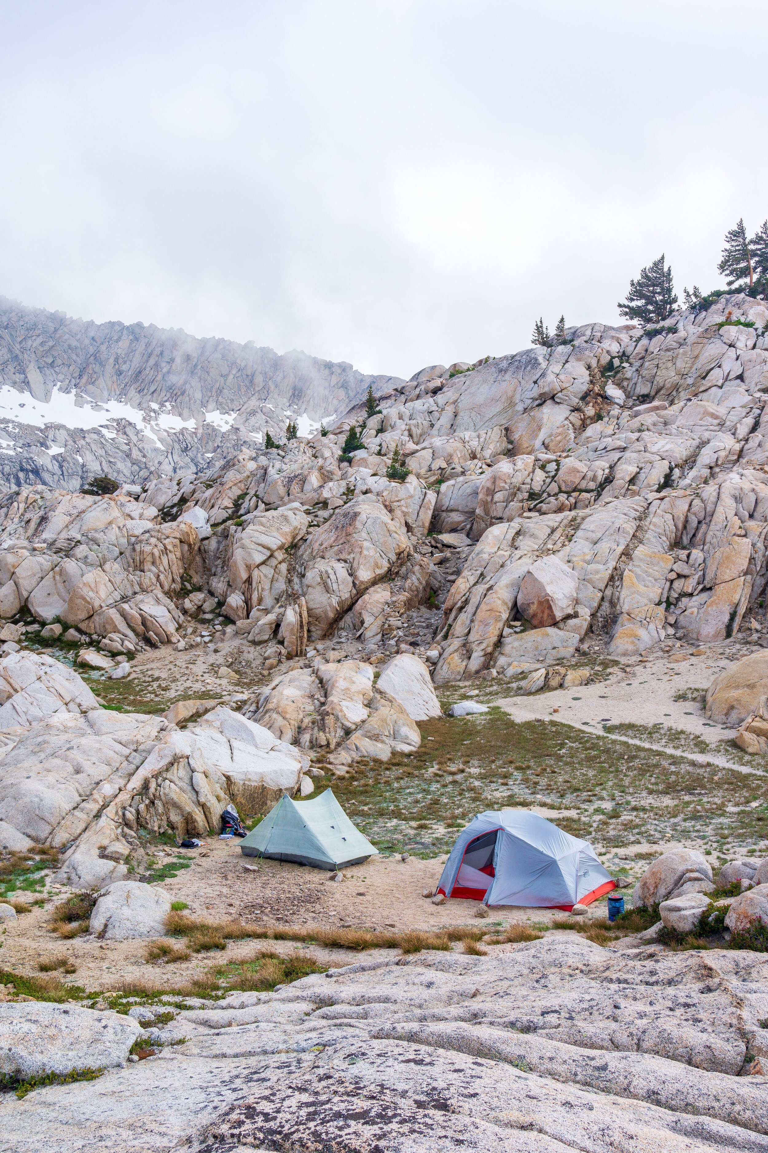
We weren’t yet sure which lake we wanted to camp at, but since it was only 2 pm by the time we got to the junction, we decided to detour to the upper lakes and find a campsite there since I heard it was supposed to be more scenic. After another half mile of hiking, we reached the middle and largest Big Five Lake and found a great campsite with good access to the lake. We set up camp, and went down to the water and soaked our lower legs. The clouds had been ominous all afternoon, but the worst looking ones were blowing to the Kaweah Range. Still, it was way too windy for me to go swimming unfortunately. At least the wind kept the mosquitos away! Both of our feet were hurting after this loooong day, so we retired to our tents for some horizontal relaxing time before dinner. After dinner I finished getting ready for bed, and laid down again. The wind had really picked up so I curled up into my quilt, staring at the lake, peaks, and clouds from my tent, hoping that a sunset would happen.
Sadly, really thick foggy clouds rolled in and we were snubbed for sunset. I took a few pictures anyways, and then crawled back into my tent and quickly fell asleep.

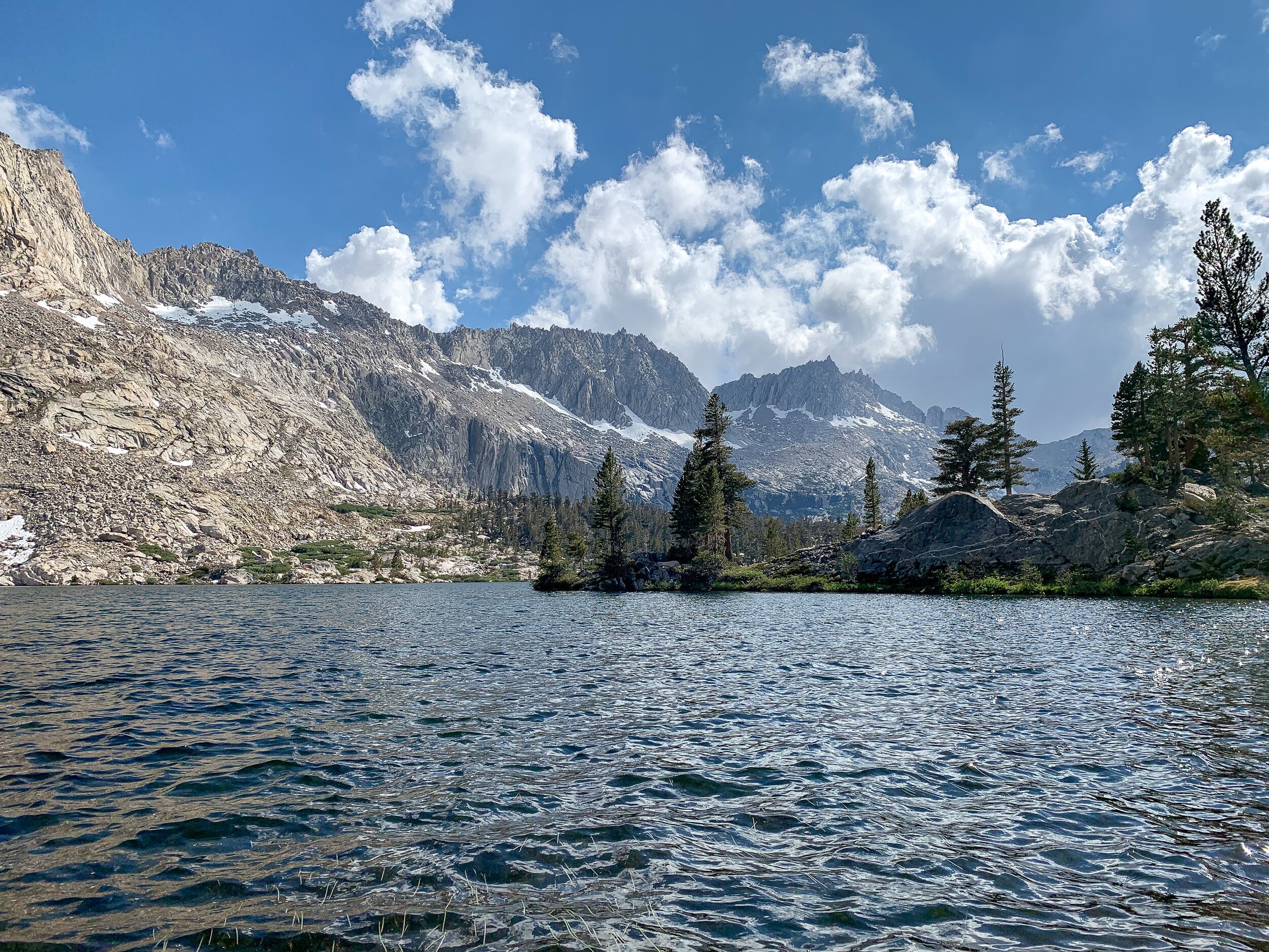
Middle Big Five Lake
Day Three:
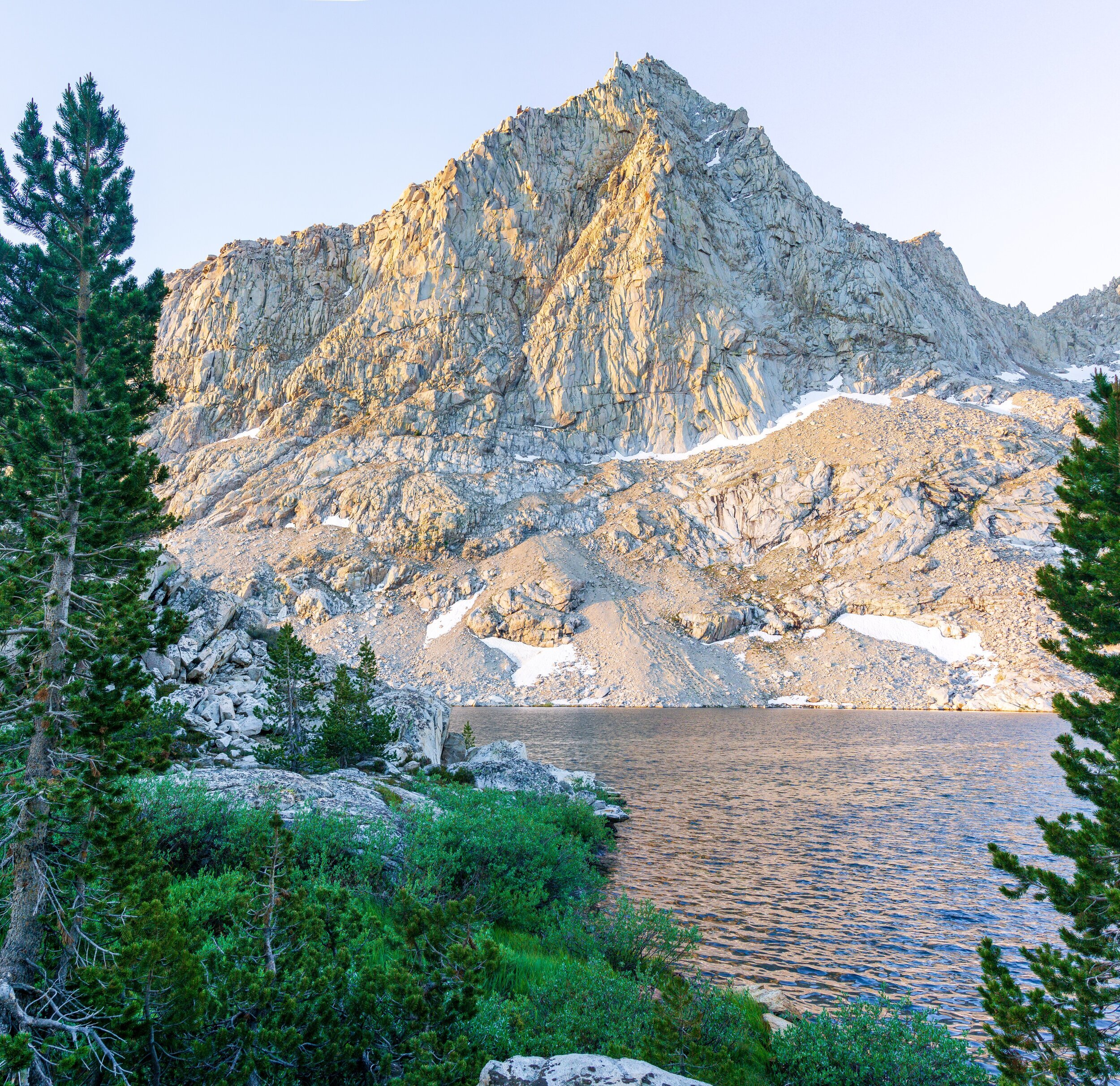
Today was our planned mellower day. I still woke up early, hoping for a decent sunrise. Around 6:00 am the sun hit the mountains, and it was very pretty. Too bad it was still windy and I couldn’t get a reflection. We took our time getting ready this morning. Holly made coffee and I had an actual breakfast. At 8:00 am we started hiking back to the trail junction. We got there before we knew it, and descended towards the lowest Big Five Lake. This lake was very pretty, but I’m happy we stayed higher up at the upper lakes. If you were going to be in a big group and/or wanted a campfire, the lower lake is perfect.


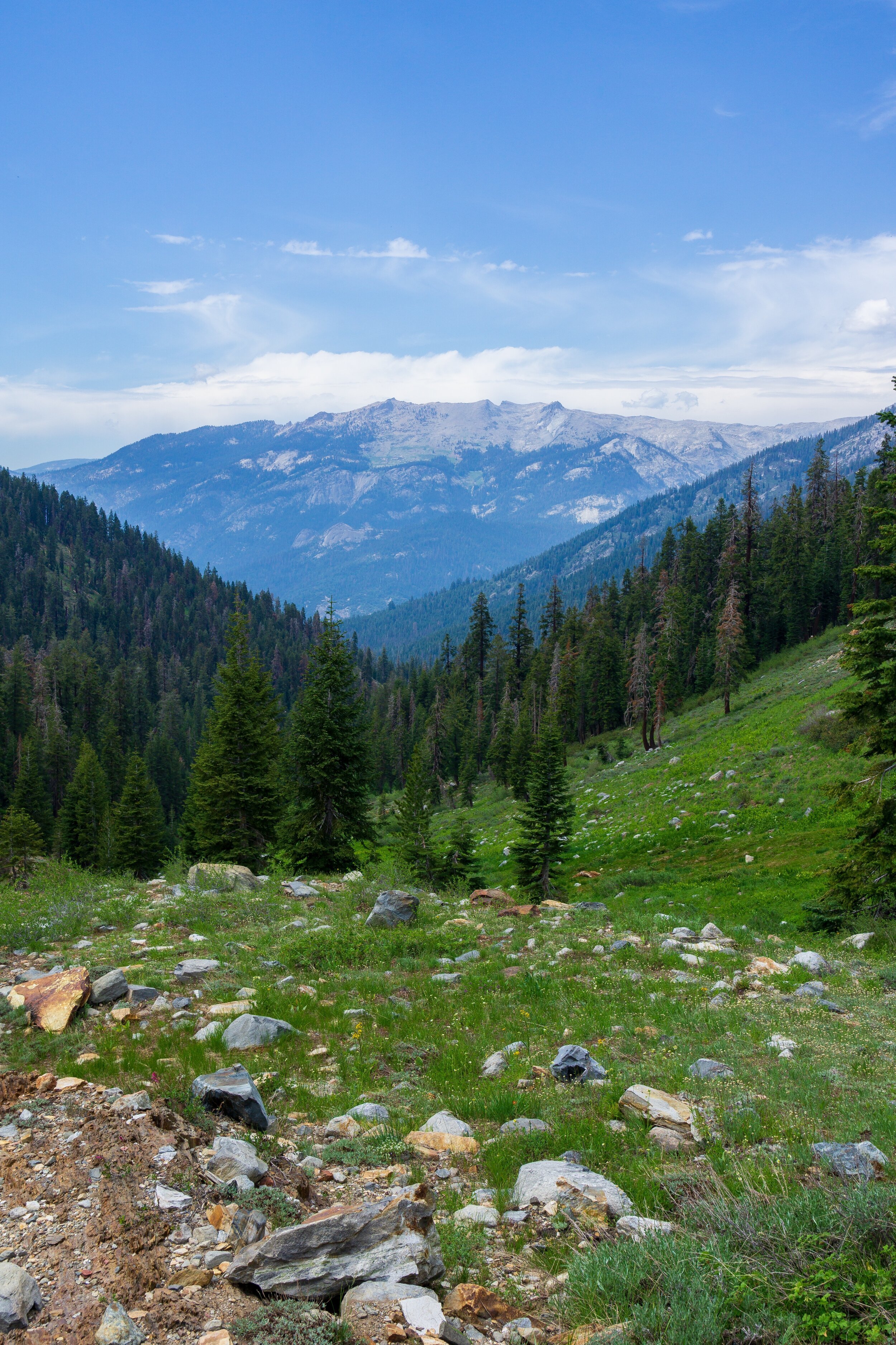
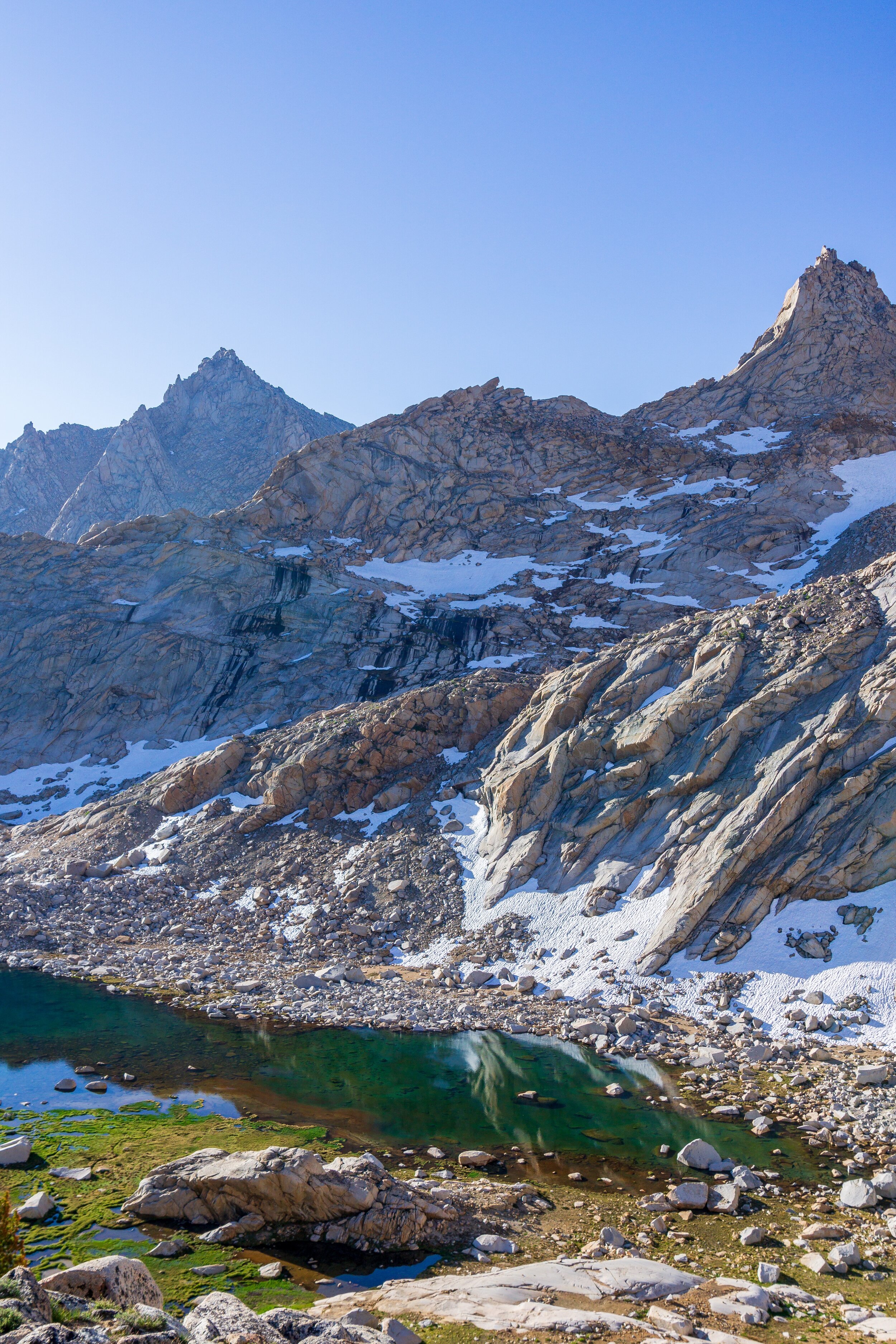
I misread the map for this section, and we ended up climbing out of the lower lake about 400 feet through stunted pine forests before descending again into Lost Canyon. The gradual climb up and through Lost Canyon was really nice. The trail follows Lost Canyon Creek the whole way, and it was serene to listen to the water flow. We ate lunch in the forested area near the creek right before the canyon opens up to a big, beautiful bowl with Sawtooth Peak and Needham Mountain showing off. The canyon was mind-blowingly stunning. Green plants, wildflowers, mountains with just a touch of snow on them, and the creek meandering through. The views kept getting better and better.


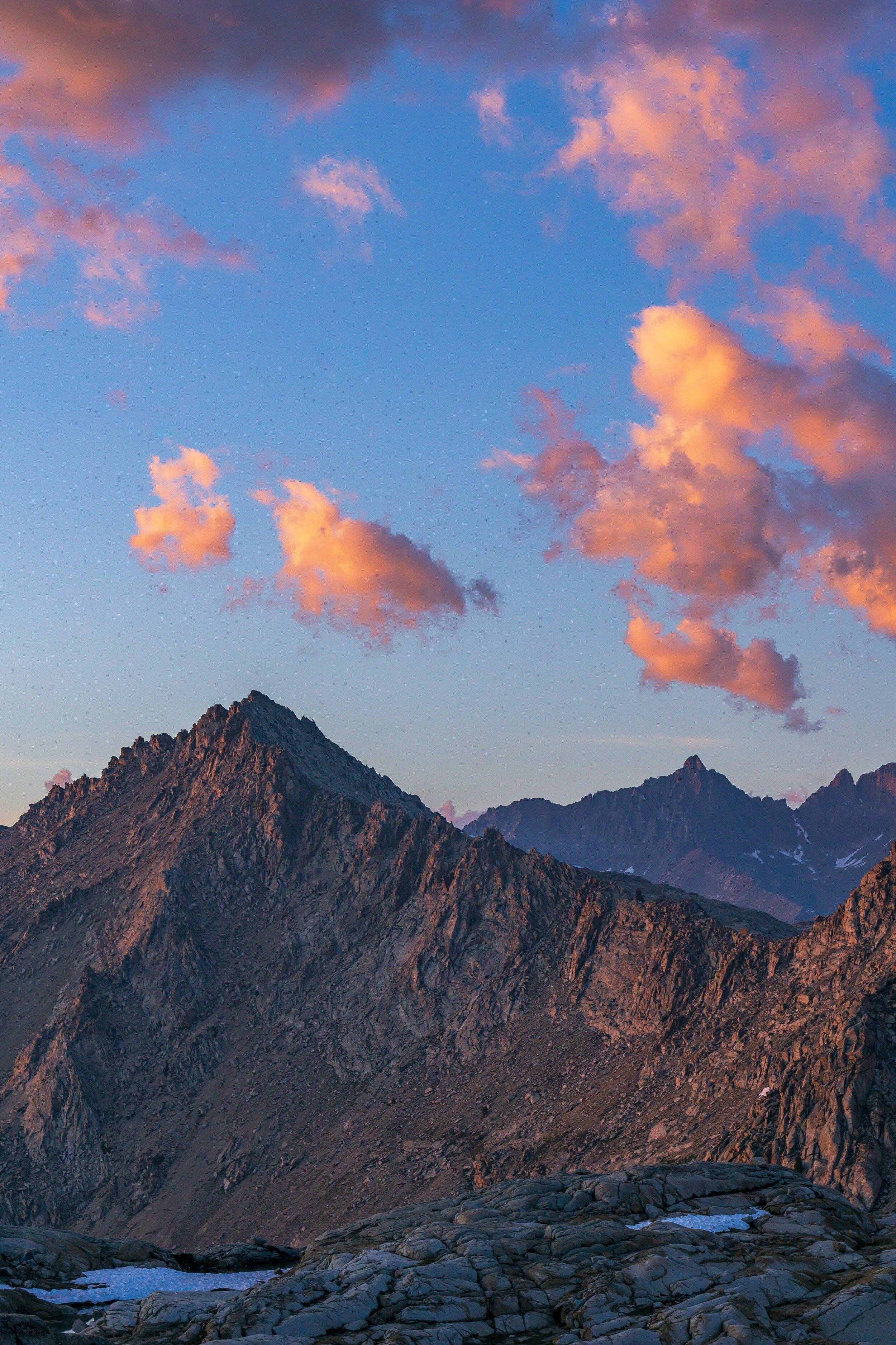
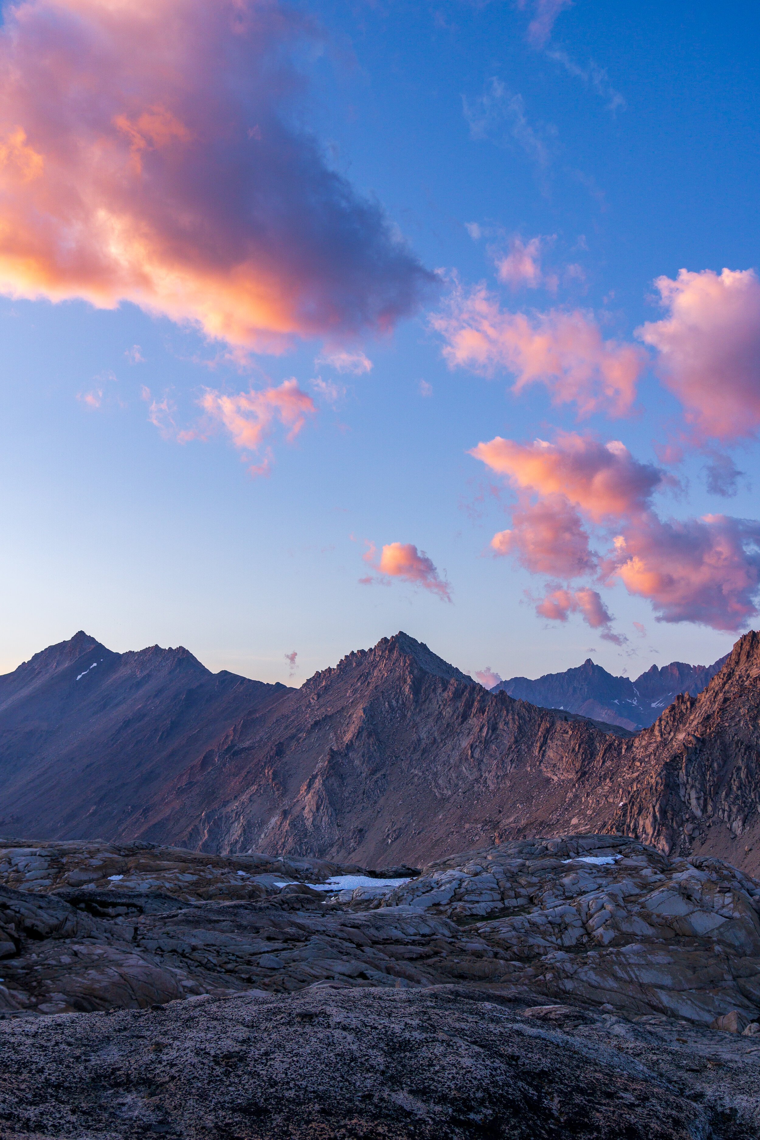
After a final #2 break in some trees (our campsite for the night is above treeline) and a water filtering stop, we approached the bottom of the big climb to Columbine Lake. It was about 600 feet up in less than a mile, but it ended up being one of the best graded climbs of the trip, plus the trail itself was in really nice condition. Mostly a light sand and some granite steps, not a lot of annoying rocks and roots in the way. Finally, we crested the top and saw the beautiful Columbine Lake with Sawtooth Peak standing stately overhead. The lake was so blue, and we even saw fish swimming around near the shores. Navigating around the outlet of Columbine was a bit of a route-finding game, following cairns and climbing the rocky ridges surrounding the lake. You have to camp 100+ feet from water at Columbine, and the campsites are very scattered. We heard from groups earlier in the day that we should continue climbing up towards Sawtooth Pass for some decent sites. This meant dry camping. So we took some time getting enough water to make it over the pass tomorrow, and I did a little exploring to find sites before we lugged our packs up.

Fast-moving clouds and a setting sun creates some awesome lighting situations.

We ended up finding a site about 100 vertical feet above the lake with great views of the lake and Black Rock Pass, Mount Eisen & Black Kaweah behind us. We laid down once we set our tents up - I like this relaxing at camp thing, haha - and after an hour or so, it was time to take more pictures and then eat dinner. After dinner, I took another lay down, listening to a podcast, until golden hour to take more pictures and watch the sunset. It was really cold during my lay down, but the wind died down for sunset, which was nice. But it’s still a little chilly at 11,200 feet! Sunset was pretty and peaceful. The fish in the lake were jumping like crazy, trying to get some bugs for dinner. Thankfully for us again, the bugs are not bad at all at this campsite. We lucked out!


Day Four:
We woke up bright and early to tackle Sawtooth Pass first thing. The trail was again a little bit of a route-finding game, trying to find cairns to follow up through the rocks, with trail re-emerging every 200 feet or so. The climb was so steep. I think I always feel more ready for climbs after about 1-2 miles of hiking in the day, not right off the bat. But, beggars, I mean, backpackers, can’t be choosers all of the time. After slowly struggling and panting up the pass, we finally made it! Columbine Lake looked so different behind us, and we snuck one last look at the mountains in the distance before turning our attention to the next leg of the hike. We rested and studied the “trail” down to Monarch Lakes, trying to decipher the best way down from up top while we could still get a good view of the whole mountainside. After our break, we followed the obvious trail north towards Glacier Pass before going down. There was a decently obvious trail for the beginning, but towards the middle and steepest parts of the descent, it petered out. We made some good guesses though and managed to stay on path for most of the descent. It was slow going though as every step had out feet sinking into the deep sandy scree. I recommend this way though - stay away from any exposed rock because it will send you sliding! We took turns safety descending really loose areas so we wouldn’t dislodge anything onto the bottom person and side-stepped/ boot skied down the mountainside. Finally, we hit trail again and we arrived at Monarch Lakes before we knew it!


We took a quick snack and bathroom break at the lake, wishing we could go swimming. But with a 6 hour drive home ahead of us, we had to get going. We filtered water at the lake’s outlet (always better than the lake itself), and continued down the trail. It was smooth sailing until we hit an obstructive pile of snow over the trail. Below the trail was a path, which I ended up taking, but it was soft, with terrible footholds, and super slick. Holly didn’t have much experience with that and I didn’t want to be responsible for a bad decision, so we troubleshooted a way for her to shimmy between the melting snow and the wall of the mountainside, which ended up working. When we continued down the trail and saw an unprepared family with flat sneakers and no poles, we almost begged them to take the shimmy route instead of the “path” below the trail. I hope they are doing ok!

The rest of the trail switchbacked through the forest towards the parking lot. And the air seemed to be getting hotter with every switchback we descended. I chomped through the rest of my food, the remaining Frito crumbs in my bag, as the slowest 4 miles of my life passed. Note to self: save enough food & water for the end so you’re not dying for the car. Once I saw the parking lot, I knew we were almost there! We whooped with joy as we unwrapped the car, used the toilet, and changed into car clothes. Unfortunately, that joy subsided once we got to the Silver City Resort and learned that the fruit pies were still setting and NOT AVAILABLE yet. It almost ruined my day. A double cheeseburger made it a little better, but pie à la mode was what I really wanted after that trip.
Questions or comments about the Five Lakes Loop? Let me know!
