

Backpacking Hetch Hetchy to Lake Vernon, Yosemite NP
When people think of Yosemite, they mostly think of the Valley: El Capitan, Half Dome, Yosemite Falls. Maybe they think of the high alpine meadows of Tuolumne Meadows, or the stunning views from Glacier Point. Most people don't think about the Hetch Hetchy reservoir or the northern wilderness. Let me tell you, it's highly underrated, and if you're looking for a one or two night backpacking trip with very few people, this loop should be on your list!
Note: Included in this blog post are links to the Outdoor Status permit notification website. These are affiliate links, and I will earn a small commission at no extra cost to you if you choose to participate in permit availability notifications. Thank you so much if you do use this service!
STATS
Date: 10.18.17 - 10.19.17
Miles: 25.6 mi
Elevation Profile: +8,830, -8,830
Trail Type: Loop
Special considerations: Bear canister required

Highlighted route in red. Red waypoints = bear sightings.


PERMITS
Yosemite National Park requires wilderness permits for all overnight backcountry stays. The permit system operates via a weekly lottery, which you can learn more about on recreation.gov.
This trip can be done clockwise (as described), or counterclockwise. The entry trailhead for the described route is Beehive Meadows, the entry trailhead for the counter-clockwise route is Rancheria Falls.
LOGISTICS
Hetch Hetchy is a little different than the rest of Yosemite. It has a different entrance than the rest of the park, accessible only from Highway 120 on the western side. For security reasons, the entry gate is actually closed overnight. So, you need to time your arrival at Hetch Hetchy correctly. This means arriving the night before the gates close (and staying in the $6/ person/ night backpackers campground) or arriving after the gates open the morning of your hike. Either way, if you are backpacking, park in the backpacker campground's lot, your first left turn after the entrance station. In this area is the backpacker's campground, food lockers to leave behind any scented items you don't want to take with you into the backcountry (but please clean your stuff out after you get back!), and flush toilets. There is a social trail from the camp to near the trailhead. Note: you must have a wilderness permit to stay the night at this campground.

Hetch Hetchy gate hours (2017)
THE HIKE
Day One: 11 miles, 4,100 ft elevation gain, 1,300 ft loss
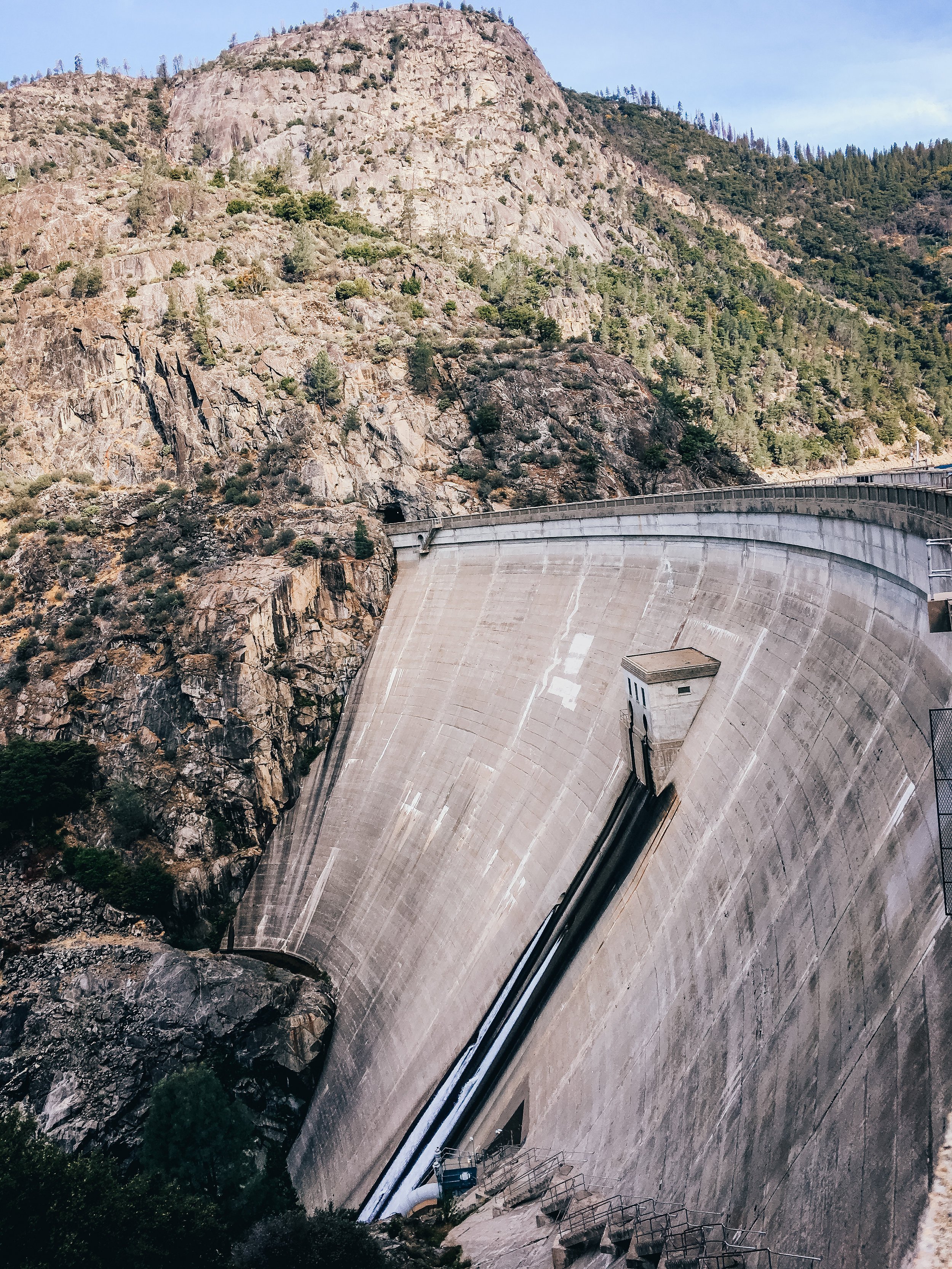
The trail officially begins at the O'Shaughnessy Dam. Walk over the dam and through the tunnel blasted through the granite. It's amazing to think about this dam (or any dam) holding back this much water. Though I am a resident of the Bay Area whose water comes from Hetch Hetchy (great drinking water, BTW), I am against the dam being here and in favor of restoring Hetch Hetchy, but I'll let you research that for yourself. For now, I stand in awe and sadness of the reservoir.


After a mile, you'll come across the first trail marker. You'll want to head to your left, and begin switchbacking up the walls of the valley.

You'll start to gain elevation quickly, but will also get some great views of the reservoir on your way up! And soak them in now, because you won't see it again until your second (or third) day!

Soon enough, the switchbacks will let up, and you'll reach another trail junction. Keep following the signs to Lake Vernon. We took a little rest at this trail junction to eat some snacks. It's a perfect spot with boulders and a large, open space. After continuing along for a little bit, we began seeing lots of fresh bear scat on the trail, easily identified by the amount of berries in it.

And sure enough, we rounded a bend in the trail and there was a mamma black bear and her cub! We were a little frightened: I hadn't been this close to a bear before, and Jazmin had never seen one in the wild. As one does with a black bear, we slowly backed away, maintaining eye contact and started talking loudly to it. They eventually moseyed away, and we gave them more time to get ahead of us, since they were obviously using the trail for getting around.


We kept running into them on the trail until they finally moved off of it, and hung out under a tree farther away and watched us hike and talk to a pair on the trail. The cub was definitely curious but cautious: looking at us while standing behind his mamma. The cub was so dang cute!
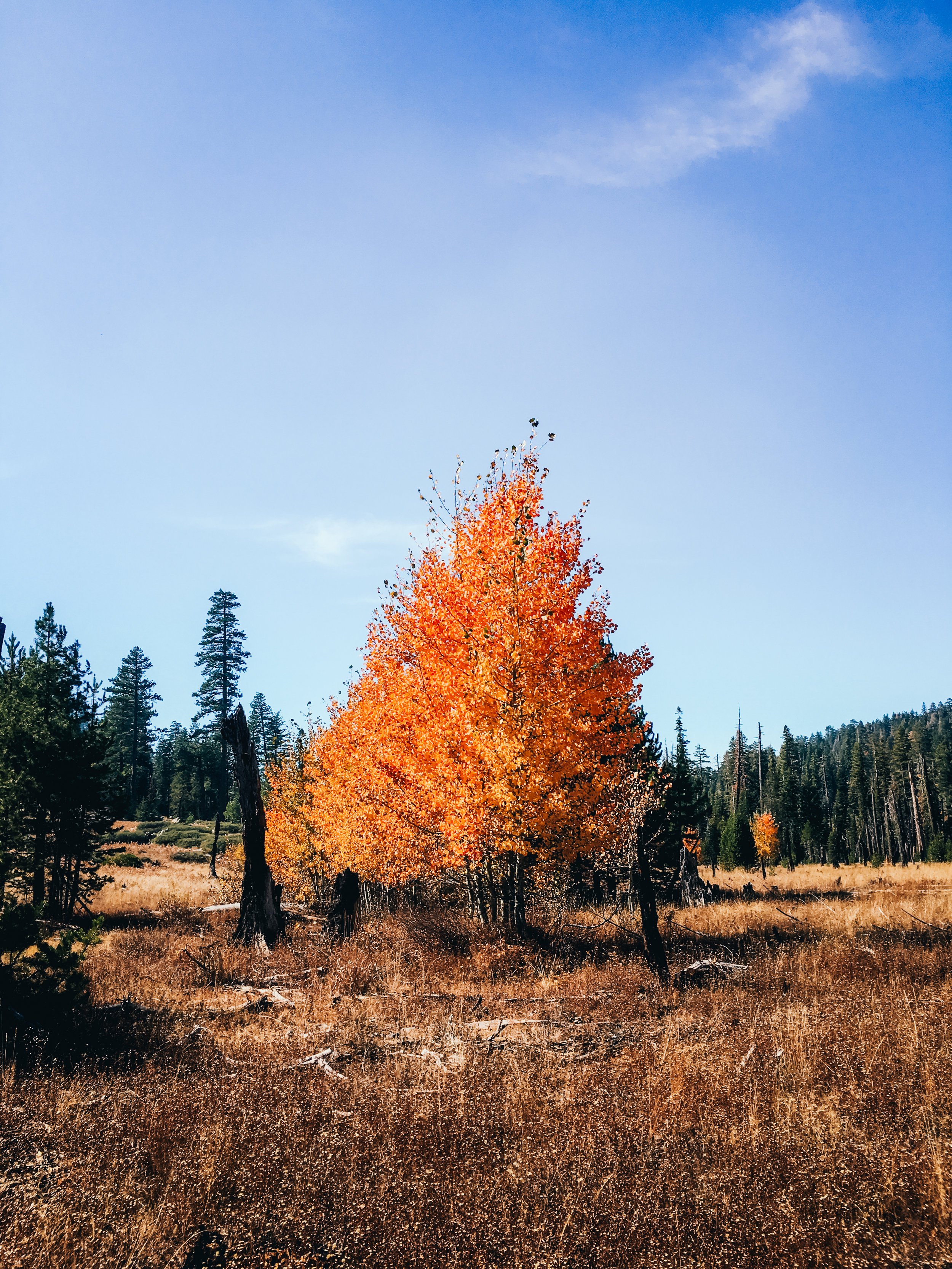
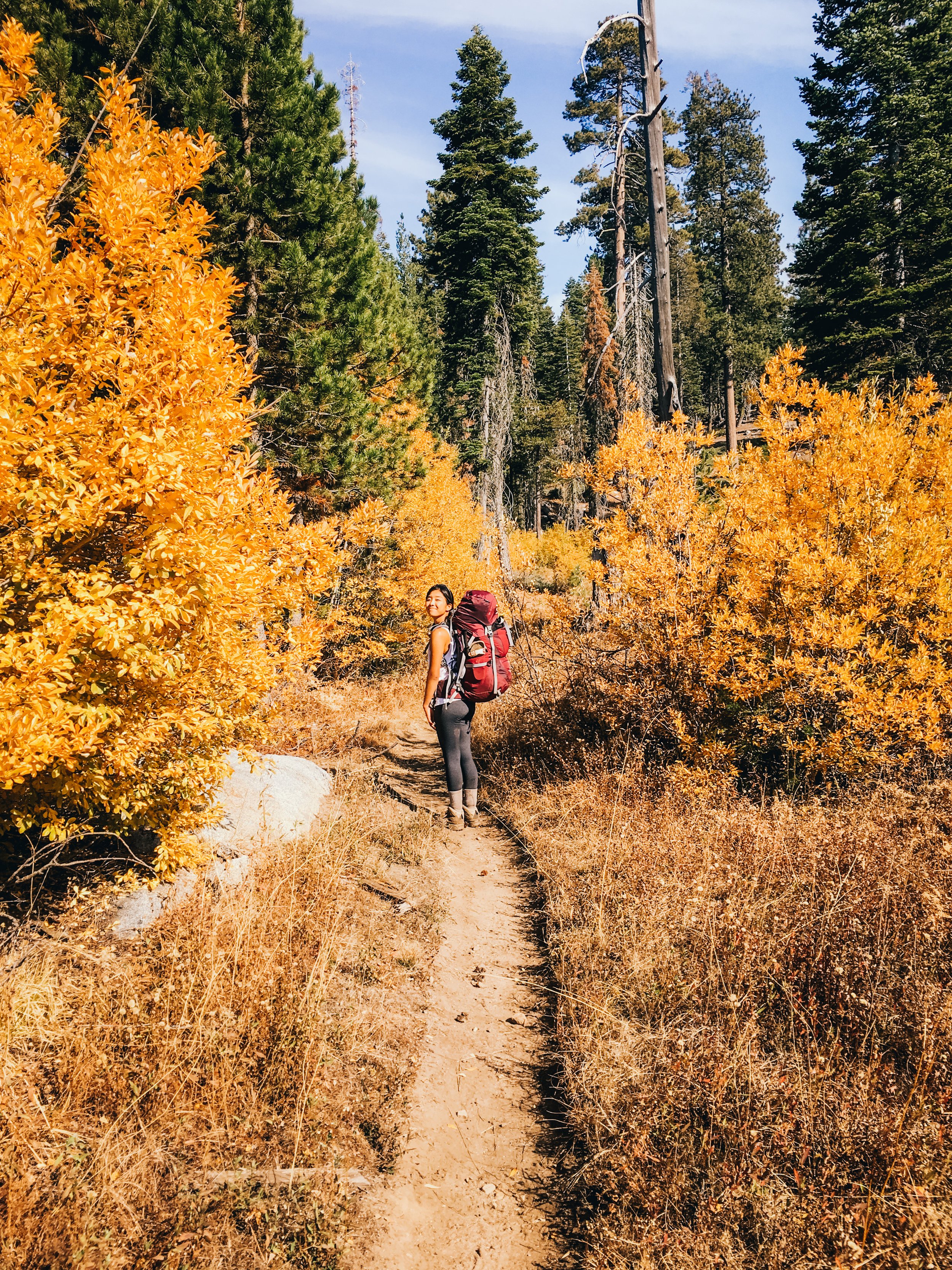
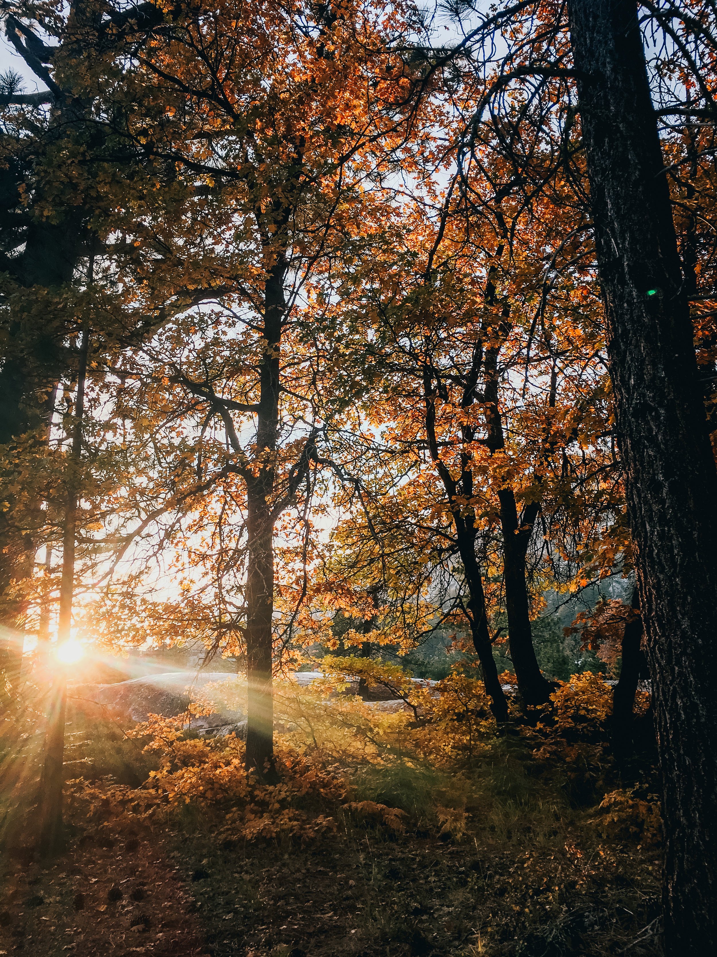
After our close encounters, we hustled up the trail, definitely with more attention. We also started talking more, to give any bears out there a heads up. The trail continued steadily climbing, but the incline was not too bad, and the fall colors were so beautiful, we had to stop to admire them.
There was a good amount of burned areas on this trail, but you could tell it was from a while ago since the growth coming back was pretty nice. It was nothing like the burned section of the Lost Valley like I experienced this summer.

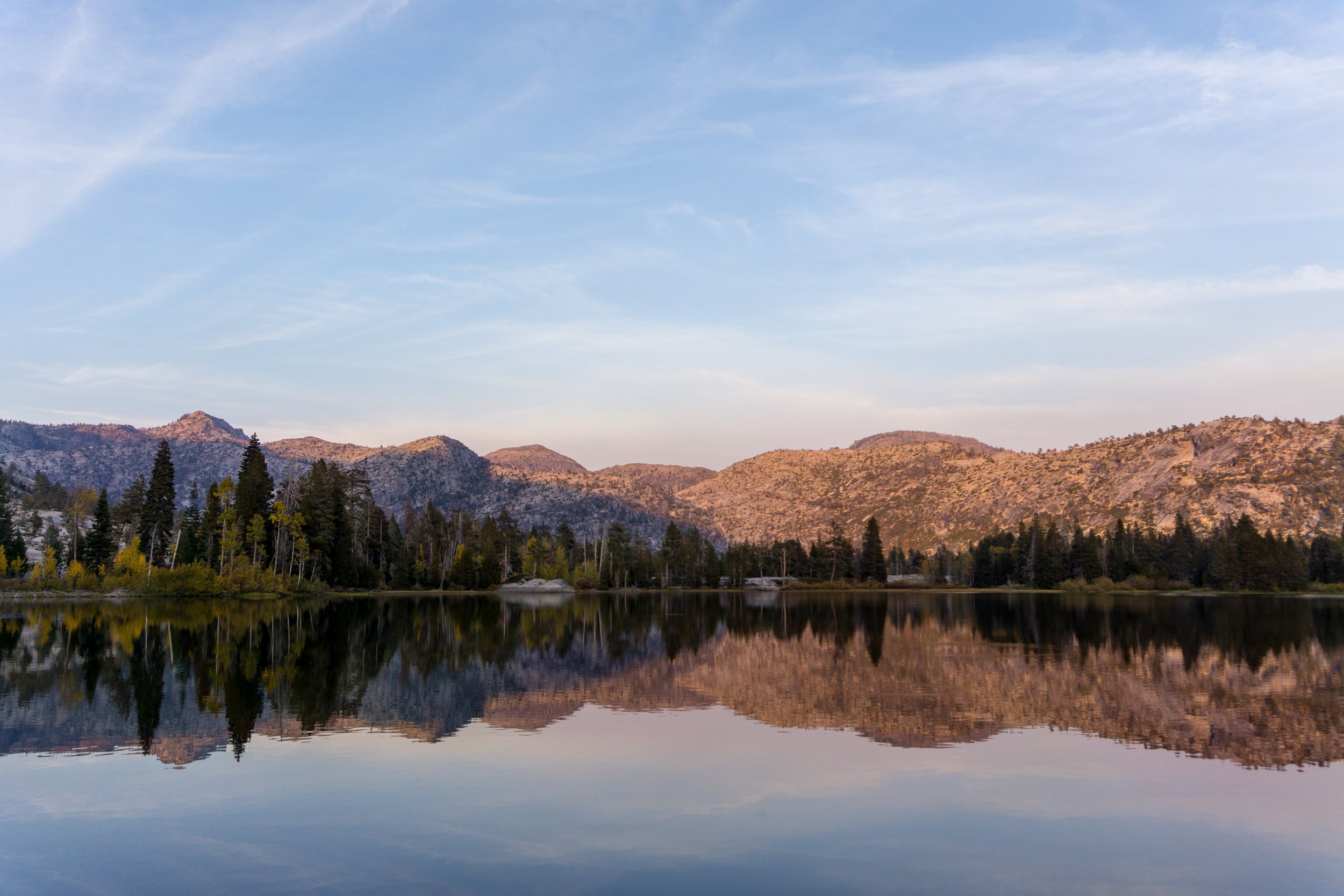
We climbed a little more, then took a lunch break in Beehive Meadows, at the junction to Laurel Lake. We only had a little longer to go before arriving at camp! The trail continues into the burnt forest, not nearly as exposed as the trail had been so far, and soon enough, after the junction to Jack Main Canyon, we started descending into the granite bowl of Lake Vernon, classic Yosemite high country!

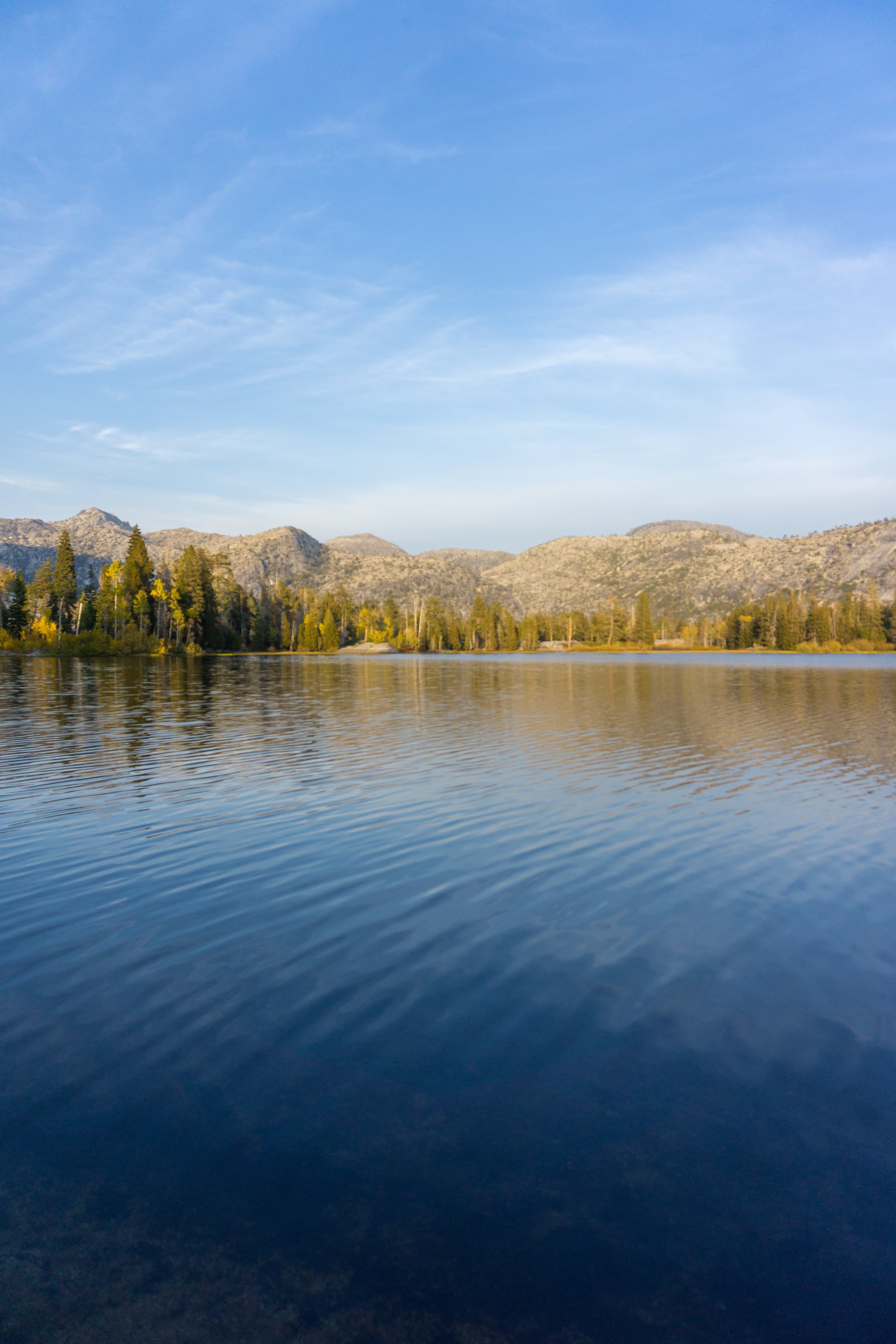
After only another mile hiking over the granite, we were at the lake! We found tons of campsites on the northwest side of the lake that are Leave No Trace friendly (aka on sandy/ granite surface, with pre-built fire rings, and 200 feet away from the lakeshore). We also saw some that clearly were not LNT friendly (within 100 ft of water, makeshift fire rings), and I went on a spiel about LNT to Jazmin. I think our campsite was AMAZING, and it was LNT approved!
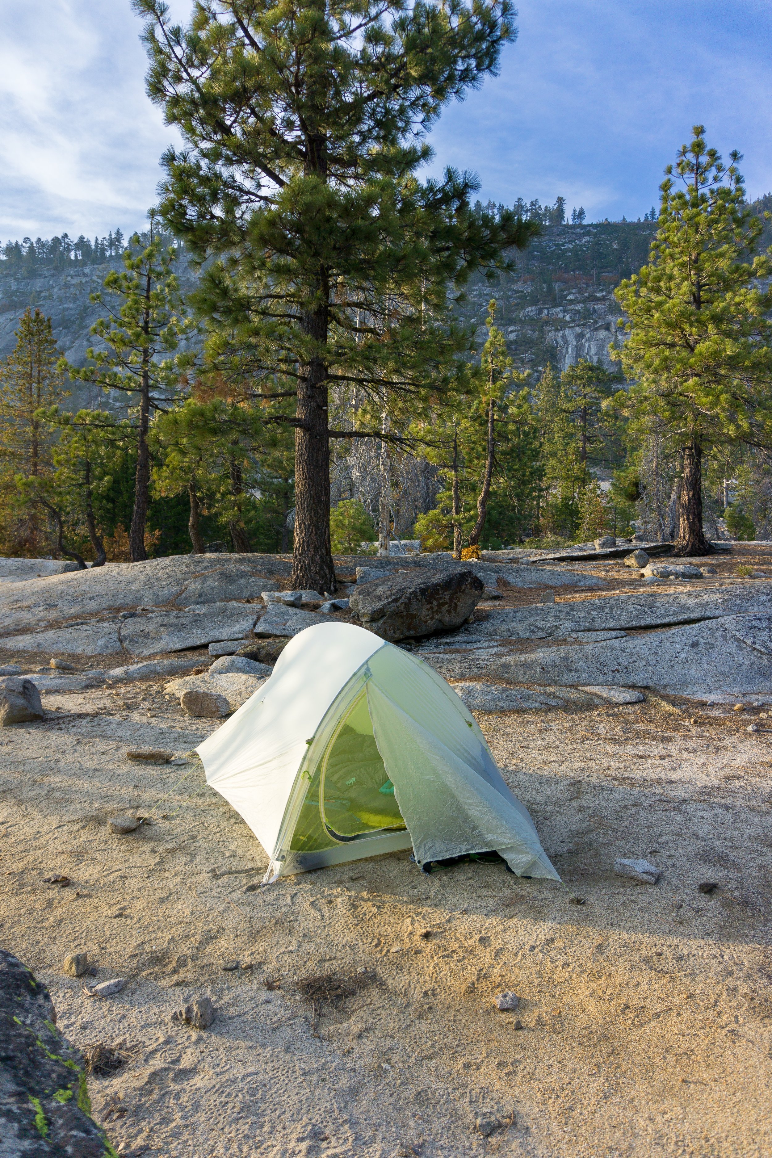
After setting up camp and doing some camp chores like filtering water and re-arringing our food into the bear canister, it was time to relax! I walked around our campsite and the lake a little bit and just admired the beauty. It was so quiet - we had the whole place to ourselves, which was amazing!
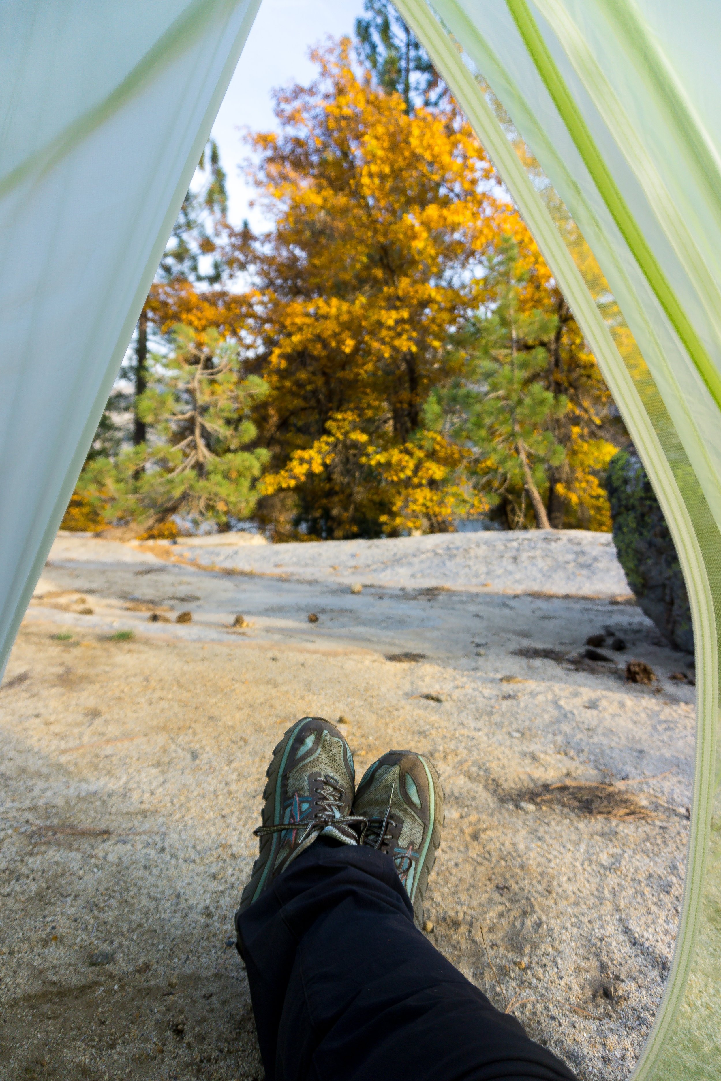
While I took photos (and marveled at the fall colors), Jazmin studied for her upcoming chemistry test!
Pretty soon, the sun started to set (so quickly in the fall!) so we prepared some yummy Mountain House Beef Stroganoff, got ready for bed, and hit the sleeping bags early!

Day Two: 16 miles, 4,750 ft elevation gain, 7,500 ft loss
We woke up early the next day, since we had a lot of ground to cover! About 16 miles, to be precise. I have to say, if I were to do this exact trail again, I would definitely split this day into 2 days, set up camp near Rancheria Falls and explore the swimming holes above the falls, and then exit the wilderness on day 3. But, this was Jazmin's first trip to Yosemite, and I wanted to show her around the Valley more after the trip, so we made do with two days!
When we woke up, we found our bear canister was a little frosty! We got the water boiling and then wrestled with the semi-frozen can with semi-frozen fingers until we finally got it open. Good thing I slept with my water filter last night, or it probably would have cracked and broken!

After another delicious breakfast by Mountain House (breakfast hash!) we broke down camp and promptly got hiking! After meeting up with the trail, we faced a lovely reminder that our first destination, Tiltill Valley was almost 7 miles away.

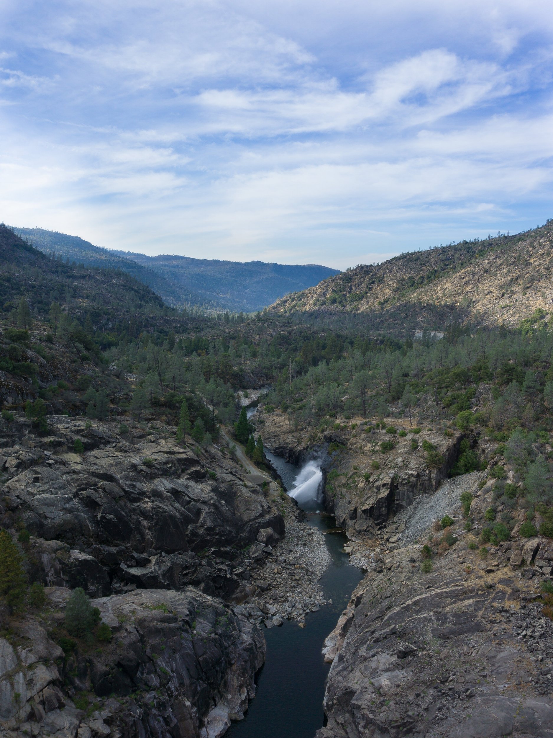
We had barely started hiking when we crossed the Lake Vernon outlet (aka Falls Creek) that will eventually lead to Wapama Falls! It really reminded me of the Merced River.

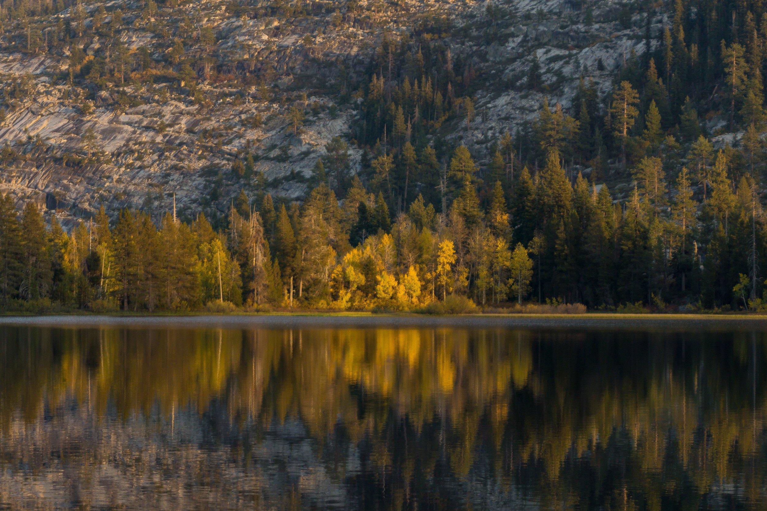
After crossing the river, we saw lots of great campsites on this side of the lake too, and they seemed to be LNT friendly! We then started climbing the granite switchbacks up and up, and got amazing views of Lake Vernon from above!


Good thing the views were so amazing - we needed an excuse the stop every few switchbacks and admire the beauty! Soon enough, we began leveling out and getting some distant views of the Hetch Hetchy Valley area (and some fire haze) before heading back into the forest.

The forested area was gorgeous. It reminded both of us of Washington.


The rest of the climbing wasn't too bad. We eventually gained a total of 1,000 ft from the lake, in about 2.5 miles. Pretty quickly, we emerged from the forest, and were welcomed by the beating morning sun and many many switchbacks down to Tiltill Valley.


After the burned switchbacks, we ended up in a nice forest of California Black Oak and Canyon White Oak trees, which were shedding their leaves and their acorns all over the trail. This area was pretty slippery and a little rocky. Tiltill Valley was absolutely gorgeous! Seeing it in the fall, I wonder what it looks like in the spring and summer! It was super dry and golden this time of year.

This was also the location of our second bear sighting! We saw some scat on the trail, and about 100 yards in the distance, on a rock formation in the middle of the meadow, we saw our third bear! This one definitely looked bigger than the mamma we saw yesterday, and much more similar in size to the one I saw in the summer, so we think it was a male (also, no cute cubs were following it around).
We were slightly nervous again since we couldn't tell which way the bear went, and the grass was so tall, we couldn't see the ground. But, we were pumped when we saw the trail marker!

For some reason, we felt like Hetch Hetchy should be so much closer than 9 miles away! But the marker was right: we still had quite a ways to go! After Tiltill, the trail gained about 500 feet of elevation again, and then the landscape shifted suddenly back to the Hetch Hetchy area: dry, rocky, and desert-like.
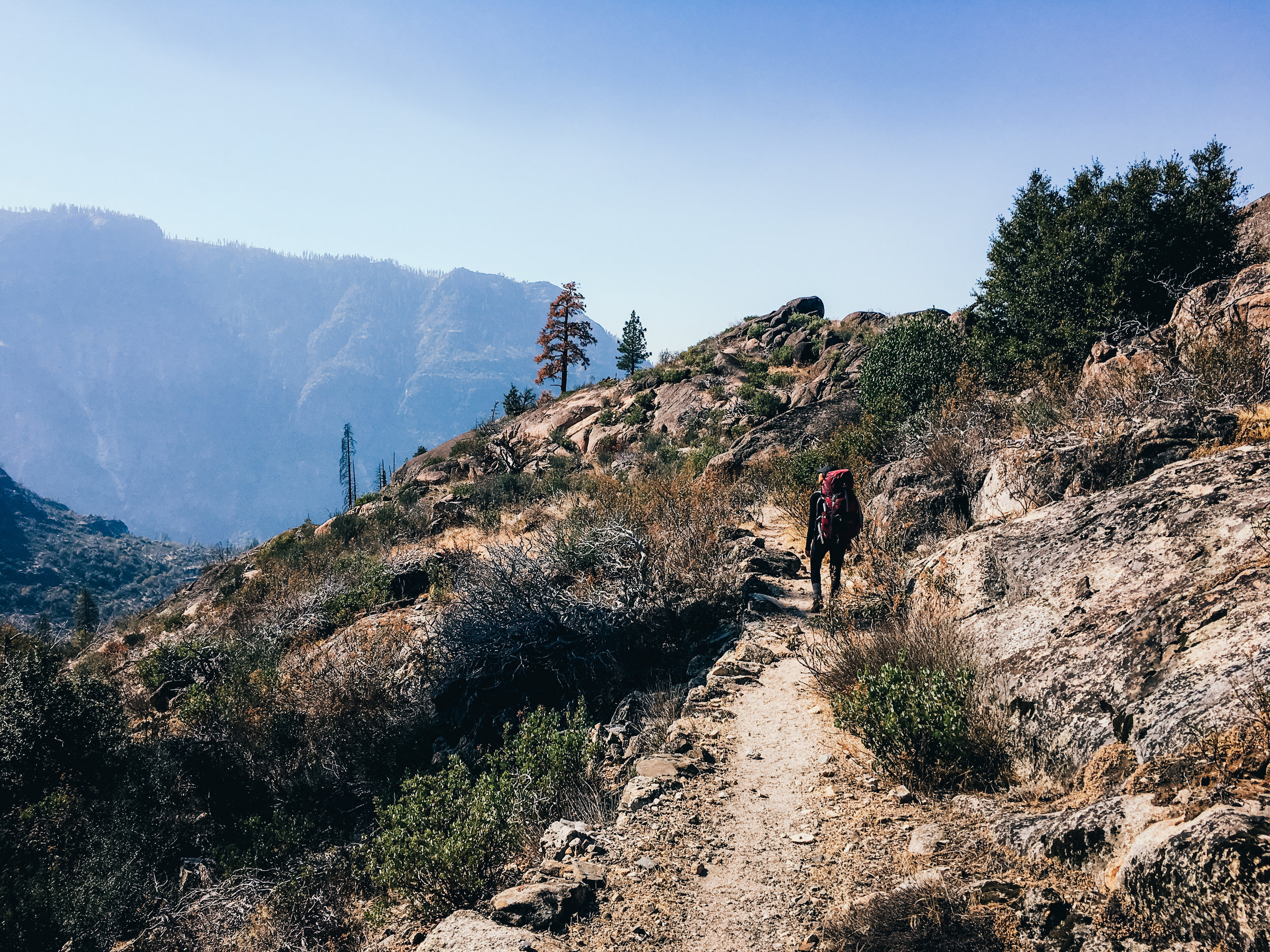
This is when the trail started dragging on for me. The Hetch Hetchy valley walls seemed so close, yet so far away at the same time! We were descending pretty rapidly on the rocky trail too, slipping in areas due to loose rock and steepness. But, we got to the top of Rancheria Falls pretty quickly. As I said earlier, if I were to do this again, I'd stop in the nice, open area here (slightly past the trail junction) and spend the rest of the day looking for the swimming holes above the falls (especially in late summer & early fall when it's still hot enough to warrant swimming & the water levels drop rapidly).
But, we continued on. We only had 5 miles left, though they would prove to be the longest miles of the day! We tracked our progress by footbridges.

The rest of the trail was decently difficult (at least, after already walking 10+ miles). I didn't read my topo maps closely enough, so was surprised by the up and down nature of the trail, especially surprised by the ~500 foot gain before Wapama Falls. We eventually made it through, with rests! Once we reached the Wapama Falls footbridges, I felt much better. Kolana Rock was behind us, the dam was looming larger, and the wind picked up, which drove the gnats away. We were in the home stretch!

Once the trail became less rocky and a little more level, we knew we were almost done!

Finally, we had reached the tunnel, and then the dam. We were done! We just had to walk back to the car and get back down to the valley! Overall, this was a successful, fun, and beautiful trip! I had never been to Hetch Hetchy, so it was cool to see a different side of Yosemite and have a new perspective. As I said earlier, I would split day 2 into 2 days, and turn this into a 3-day, 2-night trip, just so day 2 would be a little more enjoyable. Or, if doing this in 2 days again, I would do and out-and-back to Lake Vernon, because the first day's trail was very nice! But it was good to push the limits.
CONSIDERATIONS
Exposure: This trail is pretty exposed. I highly recommend sunscreen, especially when Hetch Hetchy is in sight since the sun is most intense in these areas.
Flies/ Gnats: These guys were soooo annoying in the exposed areas. I didn't bring my bug net on this trip since I knew the mosquitos would basically be gone, but I forgot about these guys! Good thing my Buff can cover my nose/ mouth, but I'd definitely bring a bug net next time. Jazmin got some mosquito bites, but I was untouched. I don't think bug spray is necessary for the fall, if you're looking to shave weight.
Bears: Bears are especially active in the fall due to entering hyperfasia: they must eat thousands of calories per day in order to sustain them through hibernation. Which probably explains why we saw 3 during the day, and we knew of at least 3 more (mamma + 2 cubs) that were seen in the middle of the day by other hikers. You must be alert while hiking and give the bears space, and always use your bear canister! Note: bear spray is illegal in Yosemite, and really isn't necessary when dealing with Black bears.
Water Sources: The water on this trail is scarce, especially on the hike to Lake Vernon. We did not pass any streams on day 1, so it is important to carry enough water with you to reach the lake. On the second day, there was accessible and good water in Tiltill valley. I would hazard a guess that the insane winter of 2017 is to thank for there still being flowing water in this area in mid-October. I would advise you to carry enough water to at least Rancheria Falls, and make the detour to the top/ near the water to filter if you need more to make it to the trailhead. But you won't see any more accessible water until the trailhead spigots if you don't fill up in Tiltill Valley or Rancheria falls. You may be able to grab some water at the base of Wapama falls - at the end of one of the footbridges, there seemed to be easy access to a pool on the cliff side of the base. Extreme caution should be used, however.
Check out this adventure on The Outbound.