

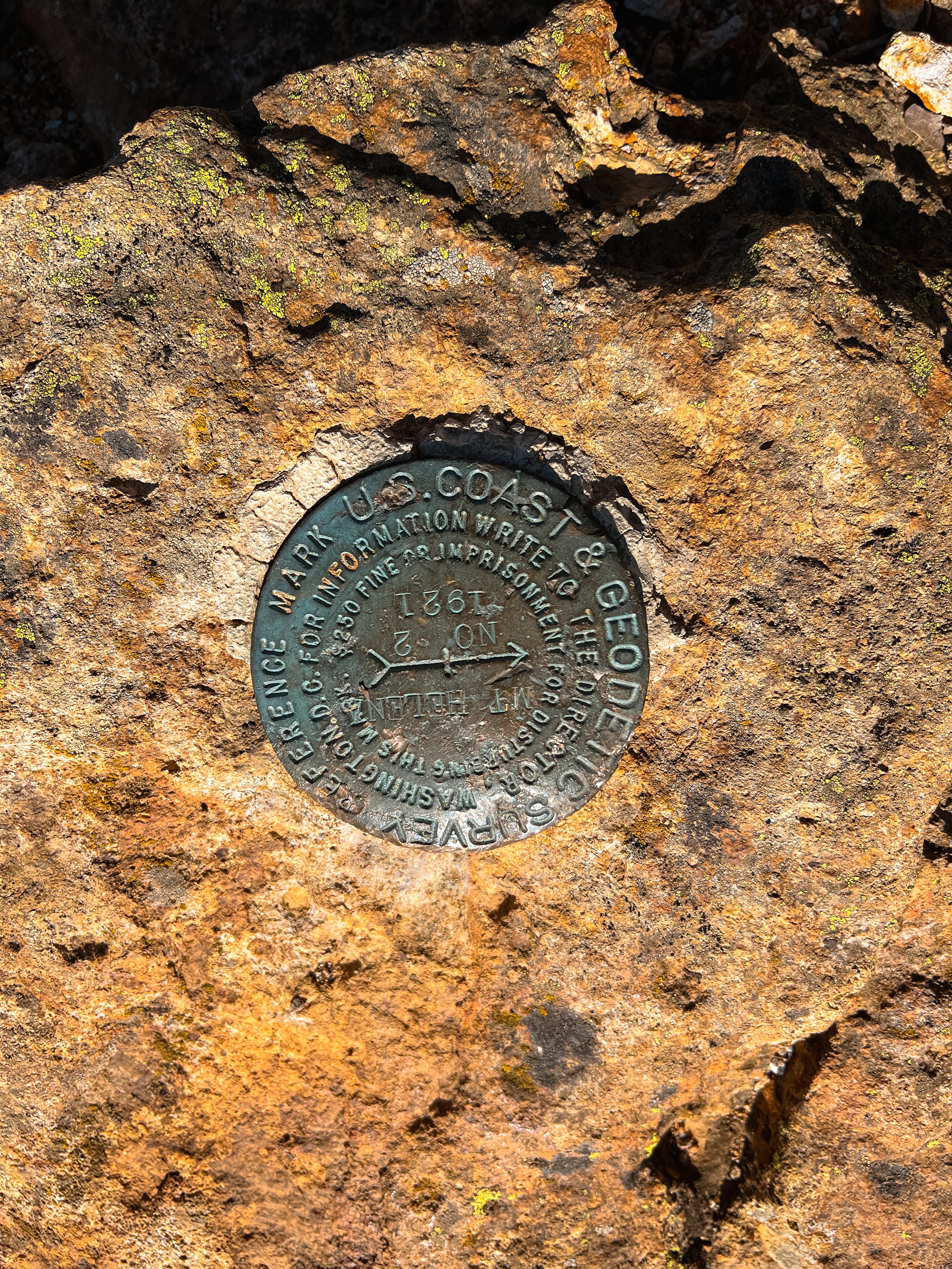
Spur: Mount Saint Helena Summit
Bay Area Ridge Trail Stats
Section: Robert Louis Stevenson State Park to Mt. Saint Helena Spur
Trail Mileage: 5 miles
My total miles to date: 56.9 miles
Date Hiked: 10.29.2022
Difficulty: Moderate
The Full Hike: Stevenson Memorial Trail to Mt. Saint Helena Trail and back. 10 miles.


Logistics & Parking

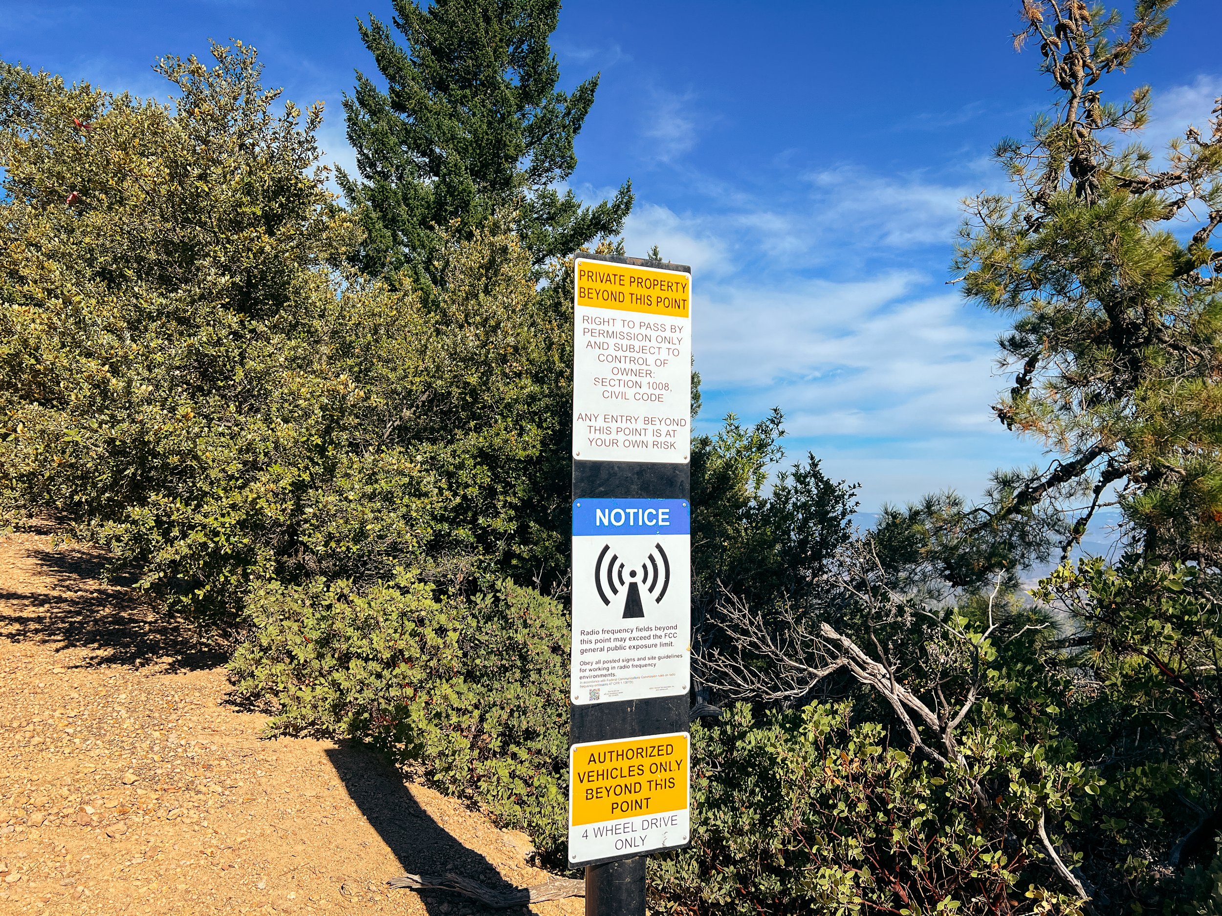
This hike is pretty straightforward. Because this is a spur trail, there is no connector or loop to be made. Just a simple out-and-back from the trailhead parking lot on the side of Hwy 29. The official Ridge Trail is along a multi-use trail whose trailhead is further up the road. But since the highway is a little sketchy and there is not adequate parking, the Ridge Trail Council highly encourages hikers to park at the Table Rock Trailhead, carefully cross highway 29, and hike the Stevenson Memorial Trail up to the Mt. Saint Helena Trail.
There is currently no fee to park at the trailhead for Mt. Saint Helena.
The Ridge Trail does continue south from this parking area onto the Table Rock Spur Trail and all the way down to the outskirts of Calistoga to the Oat Mine Trailhead. The section of trail between these two trailheads is 2 full sections and 10.5 miles!
I keep writing “spur trail” in regard to this section. Because that is officially what the Bay Area Ridge Trail Council considers it as. It is not the “primary” trail. Same with the Palisades portion of the Table Rock Spur Trail. Now, why hike it? Well, if they didn’t care about these 11ish miles being part of the Ridge Trail, then why would it get any kind of dedication? I will be including these miles in my primary ridge trail mileage tracker, along with any other spur trails I decide to do. The spur is also in the official section tracker for Ridge Trail circumnavigators.
Trail Notes
Day two of my little weekend trip up to wine country to do some BART miles. To be honest, when I woke up in the morning after the Bothe-Napa section the day before, I was not exactly in the hiking groove. But that quickly changed once we got on the trail.
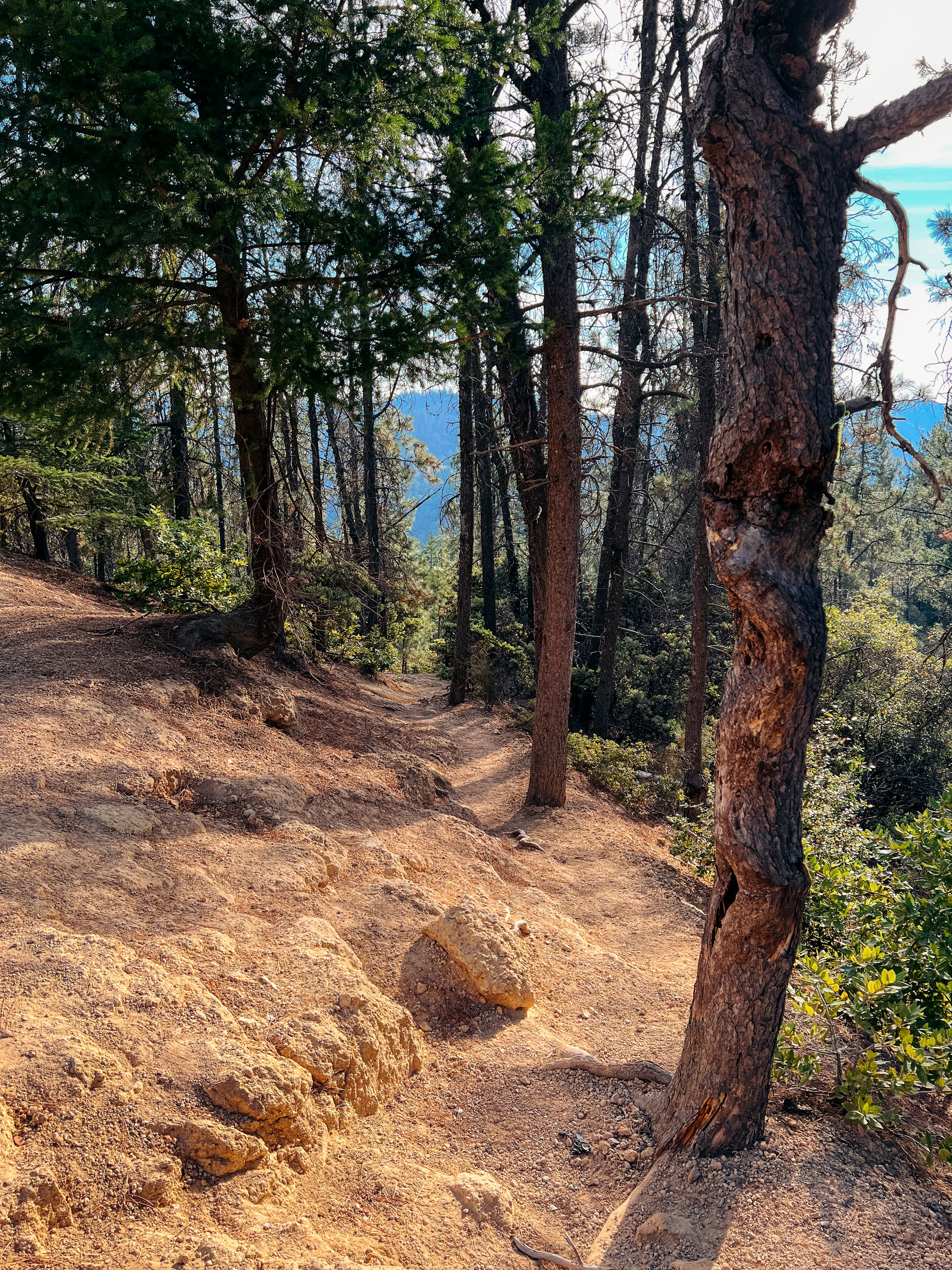
In contrast to yesterday’s slightly boring and bushwhacky experience, the hike today started great. The Stevenson Memorial Trail was an immediate climb, but on well-graded switchbacks underneath lots of tree cover. The difference in vibe was noticeable immediately, and it was a little exciting toward the top of the trail as it is reaching the main Mt. Saint Helena trail with the trail being more rock than dirt.
After 0.8 miles of the hiker-only trail, we joined the main fire road that would take us all the way to the summit. We started climbing up, after letting a really large group of people pass. I’m not the biggest fan of hiking with a huge group, especially when I’m not a part of it. It’s just easiest to let those groups go ahead of you, or if you’re a power hiker, speed up considerably for a mile or so and leave them behind. We had no plans for the day and no need to be speedy, so we hung back, taking our sweet time, and enjoying every view we had.
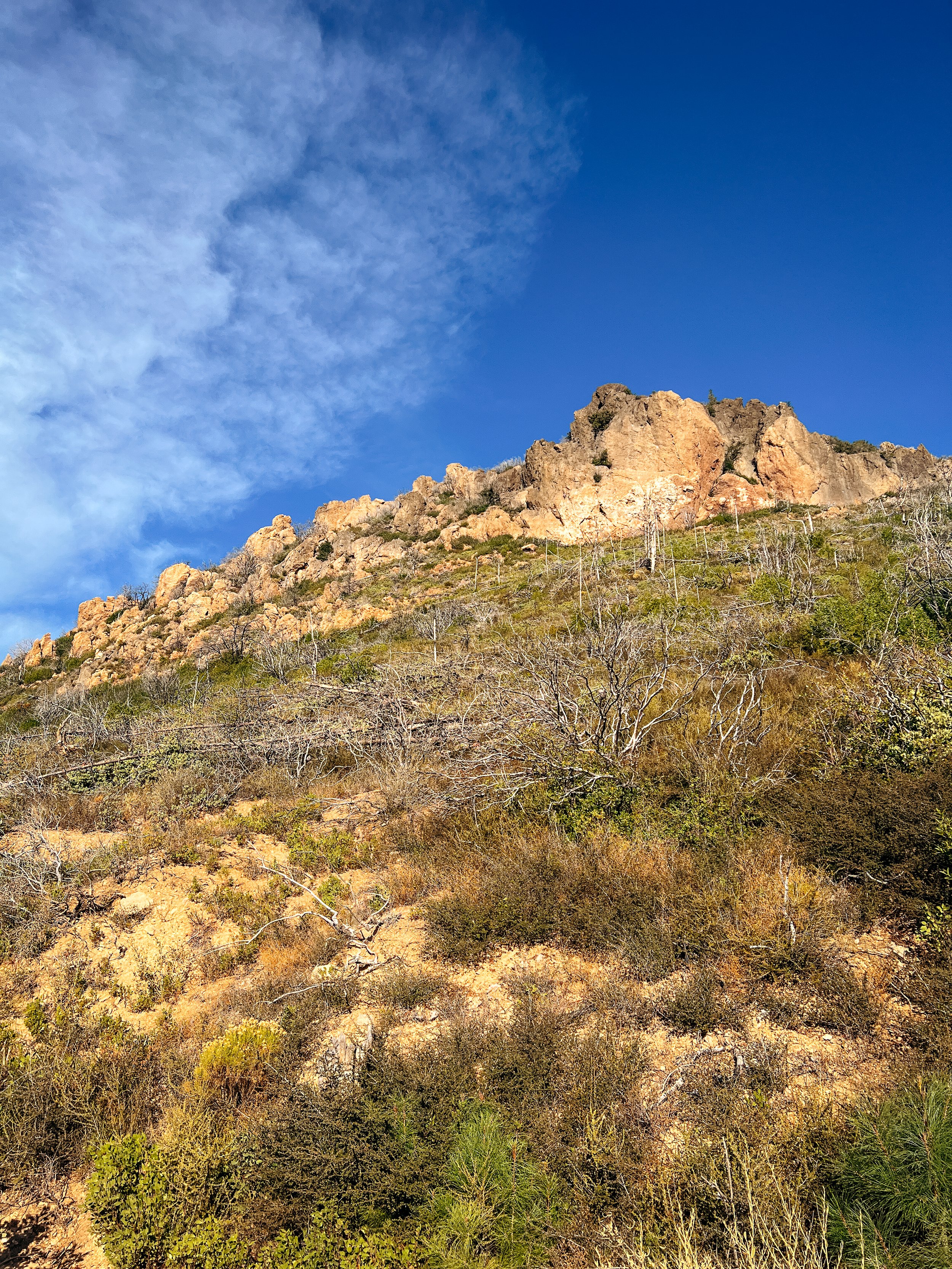
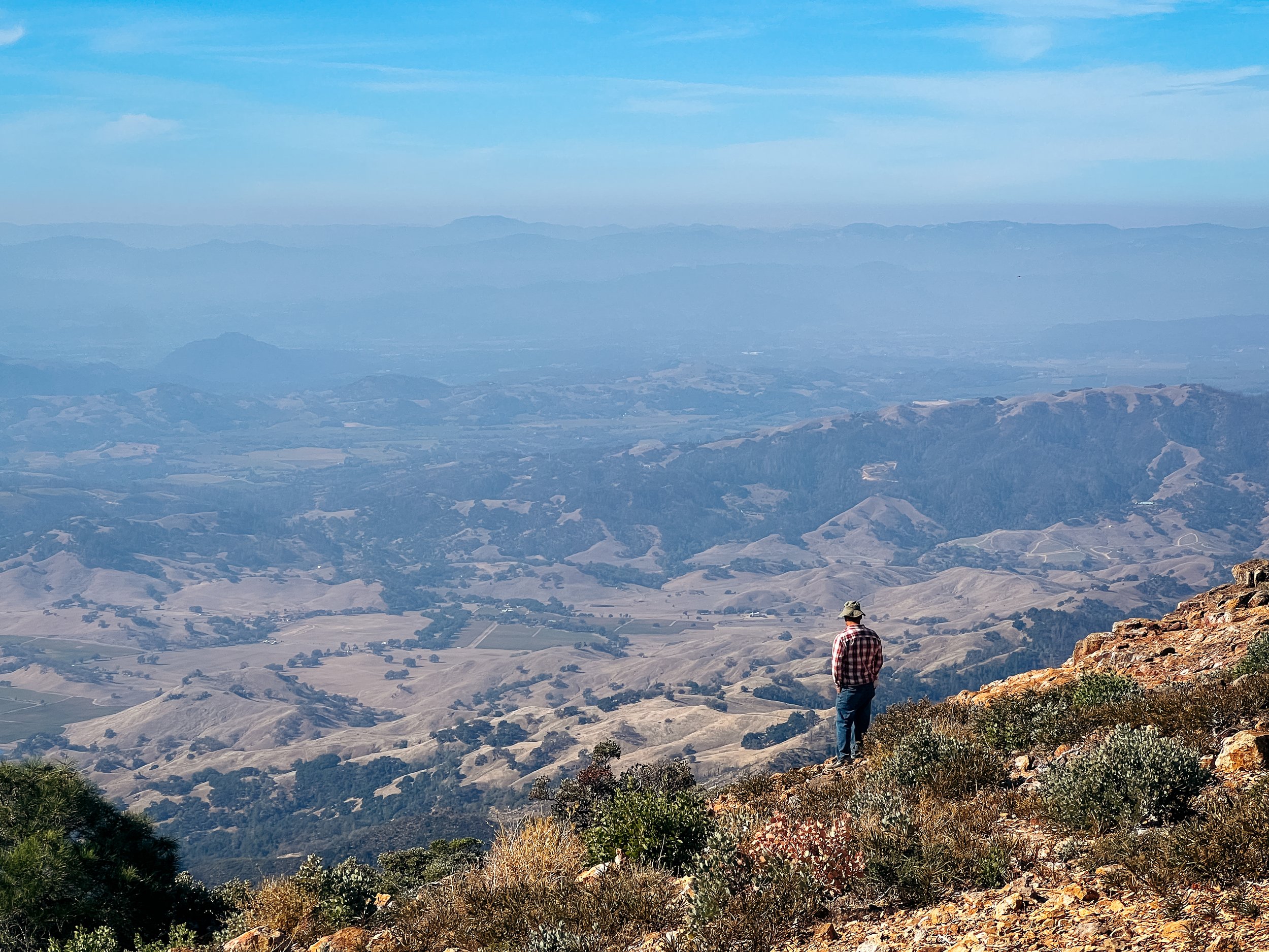
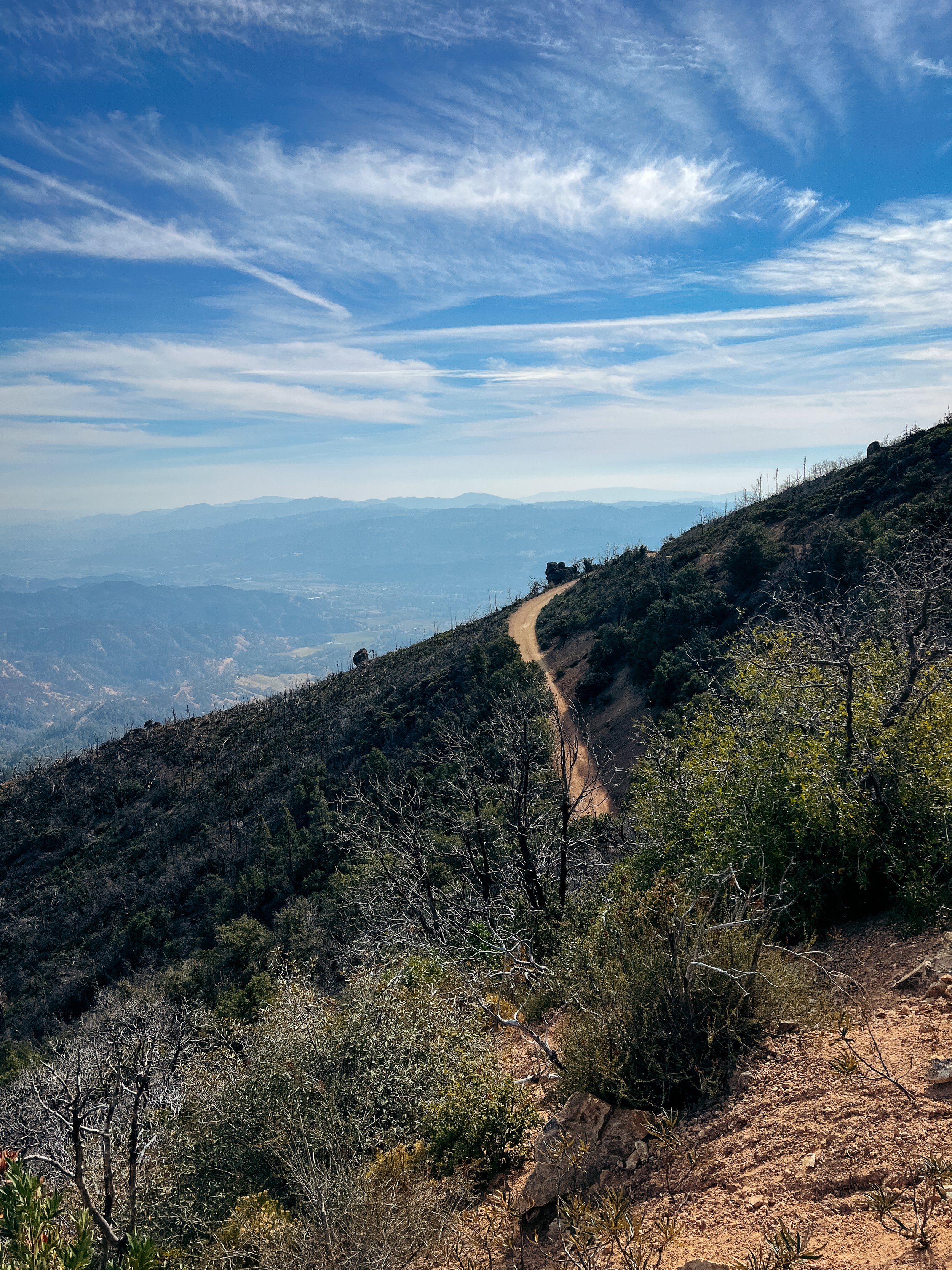
And the views started quickly! After only a half mile, we got our first views of Napa Valley below and the rocks above us. The views are unencumbered, as this mountain burned during the Tubbs Fire in 2017. The trail continued uphill, but at a very pleasant grade. It honestly felt like we were barely going uphill at times on this part of the trail. But we were making our way up, closer to the volcanic rocks above us. A real treat was getting to see a bunch of rock climbers on different parts of the craggy rock formation above us.
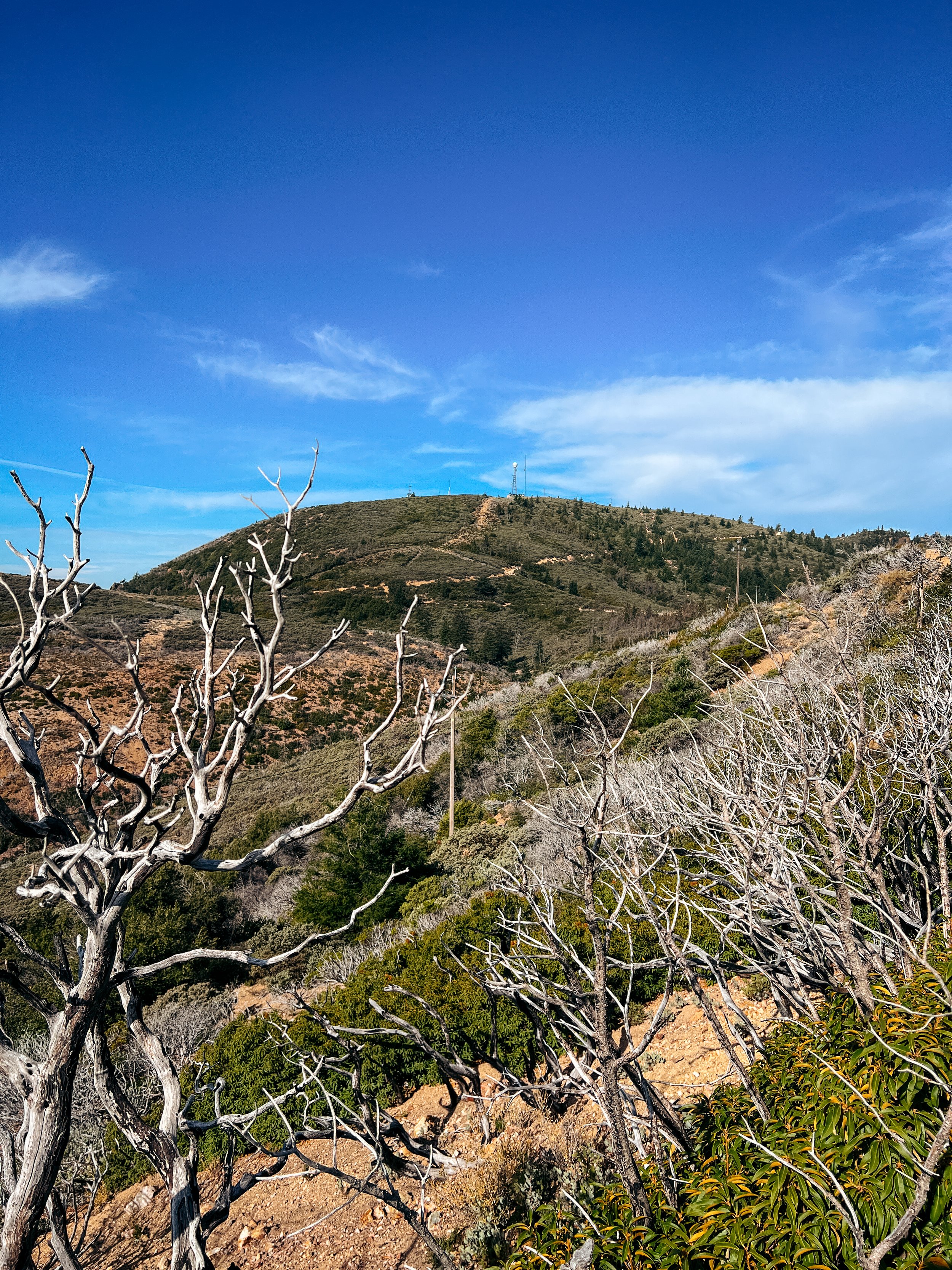
As we passed these rock formations and climbed higher, we reached a saddle - that I definitely thought was going to be near the top of the climb (spoiler: it wasn’t). At this saddle, there was a trail that split to the south peak - a shorter hike - but the Ridge Trail to the actual summit continued straight and slightly downhill/ flat. From here, we got a good view of the summit ahead: and we noticed there was still a decent amount of climbing to do!
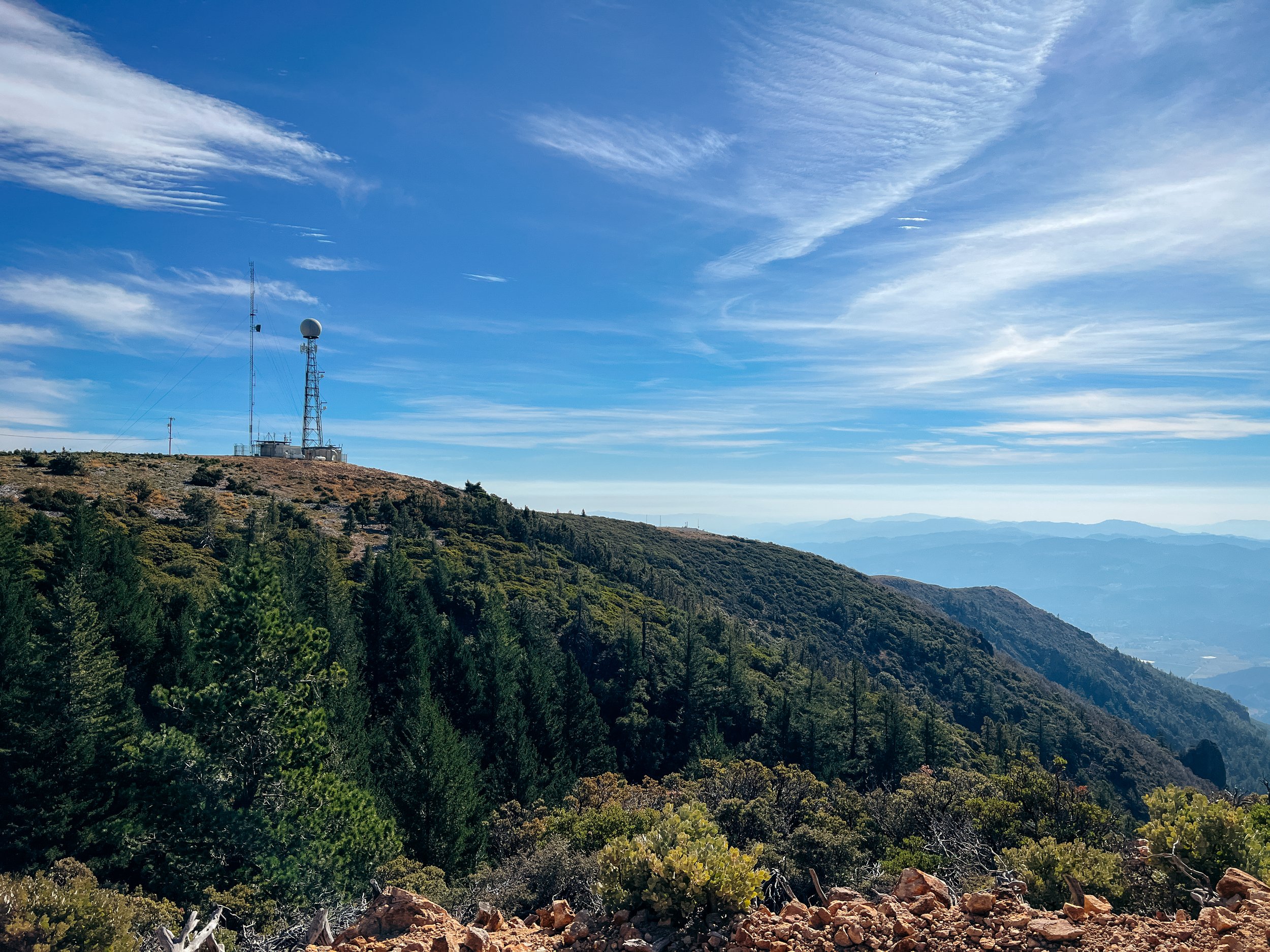
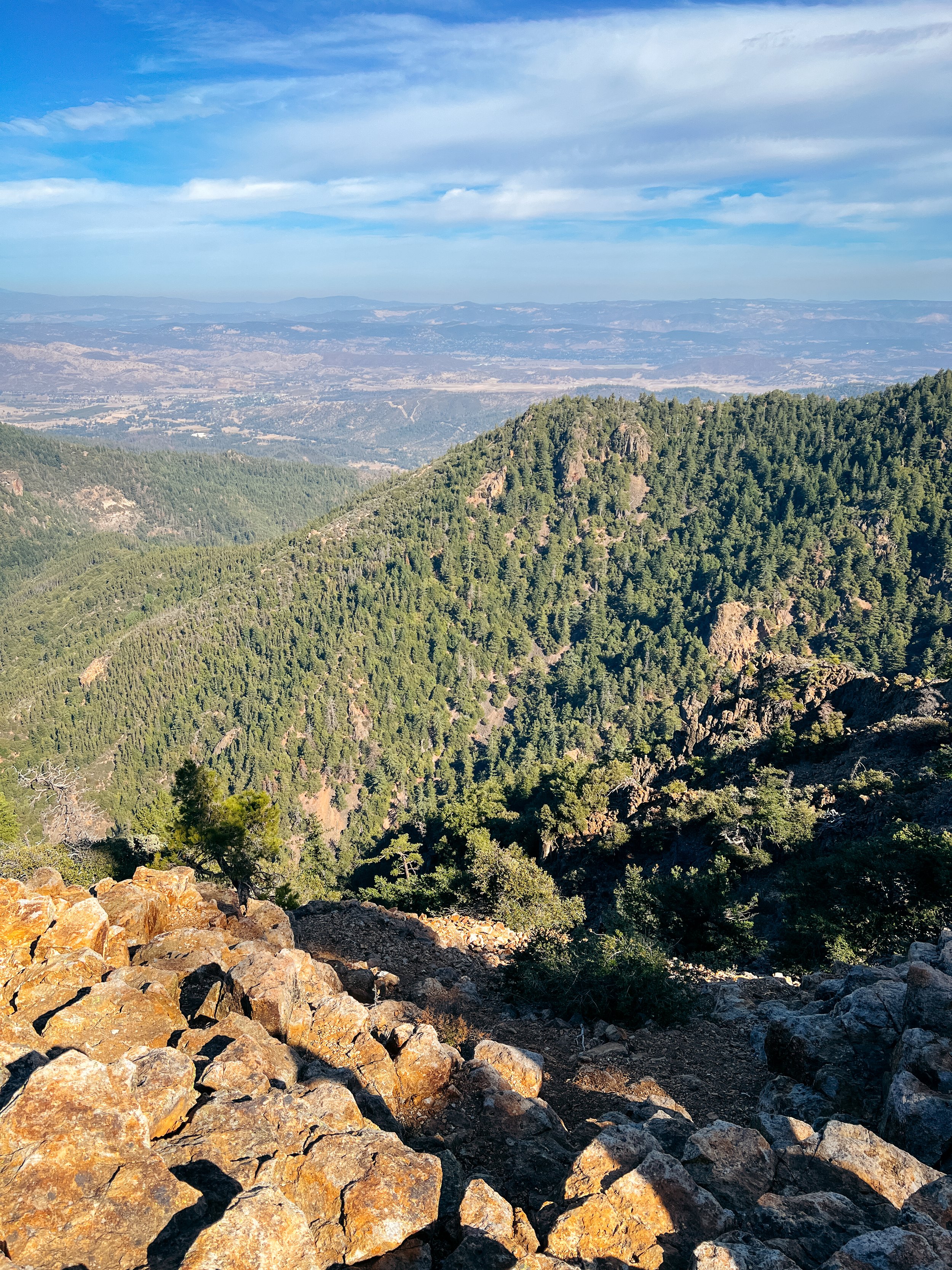
After this long saddle, we climbed up again, a little more steeply than earlier on the trail up the mountain. This continued for about a mile until the trail reached another juncture on the left to a communication tower. We kept straight, seeing the taller peak in the distance and realizing that was the actual summit! A nice respite from the sun was a tree-lined portion of the trail right before the last steep push to the summit.
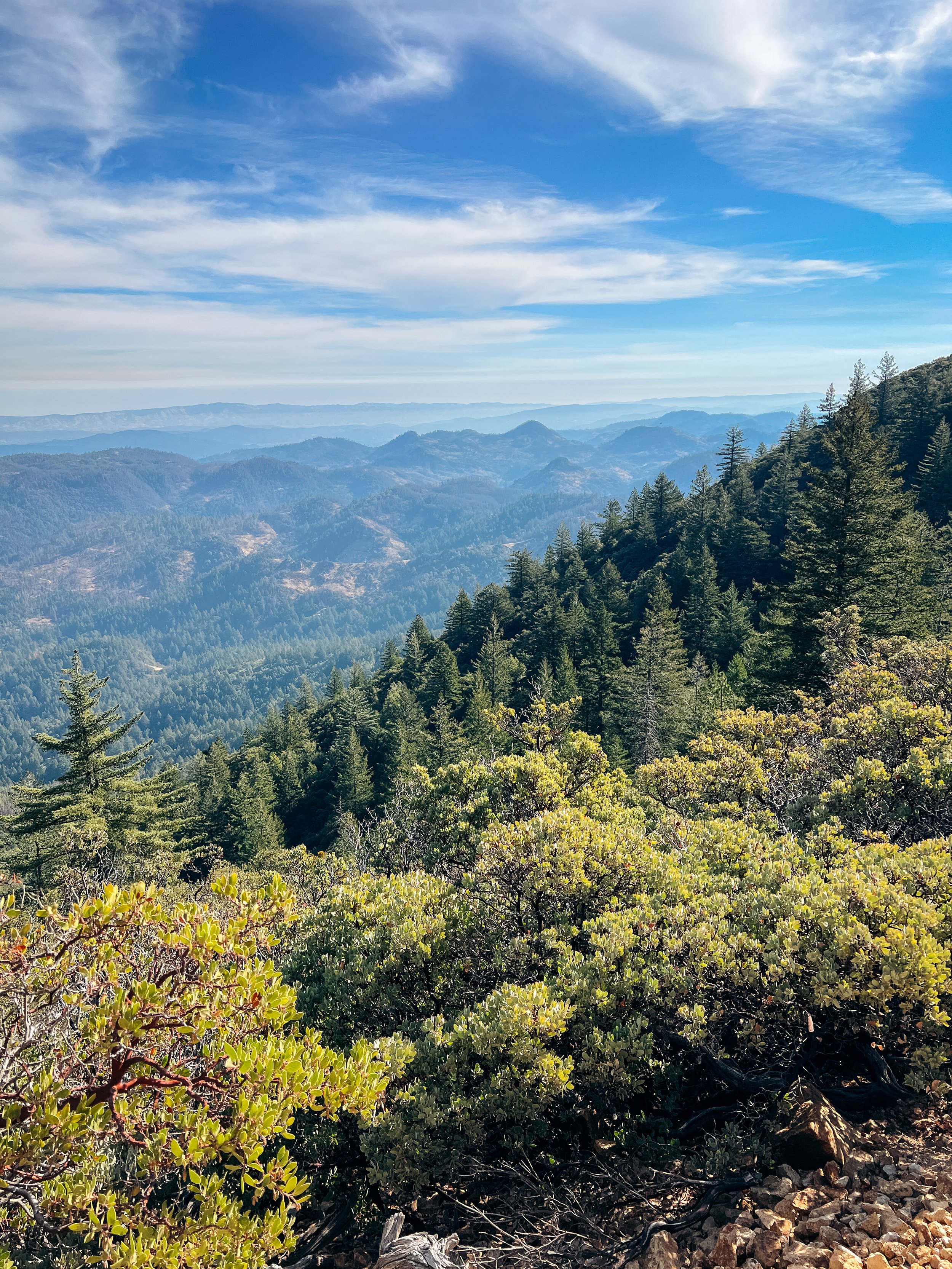
The views from the summit were really awesome. Seeing the flanks of Mt. Saint Helena itself fanning out below the summit, to the distant hills in the surrounding areas was really cool. Sadly, it was really hazy and a little cloudy on our hike, so we couldn’t get the clear views of Mt. Shasta, Mt. Lassen, and Mt. Diablo that are visible from the summit, but it was still super gorgeous!
After eating our smushed peanut butter & jelly sandwiches, taking some photos, and cleaning up after the large group ahead of us (people, please quit leaving your trash! And yes, a half-eaten pomegranate is trash), we turned back around and descended the way we came. My feet were actually beginning to hurt a bit on the way down: I hadn’t been on a longer hike since the Fifield-Cahill trail.
Once back at the car, we drove back to our campground, but promised ourselves we’d drive back into Calistoga for dinner and to get some ice cream for dessert.
