Skyline to Sanborn: My First Bay Area Ridge Trail Overnighter
Bay Area Ridge Trail Stats
Sections: Skyline Ridge and Russian Ridge Open Space Preserves
Saratoga Gap Open Space Preserve to Skyline Ridge Open Space Preserve
Sanborn County Park and Castle Rock State Park
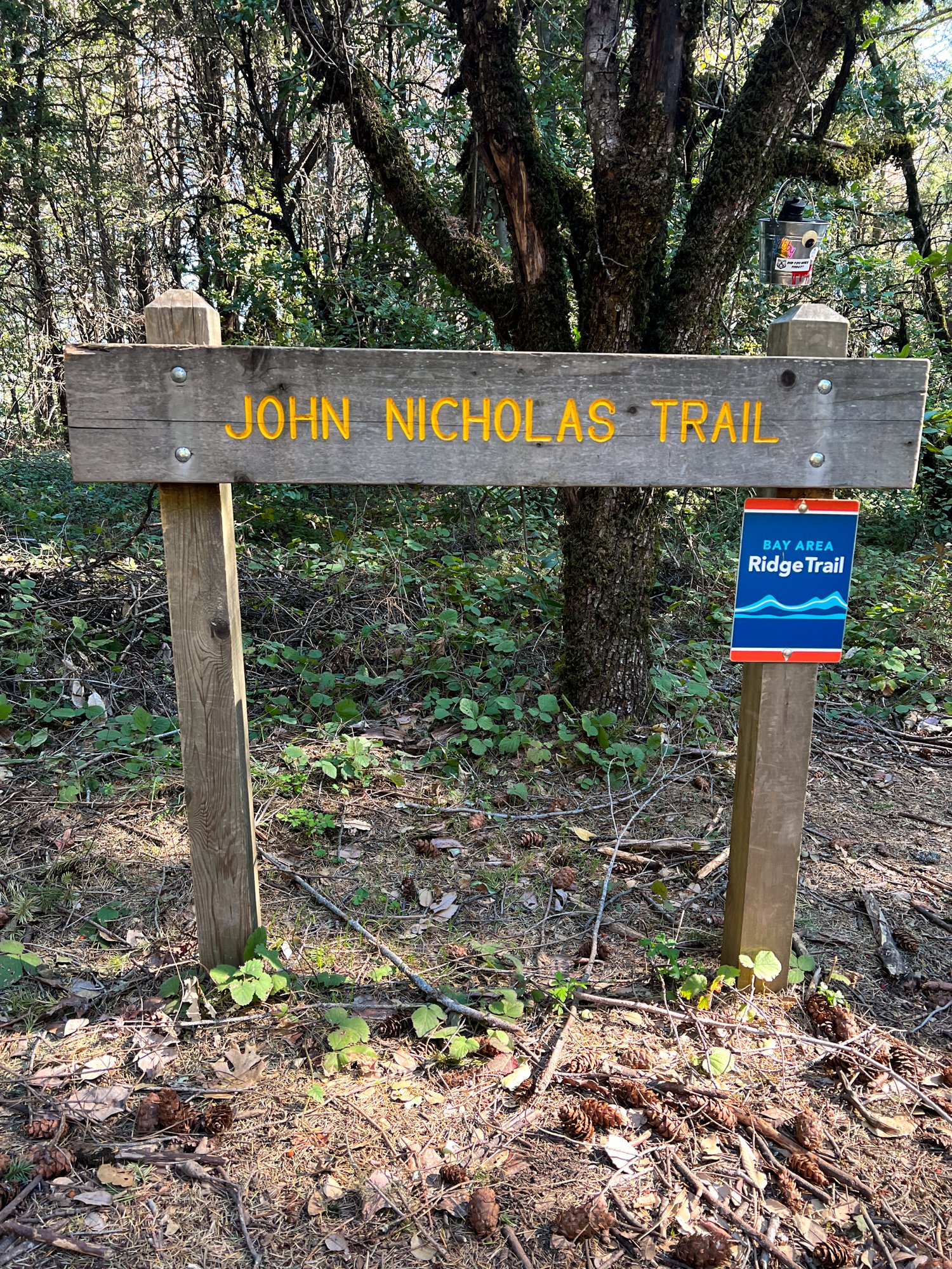
Sanborn County Park: John Nicholas Trail
Trail Mileage: 18.9 miles
My total miles to date: 25.2 miles
Date Hiked: 2.6.22 - 2.7.22
Difficulty: Moderate
The Full Hike: Russian Ridge Open Space Preserve Parking Lot south to John Nicholas Trailhead on Black Rd.


Logistics
This one-way hike involves a drop-off shuttle. Due to not being able to park in an open space preserve parking lot overnight, we parked a car at a turn out on Black Rd. to the south and were dropped off at Russian Ridge to the north.
To be accurate, I didn’t realize the miles from the Lake Ranch Reservoir to Black Rd. weren’t Ridge Trail miles… even though there’s a little Ridge Trail plaque on the trail post at the road stating it's the end of a ridge trail section. So, you could try to park at Sanborn County Park as well. But, the Ridge Trail Planner states the trailhead is on Black Rd., so overall, a little confusing.
We had to book a campsite ahead of time through the CA State Park Backcountry Camp reservation system. You must make a reservation during the weekdays via an internet form and then by calling the permit office.
Parking
John Nicholas Trailhead on Black Rd. and Russian Ridge Open Space Preserve.
Strava
Trail Notes
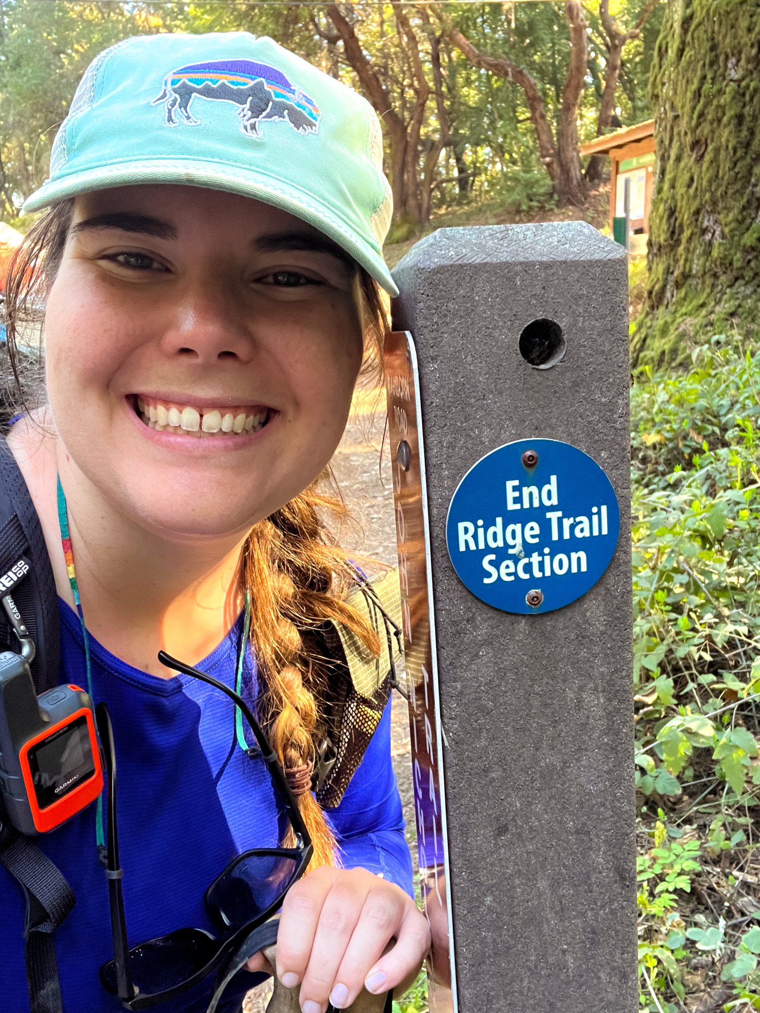
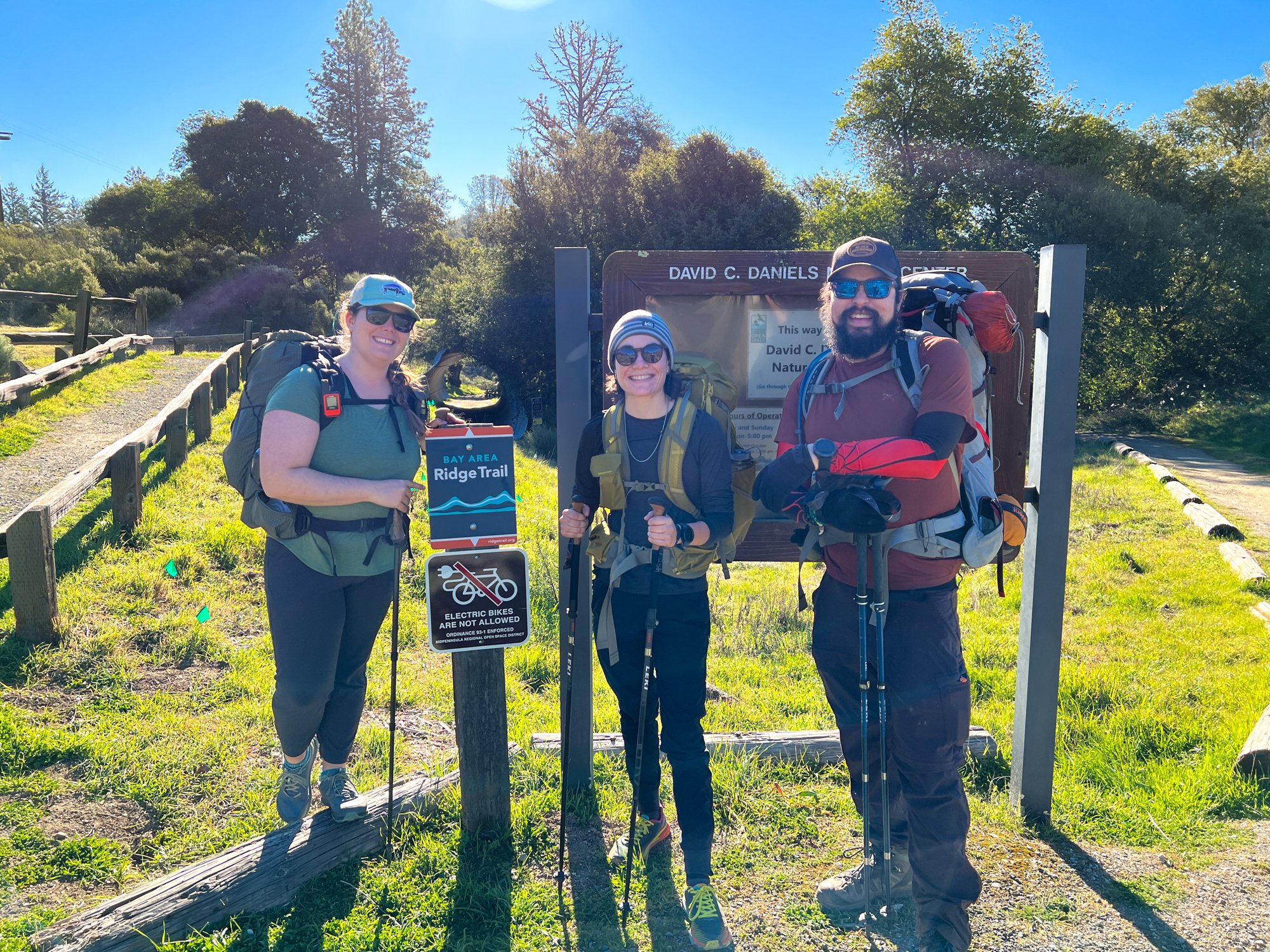
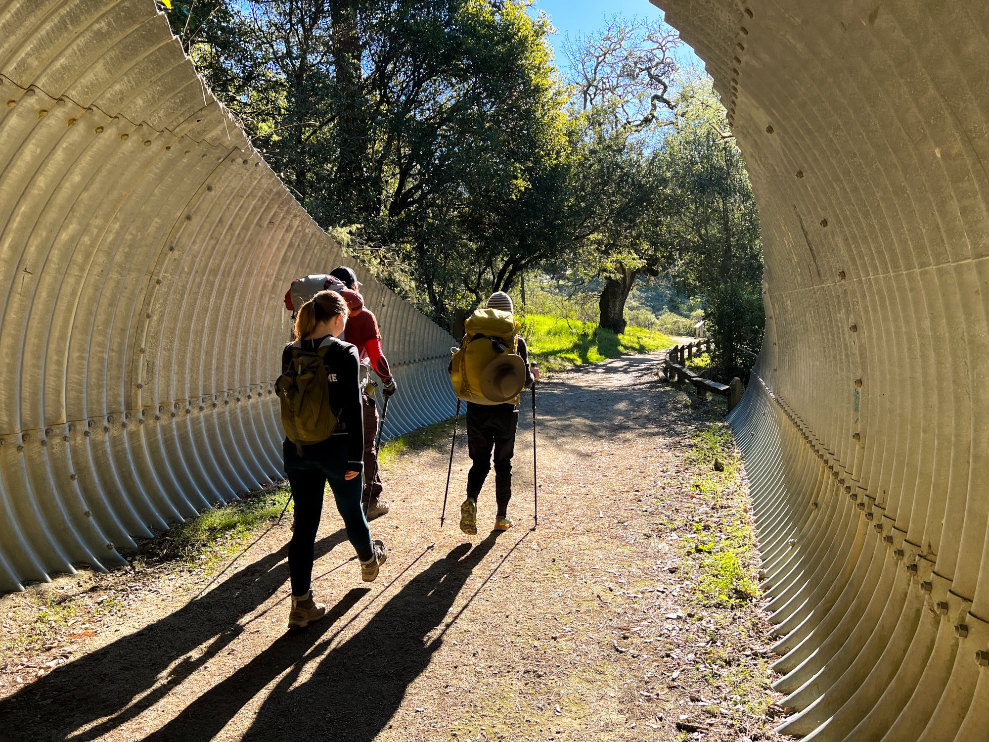
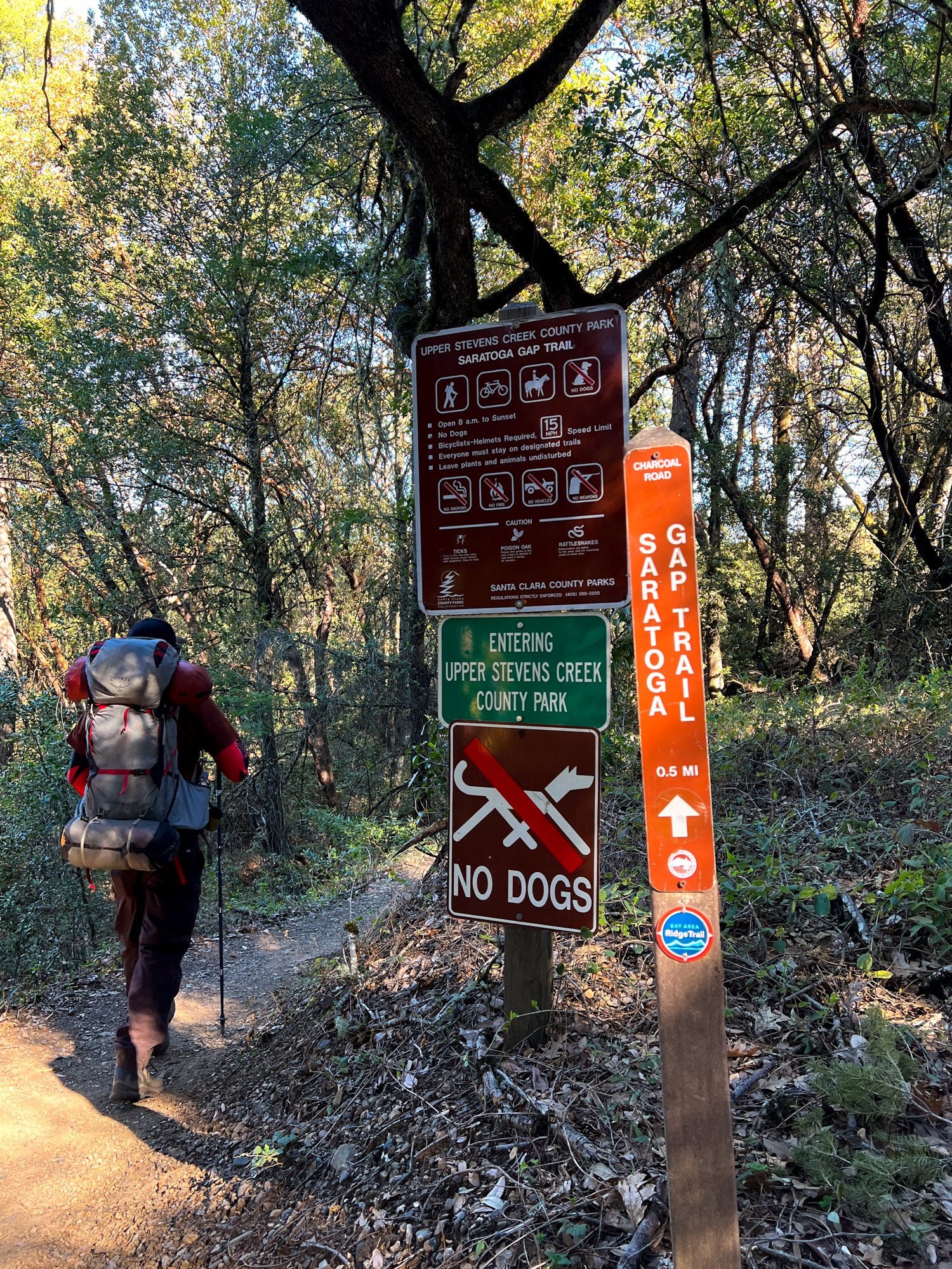
I very hastily planned this adventure, inviting two co-workers of mine at the very last minute, one of whom had never been backpacking before. Spoiler alert: she crushed it! After all meeting up and doing our car drop-off, we got started at the Russian Ridge parking lot, took a picture at the trail sign, and walked through the tunnel underneath the road, immediately entering Skyline Ridge Open Space Preserve.
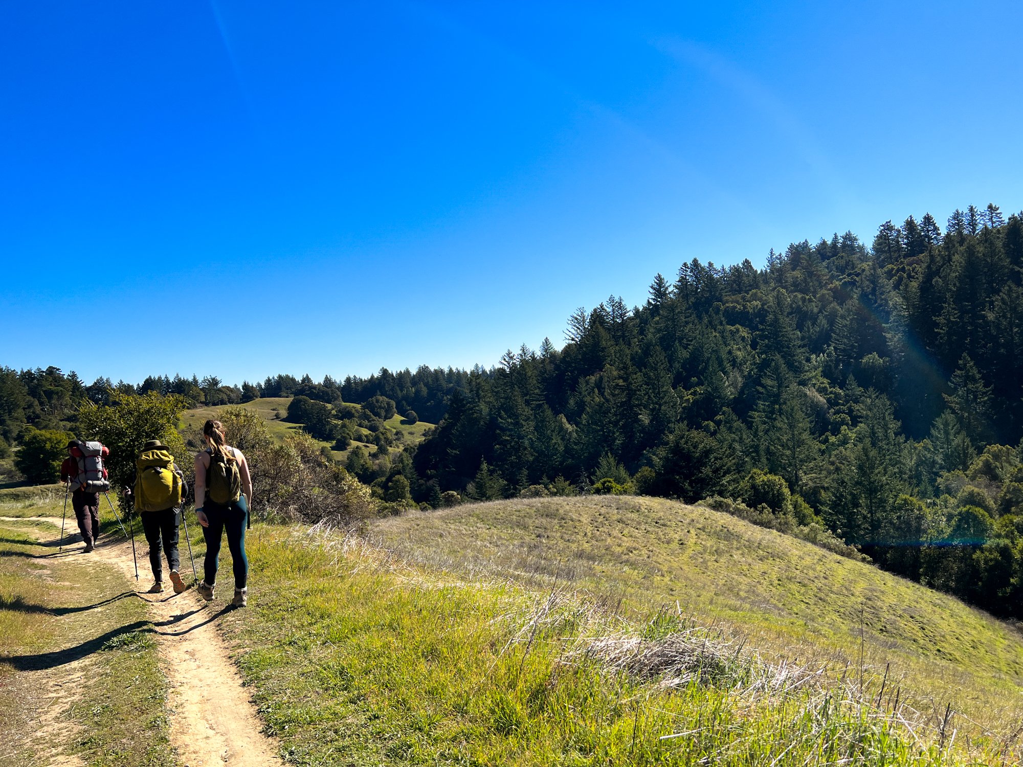
We got off to a bit of a rocky start since the multitude of trails and fire roads around the nature center were a little confusing. After back-tracking twice, we finally figured out that the Ridge Trail follows the fire road/ Sunny Jim Trail. Upon coming back home and reviewing maps, I also saw that the “hiker only” route was the Ipiwa Trail, which I didn’t realize at the time. So, we took the multi-use route that cyclists and horseback riders can use. The trail was a little rough around the edges at first - which is usually common for fire road trails. But, we did get a really beautiful view of the Santa Cruz Mountains and even saw Mt. Umunhum to the south. It is pretty cool to think that the Ridge Trail continues to there, almost continuously.
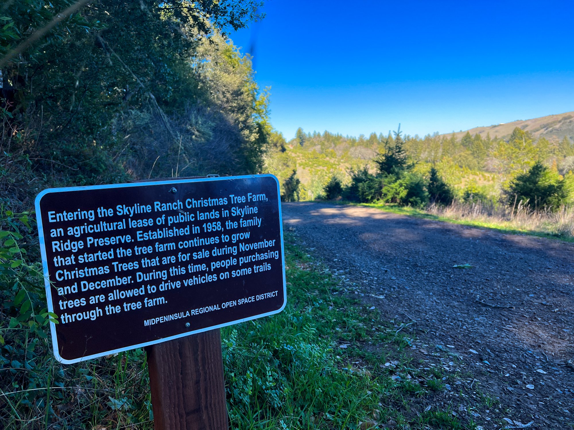
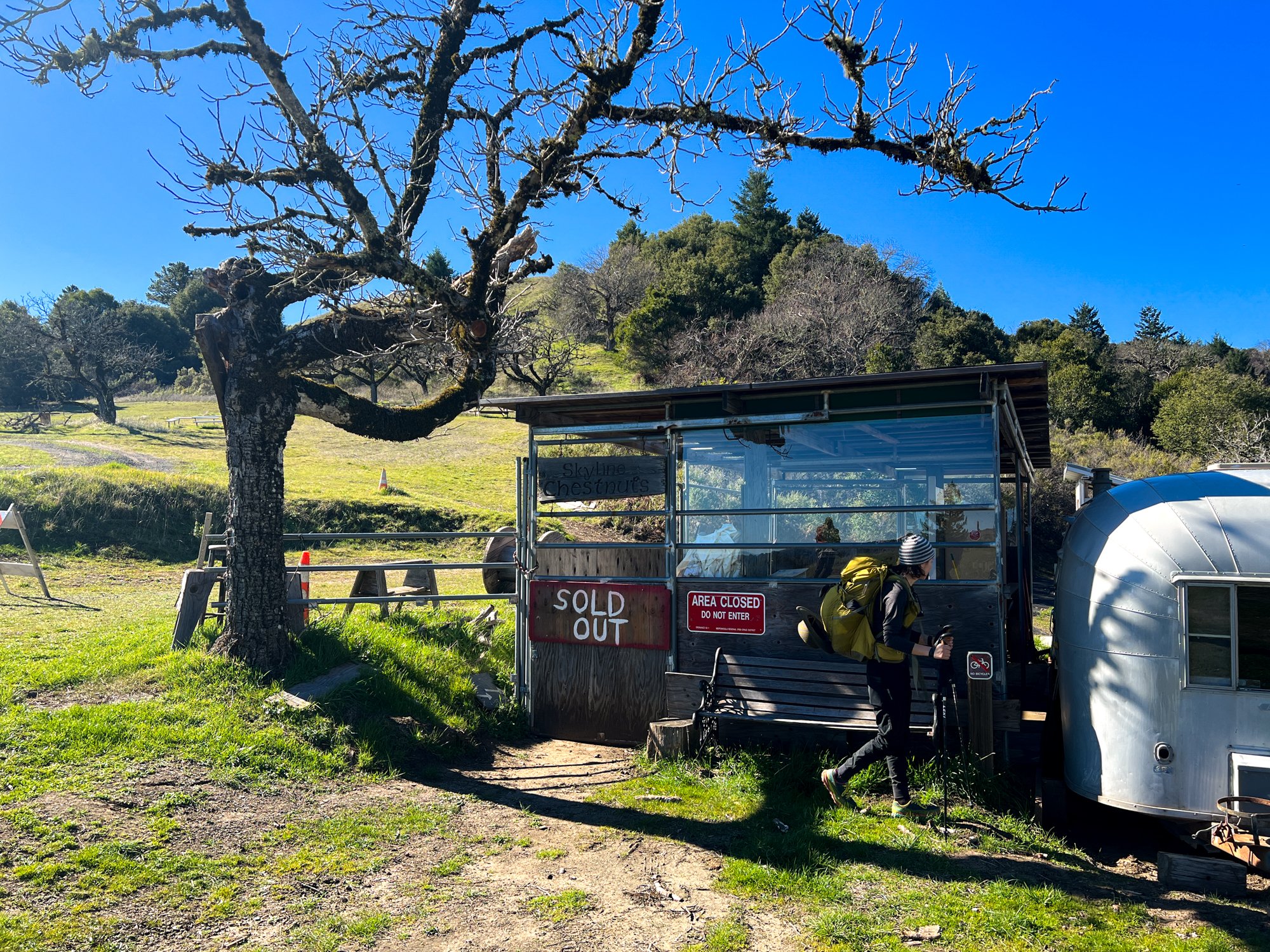
From the viewpoint, we descended to Horseshoe Lake, where a goose stared us down as we walked across the path. Don’t mess around with geese, they can be unruly and territorial! After some more ups and downs, but mainly a short but quite steep uphill, we crossed the Christmas Tree Farm and walked on their gravel roads for a bit, noticing the growth cycles and looking for the best picks for next year ;). Near the end of the property, the trail opened up even more to a Ridgeline, and we came across the Skyline Chestnuts shack, which I guess sells chestnuts during the Christmas season?
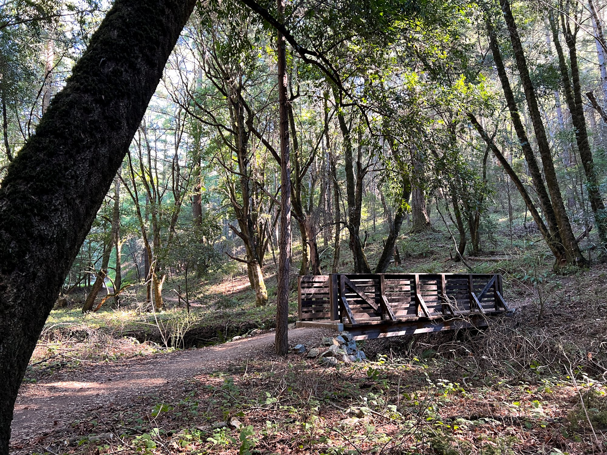
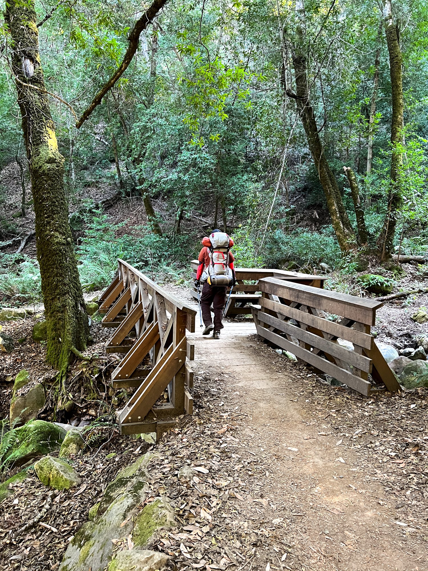
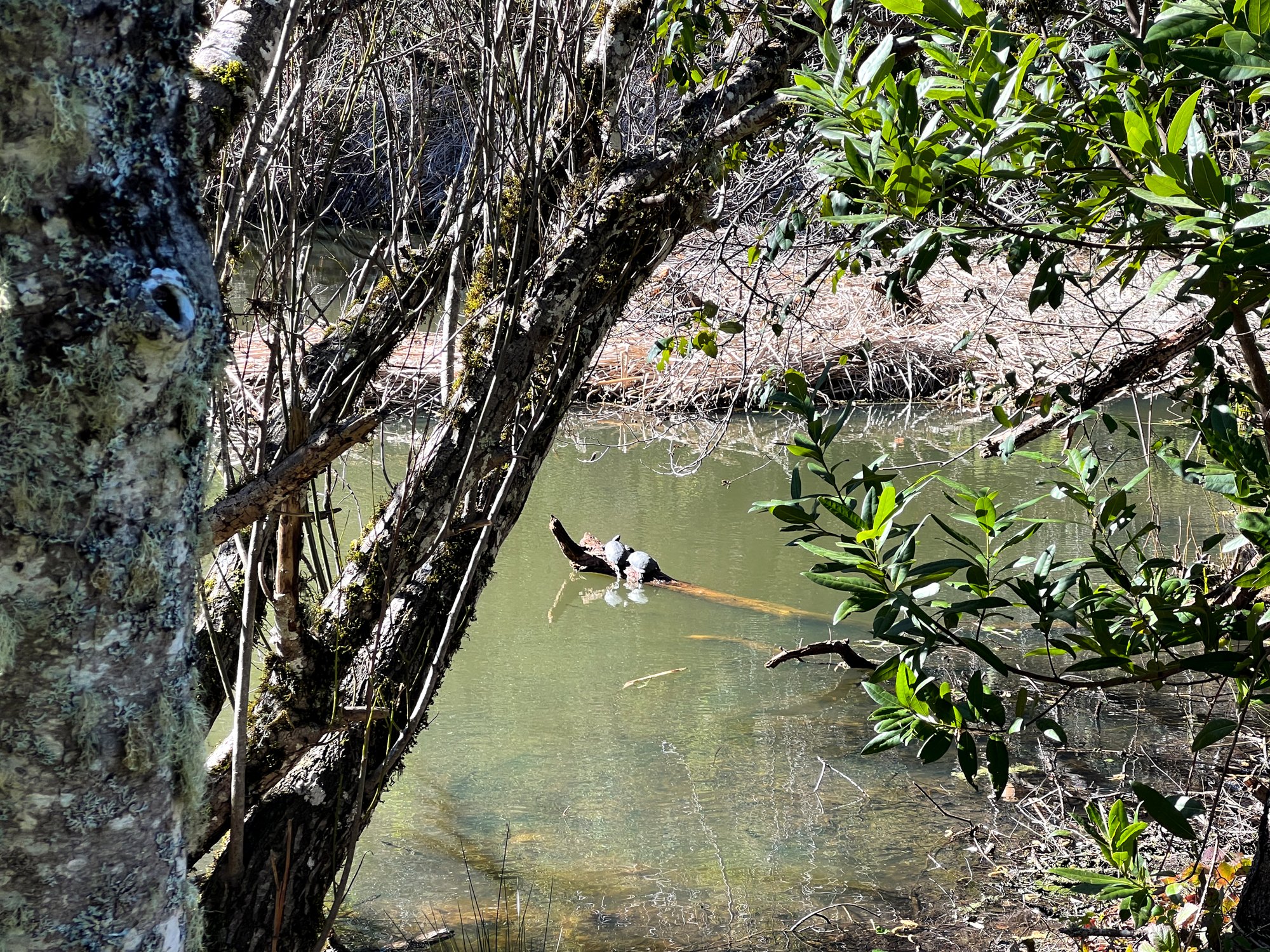
The trail stayed relatively exposed for the next mile or so. It’s always nice to feel the sun at the beginning of February and to see the hillsides covered in green. Water was a concern of ours on this trip, but we were happy to see Peter’s Creek flowing well as we crossed the footbridge. We didn’t need to stop for filtering since we were carrying enough, but it was a comforting sight to see. After not seeing a ton of people for most of the hike, we seemed to find all of them around Jikoji Pond. We also found a few turtles too! Apparently, they are invasive, but they’re so cute!
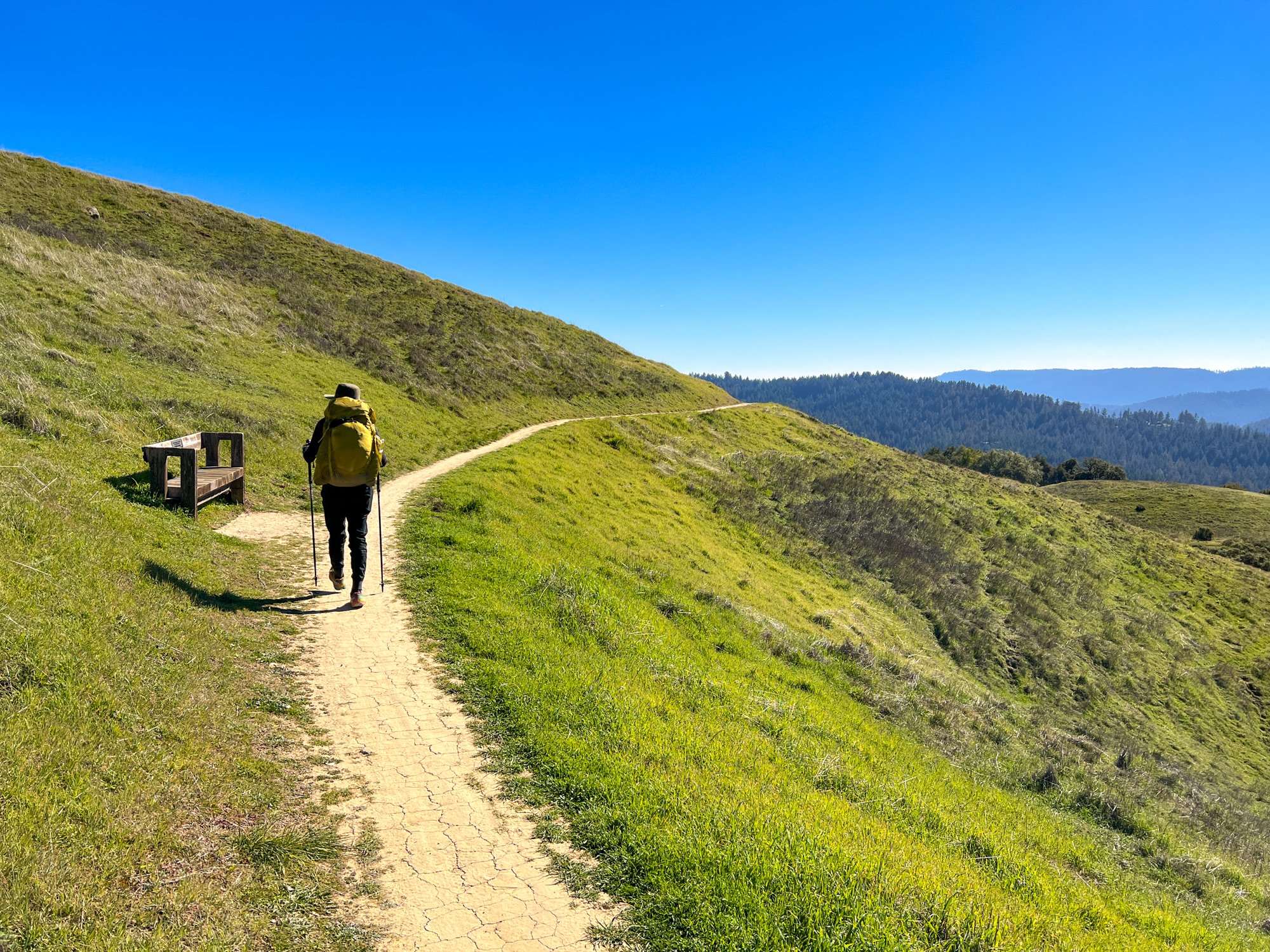
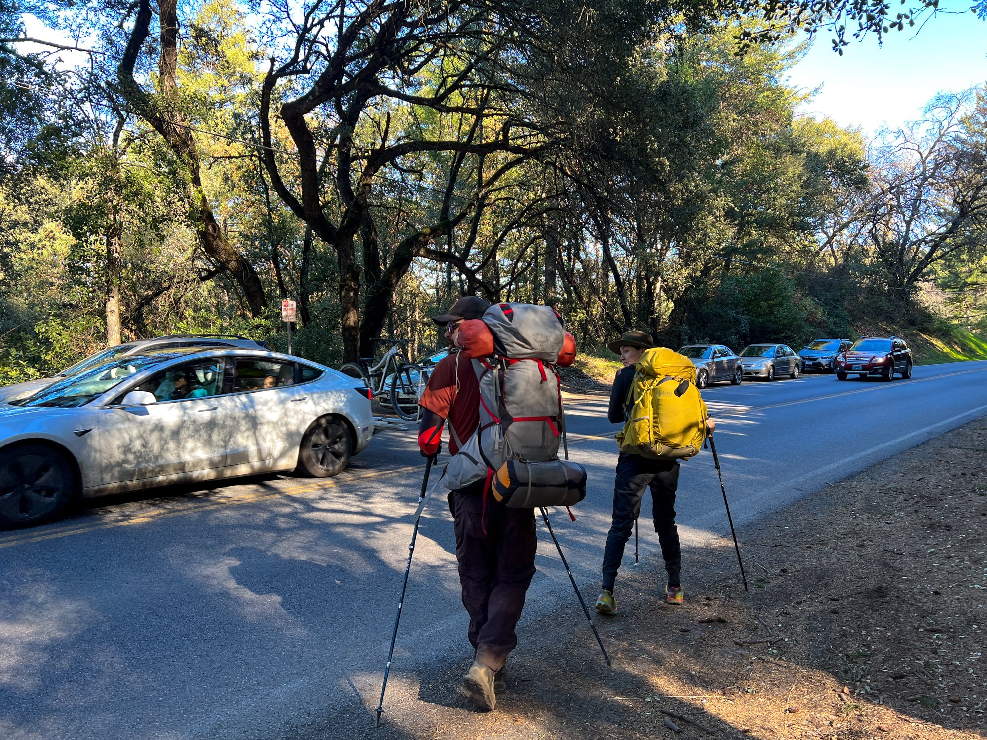
Lunchtime was approaching, so we climbed up a short spurt of switchbacks to a gorgeous view of the mountains and ocean in the distance. It was the perfect weather to sit and enjoy our lunches. Being a little over halfway through our mileage for the day, we didn’t feel the need to hurry through our first packs-off break of the day. But, all breaks have to come to an end eventually. Luckily for us, the trail right after lunch was pretty sweet. More rolling green hills with distant mountain and ocean views, until we tucked back into the woods and descended to Highway 35 for our first highway crossing.
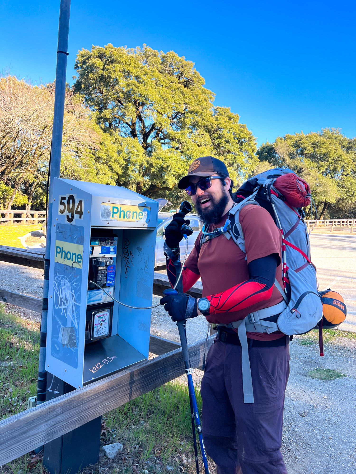
After a short time of waiting for cars and motorcycles to pass, we were able to cross and walked into Santa Clara County. We’ve come so far! The trail was pretty cruisey, with very slight uphills and downhills as we paralleled the highway. This wasn’t the most exciting scenery, and the loud road sounds from the Sunday joy riders kept us very aware that we were not far out in nature at all - unusual for most of my backpacking trips. Soon enough, we joined back with the highway at Saratoga Gap. We threw away some snack wrapper trash, heard a free prayer from the relic of a payphone that still works, and took a little sit break on the bench, preparing ourselves for the last 3ish miles until camp. The sun was starting to get lower on the horizon at this point, and the wind was starting to pick up a bit. After another relatively flat mile tracing the highway, we emerged again and crossed the road into Castle Rock State Park.
It’s really funny seeing how close to the road these trails are. I’ve driven down Highway 35 numerous times, traveling to day hiking parks, but I hardly ever notice random trails that start or end at the actual highway. I guess this is a good thing: my eyes are on the road. But it’s pretty cool how different of a perspective you get when walking vs. driving.
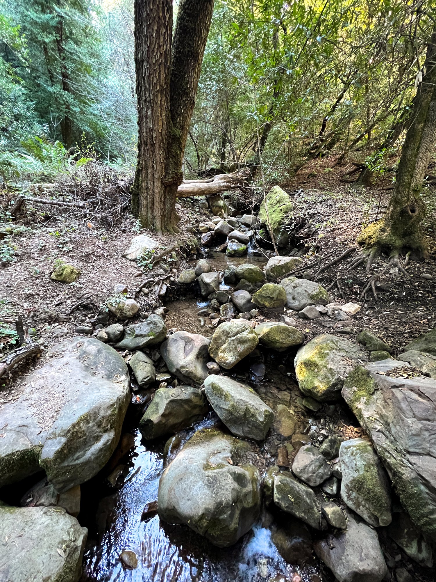
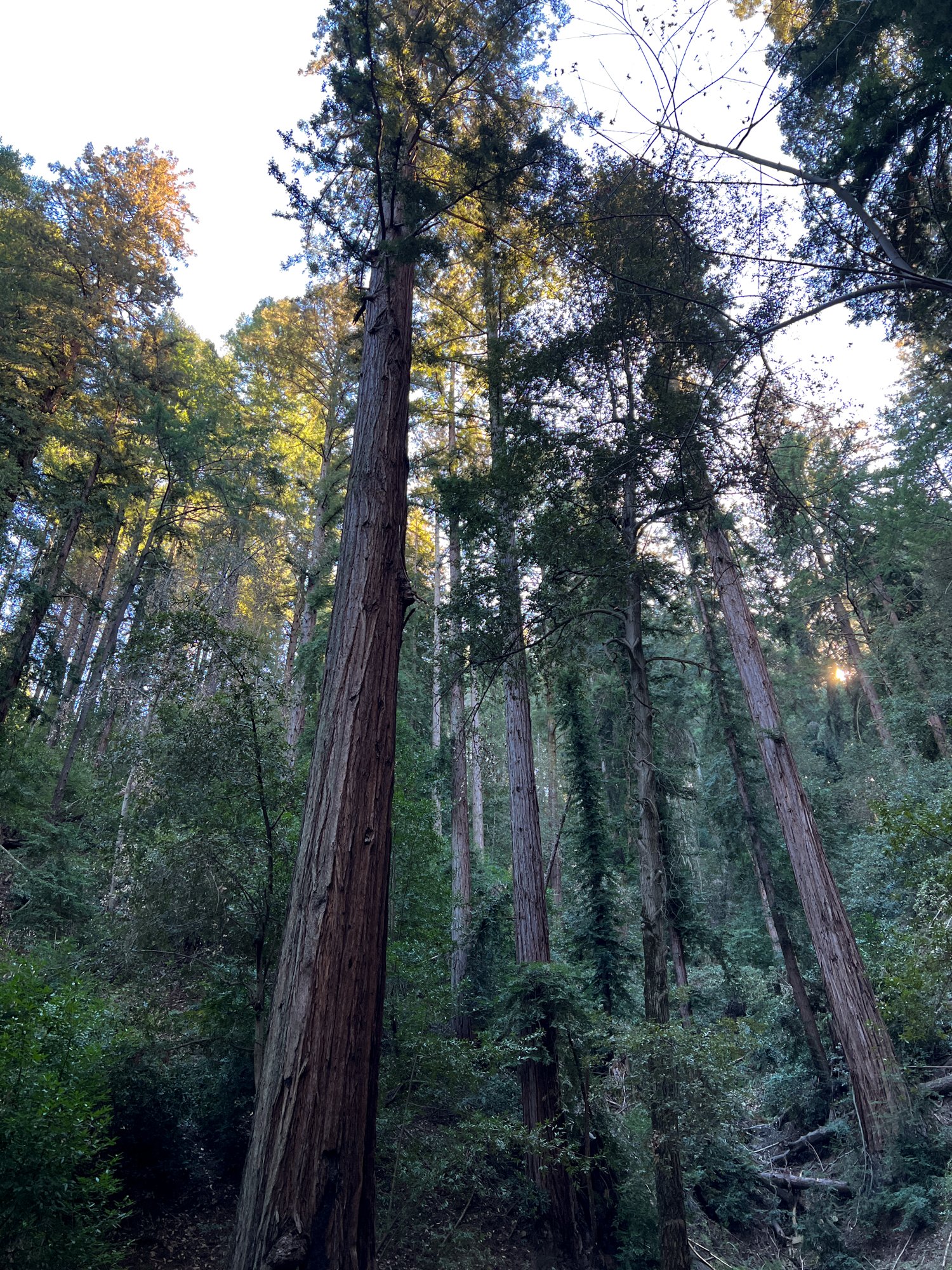
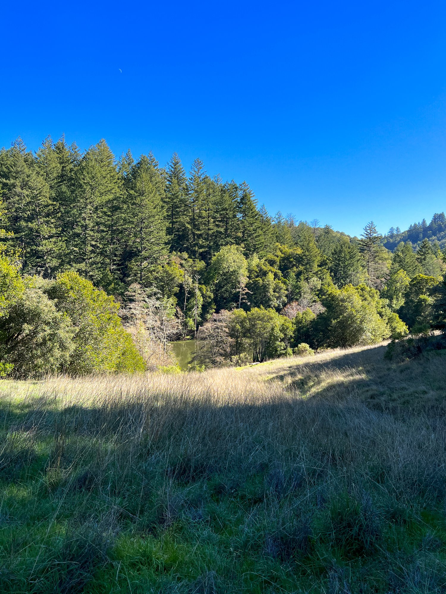
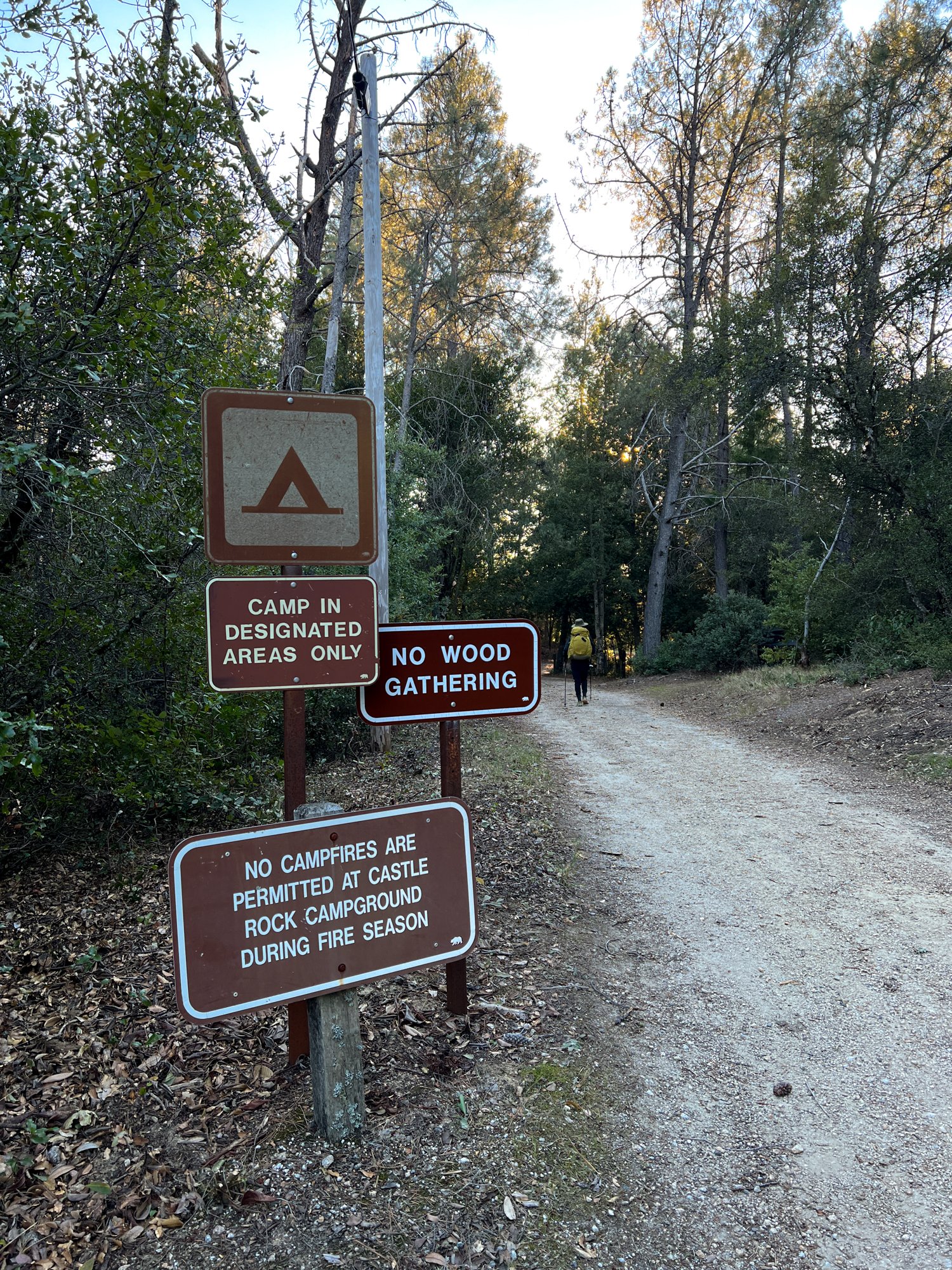
Anyways, once we got to the trail, there was a sign saying that this trail would be closed tomorrow due to tree felling. Great! The lady on the phone who gave me my permit did not mention that. We kept going, keeping in mind this little snag in the plan. After about half a mile or so, I heard water running in a creek. This was good news since I was a little nervous about how we were going to find water since the water spigots at the campground were turned off for the season. This water wasn’t exactly easy to reach, but it wasn’t too steep of a dropdown. My partners seemed like they had enough water, so I thought I just needed to get two liters for myself and call it good, so I found a tiny trickling stream above the trail and started collecting my water. But my friend Dan pulled out a huge group gravity filtering bag and went down to the lower creek and got nearly 10 L of water! Which was great at the time, because we did anticipate having a fire at the campground and needed water to douse it. After our filtering break, it was nearly 5 pm, so we shouldered our heavier packs and hiked down to the campground. It was a lovely hike, walking through chaparral, and the golden hour sun was radiating through the trees, beckoning us further west to the campground and sunset.
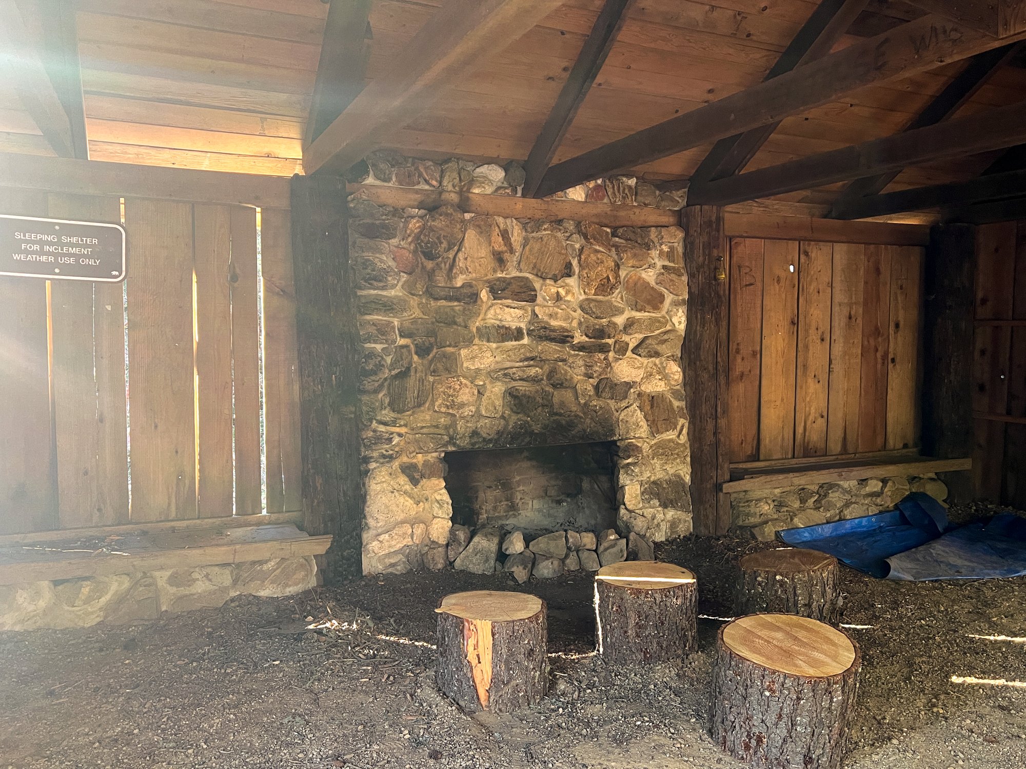
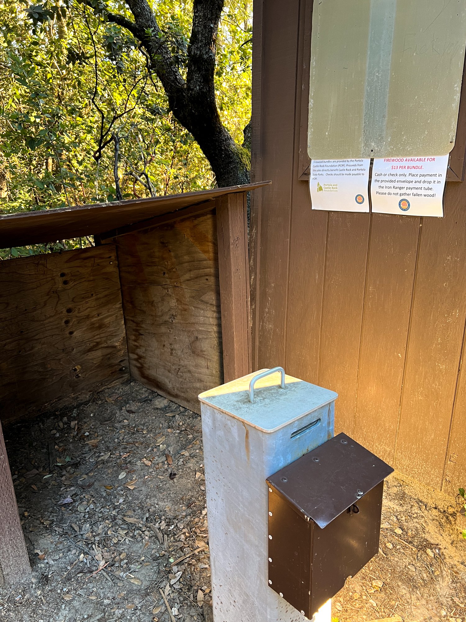
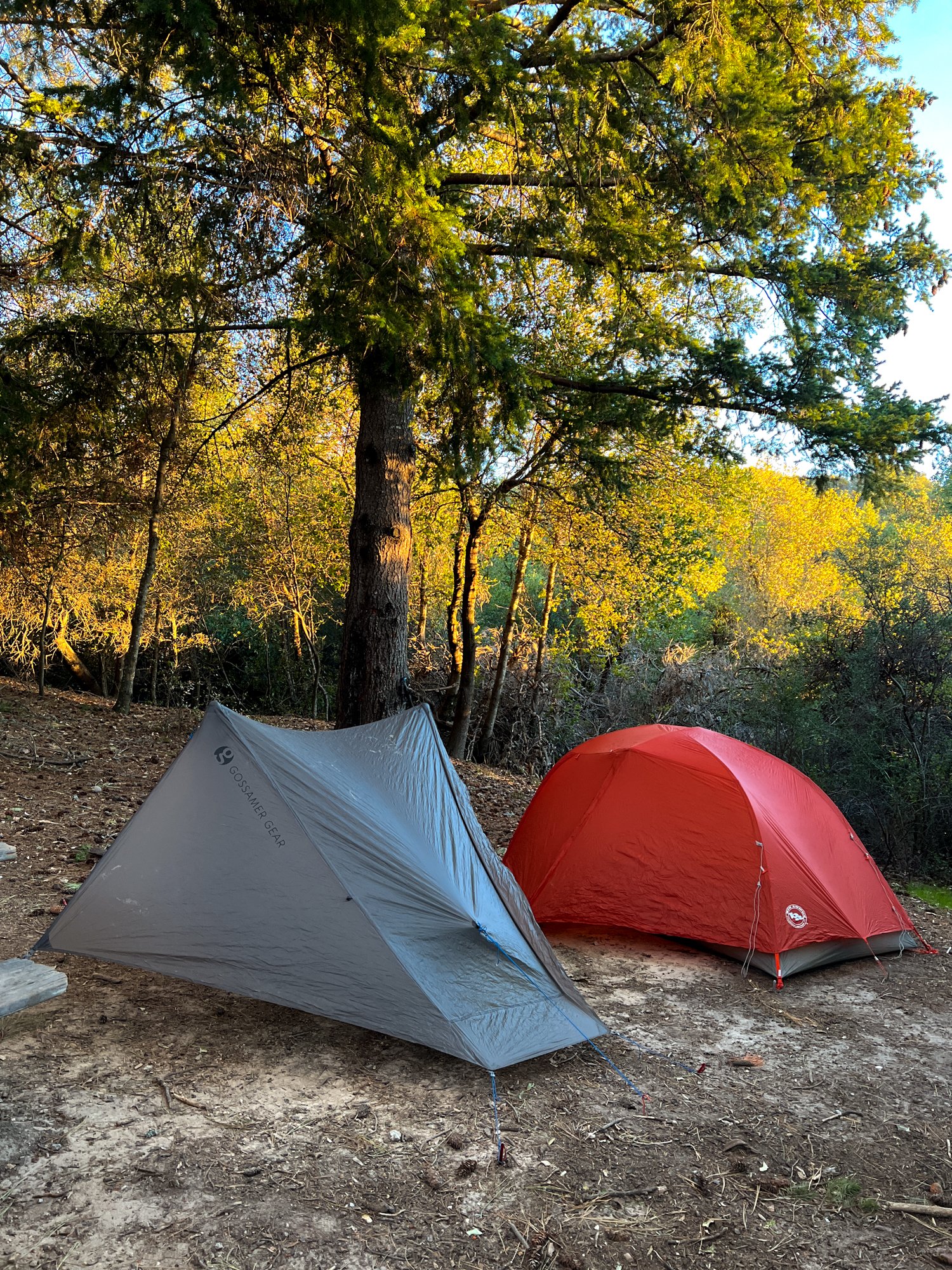
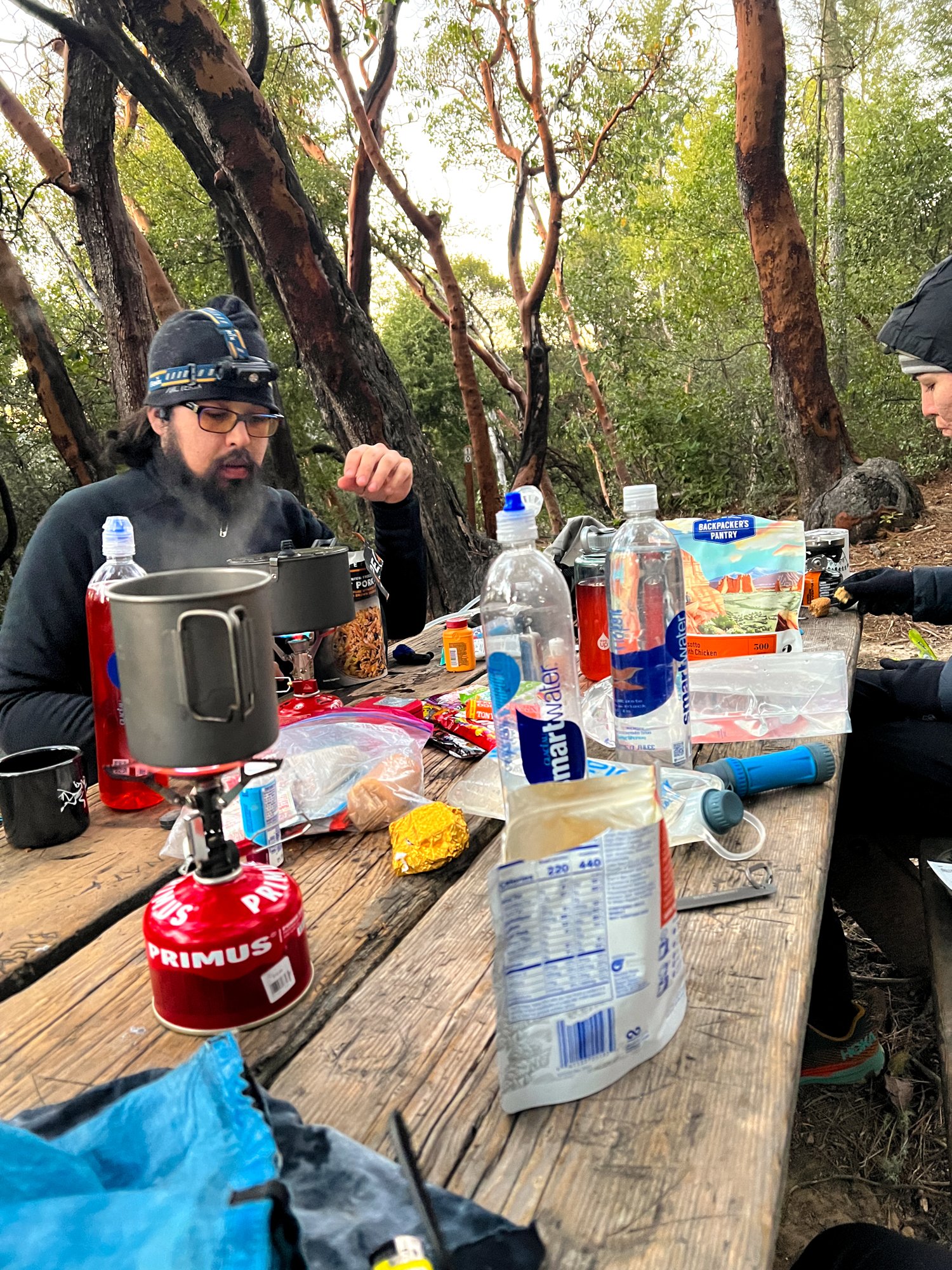
We reached the sites pretty quickly and looked around at the entrance area, reading the signs. Very, very sadly, there were no bundles of wood at the payment spot. My friend Cass was disappointed. Her first backpacking trip, and she specifically brought $13 exact change to buy the wood, and nothing was there. We lamented the lack of wood for a bit, but then got over it and followed signs to the sites. We were the only people in the whole campground, which was kind of spooky, but so nice. I couldn’t imagine how crowded this area would be if all the camps were full! We found a nice site that was close-ish to the pit toilet (yay no digging cat holes!), and immediately set up our tents and got into our cozy clothes. The sun was setting quickly, and it was time to get warm! Once set up, we yard-saled our gear across the creaky picnic table (another amazing luxury!) and got dinner cooking. We ate, drank some cider, chatted, set up head-lamp water bottle lanterns, lamented the lack of fire, and then went to bed, preparing ourselves for another hiking day.
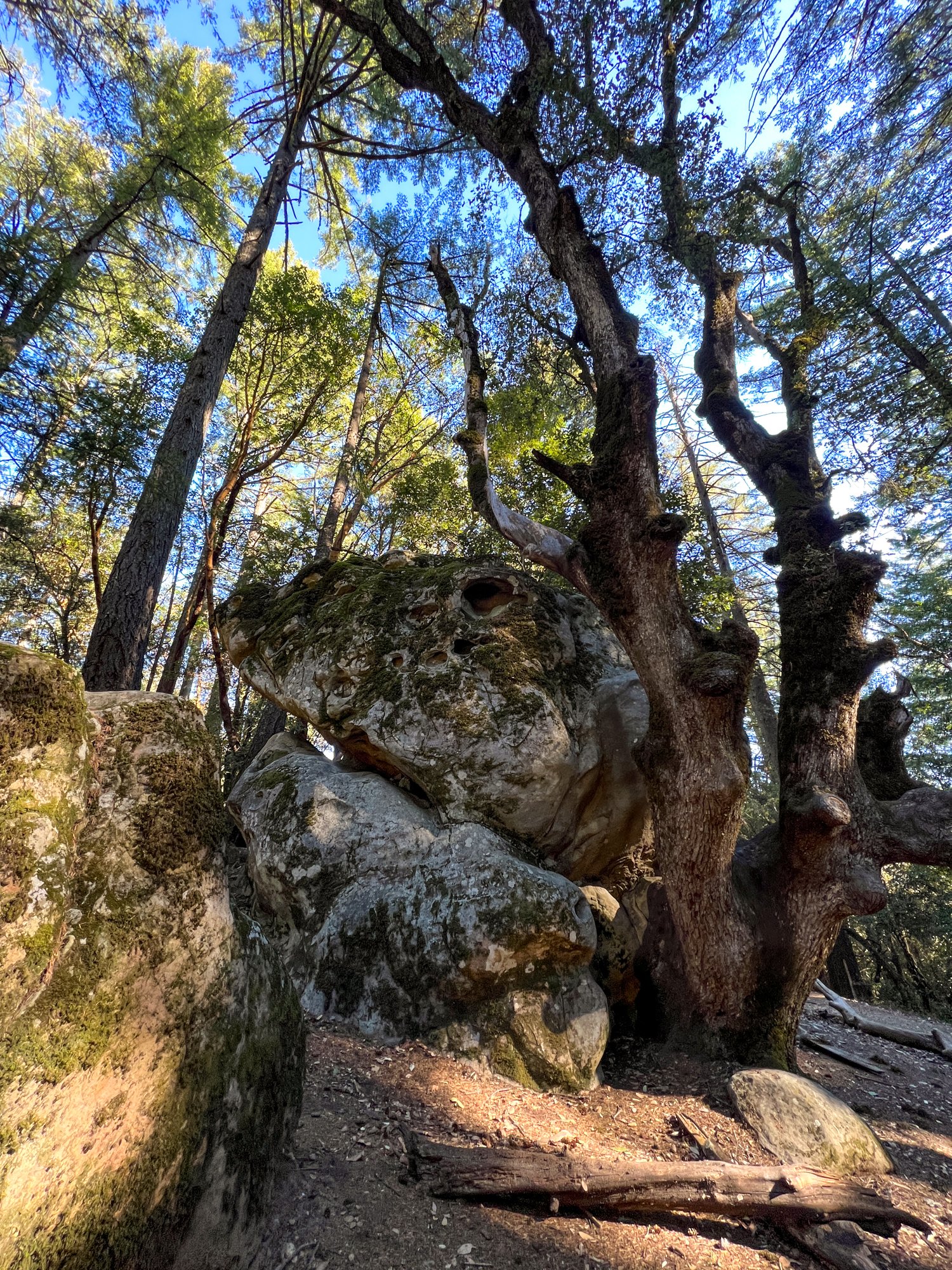
I woke up around 6:30 and could hear my friends rustling around too, but we all decided individually to stay in our warm bags for a bit. I had some cell service, so I looked at the Alltrails description of the next chunk of trail. We eventually all got up, ate breakfast, packed, and hit the trail. As we were leaving the campsite, we got a surprise, a surprise betrayal: there were now bundles of firewood at the entrance. None of us wanted to say it: what if they had been dropped off last night and we just never went back to check? So we just sighed and assumed they were dropped off this morning, to make ourselves feel better. Once we left the campsite, we found a ranger in his truck right next to the closed trail we had come down yesterday. We confirmed with him that the trail was closed, but we were able to take this service road back to the highway, which was fine. It was a well-graded uphill back to the road, a little rough for first thing in the morning, but not bad in the grand scheme of uphill hiking. Once we got to the road, we immediately crossed to re-join the Ridge Trail, and we again hiked along the highway. The rock formations around here were very cool, and we found some obvious bouldering spots - the chalk was very pronounced.
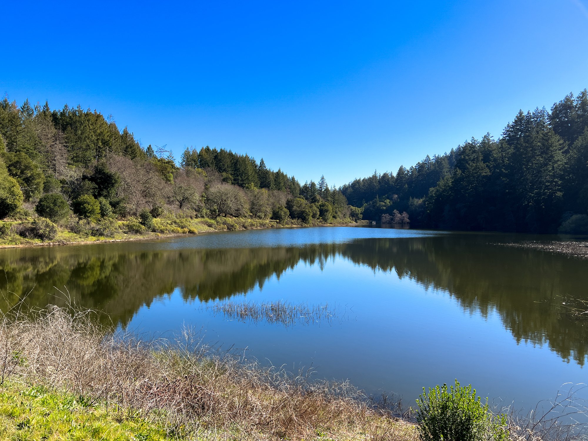
The trail meandered up and down, nothing too exciting or special, just nice woods walking in the morning. At about 5 miles in for the day, Cass had to leave us because we were a little behind the time and she needed to go to an appointment. Dan and I continued on the John Nicholas Trail, where we had a steady descent down to the Lake Ranch Reservoir. Before the big drop though, we ate lunch at a nice bench overlooking Silicon Valley and the Bay. We could see Mt. Diablo and the Apple Campus. Two places that couldn’t be more opposite or further away from each other on paper. Sadly, the air quality was kind of bad: you could also see the thin line of brown haze in the air, settled below the mountain tops and above the cities and water.
After our lunch, we traipsed down, trying to go quickly because our lower legs and feet were starting to kill us. This trail was super nice and well-graded. We passed many uphill mountain bikers and were happy we did this part on a Monday. I imagine there’s even more biking traffic on a weekend. At the bottom of the descent, there was a nice shaded area with a creek and bridges. It would be a welcome respite on a summer's day, but right now, we had enough water and both really needed a bathroom. So we kept our hiking up at a clip, passing the reservoir and walking back into the woods along a very wide trail. We saw some tiny Redwood trees when we were nearly at the trailhead, which was a nice ending to the trail. Upon seeing the port-a-potty at the trailhead, I was relieved. That morning coffee was ready, I’ll tell ‘ya. Overall, this was a nice hike and a sweet little overnight vacation so close to home. I was feeling accomplished with the amount of Ridge Trail miles that I got to complete, and proud of myself for finding some beauty in these Bay Area trails - something that can be hard for me sometimes.