

Marin Headlands: Alta Trail to Tennessee Valley
Bay Area Ridge Trail Stats
Section: Marin Headlands from the Golden Gate Bridge to Tennessee Valley
Trail Mileage: 3 miles
My total miles to date: 3 miles
Date Hiked: 9.5.21
Difficulty: Easy-Moderate
The Full Hike: Coastal Trail parking - Julian - Rodeo Valley - Alta - Bobcat - Marincello - Old Springs - Miwok Trails. 11.5 miles.
Logistics
None involved. Loop day hike with a portion of the Ridge Trail.
Parking
Strava
Trail Notes
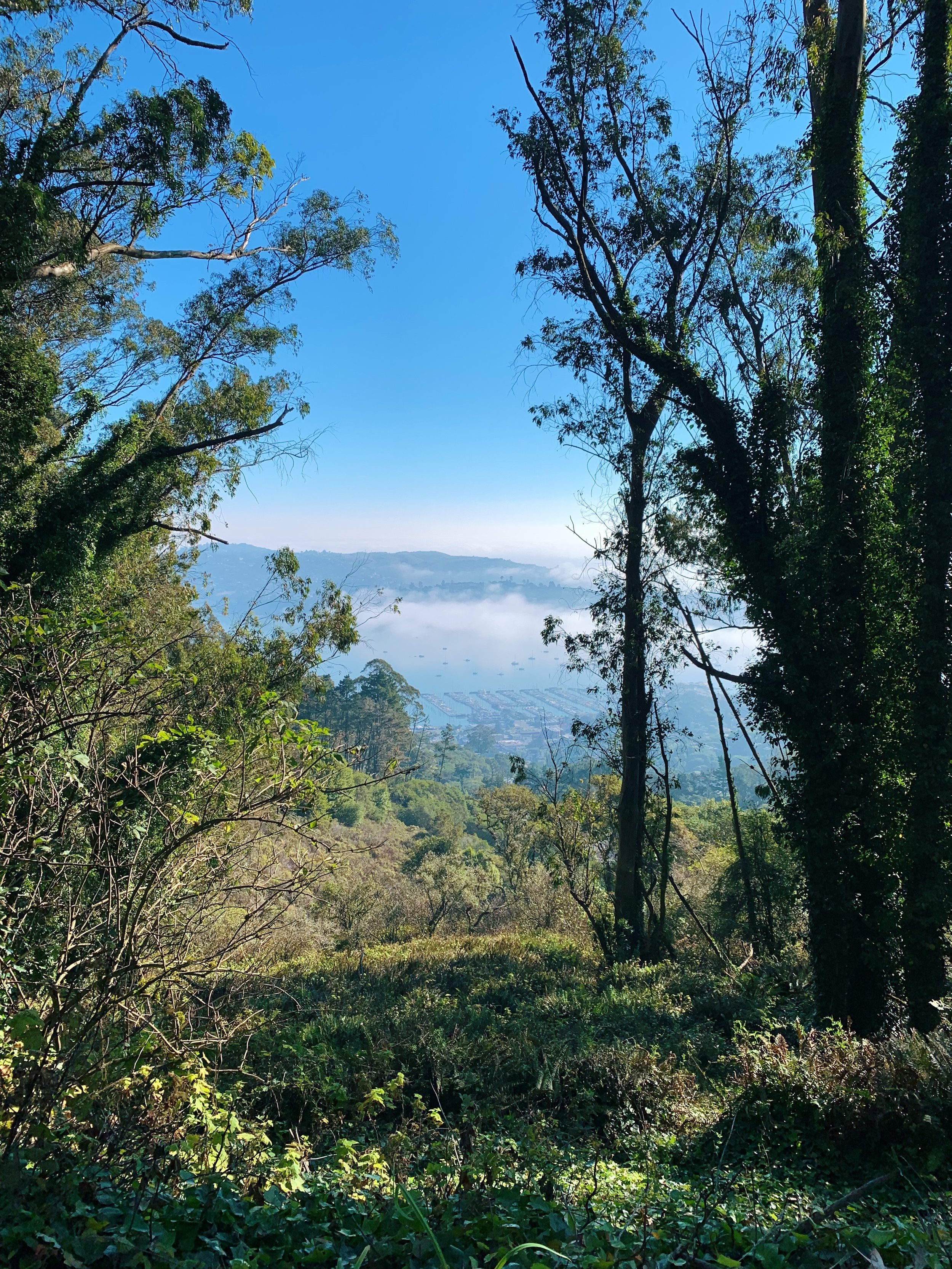
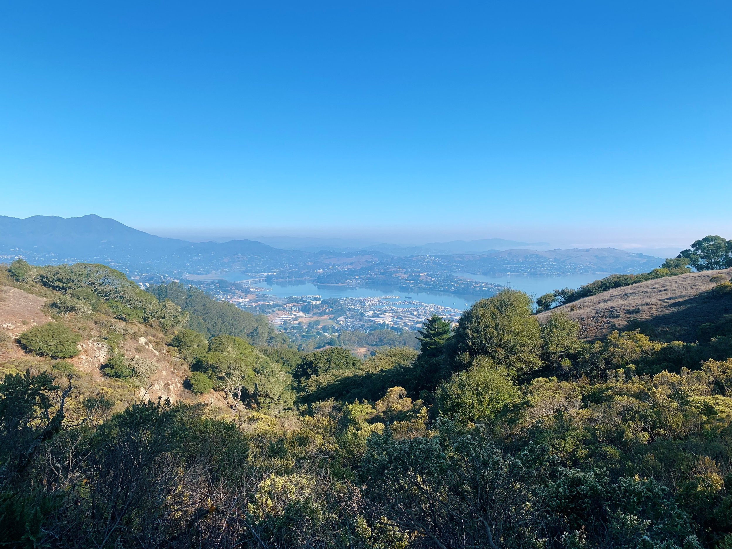
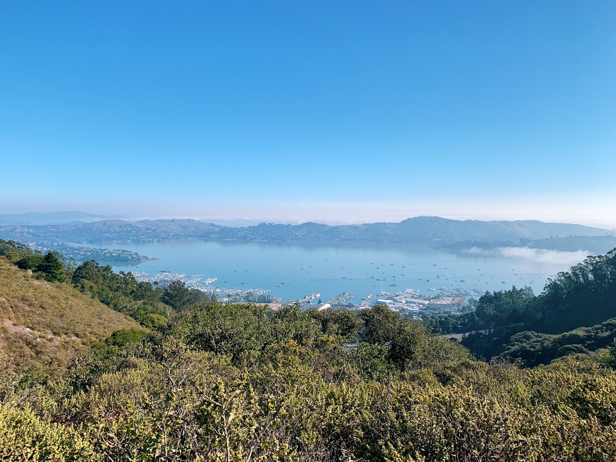
Today I began my Bay Area Ridge Trail journey, bright and early, which is essential for weekend hikes in the very popular Marin County. I drove up to San Francisco to pick up hiking buddies Kristie & Felicia, and then we went north into the foggy hills. Since a longer loop hike was on our agenda, we started early on the Julian Trail, which descends down to Bunker Rd. If I were to do this again, I’d probably leave this part of the hike out and start at the parking lot off of Bunker Rd. After we crossed the road, we took a right onto the Rodeo Valley Trail, where we started climbing, a little steeply at times, up to the SCA Trail, which was also the start of our Ridge Trail section. The fog was pretty thick here, so we didn’t have too many views yet! We crossed a residential road and went into the eucalyptus trees, sneaking peeks at the Sausalito Harbor and Richardson Bay below, happy that the fog had cleared. After emerging from the trees, we had lovely views of Mount Tamalpais in the distance, happy that we decided to do a hike with views of the mountain instead of climbing the peak like we were considering. This section of the trail was very mellow and gradual, and the views were just fantastic. I honestly can’t believe I forgot to grab a picture of Mt. Tamalpais, but we were busy chatting.
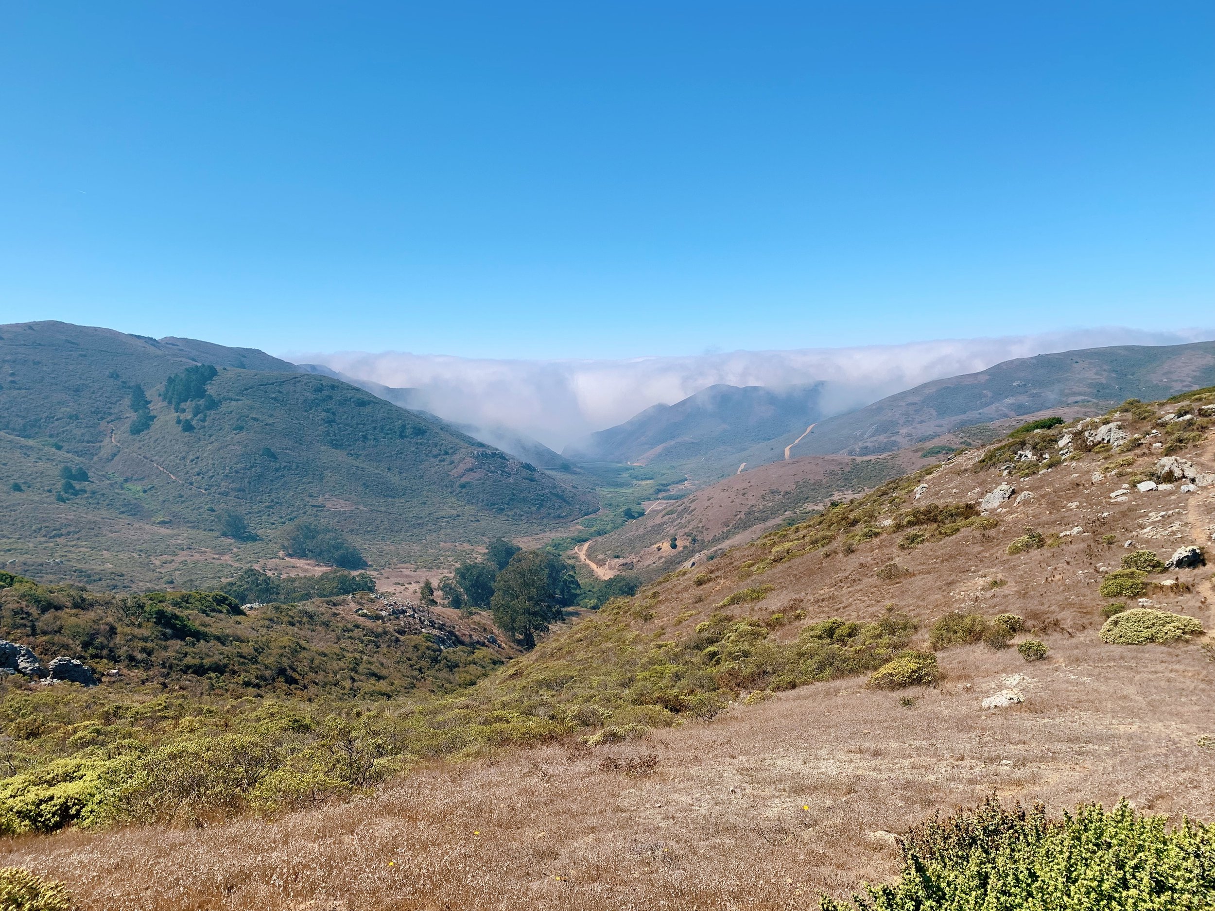
At the Bobcat Trail junction, the trail is slightly confusing and we accidentally went down the Bobcat Trail instead of up. You must turn left and then immediately right. We started climbing up this section, passing the junction to the Hawk Trail Camp, enjoying the views of the valley below. Then we stayed right onto the Marincello Trail as we descended towards the Tennessee Valley trailhead, where our little section of the Ridge Trail ended. We sat at the picnic tables and ate some snacks, then went back up through the stables and onto the Old Springs Trail (which had some wild blackberry plants!), climbing up again, above Tennessee Valley. We passed a piped spring during this climb, and I wish I brought my filter since the water was nice and cool. Sadly, the fog was still hanging onto the ocean’s edge, and we didn’t have views of the sea. After walking the flat ridge top, we hiked all the way back down to Bunker Road, and then climbed back up the Julian Trail to our car.